
File:ZoneMapOfAircraft.jpg
No higher resolution available.
ZoneMapOfAircraft.jpg (523 × 535 pixels, file size: 28 KB, MIME type: image/jpeg)
| This is a file from the Wikimedia Commons. Information from its description page there is shown below. Commons is a freely licensed media file repository. You can help. |
Summary

|
This file was moved to Wikimedia Commons from en.wikipedia using a bot script. All source information is still present. It requires review. Additionally, there may be errors in any or all of the information fields; information on this file should not be considered reliable and the file should not be used until it has been reviewed and any needed corrections have been made. Once the review has been completed, this template should be removed. For details about this file, see below. Check now! |
| Description |
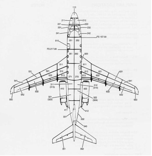
English: Zone Map of an Aircraft |
| Date | |
| Source | DOT/FAA/AR-TN06/17 |
| Author | Linzey, W. G. |
Licensing
This image or file is a work of a Federal Aviation Administration employee, taken or made as part of that person's official duties. As a work of the U.S. federal government, the image is in the public domain in the United States.
|
 |
Original upload log
Transferred from en.wikipedia to Commons by Fredlyfish4 using CommonsHelper.
The original description page was here. All following user names refer to en.wikipedia.
- 2011-02-20 02:26 Rich Baldwin 523×535× (28765 bytes) {{Information |Description = Zone Map of an Aircraft |Source = DOT/FAA/AR-TN06/17 |Date = 2006 |Author = Linzey, W. G. |Permission = |other_versions = }}
File history
Click on a date/time to view the file as it appeared at that time.
| Date/Time | Thumbnail | Dimensions | User | Comment | |
|---|---|---|---|---|---|
| current | 01:41, 27 October 2012 | | 523 × 535 (28 KB) | File Upload Bot (Magnus Manske) | Transfered from en.wikipedia by User:Fredlyfish4 using CommonsHelper |
File usage
The following pages on the English Wikipedia use this file (pages on other projects are not listed):