
Haviland, Kansas
Haviland, Kansas | |
|---|---|
 Location within Kiowa County and Kansas | |
 | |
| Coordinates: 37°37′0″N 99°6′20″W / 37.61667°N 99.10556°W[1] | |
| Country | United States |
| State | Kansas |
| County | Kiowa |
| Founded | 1880s |
| Incorporated | 1906 |
| Named for | Laura Haviland |
| Government | |
| • Type | Mayor–Council |
| Area | |
| • Total | 0.49 sq mi (1.28 km2) |
| • Land | 0.49 sq mi (1.28 km2) |
| • Water | 0.00 sq mi (0.00 km2) |
| Elevation | 2,152 ft (656 m) |
| Population | |
| • Total | 678 |
| • Density | 1,400/sq mi (530/km2) |
| Time zone | UTC-6 (CST) |
| • Summer (DST) | UTC-5 (CDT) |
| ZIP code | 67059 |
| Area code | 620 |
| FIPS code | 20-30825 |
| GNIS ID | 474263 [1] |
| Website | havilandks.com |
Haviland is a city in Kiowa County, Kansas, United States.[1] As of the 2020 census, the population of the city was 678.[3] It is located along Highway 54. It is home of Barclay College and known for meteorite finds connected to the Haviland Crater.
History[edit]
Haviland was founded by a group of Quakers originally from Indiana and named for Laura Haviland, a leader of the Underground Railroad.[4]
The first post office in Haviland was established in June 1886.[5] Haviland was incorporated as a city in 1906.[6]
Geography[edit]
Haviland is located at 37°37′0″N 99°6′20″W / 37.61667°N 99.10556°W (37.616685, -99.105478).[7] According to the United States Census Bureau, the city has a total area of 0.45 square miles (1.17 km2), all of it land.[8]
Demographics[edit]
| Census | Pop. | Note | %± |
|---|---|---|---|
| 1910 | 568 | — | |
| 1920 | 607 | 6.9% | |
| 1930 | 641 | 5.6% | |
| 1940 | 499 | −22.2% | |
| 1950 | 606 | 21.4% | |
| 1960 | 725 | 19.6% | |
| 1970 | 705 | −2.8% | |
| 1980 | 770 | 9.2% | |
| 1990 | 624 | −19.0% | |
| 2000 | 612 | −1.9% | |
| 2010 | 701 | 14.5% | |
| 2020 | 678 | −3.3% | |
| U.S. Decennial Census | |||
2020 census[edit]
The 2020 United States census counted 678 people, 227 households, and 147 families in Haviland.[9][10] The population density was 1,378.0 per square mile (532.1/km2). There were 260 housing units at an average density of 528.5 per square mile (204.0/km2).[10][11] The racial makeup was 86.14% (584) white or European American (84.51% non-Hispanic white), 3.39% (23) black or African-American, 0.29% (2) Native American or Alaska Native, 0.29% (2) Asian, 0.0% (0) Pacific Islander or Native Hawaiian, 3.54% (24) from other races, and 6.34% (43) from two or more races.[12] Hispanic or Latino of any race was 6.19% (42) of the population.[13]
Of the 227 households, 27.8% had children under the age of 18; 52.0% were married couples living together; 27.3% had a female householder with no spouse or partner present. 28.2% of households consisted of individuals and 13.7% had someone living alone who was 65 years of age or older.[10] The average household size was 2.5 and the average family size was 3.1.[14] The percent of those with a bachelor’s degree or higher was estimated to be 21.1% of the population.[15]
20.5% of the population was under the age of 18, 20.9% from 18 to 24, 19.2% from 25 to 44, 19.0% from 45 to 64, and 20.4% who were 65 years of age or older. The median age was 33.4 years. For every 100 females, there were 100.0 males.[10] For every 100 females ages 18 and older, there were 101.9 males.[10]
The 2016-2020 5-year American Community Survey estimates show that the median household income was $53,625 (with a margin of error of +/- $10,701) and the median family income was $59,375 (+/- $20,639).[16] Males had a median income of $24,688 (+/- $9,444) versus $11,513 (+/- $6,173) for females. The median income for those above 16 years old was $16,688 (+/- $4,852).[17] Approximately, 2.8% of families and 7.6% of the population were below the poverty line, including 7.5% of those under the age of 18 and 9.7% of those ages 65 or over.[18][19]
2010 census[edit]
As of the census[20] of 2010, there were 701 people, 228 households, and 162 families residing in the city. The population density was 1,557.8 inhabitants per square mile (601.5/km2). There were 261 housing units at an average density of 580.0 per square mile (223.9/km2). The racial makeup of the city was 96.1% White, 1.1% African American, 1.7% Native American, 0.6% Asian, 0.1% Pacific Islander, 0.1% from other races, and 0.1% from two or more races. Hispanic or Latino of any race were 3.6% of the population.
There were 228 households, of which 28.1% had children under the age of 18 living with them, 62.7% were married couples living together, 7.5% had a female householder with no husband present, 0.9% had a male householder with no wife present, and 28.9% were non-families. 25.9% of all households were made up of individuals, and 12.2% had someone living alone who was 65 years of age or older. The average household size was 2.43 and the average family size was 2.93.
The median age in the city was 32.8 years. 19.4% of residents were under the age of 18; 21.9% were between the ages of 18 and 24; 20.3% were from 25 to 44; 22.5% were from 45 to 64; and 15.8% were 65 years of age or older. The gender makeup of the city was 46.9% male and 53.1% female.
2000 census[edit]
As of the census[21] of 2000, there were 612 people, 207 households, and 146 families residing in the city. The population density was 1,314.5 inhabitants per square mile (507.5/km2). There were 250 housing units at an average density of 537.0 per square mile (207.3/km2). The racial makeup of the city was 96.24% White, 1.14% African American, 0.82% Native American, 0.49% Asian, 0.98% from other races, and 0.33% from two or more races. Hispanic or Latino of any race were 3.43% of the population.
There were 207 households, out of which 32.4% had children under the age of 18 living with them, 58.9% were married couples living together, 8.7% had a female householder with no husband present, and 29.0% were non-families. 27.5% of all households were made up of individuals, and 8.2% had someone living alone who was 65 years of age or older. The average household size was 2.51 and the average family size was 3.08.
In the city, the population was spread out, with 25.2% under the age of 18, 17.8% from 18 to 24, 19.4% from 25 to 44, 22.4% from 45 to 64, and 15.2% who were 65 years of age or older. The median age was 33 years. For every 100 females, there were 91.8 males. For every 100 females age 18 and over, there were 91.6 males.
The median income for a household in the city was $29,821, and the median income for a family was $36,250. Males had a median income of $30,179 versus $18,214 for females. The per capita income for the city was $12,075. About 6.6% of families and 11.2% of the population were below the poverty line, including 14.4% of those under age 18 and 8.3% of those age 65 or over.
Education[edit]
Primary and secondary[edit]
The community is served by Haviland USD 474 public school district. It shares Kiowa County High School with Kiowa County USD 422 public school district.[22]
Haviland High School was closed through school unification. The Haviland Dragons[23] won the Kansas State High School boys Track & Field championship in 1922.[24]
College[edit]
Barclay College, a four-year private college affiliated with the Religious Society of Friends, is located in Haviland.
See also[edit]
References[edit]
- ^ a b c d "Haviland, Kansas", Geographic Names Information System, United States Geological Survey, United States Department of the Interior
- ^ "2019 U.S. Gazetteer Files". United States Census Bureau. Retrieved July 24, 2020.
- ^ a b "Profile of Haviland, Kansas in 2020". United States Census Bureau. Archived from the original on December 1, 2021. Retrieved December 1, 2021.
- ^ Haviland History Archived 2007-09-10 at the Wayback Machine Accessed 6 May 2007.
- ^ "Kansas Post Offices, 1828-1961 (archived)". Kansas Historical Society. Archived from the original on October 9, 2013. Retrieved June 12, 2014.
- ^ Blackmar, Frank Wilson (1912). Kansas: A Cyclopedia of State History, Embracing Events, Institutions, Industries, Counties, Cities, Towns, Prominent Persons, Etc. Standard Publishing Company. pp. 831.
- ^ "US Gazetteer files: 2010, 2000, and 1990". United States Census Bureau. February 12, 2011. Retrieved April 23, 2011.
- ^ "US Gazetteer files 2010". United States Census Bureau. Retrieved July 6, 2012.
- ^ "US Census Bureau, Table P16: HOUSEHOLD TYPE". data.census.gov. Retrieved January 3, 2024.
- ^ a b c d e "US Census Bureau, Table DP1: PROFILE OF GENERAL POPULATION AND HOUSING CHARACTERISTICS". data.census.gov. Retrieved January 3, 2024.
- ^ Bureau, US Census. "Gazetteer Files". Census.gov. Retrieved December 30, 2023.
- ^ "US Census Bureau, Table P1: RACE". data.census.gov. Retrieved January 3, 2024.
- ^ "US Census Bureau, Table P2: HISPANIC OR LATINO, AND NOT HISPANIC OR LATINO BY RACE". data.census.gov. Retrieved January 3, 2024.
- ^ "US Census Bureau, Table S1101: HOUSEHOLDS AND FAMILIES". data.census.gov. Retrieved January 3, 2024.
- ^ "US Census Bureau, Table S1501: EDUCATIONAL ATTAINMENT". data.census.gov. Retrieved January 3, 2024.
- ^ "US Census Bureau, Table S1903: MEDIAN INCOME IN THE PAST 12 MONTHS (IN 2020 INFLATION-ADJUSTED DOLLARS)". data.census.gov. Retrieved January 3, 2024.
- ^ "US Census Bureau, Table S2001: EARNINGS IN THE PAST 12 MONTHS (IN 2020 INFLATION-ADJUSTED DOLLARS)". data.census.gov. Retrieved January 3, 2024.
- ^ "US Census Bureau, Table S1701: POVERTY STATUS IN THE PAST 12 MONTHS". data.census.gov. Retrieved January 3, 2024.
- ^ "US Census Bureau, Table S1702: POVERTY STATUS IN THE PAST 12 MONTHS OF FAMILIES". data.census.gov. Retrieved January 3, 2024.
- ^ "U.S. Census website". United States Census Bureau. Retrieved July 6, 2012.
- ^ "U.S. Census website". United States Census Bureau. Retrieved January 31, 2008.
- ^ "USD 474 - Haviland". USD 474. Retrieved January 5, 2017.
- ^ "Bison Buffaloes Stomp Haviland", Great Bend Tribune, 15 January 1969, p.6.
- ^ "Track & Field". KSHSAA. Archived from the original on November 13, 2016. Retrieved January 6, 2017.
Further reading[edit]
External links[edit]
- City of Haviland
- Haviland - Directory of Public Officials
- USD 474, local school district
- Haviland city map, KDOT
Municipalities and communities of Kiowa County, Kansas, United States | ||
|---|---|---|
| Cities | 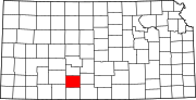 | |
| Unincorporated communities | ||
| Township | ||
| International | |
|---|---|
| National | |