Hundon
| Hundon | |
|---|---|
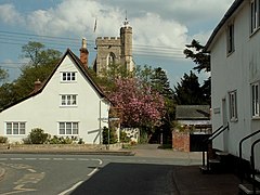
 All Saints Church | |
Location within Suffolk | |
| Population | 1,894 (2011)[1] |
| OS grid reference | TL7348 |
| Civil parish |
|
| District | |
| Shire county | |
| Region | |
| Country | England |
| Sovereign state | United Kingdom |
| Post town | SUDBURY |
| Postcode district | CO10 |
| Dialling code | 01440 |
| Police | Suffolk |
| Fire | Suffolk |
| Ambulance | East of England |
| UK Parliament | |
Hundon is a village and civil parish in the West Suffolk district in Suffolk, England. The village is about 3 miles (5 km) north-west of the small town of Clare, and 7 miles (11 km) from the larger town of Haverhill, and includes a primary school, post office, a village hall, the Rose & Crown public house, and All Saints Parish Church. At the south-west of the parish is the hamlet of Brockley Green which includes two farms and The Plough Inn public house.
References[edit]
- ^ "Civil Parish population 2011". Neighbourhood Statistics. Office for National Statistics. Retrieved 23 August 2016.

