
File:Jesusland map.svg

Size of this PNG preview of this SVG file: 600 × 600 pixels. Other resolutions: 240 × 240 pixels | 480 × 480 pixels | 768 × 768 pixels | 1,024 × 1,024 pixels | 2,048 × 2,048 pixels | 1,730 × 1,730 pixels.
Original file (SVG file, nominally 1,730 × 1,730 pixels, file size: 217 KB)
| This is a file from the Wikimedia Commons. Information from its description page there is shown below. Commons is a freely licensed media file repository. You can help. |
Summary
| Description |
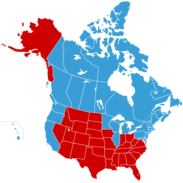
English: A re-creation of the Jesusland map internet meme graphic
"United States of Canada", Canada plus blue states in 2004
"Jesusland", red states in 2004 |
| Date | 08-12-2007 |
| Source |
|
| Author | Lokal_Profil |
| Permission (Reusing this file) |
This file is licensed under the Creative Commons Attribution-Share Alike 2.5 Generic license. Attribution: Lokal_Profil
|
| Other versions |
  |

|
This map, as well as other fictitious maps, is fictitious or too incorrect (i.e. due to anachronism) to be used in real-life contexts (contemporary or historic). It may have some visual elements that are similar to official maps such as colors or certain layout features, but they are NOT official and don't have any official recognition. |
[[Category:]]
File history
Click on a date/time to view the file as it appeared at that time.
| Date/Time | Thumbnail | Dimensions | User | Comment | |
|---|---|---|---|---|---|
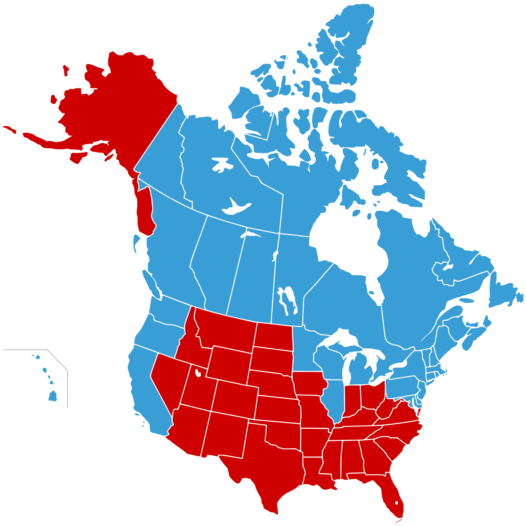
| current | 23:51, 20 November 2008 | | 1,730 × 1,730 (217 KB) | Hoshie | DC should be blue: it went for Kerry in 04 and has not voted GOP since 1964 |
| 23:50, 8 December 2007 |  | 1,730 × 1,730 (212 KB) | Lokal Profil | {{Information |Description={{en|en:Jesusland map}} {{legend|#399ed6|"United States of Canada", Canada plus blue states }} {{legend|#ce0000|"Jesusland", red states }} |Source=*Vecto |
File usage
The following pages on the English Wikipedia use this file (pages on other projects are not listed):
Global file usage
The following other wikis use this file:
- Usage on cs.wikipedia.org
- Usage on fr.wikipedia.org
- Usage on fr.wiktionary.org
- Usage on hy.wikipedia.org
- Usage on it.wikipedia.org
- Usage on ru.wikipedia.org
- Usage on tr.wikipedia.org
- Usage on uk.wikipedia.org