
File:Satellite Image of Death Valley.jpg
Size of this preview: 480 × 599 pixels. Other resolutions: 192 × 240 pixels | 596 × 744 pixels.
Original file (596 × 744 pixels, file size: 378 KB, MIME type: image/jpeg)
| This is a file from the Wikimedia Commons. Information from its description page there is shown below. Commons is a freely licensed media file repository. You can help. |
Summary
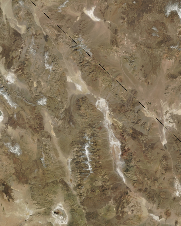
| Description | Death Valley as seen by by the Moderate Resolution Imaging Spectroradiometer (MODIS) on NASA’s Terra satellite |
| Date | |
| Source | the Moderate Resolution Imaging Spectroradiometer (MODIS) on NASA’s Terra satellite |
| Author | NASA |
| This file is in the public domain in the United States because it was solely created by NASA. NASA copyright policy states that "NASA material is not protected by copyright unless noted". (See Template:PD-USGov, NASA copyright policy page or JPL Image Use Policy.) | ||
 |
Warnings:
|
File history
Click on a date/time to view the file as it appeared at that time.
| Date/Time | Thumbnail | Dimensions | User | Comment | |
|---|---|---|---|---|---|
| current | 20:33, 7 October 2007 | | 596 × 744 (378 KB) | Sagredo | Death Valley as seen by by the Moderate Resolution Imaging Spectroradiometer (MODIS) on NASA’s Terra satellite on March 11, 2004. |
| 20:22, 7 October 2007 |  | 600 × 840 (416 KB) | Sagredo | Death Valley as seen by by the Moderate Resolution Imaging Spectroradiometer (MODIS) on NASA’s Terra satellite on March 11, 2004. Cropped to approximately the borders of the Death Valley National Park | |
| 19:50, 7 October 2007 |  | 1,456 × 1,332 (1.43 MB) | Sagredo | Death Valley as seen by by the Moderate Resolution Imaging Spectroradiometer (MODIS) on NASA’s Terra satellite on March 11, 2004. |
File usage
No pages on the English Wikipedia use this file (pages on other projects are not listed).