
File:VA 3rd Congressional District.png
No higher resolution available.
VA_3rd_Congressional_District.png (636 × 381 pixels, file size: 105 KB, MIME type: image/png)
| This is a file from the Wikimedia Commons. Information from its description page there is shown below. Commons is a freely licensed media file repository. You can help. |
Summary
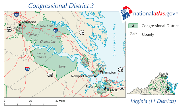
| Description | Map of Virginia's 3rd congressional district. |
| Date | 00:49:06(UTC) |
| Source | Downloaded from http://nationalatlas.gov/printable/images/preview/congdist/va03_109.gif and converted to PNG. |
| Author | Acntx |
Licensing
This map was obtained from an edition of the National Atlas of the United States. Like almost all works of the U.S. federal government, works from the National Atlas are in the public domain in the United States.
Online access: NationalAtlas.gov | 1970 print edition: Library of Congress, Perry-Castañeda Library
|
Original upload log
The original description page was here. All following user names refer to en.wikipedia.
Upload date | User | Bytes | Dimensions | Comment
- 2007-02-10 09:10:56 | Acntx | 126991 | 636×381 |
File history
Click on a date/time to view the file as it appeared at that time.
| Date/Time | Thumbnail | Dimensions | User | Comment | |
|---|---|---|---|---|---|
| current | 00:33, 7 January 2012 | | 636 × 381 (105 KB) | Grondemar | {{Information |Description ={{en|1=xxxxx}} |Source =xxxxx |Author =xxxxx |Date =xxxxx |Permission =xxxxx |other_versions =xxxxx }} xxxxx |
File usage
The following pages on the English Wikipedia use this file (pages on other projects are not listed):
- 2002 United States House of Representatives elections in Virginia
- 2004 United States House of Representatives elections in Virginia
- 2006 United States House of Representatives elections in Virginia
- 2008 United States House of Representatives elections in Virginia
- Virginia's 3rd congressional district
Global file usage
The following other wikis use this file:
- Usage on pt.wikipedia.org