
Kulim District
This article needs additional citations for verification. (November 2011) |
 Seal | |
| Country | Malaysia |
| State | Kedah |
| Establishment | mid-18th century |
| Granted municipality status | 2001[1] |
| Government | |
| • Tuan Yang DiPertua MPKK | Tn. Abdul Aziz Bin Haji Abdul Ghani AMK, BCK |
| Population (2010[2]) | |
| • Total | 228,662 |
| • Density | 590/km2 (1,500/sq mi) |
| Time zone | UTC+8 (MST) |
| • Summer (DST) | Not observed |
| Postal code | 09xxx |
| International dialling code prefix | +6044 (landline only) |
| Website | http://www.mpkk.gov.my |

Kulim is a town in the state of Kedah, Malaysia. It is located on the southeast of Kedah, bordering Penang on the west. Kulim evolved from a small settlement in the 1950's to a successful town. This is because Kulim is located very close to Bukit Mertajam and Penang State. Kulim is a district consisting of 15 smaller sub-districts also known as "mukim".
History
Kulim as a town was started in mid-18th century by 100 Malays from Pattani. By mid-19th century Kulim experienced a boom due to the discovery of tin ore. By 1890, there were 400 Chinese miners operating in Kulim. One of Kulim’s earliest settlements was a place called Belakang Tebok. [citation needed]
A few of the classical monuments still existing in Kulim includes Coronation Cinema, St. Patrick’s High School (1933), which was converted into a trade building, Sultan Badlishah High School (1948), Kulim Police Station and so on.
Meanwhile the Kulim’s independence clock was officiated by the Sultan of Kedah (15 September 1957) and serves as the unofficial landmark for the city of Kulim. The cornerstone of the clock was acquired by YPM Tunku Abdul Rahman Putra Al Haj (the First Prime Minister if Malaya, later Malaysia) on 14 June 1957. [citation needed]
The construction of the clock was completed within 3 months and upon completion, was made formalized by DYMM Tuanku Sultan Badlishah Ibni Almarhum Yang Di Pertuan Paduka Seri Sultan Abdul Hamid Shah, KOM, CMG, KBE Sultan Kedah on 15 September 1957, or 2 weeks after the declaration of independence of Malaysia (31 August 1957).[3]
The total cost of the independence clock was paid for by the residents of Kulim (records show that RM40000 was raised) as a testament of the success of the country to gain independence from the British. [citation needed] The independence clock was and still is the pride of the people of Kulim. It was recently renovated to include a small fountain system.
The establishment of Kulim Hi-tech park is hoped to be a catalyst for the continued growth of Kulim.[4] It has been proposed to build a light rail system, like Kuala Lumpur's by 2020.[5]
City Centre
Kulim still maintains shop houses that were around since before the Second World War. Unfortunately, many of these houses were demolished to make way for newer structures of development. The independence clock serves as the city’s landmark, and is one of the old structures that remain in place.[6]
Kulim’s suburbs
Kulim is home to many recently opened suburbs. One of the biggest suburbs is Taman Selasih, complete with its own commercial centre, it also called as "New town".[7] Paya besar is the 2nd most famous suburb in kulim.
- Taman Desa Makmur
- Taman Selasih
- Taman Angsana
- Taman Semarak
- Lembah Impiana
- Taman Kempas Indah
- Taman Kempas 2
- Taman Kempas 3
- Taman Desa Impian
- Taman Kemuning
- Taman Melor
- Taman Seroja
- Taman Tunku putra
- Taman Sri Kulim
- Taman Sungai Kob
- Taman Rambai
- Taman Nenas
- Taman Mutiara, Sg.Kob
- Taman Keranji
- Taman Senangin
- Taman Bersatu
- Taman Meranti
- Taman Dahlia
- Taman Hi-tech
- Taman Perindustrian Waja
- Taman Kulim Baru
- Taman Anggerik
- Taman Damai Padang Serai
- Taman Kulim Utama
- Taman Harmoni
- Taman Sejahtera Jaya
- Taman Cempaka
- Taman Kenari
- Taman Seri Tanjung
- Taman Jati
- Taman Saga Keladi
- Taman Desa Penaga
- Taman Bukit Awi
- Taman Sutera Indah
- Taman Kobis
- Taman KTC
- Taman KLC
- Bukit Kulim
- Kelang Sago
- Kampung Air Merah
- Kampung Darul Aman
- Kampung Syed Syeh
- Kampung Tunku Putra
- Taman Kota Kenari
- Taman Perak
- Taman Seluang
- Taman Camar [8]
- Taman Sutera Indah
Economy
In 1996, the Kulim Hi-Tech Park (KHTP) was officially opened as the first and fully integrated high technology industrial park in Malaysia. With the development of phase two of the MSC connecting Georgetown, Bertam and KHTP, potentials of development as the science and cyber city would spur on the development of other downstream industries in Kulim. [citation needed]
The Park comprises a total land area of approximately 14.5 square kilometres (5.6 mi²). Many local and foreign companies, such as Intel, Fuji Electric, Infineon, Showa Denko, First Solar, Gazzo Food, Entegris, Celestica and SilTerra have moved to the site since then.[9] It is strategically located nearby North-Butterworth Container Terminal (NBCT) and Bayan Lepas International Airport both located in Penang. According to the Ninth Malaysia Plan, this economic area is referred to as the Northern Corridor Economic Region (NCER). The Northern Corridor Economic Region is one of three development regions formed in Peninsular Malaysia, other development regions being the Iskandar Malaysia (or South Johor Economic Region) and the East Coast Development Region.
-
Kulim Hi-tech Park Entry
-
Kulim Hi-tech Park Business Centre
-
Kulim Hi-tech Park Business Centre
-
Kulim Hi-tech Park Business Centre
-
Intel Corporation at Kulim
-
Infineon Technologies (Kulim) Sdn. Bhd. at Kulim
-
 First Solar, Inc. at Kulim
 -
Celestica Malaysia Sdn Bhd at Kulim
-
Inokom Corporation Berhad
-
Inokom Corporation Berhad
-
Car manufacture/assembly by Inokom Corporation Berhad

Religion
Islam is the largest religion in kulim, as same as all over Malaysia.Most of Indian in kulim are Hindu and Christian. Kulim has the largest number of hinduism and Christian people in Kedah.There were also large number of Buddhist and Sikhism. Where most of the Chinese are Buddhist.
Place of worship

Hindu Temple
- Nattukkotai Nagaraththar Sri Thandayurhapani Temple
The main deity of this temple is Murugan.Meanwhile, The chief priest of the temple is Sivasri Annamalai Pandaram. The main festival in this temple is Thirukkarthigai (1 day festivities). Uthsavar procession were done during this festival in temple premise. [citation needed]
- Sree Maha Muthu Mariamman Temple, Kulim Hi-Tech Park
Mariamman is the main deity in this temple. This temple famously known as 'Sera kovil' among people in kulim.
- Kulim Sree Mariamman Temple
Famously known as 'Merah Estate Temple' is the largest temple in Kulim.Year Of establishment of this temple is 1941.The main deity of this temple is Mariamman. [citation needed]
Church
- Church of the Sacred Heart Jesus-Roman Catholic
- Kulim Chinese Methodist Church-Protestant
- Kulim Wesley Methodist Church-Protestant
- St. Thomas Church- Anglican
- FGA Centre
- Grace Community Centre
- Gereja Rivers of Water
- Tamil Baptist Church
Buddist Temple
- Wat Buddha Siam
- Vihara Fayi
Islam mosque
- Masjid Al Huda, Kelang Lama
- Masjid Kampung Air Merah
- Masjid Kampung Darul Aman
- Masjid Keladi
- Masjid Taman Kenari
Sikh
- Sikh Gurdwara Sahib
Bahai
- Kulim Bahai Centre, Kilang Lama
Education
-
 Chio Min Secondary School (觉民国民型中学)
 -
University of Kuala Lumpur (Kulim Campus)
-
elc International School (Kulim)
-
PTSB - Politeknik Tuanku Sultanah Bahiyah

Kulim was a pioneer in education in Kedah [citation needed], having some of the earliest established schools in the state. The public school system comprises national schools, vernacular (Chinese and Tamil) schools, vocational schools, and religious schools. There are also a few international schools, such as elc International School.
Chinese Schools
- Chio Min Secondary School (觉民国民型中学)
- Sekolah Rendah Jenis Kebangsaan (Chinese) Kelang Lama (居林老火较小学)
- Sekolah Rendah Jenis Kebangsaan (Chinese) Chio Min A/B (觉民小学A/B校)
- Sekolah Rendah Jenis Kebangsaan (Chinese) Chong Cheng (居林中正小学)
- Sekolah Rendah Jenis Kebangsaan (Chinese) Hwa Min (华民小学)
Tamil Schools
- Sekolah Rendah Jenis Kebangsaan (Tamil) Kulim
Formerly Missionary Schools
Formal education in Kulim stretches back to the early days of British administration. Many of the public schools in Kulim has been turned into national schools. Such as:
- Sekolah Menengah Kebangsaan St Anne's Convent Kulim
- Sekolah Menengah Kebangsaan St. Patrick
National, Vocational, and Religious Schools
- Sekolah Menengah Kebangsaan Taman Jelutong
- Sekolah Menengah Kebangsaan Sultan Badlishah
- Sekolah Menengah Jenis Kebangsaan Chio Min
- Sekolah Menengah Kebangsaan Sungai Kob
- Sekolah Menengah Kebangsaan Kulim
- Sekolah Menengah Kebangsaan Taman Selasih
- Sekolah Menengah Kebangsaan Air Merah
- Sekolah Menengah Kebangsaan Taman Kenari
- Sekolah Menengah Kebangsaan Junjong
- Sekolah Menengah Kebangsaan Taman Hi-Tech
- Sekolah Menengah Kebangsaan Keladi
- Sekolah Menengah Kebangsaan Tunku Panglima Besar
- Sekolah Menengah Teknik Kulim
- Sekolah menengah Kebangsaan Jalan Paya Besar
- Sekolah Kebangsaan Sungai Kob
- Sekolah Kebangsaan Sri Kulim
- Sekolah Kebangsaan Kulim
- Sekolah Kebangsaan Air Merah
- Sekolah Kebangsaan Taman Kenari
- Sekolah Kebangsaan St Anne's Convent
- Sekolah Kebangsaan Taman Jelutong
- Sekolah Kebangsaan Taman Hi-Tech
- Sekolah Menengah Kebangsaan Lunas
Colleges and Universities
- Universiti Kuala Lumpur
- IPK College (ACCA, LCCI and others professional qualification)
- Polytechnic Tuanku Sultanah Bahiyah ( www.ptsb.edu.my )
- Community College Kulim
- MARA College MARA Kulim
- Maktab Rendah Sains MARA (PDRM)
- ADTEC Kulim
Transport
Butterworth–Kulim Expressway is a 17 km (11 mi) expressway that connects Butterworth, Penang in the west to Kulim, Kedah in the east. It is also a main route to East-West Highway via Baling, Kedah and Gerik, Perak. The construction of BKE started in December 1994 and completed in September 1996. [citation needed]
Shopping
- Tesco Hypermarket Tesco Kulim - the premier and largest hypermarket buildings in north Malaysia[10]
Parks, Gardens and Natural Environment
- Kulim Hi-tech Park
Located 8 kilometres from Kulim Town. It is the first integrated Hi-tech Park in Malaysia. The main activities at this park are jogging and cycling whilst enjoying the breathtaking wonders of the landscape. There are also facilities like pedestrian walks, gazebos, benches and children’s playground.
- Junjung Waterfalls Recreation
Located in Junjung and is about 14 kilometres from Kulim Town. Ever since 1980s, this destination has been a great tourist attraction with its main product being the waterfalls and ecosystem surroundings of the forest, rubber plantation as well as fruit orchards. During fruit seasons, especially the durian season, visitors can buy the fruits directly from the orchard owners. The main activities or program to be enjoyed here include picnicking, dipping, swimming and camping.
- Mount Bungsu
This is found in the Mount Bungsu Forest Reserves. The height of Mount Bungsu is 658 metres with its peak at Mukim Terap. The scenery from its peak has a panoramic view surrounding it. This is where historical traces are found like the communist fort. For visitors who would like to try heavy activities like mountain climbing and cycling or dirt biking, Mount Bungsu would be a good training field and a challenge apt to their abilities. The meandering flow and rapid falls of the river is enough to attract visitors here all the time.
- Ulu Paip Recreation
Located within the Forest Reserves of Mount Bungsu with rapid river and forest ecosystem surroundings. The main activities here include picnicking, dipping, swimming and camping. During the journey to this destination, visitors will also find fruit orchards and former mining ponds on both sides of the road. This destination is 20 kilometres from Kulim Town.
- Tree Top Walk
Tree Top Walk is the latest attraction that awaits visitors. The iron bridge, which is better known as the Tree Top Walk above Sungai Sedim was constructed so high up that it almost touches the tree tops across Sungai Sedim.
- Peak of Mount Bintang
Fast flowing rapids and waterfalls feast your eyes during the journey up this mountain. The main program here would be jungle trekking while appreciating the wonders of fauna and flora, exploring caves as well as mountain climbing to enjoy the panoramic view from the mountain top. Its height reaching 1,862 metres make it the highest mountain in its range. Geographically, the peak of Mount Bintang is the boundary marker for districts in two states.
This means that if visitors manage to reach its peak, they are in Baling and Kulim Districts of the State of Kedah and Ulu Perak and Selama Districts of Perak State at the same time.
Resort
Recreational facilities include:
- Kulim Golf & Country Resort This is located at Kulim High Technology Park. There is a clubhouse facility along with a 27-hole golf course and other recreational facilities.
- Chinese Recreation Club (CRC) is located 2 kilometres from Kulim Town. Equipped with sports and recreational facilities as its main product, this complex was once the centre of sports event at national level, such as MSSM Badminton Tournament 2004 and SUKMA Kedah 2006. On ordinary days, the facilities here are for the use of club members only.
- Kulim Club is located 2 kilometres from Kulim Town. Facilities that are provided at this club are swimming pool, gym, badminton hall, tennis court and family restaurant.
Culture
Food
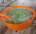
Kulim's cuisine is not only heavily influenced by the Baba Nyonya culture of Penang (which is just 26 km away), but also shows some influence of Thailand. The famous foods are ALAM'z PUFF Tmn. Selasih (various filling currypuff), Kelang Lama Laksa, Lunas Duck Roaster, Yam Rice, Curry Wan Tan Mee, Chicken Leg Wan Tan Mee, Curry Mee, Hokien Char, Prawn Mee(Hokian Mee), Loh Mee, Kuey Teow Teng, Duck Egg Char Kuay Teow, Glutinous Rice Cendol, Chee Cheong Fun, Ice Kacang, Chai Koay, Tom Yam, Stem Fish, Yau Char Kuai, Zhap Chai, and many more.
-
 Kulim (Kelang Lama) Laksa
 -
 Kulim Cendol
 -
 Kulim (Lunas) Duck Roaster
 -
 Kulim Chai Koay
 -
 Kulim Ice Kacang
 -
 Kulim Yam Rice
 -
 Kulim Char Koay Teow
 -
Kulim Hokien Char
-
Kulim Malay Char Koay Teow
-
Kulim Wan Tan Mee
-
Kulim (Kolam)Stem Fish
-
 Kulim Zhap Chai


Gallery
-
 Tune Hotel Kulim
 -
 Tesco Kulim is the premier and largest hypermarket buildings in north Malaysia
 -
Kulim Landmark Centre (Giant Hypermarket)
-
The Store Supermarket at Kulim
-
 Minat Supermarket at Kulim
 -
BIG Cinemas Lotus Five Star
-
 Sushi King at Kulim Landmark Centre
 -
Master Choo Kitchen / 朱师父 at Kulim Landmark Centre
-
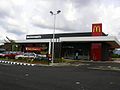 McDonald's Kulim
 -
 GazZo Internet Cafe at Taman Semarak, Kulim
 -
 Sunshine at Taman Semarak, Kulim
 -
 Secret Recipe at Kulim Landmark Centre
 -
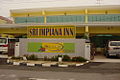 Sri Impiana Inn
 -
 Jom Pizza, Taman Kempas 3
 -
aL-ikhsaN store at Kulim
-
SEC at Kulim
-
Tan Kee Duck Roaster Restaurant
-
View of Kulim Town
-
View of Kulim Town
-
View of Kulim Town
-
View of Kulim Town
-
Kulim Town at Night
-
Kulim Town at Night
-
Kapitol Kulim (CW Snooker Centre)
-
Taman Selasih
-
Mini Stadium at Kulim
-
Tunku Putra Lake at Kulim
-
Kulim Football Field
-
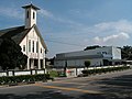 Kulim Catholic Church
 -
Hotel Seri Malaysia at Kulim
-
South Kedah Chinese Recreation Club (CRC)
-
Kulim Club
-
Kulim Heights
-
Kulim Commercial Centre
-
Kulim Avenue


Notable residents
- Ahmad Fauzi Saari, professional football player[citation needed]
- Ismail Omar, the 9th and current Inspector General of Royal Malaysian Police[11]
See also
References
- ^ Kulim Granted City Status [dead link], Kulim’s Municipal council History. October 31, 2010.
- ^ Helders, Stefan. "Malaysia: largest cities and towns and statistics of their population". World Gazetteer. Retrieved 2010-10-31.
- ^ Kulim’s Background, Laman Web Rasmi Majlis Perbandaran Kulim (Official Website of Kulim Government). January 16, 2010.
- ^ Kulim’s History, Kulim’s Municipal council website-Kulim’s Background October 31, 2010.
- ^ Kulim to have LRT system and airport by 2020, The Star Online. Friday June 22, 2007
- ^ Kulim’s City Centre, Kulim’s Municipal council website-Kulim’s Background October 31, 2010.
- ^ Kulim’s suburbs, Kulim’s Municipal council website-Kulim’s Background October 31, 2010.
- ^ List of Suburbs, Kulim’s Municipal council website-Kulim’s Background October 31, 2010.
- ^ Office & Industrial in Kulim area, Kulim Hi-tech Park website. July 26, 2010.
- ^ Tesco plans five new stores this year, The Star Online. March 5, 2010.
- ^ "Tan Sri Haji Ismail Bin Haji Omar" (in Malay). Royal Malaysian Police. Retrieved 5 May 2012.
Kulim Town as originally produced www.kulimkia.com
External links
Capital: Alor Setar, Royal town: Anak Bukit | |
| Topics | |
| Society | |
| Administrative divisions | |