
LaMoure, North Dakota
LaMoure, North Dakota | |
|---|---|
 Location of LaMoure, North Dakota | |
| Country | United States |
| State | North Dakota |
| County | LaMoure |
| Area | |
| • Total | 1.3 sq mi (3.3 km2) |
| • Land | 1.3 sq mi (3.3 km2) |
| • Water | 0.0 sq mi (0.0 km2) |
| Elevation | 1,312 ft (400 m) |
| Population (2000) | |
| • Total | 944 |
| • Density | 736.2/sq mi (284.2/km2) |
| Time zone | UTC-6 (Central (CST)) |
| • Summer (DST) | UTC-5 (CDT) |
| ZIP codes | 58415, 58431, 58458 |
| Area code | 701 |
| FIPS code | 38-44540Template:GR |
| GNIS feature ID | 1033650Template:GR |
| Website | www.lamourend.com |
LaMoure is a city in LaMoure County, North Dakota in the United States. The population was 944 at the 2000 census. LaMoure was founded in 1882.
LaMoure was one of eight global transmission sites of the Omega Navigation System until its closure on September 30, 1997. The station is now used for VLF communication purposes of the US Navy.
Geography
LaMoure is located at 46°21′31″N 98°17′37″W / 46.35861°N 98.29361°WInvalid arguments have been passed to the {{#coordinates:}} function (46.358569, -98.293697)Template:GR on the James River.
According to the United States Census Bureau, the city has a total area of 1.3 square miles (3.3 km²), all of it land.
Demographics
As of the censusTemplate:GR of 2000, there were 944 people, 386 households, and 238 families residing in the city. The population density was 736.2 people per square mile (284.8/km²). There were 433 housing units at an average density of 337.7/sq mi (130.6/km²). The racial makeup of the city was 99.15% White, 0.42% Native American, 0.11% from other races, and 0.32% from two or more races. Hispanic or Latino of any race were 0.64% of the population.
There were 386 households out of which 29.8% had children under the age of 18 living with them, 54.4% were married couples living together, 4.9% had a female householder with no husband present, and 38.1% were non-families. 35.5% of all households were made up of individuals and 18.1% had someone living alone who was 65 years of age or older. The average household size was 2.33 and the average family size was 3.06.
In the city the population was spread out with 27.4% under the age of 18, 4.4% from 18 to 24, 24.4% from 25 to 44, 18.2% from 45 to 64, and 25.5% who were 65 years of age or older. The median age was 41 years. For every 100 females there were 88.8 males. For every 100 females age 18 and over, there were 84.1 males.
The median income for a household in the city was $30,781, and the median income for a family was $42,375. Males had a median income of $28,750 versus $19,432 for females. The per capita income for the city was $15,832. About 6.8% of families and 7.6% of the population were below the poverty line, including 7.5% of those under age 18 and 13.8% of those age 65 or over.
Education
The K-12 LaMoure Public School is the home of the Loboes.
Sites of interest
- Memorial Park Country Club - a nine-hole golf course located ten miles (16 km) northwest of LaMoure off of Highway 34. It measures 3,135 yards (2,867 m) from the back tees.
References
External links
Municipalities and communities of LaMoure County, North Dakota, United States | ||
|---|---|---|
| Cities | 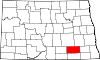 | |
| Townships | ||
| Unincorporated communities | ||