
Manchester, New Hampshire
Manchester, New Hampshire | |
|---|---|
 Clockwise from top: Manchester skyline from above Amoskeag Falls, Hanover Street, a Fisher Cats game at Northeast Delta Dental Stadium, the Arms Park Riverwalk and Millyard, the Mill Girl statue at the Millyard, and City Hall. | |
| Nickname(s): Queen City, Manch Vegas[1] | |
| Motto: Labor Vincit (work conquers) | |
 Location in Hillsborough County, New Hampshire | |
 Manchester Location within New Hampshire  Manchester Location within the United States | |
| Coordinates: 42°59′27″N 71°27′49″W / 42.99083°N 71.46361°W | |
| Country | |
| State | |
| County | Hillsborough |
| Incorporated (as Derryfield) | 1751 |
| Incorporated (as Manchester) | 1846 |
| Government | |
| • Mayor | Joyce Craig (D) |
| • Aldermen | Members
|
| Area | |
| • City | 34.94 sq mi (90.48 km2) |
| • Land | 33.08 sq mi (85.66 km2) |
| • Water | 1.86 sq mi (4.82 km2) 5.33% |
| • Urban | 86.1 sq mi (223.1 km2) |
| Elevation | 210 ft (64 m) |
| Population | |
| • City | 109,565 |
| • Estimate (2019)[4] | 112,673 |
| • Rank | US: 259th |
| • Density | 3,406.59/sq mi (1,315.29/km2) |
| • Urban | 158,377 (US: 209th) |
| • Urban density | 1,838/sq mi (709.8/km2) |
| • Metro | 406,678 (US: 132nd) |
| Time zone | UTC−5 (Eastern) |
| • Summer (DST) | UTC−4 (Eastern) |
| ZIP Codes | 03101–03105, 03108-03109, 03111 |
| Area code | 603 |
| FIPS code | 33-45140 |
| GNIS feature ID | 868243 |
| Website | www |

Manchester is a city in southern New Hampshire, United States. It is the most populous city in northern New England (the states of Maine, New Hampshire, and Vermont). As of the 2010 census the city had a population of 109,565,[5] and in 2019 the population was estimated to be 112,673.[4]
Manchester is, along with Nashua, one of two seats of New Hampshire's most populous county, Hillsborough County. Manchester lies near the northern end of the Northeast megalopolis and straddles the banks of the Merrimack River. It was first named by the merchant and inventor Samuel Blodgett, namesake of Samuel Blodget Park and Blodget Street in the city's North End. His vision was to create a great industrial center similar to that of the original Manchester in England, which was the world's first industrialized city.[6]
Manchester often appears favorably in lists ranking the affordability and livability of U.S. cities, placing particularly high in small business climate,[7][8] affordability,[9][10] upward mobility,[11] and education level.[12]
History
Native Pennacook Indians called Amoskeag Falls on the Merrimack River—the area that became the heart of Manchester—Namaoskeag, meaning "good fishing place".[13] In 1722, John Goffe III settled beside Cohas Brook, later building a dam and sawmill at what was dubbed "Old Harry's Town". It was granted by Massachusetts in 1727 as "Tyngstown" to veterans of Queen Anne's War who served in 1703 under Captain William Tyng.[14] But at New Hampshire's 1741 separation from Massachusetts, the grant was ruled invalid and substituted with Wilton, Maine, resulting in a 1751 rechartering by Governor Benning Wentworth as "Derryfield"—a name that lives on in Derryfield Park, Derryfield Country Club, and the private Derryfield School.[14]
In 1807, Samuel Blodget opened a canal and lock system to allow vessels passage around the falls, part of a network developing to link the area with Boston. He envisioned a great industrial center arising, "the Manchester of America", in reference to Manchester, England, then at the forefront of the Industrial Revolution.[14][15] In 1809, Benjamin Prichard and others built a water-powered cotton spinning mill on the western bank of the Merrimack. Apparently following Blodgett's suggestion, Derryfield was renamed "Manchester" in 1810, the year the mill was incorporated as the Amoskeag Cotton & Woolen Manufacturing Company.[16] It would be purchased in 1825 by entrepreneurs from Massachusetts, expanded to three mills in 1826, and then incorporated in 1831 as the Amoskeag Manufacturing Company.[14][15]
Amoskeag engineers and architects planned a model company town on the eastern bank, founded in 1838 with Elm Street as its main thoroughfare. Incorporation as a city followed for Manchester in 1846, soon home to the largest cotton mill in the world—Mill No. 11, stretching 900 feet (270 m) long by 103 feet (31 m) wide, and containing 4,000 looms. Other products made in the community included shoes, cigars, and paper. The Amoskeag foundry made rifles, sewing machines, textile machinery, fire engines, and locomotives in a division called the Amoskeag Locomotive Works (later, the Manchester Locomotive Works). The rapid growth of the mills demanded a large influx of workers, resulting in a flood of immigrants, particularly French Canadians. Many residents descend from these workers. The Amoskeag Manufacturing Company went out of business in 1935, although its red brick mills have been renovated for other uses. Indeed, the mill town's 19th-century affluence left behind some of the finest Victorian commercial, municipal, and residential architecture in the state.[17]
-
 Mills on the Merrimack River and the West Side of Manchester
 -
 Elm Street, c. 1905
 -
 Child laborers at Amoskeag Manufacturing in Manchester (1909); photo by Lewis Hine


Geography

Manchester is in south-central New Hampshire, 18 miles (29 km) south of Concord, the state capital, and the same distance north of Nashua, the second-largest city in the state. Manchester is 51 miles (82 km) north-northwest of Boston, the largest city in New England.
According to the United States Census Bureau, the city has a total area of 35.0 square miles (90.6 km2), of which 33.1 square miles (85.7 km2) are land and 1.9 square miles (4.8 km2) are water, comprising 5.33% of the city.[5] Manchester is drained by the Merrimack River and its tributaries the Piscataquog River and Cohas Brook. Massabesic Lake is on the eastern border. The highest point in Manchester is atop Wellington Hill, where the elevation reaches 570 feet (170 m) above sea level.
Neighborhoods
The Manchester Planning Board, in its 2010 Master Plan, defines 25 neighborhoods within the city. LivableMHT has drawn maps of the neighborhoods and neighborhood village centers as defined by the city.[18] Recognition of particular neighborhoods varies, with some having neighborhood associations, but none have any legal or political authority.
The major neighborhoods, historically, include Amoskeag, Rimmon Heights, Notre Dame/McGregorville and Piscataquog/Granite Square also known as "Piscat" on the West Side; and the North End, Janeville/Corey Square, Hallsville and Bakersville on the East Side; along with Youngsville and Goffes Falls on the periphery of the city.[19]
In 2007, the city began a Neighborhood Initiatives program to "insure that our neighborhoods are vibrant, livable areas since these are the portions of the city where most of the residents spend their time living, playing, shopping and going to school."[20] The purpose of this initiative is to foster vibrancy and redevelopment in the neighborhoods, and to restore the sense of neighborhood communities that had been overlooked in the city for some time. The city began the program with street-scape and infrastructure improvements in the Rimmon Heights neighborhood of the West Side, which has spurred growth and investment in and by the community.[21] Despite the success of the program in Rimmon Heights, it was unclear in recent years how the city planned to implement similar programs throughout the city. The city announced plans for extending the Neighborhood Initiatives program to the Hollow neighborhood in February 2012.[22]

Surrounding development
The urban core of Manchester extends beyond its city limits in several directions, particularly west and south of downtown, including:
- Pinardville: In the town of Goffstown, Pinardville is a fairly dense, former streetcar suburb along Mast Road to the west of Manchester. It is home to Saint Anselm College.
- River Corridor: In the town of Bedford, the River Corridor is a mid-density, primarily shopping district along South River Road about two-and-a-half miles from downtown Manchester. The area has recently implemented Tax Increment Financing to improve and maintain infrastructure, and the Town of Bedford's most recent master plan has called for increasing mixed-use development and promoting walkability and transit use, though the Manchester Transit Authority bus service in the area was recently curtailed following a decision by the Town of Bedford to discontinue funding service.
- Northeast Bedford: The northeast section of Bedford is a mainly low to mid-density suburban residential area near the terminus of the former St. Joseph's streetcar line along Donald Street and post-war development along Boynton Street, with some businesses scattered throughout. The area does not have a formal name, but the section along Boynton Street has variously been called the Plains and the Pines. The northern area is more rural with large portions owned by Saint Anselm College.
- South Hooksett: The southeastern portion of the town of Hooksett is a sprawling, suburban shopping area north of Manchester.
- Manchester–Boston Regional Airport near the city's southeastern corner, and the surrounding industrial areas extend into neighboring Londonderry.
Climate
Manchester has a four-season humid continental climate (Köppen Dfa), with long, cold, snowy winters, and very warm and somewhat humid summers; spring and fall in between are crisp and relatively brief transitions. The monthly daily average temperature ranges from 24.4 °F (−4.2 °C) in January to 72.5 °F (22.5 °C) in July. On average, there are 11 days of highs at or above 90 °F (32 °C) and 3.0 days of lows at or below 0 °F (−18 °C) annually.[23] Precipitation is well-spread throughout the year, though winter is the driest season while early spring tends to be the wettest. Record temperatures range from −29 °F (−34 °C) on February 16, 1943, up to 103 °F (39 °C) on July 22, 2011.[24]
| Climate data for Manchester–Boston Regional Airport, New Hampshire (1981−2010 normals, extremes 1885–present)[a] | |||||||||||||
|---|---|---|---|---|---|---|---|---|---|---|---|---|---|
| Month | Jan | Feb | Mar | Apr | May | Jun | Jul | Aug | Sep | Oct | Nov | Dec | Year |
| Record high °F (°C) | 69 (21) |
77 (25) |
85 (29) |
94 (34) |
97 (36) |
100 (38) |
103 (39) |
100 (38) |
100 (38) |
88 (31) |
76 (24) |
74 (23) |
103 (39) |
| Mean maximum °F (°C) | 54.2 (12.3) |
54.7 (12.6) |
68.3 (20.2) |
84.5 (29.2) |
89.2 (31.8) |
93.1 (33.9) |
93.2 (34.0) |
93.2 (34.0) |
89.0 (31.7) |
78.8 (26.0) |
68.4 (20.2) |
60.3 (15.7) |
96.1 (35.6) |
| Mean daily maximum °F (°C) | 33.1 (0.6) |
36.9 (2.7) |
44.9 (7.2) |
57.6 (14.2) |
68.7 (20.4) |
77.5 (25.3) |
82.4 (28.0) |
81.0 (27.2) |
72.6 (22.6) |
61.0 (16.1) |
49.8 (9.9) |
38.2 (3.4) |
58.7 (14.8) |
| Daily mean °F (°C) | 24.8 (−4.0) |
28.2 (−2.1) |
36.6 (2.6) |
48.1 (8.9) |
58.1 (14.5) |
67.5 (19.7) |
72.6 (22.6) |
71.6 (22.0) |
64.2 (17.9) |
51.2 (10.7) |
42.1 (5.6) |
30.6 (−0.8) |
48.1 (8.9) |
| Mean daily minimum °F (°C) | 15.7 (−9.1) |
19.0 (−7.2) |
27.2 (−2.7) |
37.0 (2.8) |
47.5 (8.6) |
56.6 (13.7) |
62.7 (17.1) |
60.9 (16.1) |
52.5 (11.4) |
40.6 (4.8) |
33.1 (0.6) |
22.5 (−5.3) |
39.7 (4.3) |
| Mean minimum °F (°C) | −2.5 (−19.2) |
3.3 (−15.9) |
8.6 (−13.0) |
27.5 (−2.5) |
33.8 (1.0) |
44.8 (7.1) |
53.4 (11.9) |
50.5 (10.3) |
39.2 (4.0) |
29.2 (−1.6) |
19.5 (−6.9) |
5.9 (−14.5) |
−3.1 (−19.5) |
| Record low °F (°C) | −26 (−32) |
−29 (−34) |
−18 (−28) |
13 (−11) |
25 (−4) |
34 (1) |
36 (2) |
40 (4) |
28 (−2) |
13 (−11) |
4 (−16) |
−20 (−29) |
−29 (−34) |
| Average precipitation inches (mm) | 3.02 (77) |
2.78 (71) |
4.33 (110) |
3.86 (98) |
4.05 (103) |
3.79 (96) |
3.80 (97) |
3.63 (92) |
3.81 (97) |
4.16 (106) |
4.07 (103) |
3.28 (83) |
44.58 (1,132) |
| Source: NOAA[24][23] | |||||||||||||
Demographics

The city is the center of the Manchester, New Hampshire, New England City and Town Metropolitan Area (NECTA MA), which had a population of 187,596 as of the 2010 census.[25] As of the 2010 census, the city had a population of 109,565,[5] and its 2018 population estimate was 112,525.[26] The Manchester-Nashua metropolitan area, with an estimated population in 2015 of 406,678, is home to nearly one-third of the population of New Hampshire.[27]
As of the census of 2010,[28] there were 109,565 residents, 45,766 households, and 26,066 families in the city. The population density was 3,320.2 people per square mile (1,281.5/km2). There were 49,288 housing units at an average density of 1,493.6 per square mile (576.5/km2). The racial makeup of the city was 86.1% White, 4.1% Black or African American, 0.30% Native American, 3.7% Asian, 0.1% Pacific Islander, 3.1% from some other race, and 2.7% from two or more races. Hispanic or Latino of any race were 8.1% of the population. Non-Hispanic Whites were 82.0% of the population,[29] down from 98.0% in 1980.[30]
In 2011, the largest ancestry groups within the city's population were: French and French-Canadian (23.9%), Irish (19.5%), English (9.9%), German (8.6%), and Italian (8.1%).[31]
| Census | Pop. | Note | %± |
|---|---|---|---|
| 1790 | 362 | — | |
| 1800 | 557 | 53.9% | |
| 1810 | 615 | 10.4% | |
| 1820 | 761 | 23.7% | |
| 1830 | 877 | 15.2% | |
| 1840 | 3,235 | 268.9% | |
| 1850 | 13,932 | 330.7% | |
| 1860 | 20,107 | 44.3% | |
| 1870 | 23,536 | 17.1% | |
| 1880 | 32,630 | 38.6% | |
| 1890 | 44,126 | 35.2% | |
| 1900 | 56,987 | 29.1% | |
| 1910 | 70,063 | 22.9% | |
| 1920 | 78,384 | 11.9% | |
| 1930 | 76,834 | −2.0% | |
| 1940 | 77,685 | 1.1% | |
| 1950 | 82,732 | 6.5% | |
| 1960 | 88,282 | 6.7% | |
| 1970 | 87,754 | −0.6% | |
| 1980 | 90,936 | 3.6% | |
| 1990 | 99,332 | 9.2% | |
| 2000 | 107,006 | 7.7% | |
| 2010 | 109,565 | 2.4% | |
| 2019 (est.) | 112,673 | [4] | 2.8% |
| U.S. Decennial Census[32] | |||
At the 2010 census, there were 45,766 households, out of which 26.4% had children under the age of 18 living with them, 38.4% were married couples living together, 13.1% had a female householder with no husband present, and 43.0% were non-families. Of all households 32.4% were made up of individuals, and 9.8% had someone living alone who was 65 years of age or older. The average household size was 2.34 persons and the average family size was 2.99.[28]
In the city, the population was spread out, with 21.6% under the age of 18, 10.2% from 18 to 24, 30.4% from 25 to 44, 26.0% from 45 to 64, and 11.8% who were 65 years of age or older. The median age was 36.0 years. For every 100 females, there were 98.5 males. For every 100 females age 18 and over, there were 96.6 males.[28]
In 2011, the estimated median income for a household in the city was $51,082, and the median income for a family was $63,045. Male full-time workers had a median income of $43,583 versus $37,155 for females. The per capita income for the city was $26,131. Of the population 14.1% and 9.6% of families were below the poverty line. Out of the total people living in poverty, 21.8% were under the age of 18 and 9.9% were 65 or older.[33]
Rankings
Manchester often appears favorably in lists ranking the affordability and livability of U.S. cities. In 2015, CNNMoney.com ranked it #1 in the U.S. for small businesses, and in 2009, another site ranked Manchester 13th in a list of the 100 best cities in the U.S. to live and launch a business.[7][8] In addition, Kiplinger voted Manchester the second most tax-friendly city in the U.S., second only to Anchorage, Alaska.[9] Also in 2009, Forbes magazine ranked the Manchester region first on its list of "America's 100 Cheapest Places to Live."[10] According to the Equality of Opportunity Project, released in 2013, Manchester ranked as the seventh best metropolitan area in the U.S. in terms of upward income mobility.[11] In 2014, Forbes magazine ranked the city among the top 5 most educated cities in the United States.[12]
Economy

Manchester is northern New England's largest city. Its economy has changed greatly, as Manchester was primarily a textile mill town throughout much of its history. In March 2009, Kiplinger voted Manchester the second most tax friendly city in the U.S., after Anchorage, Alaska.[9] Earlier in the year, CNN rated Manchester 13th in its top 100 best places in the U.S. to live and launch a business.[8] Manchester is nicknamed the Queen City, as well as the more recently coined "Manch Vegas".[1] In 1998, Manchester was named the "Number One Small City in the East" by Money magazine. The Mall of New Hampshire, on Manchester's southern fringe near the intersection of Interstates 93 and 293, is the city's main retail center. In 2001, the Verizon Wireless Arena, a venue seating more than 10,000, opened for major concerts and sporting events, enhancing the city's downtown revitalization efforts with a major hotel and convention center already in place across the street from the arena. The building was renamed the SNHU Arena in 2016, after Manchester's Southern New Hampshire University.
Manchester is the home of Segway, Inc., manufacturers of a two-wheeled, self-balancing electric vehicle invented by Dean Kamen.
As of 2017, the following organizations and companies were the largest employers in Manchester:[34]
- Elliot Hospital, 3,682 employees
- Catholic Medical Center, 2,600 employees
- Southern New Hampshire University, 2,093 employees
- Eversource Energy, 1,400 employees
- FairPoint Communications, 1,050 employees
- TD Bank, 900 employees
- Citizens Bank, 700 employees
- Saint Anselm College, 689 employees
- Anthem Blue Cross Blue Shield, 500 employees
Downtown
Downtown Manchester's One City Hall Plaza stands 22 stories high, quickly followed by the all-black, 20-story Brady Sullivan Plaza, formerly known as the Hampshire Plaza. They are the tallest New England buildings north of Cambridge, Massachusetts. The Sullivan Plaza is shorter than City Hall Plaza by a mere 16 feet (4.9 m). Other major buildings include the 18-story Wall Street Apartments tower; the 14-story, recently renamed Brady Sullivan Tower, which was the former New Hampshire Insurance building; the 12-story DoubleTree Hotel and Convention Center Manchester (which serves the SNHU Arena across the street), the Carpenter Center (a former hotel), and the Hampshire Towers condominium building; the 10-story Citizens Bank Building, which was, for much of the early- and mid-20th century, Manchester's iconic Amoskeag Bank "skyscraper"; and several high-rises of or exceeding 10 stories on the city's West Side. This partial list only includes residential and commercial buildings and does not include hospitals, spires and domes, etc.
The SNHU Arena has become the centerpiece of downtown Manchester. The venue can seat slightly less than 12,000 patrons for concerts, and at least 10,000-seat configurations for sporting and other forms of entertainment. It has also hosted major recording artists and comedians, national touring theatrical productions, family-oriented shows, and fairs since it opened in 2001.[35] The Northeast Delta Dental Stadium (formerly MerchantsAuto.com Stadium) is a baseball park on the Merrimack River in downtown Manchester and is home to the local AA baseball affiliate of the Toronto Blue Jays, the New Hampshire Fisher Cats. Historic Gill Stadium supported professional minor-league baseball into the early 21st century and continues to be a viable and popular downtown venue for many sporting and entertainment events, seating nearly 4,000 patrons, depending on the event format.
In recent years there has been continual redevelopment of the Amoskeag Millyard and its residential Historic District. The increasing popularity of downtown living has caused many properties originally built as tenement housing for mill workers in the 19th century to be converted to stylish, eclectic residential condominiums. Many new retail stores and higher education institutions, including the University of New Hampshire at Manchester, have been uniquely retro-fitted into properties along Commercial and Canal Street.
Shopping
Manchester has three main retail areas: downtown Manchester, South Willow Street (NH Route 28), and Second Street (NH Route 3A) on the West Side. The Mall of New Hampshire is on South Willow Street, and, with more than 125 stores, is one of the largest shopping centers in southern New Hampshire and central New England.[citation needed]
Arts and culture

Cultural landmarks include the historic Palace Theatre, the Currier Museum of Art, the New Hampshire Institute of Art, the Franco-American Center, the Manchester Historic Association Millyard Museum, the Massabesic Audubon Center, the Amoskeag Fishways Learning and Visitors Center, the Lawrence L. Lee Scouting Museum and Max I. Silber Library, the Zimmerman House designed by Frank Lloyd Wright, and the SEE Science Center.[36] Valley Cemetery, the resting place of numerous prominent citizens since 1841, is an early example of a garden-style burial ground.
The John F. Kennedy Memorial Coliseum is another, smaller venue in downtown Manchester with a capacity of approximately 3,000 seats. It was completed in 1963, serves as home ice for the Manchester Central and Memorial High School hockey teams, and is home to the Southern New Hampshire Skating Club.[37]
The nickname "ManchVegas" was derived from illegal gambling in local businesses during the late 1980s or early 1990s. Many pizza shops and local bars had video poker machines that would pay out real money. The nickname was coined following a citywide campaign of law enforcement. It was then adopted as a lampoon of the city's limited entertainment opportunities. The term has since become a source of pride as the city's entertainment scene has grown. By 2003 it was well enough known that a note on Virtualtourist.com said, "Residents reflect the regional dry humor by referring to sedate Manchester as 'ManchVegas'."[38] By 2005, an article in Manchester's Hippo (a local alternative weekly) said that then-Mayor Robert A. Baines "is pushing to replace the nickname ManchVegas with Manchhattan" (meaning Manchester+Manhattan).[39] In 2009 the film Monsters, Marriage and Murder in ManchVegas was released referencing Manchester's popular nickname and using much of the city as its backdrop.[40]
Manchester has a growing collective of artists, due in large part to the influx of young students at the New Hampshire Institute of Art, Southern New Hampshire University, and the University of New Hampshire at Manchester. Slam Free or Die, New Hampshire's only weekly slam poetry venue, is in Manchester and was voted "Best Poetry Venue in the World" [41] by readers of Write Bloody Publishing.
The Manchester City Library has served the city's residents since the mid-1850s and has been housed in the Carpenter Memorial Building on Pine Street since 1914. There is a branch location on North Main Street on the West Side[42]
Sports
The city is home to McIntyre Ski Area, which opened in 1971. There are also college sports teams that play in and out of the city.[43]
Professional
Manchester is the only city in New Hampshire with a professional sports team: three-time Eastern League champions, the New Hampshire Fisher Cats, play at Northeast Delta Dental Stadium. From 2001 to 2015, the Manchester Monarchs played in the American Hockey League. In their final season in Manchester, the Monarchs won the league championship. From 2015 to 2019, the city hosted the lower-division Manchester Monarchs in the ECHL.
The following is a list of Manchester's professional and minor-league sports teams.
| Club | League | Venue | Established | Championships |
|---|---|---|---|---|
| Amoskeag Rugby Club | NERFU, rugby | Northeast Athletic Club | 1984 | 0 |
| New Hampshire Fisher Cats | EL, baseball (professional) | Northeast Delta Dental Stadium | 2004 | 2 |
| ManchVegas Roller Girls | USARS, flat track roller derby | West Side Ice Arena | 2008 | 0 |
| New Hampshire Roller Derby | WFTDA,[44] flat track roller derby | JFK Memorial Coliseum[45] | 2007 | 0 |
| Manchester Freedom | IWFL, women's tackle football | West High | 2002 | 0 |
Government
| Year | Democratic | Republican | Third Parties |
|---|---|---|---|
| 2016 | 49.95% 24,941 | 43.17% 21,554 | 6.89% 3,438 |
| 2012 | 54.60% 26,227 | 43.60% 20,942 | 1.80% 864 |
| 2008 | 54.86% 26,526 | 43.83% 21,192 | 1.32% 636 |
| 2004 | 49.46% 23,116 | 49.82% 23,286 | 0.72% 334 |
| 2000 | 49.17% 19,991 | 47.11% 19,152 | 3.72% 1,511 |
| 1996 | 52.52% 20,185 | 38.26% 14,704 | 9.22% 3,544 |
| 1992 | 40.91% 16,627 | 40.10% 16,298 | 18.99% 7,718 |
| 1988 | 34.13% 12,567 | 64.89% 23,893 | 0.98% 359 |
| 1984 | 29.23% 10,283 | 70.44% 24,780 | 0.33% 116 |
| 1980 | 28.86% 10,919 | 62.26% 23,557 | 8.88% 3,360 |
| 1976 | 47.50% 16,243 | 51.19% 17,506 | 1.31% 448 |
| 1972 | 31.23% 12,614 | 67.55% 27,285 | 1.22% 493 |
| 1968 | 52.62% 20,853 | 42.46% 16,828 | 4.92% 1,951 |
| 1964 | 69.59% 29,364 | 30.41% 12,834 | 0.00% 0 |
| 1960 | 63.78% 28,541 | 36.22% 16,207 | 0.00% 0 |
Manchester is incorporated as a city under the laws of the state of New Hampshire, and operates under a strong mayoral form of government. The mayor serves as chairman of the fourteen-member Board of Mayor and Aldermen, the city's legislative body. Each of Manchester's twelve wards elects a single alderman, and two additional at-large members are elected citywide. Joyce Craig is the current mayor.
The mayor also serves as the chair of the board of school committee. Like the board of aldermen, the school board has twelve members elected by ward and two at-large members. The school board is not a city department; rather, it is a school district coterminous with the city, which obtains financing from the Board of Mayor and Aldermen.
In the New Hampshire Senate, Manchester is represented by three state senators, all Democrats:
- Kevin Cavanaugh (District 16): Wards 1, 2, 12
- Donna Soucy (District 18): Wards 5, 6, 7, 8, 9
- Lou D'Allesandro (District 20): Wards 3, 4, 10, 11
In the New Hampshire Executive Council, Manchester is included within the 4th District and is represented by Republican Ted Gatsas,[47] the city's former mayor. Manchester is included within New Hampshire's 1st congressional district and is represented by Democrat Chris C. Pappas.
At the presidential level, Manchester is fairly independent, but like most other large cities it does have a slight Democratic tilt. George W. Bush narrowly carried the city by 170 votes in 2004, and other presidential elections have remained close.
Education


Public schools
Manchester's public school system is run by the Manchester School District. Manchester School District has four public high schools:
- Manchester High School West
- Manchester High School Central
- Manchester Memorial High School
- Manchester School of Technology
Manchester School District has four public middle schools and fourteen elementary schools.
Private and charter schools
Manchester is served by three private high schools:
- Trinity High School, a private, Roman Catholic high school
- The Derryfield School, a private school serving sixth through twelfth grades
- Holy Family Academy, a small Roman Catholic private school serving seventh through twelfth grades
There are several charter schools in the city:
- The Founders Academy, a public charter school that began in the 2014–15 school year for children in 6th to 12th grades
- Making Community Connections Charter School Manchester Campus, also known as MC2 (M.C. Squared), a 6th to 12th grade public charter school[48]
- Mills Falls Charter School, a public charter school offering a Montessori education from kindergarten to 6th grade[49]
- Polaris Charter School, a public charter school that offers elementary education[50]
- Kreiva Academy, a public charter school in downtown Manchester for 6th to 12th grades[51]
Other schools:
- Robert B. Jolicoeur School, a private special education school
- Mount Zion Christian Schools, a non-denominational, evangelical Christian school serving kindergarten through twelfth grade
- Saint Benedict Academy, a Catholic elementary school serving kindergarten through sixth grade (formerly Saint Raphael School and Westside Regional Catholic School)
- Cardinal Lacroix School, a K–6 Catholic elementary school that combines St. Anthony School and St. Casimir School
- St. Catherine of Siena School, a pre-K to 6th grade parochial elementary school[52]
- St. Joseph Regional Junior High School, a grade 7-8 regional Catholic junior high school
Post-secondary schools
Area institutions of higher education, together enrolling more than 8,000 students, include:
- Franklin Pierce University, Manchester branch campus
- Granite State College, Manchester branch campus
- Hellenic American University
- Manchester Community College
- Massachusetts College of Pharmacy and Health Sciences, Manchester, New Hampshire Secondary Campus
- New Hampshire Institute of Art (formerly called the Manchester Institute of Arts and Sciences)
- Saint Anselm College, in the Pinardville neighborhood of the adjacent town of Goffstown, but with a Manchester mailing address and telephone exchange
- Southern New Hampshire University on the boundary between Manchester and Hooksett
- Springfield College Manchester
- University of New Hampshire at Manchester, an integral college of the University of New Hampshire
Media
The city is served by the New Hampshire Union Leader (formerly the Manchester Union Leader), The Hippo, the Manchester Mirror and the Manchester Ink Link.[53]
Radio
The Manchester radio market, which contains Hillsborough County and portions of Merrimack and Rockingham counties, is home to the following FM radio stations:
- WEVS 88.3/WEVO 89.1 (NPR), "New Hampshire Public Radio")
- WUMV 88.7 (folk music, simulcast of WUMB from Boston)
- WYDI 90.5 (Christian contemporary music, "Renew FM")
- WLMW 90.7 (religious programming, "New Hampshire Family Radio")
- WDER-FM 92.1 (Christian programming, "Life-Changing Radio")
- W231BR (classic hits, "Rewind 94.1")
- WZID 95.7 (adult contemporary)
- WMLL 96.5 (classic hits, "96.5 The Mill")
- WOKQ 97.5 (country music)
- WMVX 98.9 (classic hits, "Valley 98.9")
- WNNH 99.1 (classic hits, "Frank 106.3/99.1")
- WGIR-FM 101.1 (rock music, "Rock 101")
- W276BJ 103.1 (country music, "103.1 the Outlaw")
- WBNH-LP 105.1 (alternative rock, "Bedford 105-1")
- WJYY 105.5 (top 40, "105-5 JYY")
- WFNQ 106.3 (classic hits, "Frank 106.3/99.1")
- W295BL 106.9 (classical music, simulcast of WCRB from Lowell, Massachusetts)
- WTPL 107.7 (news/talk and sports, "107.7 The Pulse")
Additionally, almost all stations from Boston can be received throughout the market, along with some stations (depending on location) from Worcester, the Seacoast and/or the Lakes Region.
Television
Manchester is on the northern edge of the Boston television market. The following stations are based in Greater Manchester:
| Channel | Callsign | Affiliation | Branding | Subchannels | Owner | |
|---|---|---|---|---|---|---|
| (Virtual) | Channel | Programming | ||||
| 9.1 | WMUR-TV | ABC | WMUR ABC 9 | 9.2 |
MeTV |
Hearst Television |
| 11.1 | WENH-TV (licensed to Durham) | PBS | New Hampshire PBS | 11.2 11.3 11.4 11.5 |
NHPTV Explore World Create PBS Kids |
New Hampshire Public Broadcasting |
| 15.1 | WBTS-CD (licensed to Nashua) | NBC | NBC 10 Boston | 15.2 |
Cozi TV |
NBCUniversal |
| 21.1 | WPXG-TV (licensed to Concord) | Ion | Ion | 21.2 21.3 21.4 21.5 21.6 |
Qubo Ion Plus ION Shop QVC HSN |
Ion Media Networks |
| 50.1 | WWJE-DT (licensed to Derry) | Justice Network | Univision Communications | |||
| 60.1 | WNEU (licensed to Merrimack) | Telemundo | Telemundo Boston | 60.2 |
TeleXitos |
NBCUniversal |
Infrastructure
Transportation

Air
Manchester-Boston Regional Airport, the fourth-largest passenger and third-largest cargo airport in New England, serves the city.
Roads
Interstates 93 and 293 and the F.E. Everett Turnpike are multi-lane highways that connect the metropolitan area to Concord and the White Mountains to the north and Nashua and Boston to the south. NH 101 is a four-lane highway eastbound from Manchester to Hampton Beach, connecting the city with the southeastern part of the state and the seacoast, as well as Maine and the Massachusetts North Shore via Interstate 95. West of Manchester, NH 101 is a two-lane highway serving as the main artery to Keene, the Monadnock region, and other points in southwestern New Hampshire, eventually connecting to NH 9 and the state's border with Vermont. U.S. Route 3 and state routes 3A, 28, 28A, and Bypass 28 also flow through the city.
A direct highway access with the airport connects the Everett Turnpike just south of the city with the Manchester-Boston Regional Airport via a connector road crossing the Merrimack River known as Raymond Wieczorek Drive (in honor of a former Manchester mayor instrumental in getting the access road built). The connector road also intersects with highways U.S. 3 and NH 3A.
Bus
The Manchester Transit Authority runs several bus routes throughout the city and surrounding areas. Concord Coach and Boston Express run commuter services to Boston and other parts of the state. Vermont Transit Lines (affiliated with Greyhound Lines) has lines to Montreal. In 2008, Boston Express moved to suburb Londonderry, New Hampshire, and now provides limited service to downtown Manchester.
Passenger rail
Into the 1950s, numerous Boston and Maine Railroad trains operated out of Manchester Union Station, going to points northwest as far as Montreal, north to Woodsville, east to Portsmouth and south to Boston, among these the Alouette and the Ambassador (both of these being Boston - Montreal trains).[54] The last services were a once a day train between Boston and Concord; this service ended in 1967.[55][56]
The possibility of returning train service, with Manchester being served by the "Capital Corridor", an extension of the MBTA commuter rail from its current terminus in Lowell, Massachusetts, to Concord, which would also include a stop at Manchester-Boston Regional Airport, is being studied by the New Hampshire Rail Transit Authority and New Hampshire Department of Transportation, which have received federal funding for studying and planning the route.[57] The Capital Corridor route is also being studied as a possible future high-speed rail line connecting Montreal and Boston.[58] The Manchester-Nashua area is one of the 40 largest metropolitan areas in the United States without Amtrak service.[59]
With the expansion of Interstate 93 to eight lanes from Salem to Manchester under construction, space is being reserved in the median for potential future commuter or light rail service along this corridor.[60] The I-93 transit study also suggested restoring service on the Manchester and Lawrence branch for commuter and freight rail.[61] This corridor would support freight rail along with commuter, something that light rail cannot do.
In late 2011, Dean Kamen, inventor of the Segway and owner of several buildings in the Millyard, as well as co-founder of FIRST, proposed a rail loop for downtown and the Millyard. Several meetings have been held with area business and property owners, city officials and local developers, but the idea is in the early conceptual stages.[62]
The downtown rail loop, if approved by the Board of Mayor and Aldermen, would be about three miles long. The loop would go from the Manchester Millyards, down south for about half a mile, then turn over Elm Street, separate into two rails (the other going towards Manchester-Boston Regional Airport), and climb north to Bridge Street, ending at the Brady Sullivan Tower at the northern end of Elm Street.
Public safety
Law enforcement
Law enforcement is provided by the Manchester Police Department. The Manchester police station is at 405 Valley Street on the corner of Valley and Maple.
The Hillsborough County Department of Corrections is at 445 Willow Street. The prison houses an average of 500 inmates.
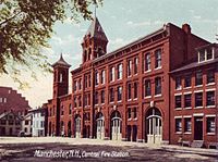
Fire department
The city of Manchester is protected all year by the 200 paid, professional firefighters (IAFF Local 856) of the City of Manchester Fire Department. The department is commanded by a Chief of Department, Daniel Goonan, one Assistant Chief, and five District Chiefs.[63][64] The Manchester Fire Department operates out of ten fire stations throughout the city, and operates a fire apparatus fleet of ten engines, four ladder trucks (two staffed/two cross-manned by the engine), one rescue, and one district chief (two if manpower permits). The Manchester Fire Department responds to over 26,000 emergency calls annually.[65][66][67]
Notable people
Sister cities
 Neustadt an der Weinstraße, Rhineland-Palatinate, Germany
 Taichung, Taiwan
 Tel Aviv, Israel [citation needed]
 Gweru, Zimbabwe [citation needed]
Gallery
-
 Granite Street (1900)
 -
 War Monument (1905)
 -
 Home of General John Stark (1906)
 -
 Old Central Fire Station (1907)
 -
 Old City Library (1908)
 -
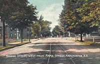 Bridge Street (1909)
 -
 Pearl Street School (c. 1910)
 -
 Union Station (c. 1914)
 -
 Monument to Spanish–American War soldiers (dedicated 1920)
 -
 Manchester houses the state Roman Catholic Diocese at 153 Ash Street.
 -
 Manchester NH Skyline (November 2014)


.jpg)
See also
Notes
- ^ Official precipitation records for Manchester were kept at an undisclosed location in the area from February 1885 to June 5, 1948, Manchester–Boston Regional Airport (KMHT) from June 6, 1948 to March 31, 1967, another, possibly differing, undisclosed location from April 1, 1967 to March 31, 1998, and again at KMHT since April 1, 1998. Temperature records began in April 1885, while snowfall records began on November 22, 1902. There are significant gaps in data coverage before April 1998; for more information, see ThreadEx.
References
- ^ a b Brooks, Scott (October 26, 2005). "ManchVegas: Love it or hate it, the Queen City's other name has stuck". New Hampshire Union Leader. Retrieved January 20, 2011.
- ^ "2019 U.S. Gazetteer Files". United States Census Bureau. Retrieved July 26, 2020.
- ^ "U.S. Census website". United States Census Bureau. Retrieved November 4, 2014.
- ^ a b c "Population and Housing Unit Estimates". Retrieved May 21, 2020.
- ^ a b c "Geographic Identifiers: 2010 Demographic Profile Data (G001): Manchester city, New Hampshire". U.S. Census Bureau, American Factfinder. Retrieved August 5, 2014.
- ^ Manchester, New Hampshire Publisher: CityTownInfo.com Retrieved: March 4, 2014.
- ^ a b Kavilanz, Parija. "10 best cities for small businesses". CNNMoney. Retrieved September 21, 2017.
- ^ a b c From textiles to high-tech: No. 13, Manchester, N.H. Mutualfunds.info (March 26, 2008). Retrieved on August 2, 2013.
- ^ a b c "Top 10 Tax-Friendly Cities". Yahoo!. Archived from the original on March 8, 2017. Retrieved January 17, 2017.
- ^ a b Greenburg, Zack O'Malley (July 14, 2009). "In Depth: America's Best Cheap Cities".
- ^ a b "10 Cities Where The American Dream Is Still Alive".
- ^ a b Dill, Kathryn. "The Most And Least Educated Cities in America". Forbes. Retrieved September 21, 2017.
- ^ Clarke, J.B. (1875). Manchester: A Brief Record of Its Past and a Picture of Its Present, Including an Account of Its Settlement and of Its Growth as a Town and City; a History of Its Schools, Churches, Societies, Banks. J. B. Clarke. p. 11.
- ^ a b c d "Manchester, New Hampshire". Encyclopædia Britannica Online. Encyclopædia Britannica. December 2, 2014. Retrieved June 22, 2015.
- ^ a b Samson, Gary (2000). Manchester: The Mills And The Immigrant Experience. Portsmouth, New Hampshire: Arcadia Publishing. pp. 13–18. ISBN 978-0-7385-0477-3.
- ^ Tamara K. Hareven, Amoskeag: Life and Work in an American Factory City
- ^ Samson, Gary (2000). Manchester: The Mills And The Immigrant Experience. Portsmouth, New Hampshire: Arcadia Publishing. pp. 22–27. ISBN 978-0-7385-0477-3.
- ^ Master Plan. Manchesternh.gov (February 6, 2012). Retrieved on August 2, 2013.
- ^ "Map". davidrumsey.com.
- ^ City of Manchester: Current Projects Archived August 18, 2010, at the Wayback Machine. Yourmanchesternh.com (June 30, 2010). Retrieved on August 2, 2013.
- ^ Oh Goodies: Wal-Mart Goes Mail-Order Gourmet | New Hampshire Public Radio. Nhpr.org (November 14, 2012). Retrieved on August 2, 2013.
- ^ Only in Print: Big-dollar facelift is hoped for the Hollow | New Hampshire Only in Print. Unionleader.com (May 26, 2013). Retrieved on August 2, 2013.
- ^ a b "Station Name: NH MANCHESTER AP". National Oceanic and Atmospheric Administration. Retrieved September 8, 2017.
- ^ a b "NowData - NOAA Online Weather Data". National Oceanic and Atmospheric Administration. Retrieved February 26, 2018.
- ^ "Profile of General Population and Housing Characteristics: 2010 Demographic Profile Data, Manchester, NH Metropolitan NECTA". United States Census Bureau. Retrieved September 16, 2011.
- ^ "Annual Estimates of the Resident Population: April 1, 2010 to July 1, 2018 (PEPANNRES): Incorporated Places, New Hampshire". Retrieved June 15, 2018.
- ^ "Annual Estimates of the Resident Population: April 1, 2010 to July 1, 2015 (PEPANNRES) - United States -- Metropolitan and Micropolitan Statistical Area; and for Puerto Rico". U.S. Census Bureau, American Factfinder. Retrieved July 11, 2016.
- ^ a b c "Profile of General Population and Housing Characteristics: 2010 Demographic Profile Data, Manchester city, New Hampshire". United States Census Bureau. Retrieved September 16, 2011.
- ^ "Manchester (city), New Hampshire". State & County QuickFacts. United States Census Bureau. Archived from the original on July 17, 2015.
- ^ "New Hampshire—Race and Hispanic Origin for Selected Cities and Other Places: Earliest Census to 1990". United States Census Bureau. Archived from the original on August 12, 2012.
- ^ "Selected Social Characteristics in the United States: 2011 American Community Survey 1-Year Estimates (DP02), Manchester city, New Hampshire". U.S. Census Bureau. Retrieved February 22, 2013.
- ^ "U.S. Decennial Census". Census.gov. Retrieved April 5, 2013.
- ^ "Selected Economic Characteristics: 2011 American Community Survey 1-Year Estimates (DP03), Manchester city, New Hampshire". U.S. Census Bureau. Retrieved February 22, 2013.
- ^ "Quick Facts". Manchester Economic Development Office. Retrieved February 9, 2019.
- ^ "Archived copy". Archived from the original on May 29, 2014. Retrieved May 12, 2014.
{{cite web}}: CS1 maint: archived copy as title (link) - ^ "SEE Science Center". Retrieved September 1, 2017.
- ^ Site, City of Manchester NH Official Web. "JFK Memorial Coliseum".
- ^ "Manchester Local Customs". VirtualTourist.com. Retrieved June 7, 2010.
- ^ "Manchester Parks need help". Hippo. Retrieved June 7, 2010.
- ^ "Monsters, Marriage and Murder in Manchvegas". Internet Movie Database.
- ^ "Slam Free or Die Voted "Best Poetry Venue in the World"". July 26, 2013.
- ^ "Manchester City Library - Visit Us". Manchester City Library.
- ^ "SNHU Athletics". Southern New Hampshire University - Official Website. SNHU. Retrieved April 29, 2015.
- ^ "WFTDA Leagues – WFTDA".
- ^ Rivers, Bryon (August 21, 2009). "The women of Skate Free or Die prepare for final match" Archived January 10, 2013, at archive.today. Lawrence Eagle Tribune. Retrieved February 12, 2010.
- ^ "Election Results". sos.nh.gov.
- ^ "District 4: Councilor Theodore L. Gatsas". State of New Hampshire. Retrieved January 10, 2019.
- ^ http://www.mc2school.org
- ^ https://millfalls.org/contact-us/
- ^ https://www.polarischarterschool.org/
- ^ https://www.kreiva.org/
- ^ "St. Catherine of Siena School".
- ^ "Manchester Ink Link - Where all things Manchester connect". manchesterinklink.com.
- ^ "Boston & Maine Railroad, Tables 1, 2, 4, 7, 19, 37, 38". Official Guide of the Railways. 82 (8). National Railway Publication Company. January 1950.
- ^ "Boston & Maine Railroad, Table 1". Official Guide of the Railways. 100 (2). National Railway Publication Company. July 1967.
- ^ "Boston & Maine Railroad, Table 1". Official Guide of the Railways. 100 (5). National Railway Publication Company. October 1967.
- ^ "Archived copy" (PDF). Archived from the original (PDF) on June 5, 2011. Retrieved May 17, 2011.
{{cite web}}: CS1 maint: archived copy as title (link) - ^ "Archived copy" (PDF). Archived from the original (PDF) on March 20, 2012. Retrieved May 18, 2011.
{{cite web}}: CS1 maint: archived copy as title (link) - ^ List of major cities in US lacking Amtrak service - Wikipedia, the free encyclopedia. En.wikipedia.org. Retrieved on August 2, 2013.
- ^ Transportation, CHA for New Hampshire Department of. "Rebuilding I93: Salem to Manchester (NHDOT)—Frequently Asked Questions (F.A.Q.)".
- ^ "Rail plan" (PDF). nh.gov.
- ^ Livable: Dean Kamen proposes downtown rail loop. LivableMHT (January 17, 2012). Retrieved on August 2, 2013.
- ^ Site, City of Manchester NH Official Web. "Fire Department".
- ^ "Organization Chart" (PDF). manchesternh.gov.
- ^ Site, City of Manchester NH Official Web. "Fire Roster".
- ^ Site, City of Manchester NH Official Web. "Fire Stations".
- ^ Site, City of Manchester NH Official Web. "Department Apparatus".
Further reading
External links
- Official website
- Manchester Historic Association
- . Encyclopædia Britannica (11th ed.). 1911.
Places adjacent to Manchester, New Hampshire | |
|---|---|

| International | |
|---|---|
| National | |
| Geographic | |
| Other | |
- Manchester, New Hampshire
- 1751 establishments in New Hampshire
- Cities in Hillsborough County, New Hampshire
- Cities in New Hampshire
- Company towns in New Hampshire
- County seats in New Hampshire
- Early American industrial centers
- History of the textile industry
- Populated places established in 1751
- New Hampshire populated places on the Merrimack River
- Ukrainian communities in the United States