
Meraux, Louisiana
Meraux | |
|---|---|
Census-designated place | |
 Location in St. Bernard Parish and the state of Louisiana. | |
| Coordinates: 29°55′39″N 89°55′07″W / 29.92750°N 89.91861°W | |
| Country | United States |
| State | Louisiana |
| Parish | St. Bernard |
| Area | |
| • Total | 4.81 sq mi (12.46 km2) |
| • Land | 4.15 sq mi (10.74 km2) |
| • Water | 0.66 sq mi (1.72 km2) |
| Elevation | 7 ft (2 m) |
| Population (2020) | |
| • Total | 6,804 |
| • Density | 1,640.31/sq mi (633.33/km2) |
| Time zone | UTC-6 (CST) |
| • Summer (DST) | UTC-5 (CDT) |
| ZIP code | 70075[2] |
| Area code | 504 |
| FIPS code | 22-49800 |
Meraux is a census-designated place (CDP) in St. Bernard Parish, Louisiana, United States. The population was 6,804 in 2020. It is part of the New Orleans–Metairie–Kenner Metropolitan Statistical Area.
History[edit]
In 2005, the town was devastated by storm surge and wind associated with Hurricane Katrina which destroyed the Mississippi River-Gulf Outlet Canal (MRGO) levee.

Geography[edit]
Meraux is located at 29°55′39″N 89°55′7″W / 29.92750°N 89.91861°W (29.927561, -89.918508).[3] According to the United States Census Bureau, the CDP has a total area of 4.8 square miles (12.4 km2), of which 4.2 square miles (10.8 km2) is land and 0.6 square mile (1.6 km2) (12.94%) is water.
Demographics[edit]
| Census | Pop. | Note | %± |
|---|---|---|---|
| 2020 | 6,804 | — | |
| U.S. Decennial Census[4] | |||
| Race | Number | Percentage |
|---|---|---|
| White (non-Hispanic) | 4,427 | 65.06% |
| Black or African American (non-Hispanic) | 1,005 | 14.77% |
| Native American | 40 | 0.59% |
| Asian | 152 | 2.23% |
| Other/Mixed | 308 | 4.53% |
| Hispanic or Latino | 872 | 12.82% |
In 2000,[6] there were 10,192 people, 3,707 households, and 2,772 families residing in the CDP. The population density was 2,447.8 inhabitants per square mile (945.1/km2). There were 3,793 housing units at an average density of 911.0 per square mile (351.7/km2). The racial makeup of the CDP was 92.71% White, 3.66% African American, 0.47% Native American, 1.63% Asian, 0.33% from other races, and 1.20% from two or more races. Hispanic or Latino of any race were 4.07% of the population. At the 2020 United States census, there were 6,804 people, 2,184 households, and 1,632 families residing in the CDP. The racial makeup was 65.06% non-Hispanic white, 14.77% Black or African American, 0.59% Native American, 2.23% Asian, 4.53% mixed or other race, and 12.82% Hispanic or Latino of any race.
Education[edit]
Residents are zoned to schools in the St. Bernard Parish Public Schools.
As of 2007, Chalmette High School serves the population.
References[edit]
- ^ "2020 U.S. Gazetteer Files". United States Census Bureau. Retrieved March 20, 2022.
- ^ "Meraux LA ZIP Code". zipdatamaps.com. 2023. Retrieved June 16, 2023.
- ^ "US Gazetteer files: 2010, 2000, and 1990". United States Census Bureau. February 12, 2011. Retrieved April 23, 2011.
- ^ "Census of Population and Housing". Census.gov. Retrieved June 4, 2016.
- ^ "Explore Census Data". data.census.gov. Retrieved December 28, 2021.
- ^ "U.S. Census website". United States Census Bureau. Retrieved January 31, 2008.
External links[edit]
Municipalities and communities of St. Bernard Parish, Louisiana, United States | ||
|---|---|---|
| CDPs | 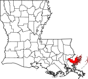 | |
| Other communities | ||
| Ghost towns | ||