
Morgan, Montana
Morgan, Montana | |
|---|---|
 Morgan, Montana  Morgan, Montana | |
| Coordinates: 48°59′36″N 107°49′56″W / 48.99333°N 107.83222°W | |
| Country | United States |
| State | Montana |
| County | Phillips |
| Elevation | 2,854 ft (870 m) |
| Time zone | UTC-7 (Mountain (MST)) |
| • Summer (DST) | UTC-6 (MDT) |
| Area code | 406 |
| GNIS feature ID | 767925[1] |
Morgan is an unincorporated community in Phillips County, Montana, United States.
Description[edit]
Morgan is located at the Canada–United States border on U.S. Route 191, 44 miles (71 km) north of Malta.
In the footnotes of The Big Roads (2011) by Earl Swift, the author says that Morgan is the U.S. settlement farthest away (191.4 miles) from an Interstate highway.[2]
Climate[edit]
According to the Köppen Climate Classification system, Morgan has a cold semi-arid climate, abbreviated "BSk" on climate maps. The hottest temperature recorded in Morgan was 103 °F (39.4 °C) on August 6, 1983, while the coldest temperature recorded was −42 °F (−41.1 °C) on December 24, 1983.[3]
| Climate data for Morgan, Montana, 1991–2020 normals, extremes 1976–present | |||||||||||||
|---|---|---|---|---|---|---|---|---|---|---|---|---|---|
| Month | Jan | Feb | Mar | Apr | May | Jun | Jul | Aug | Sep | Oct | Nov | Dec | Year |
| Record high °F (°C) | 60 (16) |
67 (19) |
73 (23) |
89 (32) |
97 (36) |
101 (38) |
102 (39) |
103 (39) |
100 (38) |
88 (31) |
76 (24) |
61 (16) |
103 (39) |
| Mean maximum °F (°C) | 45.6 (7.6) |
47.5 (8.6) |
60.6 (15.9) |
75.1 (23.9) |
83.7 (28.7) |
88.8 (31.6) |
93.7 (34.3) |
96.3 (35.7) |
88.7 (31.5) |
75.2 (24.0) |
59.2 (15.1) |
46.8 (8.2) |
97.4 (36.3) |
| Mean daily maximum °F (°C) | 22.7 (−5.2) |
27.6 (−2.4) |
40.3 (4.6) |
55.9 (13.3) |
66.8 (19.3) |
74.0 (23.3) |
83.0 (28.3) |
82.7 (28.2) |
71.5 (21.9) |
55.8 (13.2) |
38.4 (3.6) |
25.9 (−3.4) |
53.7 (12.1) |
| Daily mean °F (°C) | 13.5 (−10.3) |
17.7 (−7.9) |
29.3 (−1.5) |
42.9 (6.1) |
53.1 (11.7) |
61.2 (16.2) |
68.4 (20.2) |
67.5 (19.7) |
57.0 (13.9) |
43.2 (6.2) |
28.4 (−2.0) |
16.7 (−8.5) |
41.6 (5.3) |
| Mean daily minimum °F (°C) | 4.4 (−15.3) |
7.8 (−13.4) |
18.2 (−7.7) |
29.9 (−1.2) |
39.4 (4.1) |
48.3 (9.1) |
53.8 (12.1) |
52.2 (11.2) |
42.6 (5.9) |
30.7 (−0.7) |
18.5 (−7.5) |
7.6 (−13.6) |
29.5 (−1.4) |
| Mean minimum °F (°C) | −24.0 (−31.1) |
−15.2 (−26.2) |
−7.2 (−21.8) |
13.6 (−10.2) |
24.5 (−4.2) |
37.1 (2.8) |
43.9 (6.6) |
39.4 (4.1) |
27.9 (−2.3) |
10.2 (−12.1) |
−3.4 (−19.7) |
−16.0 (−26.7) |
−28.7 (−33.7) |
| Record low °F (°C) | −40 (−40) |
−39 (−39) |
−29 (−34) |
−4 (−20) |
14 (−10) |
29 (−2) |
36 (2) |
31 (−1) |
18 (−8) |
−14 (−26) |
−32 (−36) |
−42 (−41) |
−42 (−41) |
| Average precipitation inches (mm) | 0.46 (12) |
0.19 (4.8) |
0.25 (6.4) |
0.90 (23) |
1.83 (46) |
3.01 (76) |
1.82 (46) |
1.29 (33) |
1.28 (33) |
0.77 (20) |
0.44 (11) |
0.37 (9.4) |
12.61 (320.6) |
| Average snowfall inches (cm) | 3.5 (8.9) |
3.0 (7.6) |
4.6 (12) |
1.4 (3.6) |
0.6 (1.5) |
0.0 (0.0) |
0.0 (0.0) |
0.0 (0.0) |
0.3 (0.76) |
1.8 (4.6) |
3.6 (9.1) |
4.1 (10) |
22.9 (58.06) |
| Average precipitation days (≥ 0.01 in) | 3.7 | 3.5 | 3.3 | 5.3 | 8.5 | 11.5 | 7.4 | 6.3 | 5.8 | 4.6 | 3.8 | 3.7 | 67.4 |
| Average snowy days (≥ 0.1 in) | 3.7 | 3.1 | 2.5 | 1.0 | 0.2 | 0.0 | 0.0 | 0.0 | 0.1 | 0.9 | 2.0 | 2.9 | 16.4 |
| Source 1: NOAA[4] | |||||||||||||
| Source 2: National Weather Service[3] | |||||||||||||
See also[edit]
References[edit]
- ^ "Morgan". Geographic Names Information System. United States Geological Survey, United States Department of the Interior.
- ^ Swift, Earl (2011). The Big Roads: The Untold Story of the Engineers, Visionaries, and Trailblazers Who Created the American Superhighways. Houghton Mifflin Harcourt. p. 351. ISBN 0618812415.
- ^ a b "NOAA Online Weather Data – NWS Glasgow". National Weather Service. Retrieved November 22, 2023.
- ^ "U.S. Climate Normals Quick Access – Station: Port of Morgan, MT". National Oceanic and Atmospheric Administration. Retrieved November 22, 2023.
External links[edit]
![]() Media related to Morgan, Montana at Wikimedia Commons
Media related to Morgan, Montana at Wikimedia Commons
Municipalities and communities of Phillips County, Montana, United States | ||
|---|---|---|
| City | 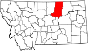 | |
| Towns | ||
| CDPs | ||
| Other communities | ||
| Indian reservations | ||
| Footnotes | ‡This populated place also has portions in an adjacent county or counties | |
This Phillips County, Montana state location article is a stub. You can help Wikipedia by expanding it. |