
Municipal Borough of Hendon
| Hendon | |
|---|---|
 Hendon Town Hall | |
 Hendon within Middlesex in 1961 | |
| Area | |
| • 1894 | 8,382 acres (34 km2) |
| • 1965 | 10,369 acres (42 km2) |
| Population | |
| • 1901 | 22,450 |
| • 1961 | 151,843 |
| History | |
| • Created | 1894 |
| • Abolished | 1965 |
| • Succeeded by | London Borough of Barnet |
| Status | Urban district (1894-1932) Municipal borough (1932-1965) |
| Government | |
| • Motto | Endeavour |
Hendon was an ancient civil parish of around 8,250 acres (33 km2) which included Mill Hill, as well as Golders Green and Childs Hill. In 1894 it was created an urban district of Middlesex and in 1932 it became a municipal borough. The municipal borough was abolished in 1965 and the area became part of the London Borough of Barnet.
History
Background
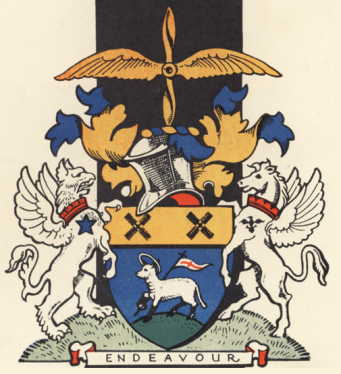
The name is Saxon and means the high down, and its earliest known use is in 1005 as Heandunigna. It was in the Hundred of Gore in the county of Middlesex. It had a vestry by the middle of the 17th century, becoming an urban district of Middlesex in 1894 and a municipal borough in 1932 (see the coat of arms and description. The municipal borough was abolished in 1965 and the area became part of the London Borough of Barnet. Between 1835 and 1930 Hendon Union was a poor Law Union, and census registrative District, which included a number of other parishes: Edgware, Great Stanmore, Little Stanmore, Kingsbury, Harrow on the Hill, Pinner, Willesden, as well as those areas in the ancient parish of Hendon. In 1932 the parish of Edgware (previously part of the Hendon Rural District) became a part of Hendon Urban District.
Development

There is evidence of Roman activity in Hendon, and along its western edge runs the Roman Road Watling Street. Hendon Manor was recorded in the Domesday survey of 1087 as lands belonging to Westminster Abbey. From at least the Saxon period until the 14th century most economic activity was centred on the extensive woodlands, cultivated for firewood and pigs, and an ancient route out of London, passing through Hampstead, Golders Green, and Mill Hill, (with slight varition in its course) continued to be important until the early 19th century. During the 17th century the area became famous for its hay. In 1765 the manor came into the possession of the actor David Garrick. In 1868 a station was opened on the Midland Railway, and this encouraged some suburban development in Hendon during the 1880s and 1890s. Samuel Clarke established the Pyramid and Fairy light works in Child’s Hill during 1885, the first of Hendon’s factories, which was joined by a number of other manufactories but it was the arrival of the trams and tubes between 1906 and 1924, that promoted the greatest growth. This was twofold as it provided not only a means of commuting for people living in the area into central London, but also provided reasonable transport for workers to come into the area. By the 1930s Hendon was a recognised industrial area of London, with companies like Schweppes, Johnson’s Photographic Ltd and Handley Page the aircraft manufacturers. However much of Hendon’s industry was minor engineer units, often employing fewer than twenty people. During the post war period demand for new housing pushed industry out of the area, and established the district as solely suburban in nature.
Hendon is famous as the location of Hendon Aerodrome which was established by Claude Grahame-White in 1911.
Population 1700-1961
- 1700 - estimated at 1900.
- 1801 - 1955
- 1811 - 2589
- 1821 - 3100
- 1831 - 3110
- 1841 - 3327
- 1851 - 3333
- 1861 - 4544
- 1871 - 6977
- 1881 - 10,484
- 1891 - 15,843
- 1901 - 22,450
- 1911 - 40,039
- 1921 - 56,013
- 1931 - 115,682
- 1940 - 166,237
- 1951 - 155,835
- 1961 - 151,843
Districts
Hendon contained the following districts:
- Brent Street
- The Burroughs
- Childs Hill
- Church End
- Clitterhouse
- Colindale
- Edgware
- Golders Green
- Grahame Park
- Hendon Central
- Holders Hill
- Mill Hill
- Parson Street
- Temple Fortune
- West Hendon
The following places were shared with other parishes:
- Burnt Oak was shared with Stanmore
- Cricklewood was shared with Willesden
- Hampstead Garden Suburb was shared with Finchley
- The Hyde was shared with Kingsbury
- North End was shared with Hampstead
External links
- Plan of parish
- Barnet Archives and Local Studies
- HADAS Archived Newsletters (The Hendon & District Archaeological Society)
- Victoria County History Hendon Chapter
- Pictures 1700 - 1900
- Pictures 1900 - 1930
- Hendon and Finchley Times is archived from 1998 for more recent history.
- Kelly’s Directory - These contain lists of residents for Hendon and interesting descriptions of the area:
Local government districts abolished or transferred by the London Government Act 1963 | ||
|---|---|---|
| London | ||
| Essex | ||
| Hertfordshire | ||
| Middlesex, CC | ||
| Kent | ||
| Surrey | ||
| Transfers | Middlesex to Hertfordshire: Potters Bar
| |
