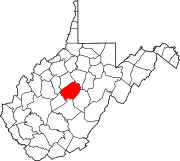
Napier, West Virginia
Napier | |
|---|---|
| Coordinates: 38°47′27″N 80°35′20″W / 38.79083°N 80.58889°W | |
| Country | United States |
| State | West Virginia |
| County | Braxton |
| Time zone | UTC-5 (Eastern (EST)) |
| • Summer (DST) | UTC-4 (EDT) |
| ZIP codes | 26631 |
| GNIS feature ID | 1549844[1] |
Napier is an unincorporated community in Braxton County, West Virginia, United States, founded in 1894, with the ZIP code of 26631. Napier has two significant historical landmarks: the Cunningham House and Outbuildings and the Union Civil War Fortification, and both are listed on the National Register of Historic Places.[2]
References[edit]
- ^ "US Board on Geographic Names". United States Geological Survey. October 25, 2007. Retrieved January 31, 2008.
- ^ "National Register Information System". National Register of Historic Places. National Park Service. March 13, 2009.


