
Oak Ridge, Tennessee
Oak Ridge, Tennessee | |
|---|---|
| Nickname(s): The Atomic City The Secret City | |
| Motto: The Vision Lives On | |
 Location in Anderson County and the state of Tennessee. | |
| Country | United States |
| State | Tennessee |
| Counties | Anderson, Roane |
| Established | 1942 |
| Incorporated | 1959 |
| Government | |
| • Type | Council-manager (under home-rule charter) |
| • Mayor | Warren Gooch |
| • City manager | Mark Watson |
| Area | |
| • Total | 89.9[1] (7th) sq mi (232.9 km2) |
| • Land | 85.3 sq mi (220.8 km2) |
| • Water | 4.7 sq mi (12.2 km2) |
| Elevation | 850 ft (259 m) |
| Population (2010) | |
| • Total | 29,330 (17th) |
| • Density | 344/sq mi (132.8/km2) |
| Time zone | UTC-5 (EST) |
| • Summer (DST) | UTC-4 (EDT) |
| ZIP codes | 37830-37831 |
| Area code | 865 |
| FIPS code | 47-55120[2] |
| GNIS feature ID | 1296156[3] |
| Website | www |
Oak Ridge is a city in Anderson and Roane counties in the eastern part of the U.S. state of Tennessee, about 25 miles (40 km) west of Knoxville. Oak Ridge's population was 29,330 at the 2010 census.[4] It is part of the Knoxville Metropolitan Area. Oak Ridge's nicknames include the Atomic City,[5] the Secret City,[6] the Ridge, and the City Behind the Fence.[7]
Oak Ridge was established in 1942 as a production site for the Manhattan Project—the massive American, British, and Canadian operation that developed the atomic bomb. As it is still the site of Oak Ridge National Laboratory, scientific development still plays a crucial role in the city's economy and culture in general.
History


The earliest substantial occupation of the Oak Ridge area occurred during the Woodland period (c. 1000 BC – 1000), although artifacts dating to the Paleo-Indian period have been found throughout the Clinch Valley.[8] Two Woodland mound sites—the Crawford Farm Mounds and the Freels Farm Mounds—were uncovered in the 1930s as part of the Norris Basin salvage excavations. Both sites were located just southeast of the former Scarboro community.[9] The Bull Bluff site, which was occupied during both the Woodland and Mississippian (c. 1000–1600) periods, was uncovered in the 1960s in anticipation of the construction of Melton Hill Dam.[10] Bull Bluff is a cliff located immediately southeast of Haw Ridge, opposite Melton Hill Park. The Oak Ridge area was largely uninhabited by the time Euro-American explorers and settlers arrived in the late 18th century, although the Cherokee claimed the land as part of their hunting grounds.
During the early 19th century, several rural farming communities developed in the Oak Ridge area, namely Edgemoor and Elza in the northeast, East Fork and Wheat in the southwest, Robertsville in the west, and Bethel and Scarboro in the southeast. The European-American settlers who founded these communities arrived in the late 1790s following the American Revolutionary War and after the Cherokee signed the Treaty of Holston, ceding what is now Anderson County to the United States.
According to local tradition, John Hendrix (1865–1915), an eccentric local resident regarded as a mystic, prophesied the establishment of Oak Ridge some 40 years before construction began. Upset by the death of his young daughter and the subsequent departure of his wife and remaining family, he became religious and told his neighbors he was seeing visions. When he described his visions, people thought he was insane; for this reason, he was institutionalized for a time. According to several published accounts,[11] one vision that he described repeatedly was considered to be a description of the city and production facilities built 28 years after his death, to be used in World War II.
The version recalled by neighbors and relatives has been reported as follows:
In the woods, as I lay on the ground and looked up into the sky, there came to me a voice as loud and as sharp as thunder. The voice told me to sleep with my head on the ground for 40 nights and I would be shown visions of what the future holds for this land.... And I tell you, Bear Creek Valley someday will be filled with great buildings and factories, and they will help toward winning the greatest war that ever will be. And there will be a city on Black Oak Ridge and the center of authority will be on a spot middle-way between Sevier Tadlock's farm and Joe Pyatt's Place. A railroad spur will branch off the main L&N line, run down toward Robertsville and then branch off and turn toward Scarborough. Big engines will dig big ditches, and thousands of people will be running to and fro. They will be building things, and there will be great noise and confusion and the earth will shake. I've seen it. It's coming.[11]
Manhattan Project

In 1942, the United States federal government chose the area as a site for developing materials for the Manhattan Project. Maj. Gen. Leslie Groves, military head of the Manhattan Project, liked the area for several reasons. Its relatively low population made acquisition affordable, yet the area was accessible by both highway and rail, and utilities such as water and electricity were readily available due to the recent completion of Norris Dam. Finally, the project location was established within a 17-mile-long (27 km) valley. This feature was linear and partitioned by several ridges, providing natural protection against the spread of disasters at the four major industrial plants—so they wouldn't blow up "like firecrackers on a string."[12]
When the Governor of Tennessee Prentice Cooper was officially handed by a junior officer (a lieutenant) the July 1943 presidential proclamation making Oak Ridge a military district not subject to state control, he tore it up and refused to see the MED District Engineer Lt-Col James C. Marshall. The new District Engineer Kenneth Nichols had to placate him.[13][14] Cooper came to see the project (except for the production facilities under construction) on November 3, 1943; and he appreciated the bourbon-laced punch served (although Anderson County was "dry"). [15] CEW and HEW accommodation in houses and dormitories was basic, with coal rather than oil or electric furnaces. But it was of a higher standard than Groves would have liked, and was better than at Los Alamos.[16] Medical care was provided by Army doctors and hospitals, with civilians paying $2.50 per month ($5 for families) to the medical insurance fund. [17]
The location and low population also helped keep the town a secret, though the population of the settlement grew from about 3,000 in 1942 to about 75,000 by 1945. The K-25 uranium-separating facility by itself covered 44 acres (18 ha) and was the largest building in the world at that time.[18] The name "Oak Ridge" was chosen for the settlement in 1943 from among suggestions submitted by project employees. The name related to the settlement's location along Black Oak Ridge, and officials thought the rural-sounding name "held outside curiosity to a minimum."[19] The name wasn't formally adopted until 1949, and the site was referred to as the Clinton Engineer Works (CEW) until then. All workers wore badges. The town was surrounded by guard towers and a fence with seven gates.


Starting in October 1942, the United States Army Corps of Engineers began acquiring more than 60,000 acres (24,000 ha) in the Oak Ridge area for the United States' Manhattan Project. Unlike the earlier land acquisitions by the Tennessee Valley Authority for Norris Dam—which were still fresh on the minds of many Anderson Countians—the Corps' "declaration of taking" was much more swift and final. Many residents came home to find eviction notices tacked to their doors. Most were given six weeks to evacuate, although several had as little as two weeks. Some were forced out before they received compensation.
By March 1943, the COE had removed the area's earlier communities and established fences and checkpoints. Anderson County lost one-seventh of its land and $391,000 in annual property tax revenue. The manner by which the Oak Ridge area was acquired by the government created a tense, uneasy relationship between the Oak Ridge complex and the surrounding towns that lasted throughout the Manhattan Project.[20] Although original residents of the area could be buried in existing cemeteries, every coffin was reportedly opened for inspection.[21]
The Corps' Manhattan Engineer District (MED) managed the acquisition and clearing. The K-25, S-50, and Y-12 plants were each built in Oak Ridge to separate the fissile isotope uranium-235 from natural uranium, which consists almost entirely of the isotope uranium-238. During construction of the magnets, which were required for the process that would separate the uranium at the Y-12 site, a shortage of copper forced the MED to borrow 14,700 tons of silver bullion from the United States Treasury to be used for electrical conductors for the electromagnet coils as a substitute.[22] The X-10 site, now the location of Oak Ridge National Laboratory, was established as a pilot plant for production of plutonium using the Graphite Reactor.
Because of the large number of workers recruited to the area for the Manhattan Project, the Army planned a town for project workers at the eastern end of the valley. The time required for the project's completion caused the Army to opt for a relatively permanent establishment rather than a camp of enormous size.
The architecture firm Skidmore, Owings and Merrill (SOM) was contracted to provide a layout for the town and house designs.[23] SOM Partner John O. Merrill moved to Tennessee to take charge of designing the secret buildings at Oak Ridge.[24] He directed the creation of a town,[25] which soon had 300 miles (480 km) of roads, 55 miles (89 km) of railroad track, ten schools, seven theaters, 17 restaurants and cafeterias, and 13 supermarkets. A library with 9,400 books, a symphony orchestra, sporting facilities, church services for 17 denominations, and a Fuller Brush Company salesman served the new city and its 75,000 residents.[26] No airport was built, however, for security reasons.[21] Prefabricated modular homes, apartments, and dormitories, many made from cemesto (bonded cement and asbestos) panels, were quickly erected. Streets were laid out in the manner of a "planned community".
The original streets included several main east-to-west roads, namely the Oak Ridge Turnpike, Tennessee Avenue, Pennsylvania Avenue, Hillside Road, Robertsville Road, and Outer Drive. North-to-south oriented streets connecting these main roads were designated "Avenues", and streets branching off from the avenues were designated "Roads", "Places", "Lanes", or "Circles". "Roads" connected two streets, while "Lanes" and "Places" were dead ends.[27] The names of the main avenues generally progressed alphabetically from east to west (e.g., Alabama Avenue in the east, Vermont Avenue in the west), and the names of the smaller streets began with the same letter as the main avenue from which they started (e.g., streets connected to Florida Avenue began with "F").[27][28] This made it considerably easier for the city's new residents to find each other.
Housing for families was constructed according to a series of templates, identified by letters. Thus an "A" house was the smallest lettered design, with two small bedrooms and one bathroom. A "B" house featured two bedrooms, one bathroom and a larger living space. A "C" house featured three bedrooms and one bathroom. A "D" house featured three bedrooms with one and one-half bathrooms and a larger living space. An "E" was a two-story four-unit structure, and an "F" was the largest type home. The smallest homes were called "flat tops"; originally intended to be only temporary structures, they proliferated atop the ridges in the west end of town.
More spacious homes were awarded by the government based upon family size and the status of the worker.[29] If a couple became divorced, they would usually be "demoted" in terms of their housing allocation, and a worker who became unemployed would usually lose his or her home altogether.[30]
Construction personnel swelled the wartime population of Oak Ridge to as much as 70,000. That dramatic population increase, and the secret nature of the project, meant chronic shortages of housing and supplies during the war years. The town was administered by Turner Construction Company through a subsidiary named the Roane-Anderson Company.[21] For most residents, however, their "landlord" was known as "MSI" (Management Services, Inc.).
The news of the use of the first atomic bomb against Japan on August 6, 1945, revealed to the people at Oak Ridge what they had been working on.
Segregation
Oak Ridge was developed by the federal government as a segregated community as a requirement by the Southern bloc of Democrats in Congress to authorize funding for the project. Due to generally holding lower-ranked jobs, their assigned dwellings were predominantly government-built "hutments" (one-room shacks) located very close to the Y-12 plant, in the one residential area designated as colored. Kenneth Nichols, the MED District Engineer, was told by the main construction contractor for the K-25 plant that the Negro construction labor force had a large turnover rate, so Nichols gave permission to set up a separate black women's camp. When Leslie Groves visited the plant with K. T. Keller of Chrysler, Keller saw twelve Negro women sweeping the thirty-foot wide alley between the production units, and said "Nichols, don't you know there is a machine made to sweep a concrete floor like this?" Nichols replied "Sure I do, but these gals can do more than one of those machines". The men now had an opportunity to "fracas" on Saturday night, and labor turnover had reduced.[31] During the war, plans were made for a colored neighborhood of houses equal in quality to those provided for whites, but it was not implemented due to limited resources. After the war, all hutments were dismantled, and a colored neighborhood of permanent houses was developed in the Gamble Valley area of Oak Ridge, which during wartime had been occupied by a white trailer community.
Oak Ridge elementary education prior to 1954 was totally segregated; it was legally part of the Anderson County system though built and operated primarily with federal funds.[32] Black children could attend only the Scarboro Elementary School. Oak Ridge High School was closed to black students, who had to be bussed to Knoxville for an education. Starting in 1950, Scarboro High School was established at Scarboro Elementary School to offer classes for African-American students. It operated until Oak Ridge High School was desegregated in the fall of 1955.
In 1953, the Oak Ridge Town Council encouraged desegregation of Oak Ridge High School; this resulted in an unsuccessful attempt by some residents to recall Waldo Cohn, one of the council.
Following the U.S. Supreme Court decision in Brown v. Board of Education (1954) that segregated public schools were unconstitutional, the Oak Ridge officials changed their policy and desegregated the schools. The nearby high school in Clinton was desegregated in the fall of 1956. It was later bombed and closed. Oak Ridge provided space at a recently vacated elementary school building (the original Linden Elementary School) for the education of high school students from Clinton for two years while Clinton High School was being rebuilt. Robertsville Junior High School, serving the west half of Oak Ridge, was desegregated at the same time as the high school. Elementary schools in other parts of the city and Jefferson Junior High School, serving the east half of the city, were desegregated slowly as African-American families moved into housing outside of Gamble Valley. In 1967, Scarboro Elementary School was closed, and African-American students from Gamble Valley were bussed to other schools around the city.
Following the Brown decision, public accommodations in Oak Ridge were also integrated, although this took a number of years. In the early 1960s, Oak Ridge briefly experienced protest picketing against racial segregation in public accommodations, notably outside a local cafeteria and a laundromat.[33]
Since World War II

Two years after World War II ended, Oak Ridge was shifted to civilian control, under the authority of the U.S. Atomic Energy Commission (AEC). The Roane Anderson Company administered community functions, including arranging housing and operating buses, under a government contract.[34] In 1959 the town was incorporated. The community adopted a city manager and City Council form of government rather than direct federal control.
The S-50 liquid thermal diffusion plant was demolished soon after the war. K-25, where uranium was enriched by the gaseous diffusion process until 1985, was demolished in 2013-15. Two of the four major facilities created for the wartime bomb production are still standing today:
- Y-12, originally used for electromagnetic separation of uranium, is used for nuclear weapons processing and materials storage.
- X-10, site of a test graphite reactor, is now the site of Oak Ridge National Laboratory.
In 1983, the Department of Energy declassified a report showing that significant amounts of mercury had been released from the Oak Ridge Reservation into the East Fork Poplar Creek between 1950 and 1977. A federal court ordered the DOE to bring the Oak Ridge Reservation into compliance with federal and state environmental regulations.[35]
The Department of Energy runs Oak Ridge National Laboratory, a nuclear and high-tech research establishment at the site, and performs national security work. Titan, a supercomputer at the National Laboratory, was named the world's fastest supercomputer in 2012.[36] It was surpassed in 2013 by China's Tianhe-2 supercomputer. Tours of parts of the original facility are available to American citizens from June through September. The tour is so popular that a waiting list is required for seats.[37]
Oak Ridge's scientific heritage is explored in the American Museum of Science and Energy. Its role in the Manhattan Project is preserved in the Manhattan Project National Historical Park (along with sites in Hanford, Washington and Los Alamos, New Mexico), run cooperatively by the National Park Service and the Department of Energy.
Geography

Immediately northeast of Oak Ridge, the southwestward-flowing Clinch River bends sharply to the southeast for roughly 6 miles (10 km) toward Solway, where it turns again to the southwest. After flowing for approximately 17 miles (27 km), the river bends sharply to the northwest at Copper Ridge, and continues in this direction for nearly 7 miles (11 km). At the K-25 plant, the Clinch turns southwest again and flows for another 11 miles (18 km) to its mouth along the Tennessee River at Kingston. This series of bends creates a half-rectangle formation—surrounded by water on the northeast, east, and southwest—in which Oak Ridge is situated.
The Oak Ridge area is striated by five elongated ridges that run roughly parallel to one another in a northeast-to-southwest direction. In order from west-to-east, the five ridges are Blackoak Ridge—which connects the Elza and K-25 bends of the Clinch and thus "walls off" the half-rectangle—East Fork Ridge, Pine Ridge, Chestnut Ridge, and Haw Ridge. The five ridges are divided by four valleys—East Fork Valley (between Blackoak and East Fork Ridge), Gamble Valley (between East Fork Ridge and Pine Ridge), Bear Creek Valley (between Pine Ridge and Chestnut), and Bethel Valley (between Chestnut and Haw). These ridges and valleys are part of the Ridge-and-Valley Appalachians physiographic province. The main section of the city is located in the northeast, where East Fork and Pine Ridge give way to low, scattered hills. Many of the city's residences are located along the relatively steep northeastern slope of Blackoak Ridge.
The completion of Melton Hill Dam (along the Clinch near Copper Ridge) in 1963 created Melton Hill Lake, which borders the city on the northeast and east. The lakefront on the east side of the city is a popular recreation area, with bicycling trails and picnic areas lining the shore. The lake is also well known as a venue for rowing competitions. Watts Bar Lake, an impoundment of the Tennessee River which covers the lower 23 miles (37 km) of the Clinch, borders Oak Ridge to the south and southwest.
According to the United States Census Bureau, the city has a total area of 90.0 square miles (233.0 km2), of which 85.3 square miles (220.8 km2) is land and 4.7 square miles (12.2 km2), or 5.25%, is water.[4]
The highest point is Melton Hill (35°54′35″N 84°18′19″W / 35.90962°N 84.30525°W) on the DOE reservation, at elevation 1,356 feet (413 m).
Climate
| Monthly Normal and Record High and Low Temperatures | ||||||||||||
| Month | Jan | Feb | Mar | Apr | May | Jun | Jul | Aug | Sep | Oct | Nov | Dec |
|---|---|---|---|---|---|---|---|---|---|---|---|---|
| Rec High °F | 75 | 79 | 86 | 92 | 93 | 101 | 105 | 103 | 102 | 90 | 85 | 78 |
| Norm High °F | 45.9 | 51.6 | 61 | 70.5 | 77.8 | 84.9 | 88.1 | 87.2 | 81.1 | 71.1 | 59 | 49 |
| Norm Low °F | 27.2 | 29.5 | 36.6 | 43.8 | 53.4 | 61.7 | 66.4 | 65.2 | 58.8 | 45.7 | 36.4 | 29.8 |
| Rec Low °F | -17 | -13 | 1 | 20 | 30 | 39 | 49 | 50 | 33 | 21 | 0 | -7 |
| Precip (in) | 5.13 | 4.5 | 5.72 | 4.32 | 5.14 | 4.64 | 5.16 | 3.39 | 3.75 | 3.02 | 4.86 | 5.42 |
| Source: USTravelWeather.com | ||||||||||||
Demographics
| Census | Pop. | Note | %± |
|---|---|---|---|
| 1960 | 27,169 | — | |
| 1970 | 28,319 | 4.2% | |
| 1980 | 27,662 | −2.3% | |
| 1990 | 27,310 | −1.3% | |
| 2000 | 27,387 | 0.3% | |
| 2010 | 29,330 | 7.1% | |
| 2015 (est.) | 29,302 | [38] | −0.1% |
| Sources:[39][40] | |||
As of the census[2] of 2000, there were 27,387 people, 12,062 households, and 7,695 families residing in the city. The population density was 320.1 people per square mile (123.6/km²). There were 13,417 housing units at an average density of 156.8 per square mile (60.6/km²). The racial makeup of the city was 86.96% White, 8.18% African American, 0.30% Native American, 2.10% Asian, 0.02% Pacific Islander, 0.76% from other races, and 1.68% from two or more races. Hispanic or Latino of any race were 1.93% of the population.

There were 12,062 households out of which 26.8% had children under the age of 18 living with them, 49.7% were married couples living together, 11.1% had a female householder with no husband present, and 36.2% were non-families. 32.7% of all households were made up of individuals and 15.0% had someone living alone who was 65 years of age or older. The average household size was 2.24 and the average family size was 2.83.
In the city the population was spread out with 22.4% under the age of 18, 6.6% from 18 to 24, 23.6% from 25 to 44, 26.3% from 45 to 64, and 21.1% who were 65 years of age or older. The median age was 43 years. For every 100 females there were 88.1 males. For every 100 females age 18 and over, there were 83.4 males.
The median income for a household in the city was $41,950, and the median income for a family was $57,087. Males had a median income of $45,149 versus $27,500 for females. The per capita income for the city was $24,793. About 8.0% of families and 10.9% of the population were below the poverty line, including 17.5% of those under age 18 and 5.5% of those age 65 or over.
Economy

The federal government projects at Oak Ridge are reduced in size and scope, but are still the city's principal economic activity and one of the biggest employers in the Knoxville metropolitan area. The Department of Energy owns the federal sites and maintains a major office in the city. Oak Ridge National Laboratory is the largest multipurpose lab in the Department of Energy's National Laboratory system. It is home to the Spallation Neutron Source, a 1.4 billion dollar project completed in 2006, and "Titan", one of the world's most powerful scientific supercomputers, which has peak performance of more than one quadrillion operations per second.
The Y-12 National Security Complex is a component of the U.S. nuclear weapons complex. The Department of Energy's Environmental Management office is conducting an extensive program of decontamination and decommissioning, environmental cleanup, and waste management to remove or stabilize the hazardous residues remaining from decades of government production and research activities.
The Department of Energy Office of Scientific and Technical Information, which disseminates government research and development information and operates the Science.gov website, is located in the city. The Oak Ridge Institute for Science and Education, operated by Oak Ridge Associated Universities, conducts research and education programs for the DOE, Department of Homeland Security, and other federal agencies. The Atmospheric Turbulence and Diffusion Division (ATDD), one of several field divisions of the National Oceanic and Atmospheric Administration (NOAA) Air Resources Laboratory, is also located in the city. ATDD began under AEC sponsorship in 1948 as a Weather Bureau research office providing meteorological information and expertise for the AEC. Currently its main function is to perform air quality-related research directed toward issues of national and global importance.
Boeing operated a manufacturing plant in the city beginning in the early 1980s, but closed in 2007. IPIX, Remotec (now a subsidiary of Northrop Grumman), and several other technology-based companies have been founded in Oak Ridge. Several radioactive waste processing companies, including EnergySolutions, have operations in Oak Ridge.
The infrastructure that was new in the 1940s is aging. The once-isolated city is now incorporated into the Knoxville metropolitan area. Oak Ridge is now challenged to blend into the suburban orbit of Knoxville as its heritage as a "super secret" government installation subsides. Changing economic forces have led to continuing changes in the commercial sector. For example, the Oak Ridge City Center, a shopping center built in the 1950s and converted to an indoor shopping mall in the 1980s, is largely empty. It is to be partially demolished and redeveloped as a more open-type of shopping area.[41]
Education

The city operates a preschool, four elementary schools enrolling kindergarten through grade 4, two middle schools enrolling grades 5 through 8, and one high school enrolling grades 9 through 12.
In an August 2004 referendum, city voters approved an increase in local sales taxes to fund a $55 million project for Oak Ridge High School. Following demolition of one wing of the main building, construction on the first wall of the new building began in April 2005. Temporary classrooms were set up to house science classes; they will continue to be used for different purposes as the multi-year project progresses.
Roane State Community College has its largest branch campus in Oak Ridge. Other higher education organizations present in the community, but not offering classes locally, include the Oak Ridge Institute for Science and Education, Oak Ridge Associated Universities, and the University of Tennessee Forestry Stations and Arboretum.
Independent schools in the city include the Montessori School of Oak Ridge (preschool and kindergarten), St. Mary's School (Roman Catholic, pre-kindergarten through grade 8), and several preschools. The Oak Ridge Institute for Continued Learning offers a diverse array of educational opportunities for adults.[42]
Media
Oak Ridge is served by a daily newspaper, The Oak Ridger, and was for many years the home of AM radio station WATO.
A smaller daily newspaper in the area is The Oak Ridge Observer.
Notable people
This section needs additional citations for verification. (May 2008) |
The following are notable people who were born, educated, resided, or worked in Oak Ridge:
- Arnold Anderson, Chemical Engineer on the Manhattan Project,[43] Consultant for American Indian Policy Review Commission[44] and founder of American Indian Science and Engineering Society (AISES)[45]
- E. Riley Anderson, Tennessee Supreme Court justice
- Jennifer Azzi, former WNBA player and Olympic gold medalist
- General B.B. Bell, general in command of U.S. Forces Korea since 2006 and previously in command of United States Army, Europe and NATO's Joint Command
- Manson Benedict, nuclear engineering pioneer
- Mike Caldwell, former NFL football player
- Nikki Caldwell, women's basketball head coach (formerly at UCLA, now at LSU), grew up in Oak Ridge[46][47]
- Kenneth Lee Carder, United Methodist Church bishop
- Lee Clayton, country-rock singer/songwriter best known as the writer of "Ladies Love Outlaws"[48]
- Sheldon Datz, chemist[49]
- Charlie Ergen, co-founder and CEO of EchoStar Communications Corporation, the parent company of Dish Network
- Megan Fox, actress, born in Oak Ridge[50]
- Jeannine Hall Gailey, author who grew up in Oak Ridge, as described in The Robot Scientist's Daughter.[51]
- John H. (Jack) Gibbons, Director of the Office of Technology Assessment and White House Office of Science and Technology Policy
- Eugene Guth, physicist
- Elaine Hendrix, actress
- Otis Howard, former NBA player
- Alston Scott Householder, mathematician who invented the Householder transformation
- Kai-Fu Lee, Google executive
- Randy McNally, Tennessee state senator
- John O. Merrill, architect[52]
- Edgar Meyer, Grammy Award-winning bassist
- Sarah Monette, author
- Karl Z. Morgan, health physics pioneer
- Ward Plummer, physicist
- William G. Pollard, nuclear physicist and Episcopal priest who was the first director of the Oak Ridge Institute of Nuclear Studies (now Oak Ridge Associated Universities) and the author of many works on the topic of Christianity and science
- Mitch Rouse, actor, director and screenwriter
- Danny Sanders, gridiron football player
- William Shepherd, American astronaut who served as commander of Expedition 1, the first crew on the International Space Station
- Clifford Shull, Nobel Prize-winning physicist
- Gore Verbinski, film director best known for his direction of Pirates of the Caribbean series
- Alvin Weinberg, nuclear physicist
- Ed Westcott, only authorized photographer in Oak Ridge during the Manhattan Project
- Richard White, actor, voice of Gaston in Disney's Beauty and the Beast
- Eugene Wigner, Nobel Prize-winning physicist
- Adam Wingard, director
- Herbert York, nuclear physicist
Points of interest
- Alexander Inn, (Retirement Home)
- American Museum of Science and Energy
- Children's Museum of Oak Ridge
- East Tennessee Technology Park, formerly known as the K-25 site
- Manhattan Project National Historical Park, National Park Service and Department of Energy site
- Oak Ridge National Laboratory
- Office of Scientific and Technical Information (OSTI), U.S. Department of Energy
- United Church, The Chapel on the Hill
- University of Tennessee Arboretum
Sister cities
Oak Ridge has two sister cities, as designated by Sister Cities International:
Footnotes
- ^ U.S. Census Bureau, GCT-PH1. Population, Housing Units, Area, and Density: 2000
- ^ a b "American FactFinder". United States Census Bureau. Archived from the original on September 11, 2013. Retrieved 2008-01-31.
{{cite web}}: Unknown parameter|deadurl=ignored (|url-status=suggested) (help) - ^ "US Board on Geographic Names". United States Geological Survey. 2007-10-25. Retrieved 2008-01-31.
- ^ a b "Geographic Identifiers: 2010 Demographic Profile Data (G001): Oak Ridge city, Tennessee". U.S. Census Bureau, American Factfinder. Retrieved January 28, 2013.
- ^ Olwell, Russell, At Work in the Atomic City: A Labor and Social History of Oak Ridge, Tennessee (Knoxville, Tenn.: University of Tennessee Press, 2004).
- ^ Warren Resen, "The Secret City: Oak Ridge, Tennessee," The Observer News, 3 August 2010. Retrieved: 9 November 2011.
- ^ Charles Johnson and Charles Jackson, City Behind a Fence: Oak Ridge, Tennessee, 1942–1946 (Knoxville, Tenn.: University of Tennessee Press, 1981).
- ^ Beverly Burbage, "Paleo-Indian Points and Uniface Material from the Clinch River Valley." Tennessee Archaeologist 28, no. 1 (Spring of 1962), 47–50.
- ^ William Webb, An Archaeological Survey of the Norris Basin in Eastern Tennessee (Washington, D.C.: U.S. Government Printing Office, 1938), 180–189.
- ^ Glyn DuVall, "A Phase I Archaeological Survey of Proposed Potable Water Storage and Force Main Facilities, Y-12 National Security Complex Site, Anderson County, Tennessee" (August 2005), p. 4. Retrieved: 3 April 2008.
- ^ a b See ORNL, Swords to Plowshares: A Short History of Oak Ridge National Laboratory (1943–1993); David Ray Smith, John Hendrix and the Y-12 National Security Complex; and D. Ray Smith, John Hendrix – Oak Ridge Prophet, The Oak Ridger, March 15, 2006. The first written record of the vision is reported to have been in The Oak Ridge Story, by George O. Robinson, 1950.
- ^ Johnson and Jackson, City Behind a Fence, 6–8.
- ^ *Groves, Leslie (1962). Now it can be told: The Story of the Manhattan Project. New York: Harper & Brothers. pp. 26, 27.
- ^ *Nichols, Kenneth (1987). The Road to Trinity: A Personal Account of How America's Nuclear Policies Were Made. New York: William Morrow. pp. 99–100. ISBN 068806910X.
- ^ Nichols 1987, pp. 117–9. sfn error: multiple targets (2×): CITEREFNichols1987 (help)
- ^ Nichols 1987, pp. 59, 125, 175. sfn error: multiple targets (2×): CITEREFNichols1987 (help)
- ^ Nichols 1987, pp. 121–4. sfn error: multiple targets (2×): CITEREFNichols1987 (help)
- ^ "The Scientific History of the Atomic Bomb." Retrieved: 4 March 2014.
- ^ For Your Information: A Guide to Oak Ridge (United States Engineering Department – Community Relations Section, September 1946), p. 3.
- ^ Johnson and Jackson, City Behind a Fence, pp. 41–47.
- ^ a b c Wickware, Francis Sill (1946-09-09). "Oak Ridge". Life. p. 2. Retrieved 17 December 2014.
- ^ [1] Template:Wayback
- ^ Johnson and Jackson, City Behind a Fence, 14.
- ^ Westcott, Ed. (2005). Westcott, Ed. (2005). Oak Ridge, Charleston, South Carolina: Arcadia Publishing. ISBN 978-0-7385-4170-9; OCLC 62511041, page 61
- ^ Lehman College Art Gallery, Skidmore, Owings and Merrill (SOM), Merrill bio notes
- ^ "Mystery Town Cradled Bomb: 75,000 in Oak Ridge, Tenn. Worked Hard and Wondered Long about Their Secret Job". Life. 1945-08-20. p. 94. Retrieved November 25, 2011.
- ^ a b For Your Information: A Guide to Oak Ridge (United States Engineering Department – Community Relations Section, September 1946), p. 18.
- ^ Local lore had it that a committee of the wives of the U.S. Army Engineers were put in charge of naming the streets.
- ^ Homes in ridge-top locations were generally awarded only to top officials.
- ^ In the late 1950s, the government began selling Oak Ridge residences to the public, with the current occupants receiving priority for the houses they lived in. A tremendous burst of renovation and new construction then ensued, as owners remodeled their homes (often still according to standardized designs) and vast areas of town that had been undeveloped were built upon.
- ^ Nichols, Kenneth (1987). The Road to Trinity: A Personal Account of How America's Nuclear Policies Were Made. New York: William Morrow. pp. 287–8. ISBN 068806910X.
- ^ Nichols 1987, p. 121. sfn error: multiple targets (2×): CITEREFNichols1987 (help)
- ^ Much of this history is documented in The Oak Ridger, particularly in the Historically Speaking columns by D. Ray Smith.
- ^ "Carson v. Roane-Anderson Co., 342 U.S. 232 (1952)". Supreme.justia.com. 1946-12-31. Retrieved 2011-07-26.
- ^ "Status Report to the Public", The Tennessee Department of Environment and Conservation, December 1998, Retrieved: 20 March 2008.
- ^ "Oak Ridge Claims No. 1 Position on Latest TOP500 List with Titan". TOP500. November 12, 2012. Retrieved November 15, 2012.[dead link]
- ^ Gates, Verna (3 August 2007). "Secret World War Two nuclear city open to tours". Reuters.com. Retrieved 2011-07-26.
- ^ "Annual Estimates of the Resident Population for Incorporated Places: April 1, 2010 to July 1, 2015". Retrieved July 2, 2016.
- ^ "Census of Population and Housing: Decennial Censuses". United States Census Bureau. Retrieved 2012-03-04.
{{cite web}}: Unknown parameter|deadurl=ignored (|url-status=suggested) (help) - ^ "Incorporated Places and Minor Civil Divisions Datasets: Subcounty Resident Population Estimates: April 1, 2010 to July 1, 2012". Population Estimates. U.S. Census Bureau. Archived from the original on June 17, 2013. Retrieved 11 December 2013.
{{cite web}}: Unknown parameter|deadurl=ignored (|url-status=suggested) (help) - ^ "Oak Ridge City Center – News & Events." Retrieved: 19 June 2008.
- ^ Oak Ridge Institute for Continued Learning website.
- ^ http://www.pps.k12.or.us/depts-c/mc-me/be-ai-sc.pdf
- ^ http://www.fordlibrarymuseum.gov/library/document/0142/1103353.pdf
- ^ American Indian Science and Engineering Society
- ^ "Nikki Caldwell accepts UCLA head coaching job". Wate.com. Retrieved 2011-07-26.
- ^ "Nikki Caldwell Bio- LSUsports.net". Retrieved 2011-09-09.
- ^ Lee Clayton biography, allmusic.com
- ^ Sheldon Datz, 74, Pioneer in Molecular Chemistry, Dies, New York Times, September 6, 2001
- ^ Megan Fox at The Insider
- ^ Gailey, Jeannine Hall (2015). The Robot Scientist's Daughter. Mayapple Press. ISBN 978-1936419425. Retrieved 2015-03-01.
- ^ Westcott, p. 61., p. 61, at Google Books; see photo
Further reading
- Lindsey A. Freeman, Longing for the Bomb: Oak Ridge and Atomic Nostalgia. Chapel Hill, NC: University of North Carolina Press, 2015.
External links
- City of Oak Ridge official website
- Oak Ridge Convention and Visitors Bureau
- Oak Ridge, Tennessee at Curlie
- Historic photos of Oak Ridge during the Manhattan Project
Municipalities and communities of Anderson County, Tennessee, United States | ||
|---|---|---|
| Cities | 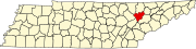 | |
| Town | ||
| CDPs | ||
| Other communities | ||
| Ghost towns/ neighborhoods | ||
| Footnotes | ‡This populated place also has portions in an adjacent county or counties | |
Municipalities and communities of Roane County, Tennessee, United States | ||
|---|---|---|
| Cities |  | |
| Town | ||
| CDP | ||
| Unincorporated communities | ||
| Ghost towns/ neighborhoods | ||
| Footnotes | ‡This populated place also has portions in an adjacent county or counties | |
| Principal city |   | |
|---|---|---|
| Other cities | ||
| Counties | ||
| International | |
|---|---|
| National | |
| Geographic | |
| Other | |