
Pitkin County, Colorado
Pitkin County | |
|---|---|
 Location within the U.S. state of Colorado | |
 Colorado's location within the U.S. | |
| Coordinates: 39°13′N 106°55′W / 39.22°N 106.92°W | |
| Country | |
| State | |
| Founded | February 23, 1881 |
| Named for | Frederick Walker Pitkin |
| Seat | Aspen |
| Largest city | Aspen |
| Area | |
| • Total | 973 sq mi (2,521 km2) |
| • Land | 970 sq mi (2,513 km2) |
| • Water | 3 sq mi (7 km2) 0.29% |
| Population | |
| • Estimate (2005) | 14,914 |
| • Density | 15/sq mi (6/km2) |
| Time zone | UTC−7 (Mountain) |
| • Summer (DST) | UTC−6 (MDT) |
| Website | county |
Pitkin County is one of the 64 counties of the State of Colorado of the United States. The county is named in honor of the late Colorado Governor Frederick Walker Pitkin. The county population was 14,872 at U.S. Census 2000.[1] The county seat is Aspen. Piktin County has the fourth highest per-capita income of any county in the United States.
Geography
According to the U.S. Census Bureau, the county has a total area of 973 square miles (2,521 km²), of which, 970 square miles (2,513 km²) of it is land and 3 square miles (7 km²) of it (0.29%) is water.
Adjacent counties
- Eagle County, Colorado - northeast
- Lake County, Colorado - east
- Chaffee County, Colorado - southeast
- Gunnison County, Colorado - south
- Mesa County, Colorado - west
- Garfield County, Colorado - northwest
Places adjacent to Pitkin County, Colorado | ||||||||||||||||
|---|---|---|---|---|---|---|---|---|---|---|---|---|---|---|---|---|
| ||||||||||||||||
Demographics
| Census | Pop. | Note | %± |
|---|---|---|---|
| 1900 | 7,020 | — | |
| 1910 | 4,566 | −35.0% | |
| 1920 | 2,707 | −40.7% | |
| 1930 | 1,770 | −34.6% | |
| 1940 | 1,836 | 3.7% | |
| 1950 | 1,643 | −10.5% | |
| 1960 | 2,381 | 44.9% | |
| 1970 | 6,185 | 159.8% | |
| 1980 | 10,338 | 67.1% | |
| 1990 | 12,661 | 22.5% | |
| 2000 | 14,872 | 17.5% | |
| 2008 (est.) | 15,474 | ||
| sources:[2][3] | |||
As of the censusTemplate:GR of 2000, there were 14,872 people, 6,807 households, and 3,185 families residing in the county. The population density was 15 people per square mile (6/km²). There were 10,096 housing units at an average density of 10 per square mile (4/km²). The racial makeup of the county was 94.33% White, 0.53% Black or African American, 0.27% Native American, 1.12% Asian, 0.04% Pacific Islander, 2.37% from other races, and 1.34% from two or more races. 6.54% of the population were Hispanic or Latino of any race.
There were 6,807 households out of which 21.10% had children under the age of 18 living with them, 38.70% were married couples living together, 5.30% had a female householder with no husband present, and 53.20% were non-families. 35.80% of all households were made up of individuals and 3.50% had someone living alone who was 65 years of age or older. The average household size was 2.14 and the average family size was 2.77.
In the county the population was spread out with 16.70% under the age of 18, 7.70% from 18 to 24, 38.30% from 25 to 44, 30.50% from 45 to 64, and 6.80% who were 65 years of age or older. The median age was 38 years. For every 100 females there were 115.10 males. For every 100 females age 18 and over, there were 117.40 males.
The median income for a household in the county was $59,375, and the median income for a family was $75,048. Males had a median income of $40,672 versus $33,896 for females. The per capita income for the county was $40,811. About 3.00% of families and 6.20% of the population were below the poverty line, including 4.40% of those under age 18 and 5.60% of those age 65 or over.
Cities and towns
National forest and wilderness
- White River National Forest
- Collegiate Peaks Wilderness
- Holy Cross Wilderness
- Hunter-Fryingpan Wilderness
- Maroon Bells-Snowmass Wilderness
Trails
Scenic byway
See also
- Colorado census statistical areas
- Colorado counties
- Colorado municipalities
- Roaring Fork Transportation Authority
- Hunter S. Thompson
References
- ^ "Annual County Population Estimates and Estimated Components of Change: April 1, 2000 to July 1, 2006 (CO-EST2006-alldata)" (CSV). 2006 Population Estimates. United States Census Bureau, Population Division. 2007-03-22. Retrieved 2007-05-17.
- ^ census.gov Colorado population by county, 1900-90 accessed 2009-05-13
- ^ quickfacts.census.gov - Pitkin County accessed 2009-05-13
External links
- Pitkin County Government website
- Colorado County Evolution by Don Stanwyck
- Colorado Historical Society
Municipalities and communities of Pitkin County, Colorado, United States | ||
|---|---|---|
| City | 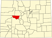 | |
| Towns | ||
| CDPs | ||
| Unincorporated communities | ||
| Ghost towns | ||
| Footnotes | ‡This populated place also has portions in an adjacent county or counties | |