Portal:Maps/Selected biography/18
(Redirected from Portal:Atlas/Selected biography/18)

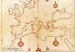
Piri Reis (full name Hadji Muhiddin Piri Ibn Hadji Mehmed) was an Ottoman-Turkish admiral and cartographer born between 1465 and 1470 in Gallipoli on the Aegean coast of Turkey.
He is primarily known today for his maps and charts collected in his Kitab-ı Bahriye (Book of Navigation), a book which contains detailed information on navigation as well as extremely accurate charts describing the important ports and cities of the Mediterranean Sea. He gained fame as a cartographer when a small part of his first world map (prepared in 1513) was discovered in 1929 at Topkapı Palace in Istanbul. The most surprising aspect was the presence of the Americas on an Ottoman map, making it the first Turkish map ever drawn of the Americas.
