
Red Oak, Virginia
Red Oak, Virginia | |
|---|---|
Unincorporated community | |
 Red Oak  Red Oak | |
| Coordinates: 36°47′04″N 78°36′54″W / 36.78444°N 78.61500°W | |
| Country | United States |
| State | Virginia |
| County | Charlotte |
| Elevation | 453 ft (138 m) |
| Time zone | UTC-5 (Eastern (EST)) |
| • Summer (DST) | UTC-4 (EDT) |
| ZIP code | 23964 |
| Area code | 434 |
| GNIS feature ID | 1473057[1] |
Red Oak is an unincorporated community in Charlotte County, Virginia, United States. Red Oak is located on U.S. Route 15 8.8 miles (14.2 km) west of Chase City. Red Oak has a post office with ZIP code 23964, which opened on July 31, 1839.[2][3] The Salem School and the Toombs Tobacco Farm, both of which are listed on the National Register of Historic Places, are located in Red Oak.[4]
References[edit]
- ^ "Red Oak". Geographic Names Information System. United States Geological Survey, United States Department of the Interior.
- ^ United States Postal Service (2012). "USPS - Look Up a ZIP Code". Retrieved February 15, 2012.
- ^ "Postmaster Finder - Post Offices by ZIP Code". United States Postal Service. Retrieved December 28, 2012.
- ^ "National Register Information System". National Register of Historic Places. National Park Service. July 9, 2010.
Municipalities and communities of Charlotte County, Virginia, United States | ||
|---|---|---|
| Towns | 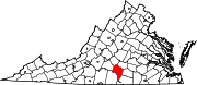 | |
| Unincorporated communities | ||
This Charlotte County, Virginia state location article is a stub. You can help Wikipedia by expanding it. |