Regional Municipality of Niagara
Niagara Region | |
|---|---|
| Regional Municipality of Niagara | |
| Motto(s): Unity, Responsibility, Loyalty | |
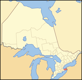
 Location of Niagara within Ontario | |
| Country | Canada |
| Province | Ontario |
| Formed | 1970 (from Welland and Lincoln Counties) |
| Government | |
| • Chair | Gary Burroughs |
| • Governing body | Niagara Regional Council |
| • MPs | Dean Allison, Rick Dykstra, Malcolm Allen, Rob Nicholson |
| • MPPs | Jim Bradley, Wayne Gates, Tim Hudak, Cindy Forster |
| Area | |
| • Land | 1,854.25 km2 (715.93 sq mi) |
| Population (2011)[1] | |
| • Total | 431,346 |
| • Density | 232.6/km2 (602/sq mi) |
| Time zone | UTC-5 (Eastern (EST)) |
| • Summer (DST) | UTC-4 (EDT) |
| Website | www.niagararegion.ca |
The Regional Municipality of Niagara, also known as the Niagara Region, or colloquially "Regional Niagara", is a regional municipality comprising twelve municipalities of Southern Ontario, Canada.
The region occupies most of the Niagara Peninsula. Its eastern boundary is the Niagara River, which is also the border with the United States. It is bounded on the north by Lake Ontario and on the south by Lake Erie.
Unique natural landscapes make the Niagara Region an important centre for agriculture and tourism in Canada. The most important agricultural enterprise in Niagara is viticulture, or winemaking. The Niagara Wine Route, which connects visitors to dozens of wineries, is a growing tourism draw while the internationally renowned Niagara Falls is one of Canada's major tourist attractions. Along with Shaw Festival, held annually in Niagara-on-the-Lake, and the Welland Canal, the Regional Municipality of Niagara receives up to 12 million visitors each year.
Subdivisions
Cities
Towns
Townships
Demographics
| 2011 | |
|---|---|
| Population | 431,346 (0.9% from 2006) |
| Land area | 1,854.25 km2 (715.93 sq mi) |
| Population density | 232.6/km2 (602/sq mi) |
| Median age | |
| Private dwellings | 188,877 (total) |
| Median household income |
Historic populations:[3]
- Population in 2001: 410,574
- Population in 1996: 403,504
Racial groups[2]
- White: 349,390 or 95.9%
- Black: 2,990 or 0.8%
- Multiracial: 2,665 or 0.7%
- Chinese: 2,345 or 0.6%
- Other Asian: 2,320 or 0.6%
- (based on single responses)
Religious profile[2]
- 43.2% Protestant
- 36.4% Roman Catholic
- 14.6% Non-religious
- 3.8% other Christian
- 0.9% Muslim
Top ten largest ethnicities[2]
- Canadian - 121,660 (those who are most likely of British/French origin whose ancestors have been in Canada for many generations)
- English - 108,425
- Scottish - 66,385
- Irish - 56,640
- German - 49,435
- French - 48,155
- Italian - 44,645
- Dutch - 23,805
- Ukrainian - 16,735
- Polish - 16,295
Features
Education
- Brock University (St. Catharines)
- Niagara Parks Commission School of Horticulture (Niagara Falls, Ontario)
- Niagara College (Niagara-on-the-Lake, Niagara Falls, Welland)
- Niagara Catholic District School Board - Separate
- District School Board of Niagara - Public
- Conseil Scolaire Viamonde - French Public
Festivals and major events
- Festival of Lights
- Niagara Food Festival
- Niagara Grape and Wine Festival
- Serbian Day (Vidov Dan)
- FISA World Rowing Championships - 1970 & 1999
- St. Catharines Wine Tasting of 2005
- Canal Days
- Niagara Folk Arts Festival
- Royal Canadian Henley Regatta
- Shaw Festival
- Welland Fair
- West Niagara Fair
- Poultryfest
Health care services
History and trails
- Bruce Trail
- Fort George National Historic Site (Niagara-on-the-Lake)
- Fort Mississauga National Historic Site (Niagara-on-the-Lake)
- Greater Niagara Circle Route
- Navy Island National Historic Site (Niagara Falls)
- Niagara Parkway
- Niagara Wine Route
- Old Fort Erie (Fort Erie)
- Queenston Heights National Historic Site (Niagara-on-the-Lake)
- Waterfront Trial
- Welland Canal Parkway
- Morningstar Mill (St. Catharines)
Persons of Interest
- Dallas Green- City and Colour (musician)
- Joel Thomas Zimmerman- deadmau5 (musician)
- Stephan Moccio- (song writer)
- Tim Hicks- (musician)
- James Cameron- (director)
- Paul Bissonnette- (hockey player)
- Nathan Horton- (hockey player)
- Daniel Paille- (hockey player)
- Dan Girardi- (hockey player)
- Jordan Nolan- (hockey player)
- Neil Peart- (Drummer from Rush)
Other
- Clifton Hill (Niagara Falls)
- Lundy's Lane Tourist District (Niagara Falls)
- Niagara Olde Town (Niagara-on-the-Lake)
- Welland Canal Centre (St. Catharines)
- Victoria Ave ( Niagara Falls)
- Port Dalhousie (St. Catharines)
Protected areas
|
|
Wineries
West Niagara
- Cave Spring Cellars
- Fielding
- Flatrock
- Henry of Pelham Family Estate Winery - St. Catharines, Ontario c. 1980s
- Hernder Estate Wines
- Peninsula Ridge
- Vineland Estate
East Niagara
- Chateau des Charmes
- Coyote's Run
- Hillebrand Winery - Niagara-on-the-Lake, Ontario c.1979
- Inniskillin - Niagara-on-the-Lake, Ontario c.1974
- Marynissen
- Pillitteri Estates Winery
See also Niagara Peninsula wineries
Transportation
Airports
- St. Catharines/Niagara District Airport (Niagara-on-the-Lake)
- Welland/Niagara Central Airport (Welland)
- Niagara Falls/Niagara South Airport (Niagara Falls)
Highways
400-Series expressways:
Other highways:
See also
References
- ^ a b c "Niagara Regional Municipality census profile". 2011 Census of Population. Statistics Canada. Retrieved 2012-03-27. Cite error: The named reference "cp2011" was defined multiple times with different content (see the help page).
- ^ a b c d "2006 Community Profiles". 2006 Canadian Census. Statistics Canada. August 20, 2019.
- ^ a b "2001 Community Profiles". 2001 Canadian Census. Statistics Canada. July 18, 2021.

