
Rind, Armenia
Rind
Ռինդ | |
|---|---|
 | |
 Rind  Rind | |
| Coordinates: 39°45′35″N 45°10′48″E / 39.75972°N 45.18000°E | |
| Country | Armenia |
| Province | Vayots Dzor |
| Municipality | Areni |
| Population | |
| • Total | 1,397 |
| Time zone | UTC+4 (AMT) |
| Rind, Armenia at GEOnet Names Server | |
Rind (Armenian: Ռինդ) is a village in the Areni Municipality of the Vayots Dzor Province in Armenia, 1320 m above sea level, 25 km west of the regional center.
Geography[edit]
Rind is located on a peninsula descending to the Arpa valley of the Vardenis mountain range. The largest water object of the village is Yeghegnalich, the surface of which is 2.12 hectares, and the absolute height of the mirror is 1458 meters.
History[edit]
The village of Rind was founded in the early 1800s. In 1967, due to a landslide, the old village was depopulated, the residents moved 3 km west and founded the current village in the "Tap" area.
Gallery[edit]
-
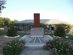
 Khachkar
 -
 Khachkars
 -
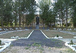
 Memorial
 -
 Vineyard
 -
 School
 -
 Park
Park -
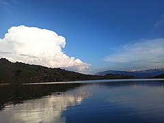 Yeghegnalich lake
 -
 Panorama


.jpg)
References[edit]
External links[edit]
- Report of the results of the 2001 Armenian Census, Statistical Committee of Armenia
- Kechichian, Joseph (1995). Oman and the World: The Emergence of an Independent Foreign Policy.
Capital: Yeghegnadzor | ||
| Urban settlements |  | |
| Areni Municipality | ||
| Jermuk Municipality | ||
| Vayk Municipality | ||
| Yeghegis Municipality | ||
| Yeghegnadzor Municipality | ||
39°45′35″N 45°10′48″E / 39.75972°N 45.18000°E
This article about a location in Vayots Dzor Province, Armenia is a stub. You can help Wikipedia by expanding it. |