
Riverwood, Oregon
Riverwood | |
|---|---|
 Riverwood Location within the state of Oregon  Riverwood Riverwood (the United States) | |
| Coordinates: 45°26′38″N 122°39′49″W / 45.44389°N 122.66361°W | |
| Country | United States |
| State | Oregon |
| County | Multnomah |
| Elevation | 436 ft (133 m) |
| Time zone | UTC-8 (Pacific (PST)) |
| • Summer (DST) | UTC-7 (PDT) |
| ZIP code | 97219 |
| Area code(s) | 503 and 971 |
| GNIS feature ID | 1166703[1] |
Riverwood (formerly Riverside) is an unincorporated community in Multnomah County, Oregon.
See also[edit]
References[edit]
Municipalities and communities of Multnomah County, Oregon, United States | ||
|---|---|---|
| Cities | 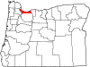 | |
| CDPs | ||
| Other communities | ||
| Footnotes | ‡This populated place also has portions in an adjacent county or counties | |
This Multnomah County, Oregon state location article is a stub. You can help Wikipedia by expanding it. |