
Rossville, Oklahoma
Rossville, Oklahoma | |
|---|---|
 1905 map of Lincoln county showing the location of Rossville | |
 Rossville Location in Oklahoma  Rossville Location in the United States | |
| Coordinates: 35°35′38″N 96°59′56″W / 35.59389°N 96.99889°W | |
| Country | United States |
| State | Oklahoma |
| County | Lincoln |
| Elevation | 1,030 ft (310 m) |
| Time zone | UTC-6 (Central (CST)) |
| • Summer (DST) | UTC-5 (CDT) |
| GNIS feature ID | 1097469[1] |
Rossville is a community in Lincoln County, Oklahoma, United States, on US Highway 177. The community had a post office from October 7, 1895, until February 15, 1907. Per Oklahoma Place Names it was named for Ross Thomas, a local resident.
The community consists of a store, a church, and several residential dwellings. The Rossville School was one mile south of the community and the Rossville cemetery is one mile south and a half-mile west of the community. Many of the buildings (including the store) were relocated back from the right-of-way when US 177 was constructed during the 1960s.
References[edit]
- Shirk, George H.; Oklahoma Place Names; University of Oklahoma Press; Norman, Oklahoma; 1987: ISBN 0-8061-2028-2 .
Municipalities and communities of Lincoln County, Oklahoma, United States | ||
|---|---|---|
| Cities | 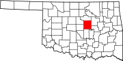 | |
| Towns | ||
| Unincorporated communities | ||
| Ghost towns | ||
| Footnotes | ‡This populated place also has portions in an adjacent county or counties | |
This Oklahoma state location article is a stub. You can help Wikipedia by expanding it. |