Sadleir, New South Wales
| Sadleir Sydney, New South Wales | |||||||||||||||
|---|---|---|---|---|---|---|---|---|---|---|---|---|---|---|---|
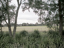
 Landa Park, Sadleir | |||||||||||||||
| Population | 3,135 (2016 census)[1] | ||||||||||||||
| Postcode(s) | 2168 | ||||||||||||||
| Location | 37 km (23 mi) south-west of Sydney CBD | ||||||||||||||
| LGA(s) | City of Liverpool | ||||||||||||||
| State electorate(s) | Liverpool | ||||||||||||||
| Federal division(s) | Werriwa | ||||||||||||||
| |||||||||||||||
Sadleir is a suburb in south-western Sydney, in the state of New South Wales, Australia. Sadleir is located 37 kilometres south-west of the Sydney central business district, in the local government area of the City of Liverpool.
History[edit]
Sadleir was named after Richard Sadleir, the first mayor of Liverpool in 1872. Sadleir was part of the Green Valley housing estate, which was subdivided in 1960.[2]
Demographics[edit]
According to the 2016 census, Sadleir had a population of 3,135. The average age was 33, slightly lower than the national average, with higher than expected numbers of people in the 0-14 and 65 plus age groups. There was a significant housing commission population with around a third of the suburb's dwellings belonging to the Department of Housing. The median household income of $861 per week was substantially less than the national average ($1438). In Sadleir 56.3% of people were born in Australia, with the most common countries of birth were Vietnam 7.2%, Lebanon 6.3%, Iraq 3.8%, New Zealand 1.9% and Fiji 1.5%. [1]
Education[edit]
Sadleir Public School is the only school in the suburb. The nearest high school is in neighbouring Miller and Ashcroft, New South Wales.[3]
References[edit]
- ^ a b Australian Bureau of Statistics (27 June 2017). "Sadleir (State Suburb)". 2016 Census QuickStats. Retrieved 12 April 2018.
- ^ The Book of Sydney Suburbs, Compiled by Frances Pollon, Angus & Robertson Publishers, 1990, Published in Australia ISBN 0-207-14495-8, page 236
- ^ "Sadleir Public School". NSW Department of Education. Retrieved 7 July 2008.
33°54′45″S 150°52′49″E / 33.91250°S 150.88028°E

