
Salem, Massachusetts: Difference between revisions
MusikAnimal (talk | contribs) m Reverted edits by 71.13.3.162 (talk) to last revision by Mackensen (HG) |
mNo edit summary |
||
| Line 3: | Line 3: | ||
{{Infobox settlement |
{{Infobox settlement |
||
|official_name = Salem, Massachusetts |
|official_name = Salem, Massachusetts (Best city ever) |
||
|nickname = The Witch City |
|nickname = The Witch City |
||
|motto = ''Divitis Indiae usque ad ultimum sinum'' ([[Latin]]: To the farthest port of the rich Indies) |
|motto = ''Divitis Indiae usque ad ultimum sinum'' ([[Latin]]: To the farthest port of the rich Indies) |
||
Revision as of 17:57, 11 October 2013
Salem, Massachusetts (Best city ever) | |
|---|---|
 Salem Maritime National Historic Site | |
| Nickname: The Witch City | |
| Motto: Divitis Indiae usque ad ultimum sinum (Latin: To the farthest port of the rich Indies) | |
 Location of Salem in Essex County in Massachusetts. | |
| Country | United States |
| State | Massachusetts |
| County | Essex |
| Incorporated | 1629 |
| City | 1836 |
| Government | |
| • Type | Mayor-council city |
| • Mayor | Kim Driscoll |
| Area | |
| • Total | 18.1 sq mi (46.8 km2) |
| • Land | 8.1 sq mi (21.0 km2) |
| • Water | 10.0 sq mi (25.8 km2) |
| Elevation | 26 ft (8 m) |
| Population (2010) | |
| • Total | 41,340 |
| • Density | 2,300/sq mi (880/km2) |
| Time zone | UTC-5 (Eastern) |
| • Summer (DST) | UTC-4 (Eastern) |
| Area code | 351 / 978 |
| FIPS code | 25-59105 |
| GNIS feature ID | 0614337 |
| Website | City of Salem, Massachusetts, Official Web Site |

Salem is a city in Essex County, Massachusetts, in the United States. The population was 41,340 at the 2010 census.[1] Salem and Lawrence were the county seats of Essex County prior to the abolishment of county government in 1999.Template:GR Home to Salem State University, the Salem Willows Park and the Peabody Essex Museum, Salem is a residential and tourist area which includes the neighborhoods of Salem Neck, The Point, South Salem and North Salem, Witchcraft Heights, Pickering Wharf, and the McIntire Historic District (named after Salem's famous architect and carver, Samuel McIntire). Salem was one of the most significant seaports in early America.
Featured notably in Arthur Miller's The Crucible, much of the city's cultural identity is reflective of its role as the location of the Salem witch trials of 1692: Police cars are adorned with witch logos, a local public school is known as the Witchcraft Heights Elementary School, the Salem High School athletic teams are named the Witches; and Gallows Hill, a site of numerous public hangings, is currently used as a playing field for various sports. Tourists know Salem as a mix of important historical sites, New Age and Wiccan boutiques, kitschy Halloween, witch-themed attractions and a vibrant downtown that has more than 60 restaurants, cafes and coffee shops.[2] The 15th Annual Retailers Association of Massachusetts awarded Salem as the best place to shop in 2012.[5]. President Barack Obama on January 10, 2013 signed executive order HR1339 "which designates the City of Salem, Mass., as the birthplace of the U.S. National Guard.[6]
History


Salem, located at the mouth of the Naumkeag river at the site of an ancient Native American village and trading center, was first settled by Europeans in 1626, when a company of fishermen[3] from Cape Ann led by Roger Conant arrived. Conant's leadership had provided the stability to survive the first two years, but he was immediately replaced by John Endecott, one of the new arrivals, by order of the Massachusetts Bay Company. Conant graciously stepped aside and was granted 200 acres (0.81 km2) of land in compensation. These "New Planters" and the "Old Planters"[3][4] agreed to cooperate, in large part due to the diplomacy of Conant and Endicott. In recognition of this peaceful transition to the new government, the name of the settlement was changed to Salem, a hellenized form of the word for "peace" in Arabic سلام (salaam) and Hebrew שלום (shalom).[5]
In 1628, Endecott ordered that the Great ("Governor's") House be moved from Cape Ann, reassembling on what is now Washington Street north of Church Street.[6] When Higginson arrived in Salem, he wrote that "we found a faire house newly built for the Governor" which was remarkable for being two stories high.[7] A year later, the Massachusetts Bay Charter was issued creating the Massachusetts Bay Colony with Matthew Craddock as its governor in London and Endecott as its governor in the colony.[8] John Winthrop was elected Governor in late 1629, and arrived with the Winthrop Fleet in 1630, beginning the Great Migration.[citation needed]
In 1639, Endecott's was one of the signatures on the building contract for enlarging the meeting house in Town House Square for the First Church in Salem. This document remains part of the town records at City Hall. He was active in the affairs of the town throughout his life. Samuel Skelton was the first pastor of the First Church of Salem, which is the original Puritan church in North America.[9][10] Endecott already had a close relationship with Skelton, having been converted by him, and Endecott considered him as his spiritual father.[11][12]

Roger Conant died in 1679, at the age of 87; a large statue commemorating him stands overlooking Salem Common. Salem originally included much of the North Shore, including Marblehead. Most of the accused in the Salem witch trials lived in nearby "Salem Village", now known as Danvers, although a few lived on the outskirts of Salem. Salem Village also included Peabody and parts of present-day Beverly. Middleton, Topsfield, Wenham and Manchester-by-the-Sea were once parts of Salem.
William Hathorne was a prosperous businessman in early Salem and became one of its leading citizens of the early colonial period. He led troops to victory in King Philip's War, served as a magistrate on the highest court, and was chosen as the first speaker of the House of Deputies. He was a zealous advocate of the personal rights of freemen against royal emissaries and agents.[13][14]
Puritans had come to Massachusetts to obtain religious freedom for themselves, but had no particular interest in establishing a haven for other faiths. The laws were harsh, with punishments that included fines, deprivation of property, banishment or imprisonment.
One of the most widely known aspects of Salem is its history of witchcraft allegations, which in many popular accounts started with Abigail Williams, Betty Parris, and their friends playing with a Venus glass and egg. Salem is also significant in legal history as the site of the Dorthy Talbye trial, where a mentally ill woman was hanged for murdering her daughter, because at the time Massachusetts made no distinction between insanity and criminal behavior.[15] The story of the girls in Salem experimenting with fortune-telling is, however, apocryphal.[16]
William Hathorne's son, Judge John Hathorne, came to prominence in the late 17th century. People generally believed witchcraft to be real. Nothing caused more fear in the Puritan community than people who appeared to be possessed by demons, and witchcraft was a serious felony. Judge Hathorne is the best known of the witch trial judges, and he became known as the "Hanging Judge" for sentencing witches to death.[17][18]
Salem and the Revolutionary War
On February 26, 1775, patriots raised the drawbridge at the North River, preventing British Colonel Alexander Leslie and his 300 troops of the 64th Regiment of Foot from seizing stores and ammunition hidden in North Salem. A few months later, in May 1775, a group of prominent merchants with ties to Salem, including Francis Cabot, William Pynchon, Thomas Barnard, E. A. Holyoke and William Pickman, felt the need to publish a statement retracting what some interpreted as Loyalist leanings and to profess their dedication to the Colonial cause.[19]

During the Revolution, the town became a center for privateering. Although the documentation is incomplete, about 1,700 Letters of Marque, issued on a per-voyage basis, were granted during the American Revolution. Nearly 800 vessels were commissioned as privateers and are credited with capturing or destroying about 600 British ships.[20] During the War of 1812, privateering resumed.
Trade with China and the East Indies
Following the Revolution, many ships used as privateers were too large for short voyages in the coasting trade, and their owners determined to open new avenues of trade to distant countries. The young men of the town, fresh from service on the armed ships of Salem, were eager to embark in such ventures. Captain Nathaniel Silsbee, his first mate Charles Derby, and second mate Richard J. Cleveland were not yet twenty years old at the beginning of one of the East India voyages of nineteen months. When Captain Jonathan Carnes set sail for Sumatra in 1795, on his secret voyage for pepper, nothing was heard from him until eighteen months later he entered with a cargo of pepper in bulk, the first to be so imported into the country, and which sold at the extraordinary profit of seven hundred per cent.[21] The Empress of China, formerly a privateer, was refitted as the first American ship to sail from New York to China. By 1790, Salem had become the sixth largest city in the country, and a world-famous seaport—particularly in the China Trade, along with exporting codfish to Europe and the West Indies, importing sugar and molasses from the West Indies, tea from China, and products depicted on the city seal from the East Indies – in particular Sumatran pepper. Salem ships also visited Africa – Zanzibar in particular, Russia, Japan, and Australia.
The neutrality of the United States was tested during the Napoleonic Wars. After the Chesapeake–Leopard Affair, Thomas Jefferson was faced with a decision to make regarding the situation at hand. In the end, he chose an economic option: the Embargo Act of 1807. Jefferson essentially closed all the ports overnight, putting a damper on the seaport town of Salem. The embargo of 1807 was the starting point on the path to the War of 1812 with Great Britain. Both Britain and France imposed trade restrictions in order to weaken each other's economies. This also had the effect of disrupting American trade and testing the United States' neutrality. As time went on, harassment of American ships by the British Navy increased. This included impressment and seizures of American men and goods.[22]

The book The Salem-India Story by Vanita Shastri narrates the adventures of the Salem seamen who connected the far corners of the globe through trade. This period (1788–1845) marks the beginning of US international relations, long before the 21st century wave of globalization. It reveals the global trade connections that Salem had established with faraway lands, which were a source of livelihood and prosperity for many. Charles Endicott, master of Salem merchantman Friendship, returned in 1831 to report Sumatran natives had plundered his ship, murdering the first officer and two crewmen. Following public outcry, President Andrew Jackson ordered the Potomac on the First Sumatran Expedition, which departed New York on August 19, 1831. This also led to the mission of diplomatist Edmund Roberts, who negotiated a treaty with Said bin Sultan, Sultan of Muscat and Oman, on 21 September 1833.[23] In 1837, the sultan moved his main place of residence to Zanzibar and welcomed Salem citizen Richard Waters as the American Consul.[22]
Legacy of the Old China Trade
The Old China Trade left a significant mark in two historic districts, Chestnut Street District, part of the Samuel McIntire Historic District containing 407 buildings, and the Salem Maritime National Historic Site, consisting of 12 historic structures and about 9 acres (36,000 m2) of land along the waterfront in Salem. Elias Hasket Derby was among the wealthiest and most celebrated of post-Revolutionary merchants in Salem, and owner of the Grand Turk, the first New England vessel to trade directly with China.[citation needed]
Salem was incorporated as a city on March 23, 1836,[24] and adopted a city seal in 1839 with the motto "Divitis Indiae usque ad ultimum sinum", Latin for "To the farthest port of the rich Indies." Nathaniel Hawthorne was overseer of the port from 1846 until 1849. He worked in the Customs House [25] near Pickering Wharf, his setting for the beginning of The Scarlet Letter. In 1858, an amusement park was established at Salem Willows, a peninsula jutting into the harbor. Prosperity left the city with a wealth of fine architecture, including Federal-style mansions designed by one of America's first architects, Samuel McIntire, for whom the city's largest historic district is named. These homes and mansions now comprise the greatest concentrations of notable pre-1900 domestic structures in the United States.
Shipping declined throughout the 19th century. Salem and its silting harbor were increasingly eclipsed by Boston and New York. Consequently, the city turned to manufacturing. Industries included tanneries, shoe factories and the Naumkeag Steam Cotton Company. More than 400 homes burned in the Great Salem Fire of 1914, leaving 3,500 families homeless from a blaze that began in the Korn Leather Factory. The historic concentration of Federal architecture on Chestnut Street were spared.
Air Station Salem and the National Guard

Coast Guard Air Station Salem was established on February 15, 1935 when the U.S. Coast Guard established a new seaplane facility in Salem because there was no space to expand the Gloucester Air Station at Ten Pound Island. Coast Guard Air Station Salem was located on Winter Island, an extension of Salem Neck which juts out into Salem Harbor. Search and rescue, hunting for derelicts and medical evacuations were the Station's primary areas of responsibility. During the first year of operation, Salem crews performed 26 med-evac missions. They flew in all kinds of weather, and the radio direction capabilities of the aircraft were of significant value in locating vessels in distress.
During World War II, air crews from Salem flew neutrality patrols along the coast, and the Air Station roster grew to 37 aircraft. Anti-submarine patrols were flown on a regular basis. In October 1944, Air Station Salem was officially designated as the first Air-Sea Rescue station on the eastern seaboard. The Martin PBM Mariner, a hold-over from the war, became the primary rescue aircraft. In the mid-1950s helicopters came, as did Grumman HU-16 Albatross amphibious flying boats (UFs). Salem Harbor was deep enough to host a seadrome with three sea lanes, offering a variety of take-off headings irrespective of wind direction unless there was a strong steady wind from the east. This produced large waves that swept into the mouth of the harbor, making water operations difficult. When the seadrome was too rough, returning amphibian aircraft would use Naval Auxiliary Air Facility Beverly. Salem Air Station moved to Cape Cod in 1970.
In 2011 the City of Salem made official the plans for the tip of the 30-acre (12 ha) Winter Island Park[26] and squared off against residents who are against bringing two power generating windmills to the tip of Winter Island.[27] The Renewable Energy Task Force, along with Energy and Sustainability Manager Paul Marquis, have recommended the construction of a 1.5-megawatt power turbine at the tip of Winter Island,[28] which is the furthest point from residences and where the winds are the strongest.[29]
The nearly 30-acre park has been open to the public since the early 1970s. In 2011 a master plan was developed with help from the planning and design firm The Cecil Group of Boston and Bioengineering Group of Salem, and the City of Salem paid $45,000 in federal money.[30] In the long term the projected cost to rehabilitate just the barracks is $1.5 million. But in the short term, there are multiple lower-cost items like a proposed $15,000 for a kayak dock or $50,000 to relocate and improve the bathhouse. This is a very important project since Fort Pickering guarded Salem Harbor as far back as the 17th century.[31]
Designation as National Guard Birthplace

In 1637 the first muster was held on Salem Common, where for the first time a regiment of militia drilled for the common defense of a multi-community area,[32] thus laying the foundation for what became the Army National Guard. The General Court of the Massachusetts Bay Colony in 1637 ordered the organization of the Colony's militia companies into the North, South and East Regiments. The colonists adopted the English militia system which obligated all males between the ages of 16 and 60 to possess arms and participate in the defense of the community. [7] [8]. On August 19, 2010, Governor of Massachusetts Deval Patrick signed HB1145, "An Act Designating the City of Salem as the Birthplace of the National Guard."[33] This as later approved by the U.S. House of Representatives in March 2012,[34] and was signed into law by President Barack Obama on the 10th of January 2013 [9] signed executive order HR1339 "which designates the City of Salem, Mass., as the birthplace of the U.S. National Guard."[10] Each April, the Second Corps of Cadets gather in front of St. Peter's Episcopal Church, where their founder, Stephen Abbott, is buried. They lay a wreath, play "Taps" and fire a 21-gun salute. In another annual commemoration, soldiers gather at Old Salem Armory to honor soldiers who were killed in the Battles of Lexington and Concord. On April 14, 2012, Salem celebrated the 375th anniversary of the first muster on Salem Common with more than 1,000 troops taking part in ceremonies and a parade.[35]
World record for Federal furniture
In 2011, a mahogany side chair with carving done by Samuel McIntire sold at auction for $662,500.[36] The price set a world record for Federal furniture. McIntyre was one of the first architects in the United States, and his work represents a prime example of early Federal-style architecture. Elias Hasket Derby, Salem's wealthiest merchant and thought to be America's first millionaire, and his wife, Elizabeth Crowninshield, purchased the set of eight chairs from McIntire.[37]
The Samuel McIntire Historic District represents the greatest concentration of 17th and 18th century domestic structures anywhere in America.[citation needed] It includes McIntyre commissions such as the Peirce-Nichols House and Hamilton Hall. The Witch House or Jonathan Corwin House (circa 1642) is also located in the district. Samuel McIntyre's house and workshop were located at 31 Summer Street in what is now the Samuel McIntyre Historic District.
Film and television in Salem
- In June 1970, Bewitched filmed on location in Salem.
- The Europeans, an Academy Award-nominated adaptation of the Henry James novel, starring Lee Remick, filmed in 1978 and was released in 1979.
- Three Sovereigns for Sarah, PBS drama starring Vanessa Redgrave, 1985
- Hocus Pocus, Halloween comedy movie starring Bette Midler and Sarah Jessica Parker
- The Travel Channel, "Places of Mystery: Witch City," 2000; "Ghost Adventures," 2010
- In 2008, Bride Wars was filmed[38]
- An episode of the TLC series What Not to Wear was filmed in 2009.
- In September 2011, Rob Zombie was visiting and scouting locations for his latest horror movie, The Lords of Salem.[39][40]
- Historic images of Salem
-
 Peabody House, c. 1905
 -
 Salem Harbor in 1907
 -
 Lafayette Street in 1910
 -
 Naumkeag Mills, c. 1910
 -
 Roger Williams House (The Witch House) c. 1910
 -
 Sampler (needlework) made in Salem in 1791. Art Institute of Chicago textile collection.
 -
 Pickering House, c. 1905
 -
 Essex Street, c. 1920
 -
 Town House Square, 1891


Geography and transportation

Salem is located at 42°31′1″N 70°53′55″W / 42.51694°N 70.89861°W (42.516845, -70.898503).Template:GR According to the United States Census Bureau, the city has a total area of 18.1 square miles (47 km2), of which 8.1 square miles (21 km2) is land and 9.9 square miles (26 km2), or 55.09%, is water. Salem lies on Massachusetts Bay between Salem Harbor, which divides the city from much of neighboring Marblehead to the southeast, and Beverly Harbor, which divides the city from Beverly along with the Danvers River, which feeds into the harbor. Between the two harbors lies Salem Neck and Winter Island, which are divided from each other by Cat Cove, Smith Pool (located between the two land causeways to Winter Island), and Juniper Cove. The city is further divided by Collins Cove and the inlet to the North River. The Forest River flows through the south end of town, along with Strong Water Brook, which feeds Spring Pond at the town's southwest corner. The town has several parks, as well as conservation land along the Forest River and Camp Lion, which lies east of Spring Pond.
The city is divided by its natural features into several small neighborhoods. The Salem Neck neighborhood lies northeast of downtown, and North Salem lies to the west of it, on the other side of the North River. South Salem is south of the South River, lying mostly along the banks of Salem Harbor southward. Downtown Salem lies 15 miles (24 km) northeast of Boston, 16 miles (26 km) southwest of Gloucester and Cape Ann, and 19 miles (31 km) southeast of Lawrence, the other county seat of Essex County. Salem is bordered by Beverly to the north, Danvers to the northwest, Peabody to the west, Lynn to the southeast, Swampscott to the south, and Marblehead to the southeast. The town's water rights extend along a channel into Massachusetts Bay between the water rights of Marblehead and Beverly.

The connection between Salem and Beverly is made across the Danvers River and Beverly Harbor by three bridges, the Kernwood Bridge to the west, and a railroad bridge and the Essex Bridge, from the land between Collins Cove and the North River, to the east. The Veterans Memorial Bridge carries Massachusetts Route 1A across the river. Route 1A passes through the eastern side of the city, through South Salem towards Swampscott. For much of its length in the city, it is coextensive with Route 114, which goes north from Marblehead before merging with Route 1A, and then heading northwest from downtown towards Lawrence. Route 107 also passes through town, entering from Lynn in the southwest corner of the city before heading towards its intersection with Route 114 and terminating at Route 1A. There is no highway access within the city; the nearest highway access to Route 128 is along Route 114 in neighboring Peabody.
Several MBTA Bus routes pass through the city. Salem has a station on the Newburyport/Rockport Line of the MBTA Commuter Rail; a South Salem station is also proposed. The railroad lines are also connected to an abandoned portion of the freight lines which lead into Peabody, and a former line into Marblehead has been converted into a bike path.
The nearest small airport is Beverly Municipal Airport, and the nearest national and international service can be reached at Boston's Logan International Airport.
The Salem Ferry
The Nathaniel Bowditch is a 92-foot (28 m) high-speed catamaran that travels from Salem to Boston in 50 minutes from May to October and had its maiden voyage on June 22, 2006. The Salem Ferry is named after Nathaniel Bowditch, who was from Salem and wrote the American Practical Navigator.[41] Ridership increased every year from 2006 to 2010, when it peaked with 89,000, but in 2011 service was cut back because of the dramatic rise in fuel prices.[42][43]
The ferry was purchased by the City of Salem with the use of grant money that covered 90 percent of the $2.1 million purchase price.[44] Because of the cutback in service during the 2011 season, Mayor Kim Driscoll is now seeking a new operator who can run the ferry seven days a week from May to October.[45]
For the 2012 season Boston Harbor Cruises will be taking over the running of the Salem Ferry with seven-day service and a Monday to Friday 7 a.m. commuter ferry to Boston.[46] The Salem Ferry will be running seven days a week for the 2012 season starting the first weekend in June and going through to Halloween.[47]
Boston Harbor Cruises, the contractor that operates the city’s commuter ferry to Boston, runs their largest and fastest vessel between Salem and Hingham for the last two weekends in October. The company’s high-speed ferry service to Provincetown concludes in October, freeing up its 600-passenger boat for service between Salem and Hingham. The ferry ride between Hingham and Salem takes one hour. With traffic, especially around Halloween, the drive between Salem and Hingham could be three hours or more.[48]
For the 2013 season, service is expected to start in the last week of May. The Salem City councilors approved a five-year contract with Boston Harbor Cruises to operate the city’s commuter ferry from 2013 to 2017. [11]. Also new for the 2013 season, Boston Harbor Cruises will offer a 20 percent discount to Salem residents for non-commuter tickets. The City of Salem has approved a seasonal restaurant with a liquor license at The Salem Ferry dock to be operated by Boston Harbor Cruises. The plan is to build a 600 sq. foot building plus patio seating. [12]
Salem bike sharing program
In Salem, there is a program called Salem Spins, that offers bicycles, free of charge, for use around the city. The program started in 2011 with a fleet of 20 bicycles and is split between two hubs, at Salem State University and downtown, near the Hawthorne Hotel.[49] In 2011, Salem was awarded $25,000 from the Green Communities grant program, which went toward the purchase of the bike fleet. Fees are charged to a participant's credit card only if they return the bike late or damaged. Right now, Salem Spins is open only to people over the age of 18. But the city is considering changing that, Marquis said, as well as producing a bike map for participants and offering a "seasonal pass" where bikes could be used for more than one day at a time.
Electric car charge program
Salem has eight stations where drivers can charge their electric cars. Four are located at the Museum Place Mall near the Peabody Essex Museum and the other four are in the South Harbor garage across the street from the Salem Waterfront Hotel. [13] The program started in January 2013 and will be free of charge for two years, allowing people to charge their electric cars and other electric vehicles for up to six hours. This program was paid for by a grant from the state of Massachusetts due to Salem's status as a Massachusetts Green Community. [14]
Salem Senior Center
The 20,000-square-foot Salem Senior Center was finalized in March 2013 by the Mayor of Salem & the Salem city councilors it is official, Salem will be getting a new state-of-the-art senior center - a $4.9 million bond — the final OK needed to build a community/senior center as part of a private/public development at Boston and Bridge streets.[15] [16] The Salem Senior Center will also include parking for 374 automobiles.
Waterfront redevelopment

The first step in the redevelopment was in 2006, when the State of Massachusetts gave Salem $1,000,000.[50] The bulk of the money - $750,000 - was earmarked for acquisition of the Blaney Street landing, the private, 2-acre (8,100 m2) site off Derby Street used by the ferry. Another $200,000 was approved for the design of the new Salem wharf, a large pier planned for the landing, which officials said could be used by small cruise ships, commercial vessels and fishing boats. In June 2012, the $1.75 million was awarded by the state of Massachusetts and will launch a first phase of dredging and construction of a 100-foot (30 m) extension of the pier; a harborwalk to improve pedestrian access; and other lighting, landscaping and paving improvements. Dredging will allow the city to attract other ferries, excursion vessels and cruise ships of up to 250 feet (76 m).[51]
In October 2010, Mayor Driscoll announced that the city would formally acquire the Blaney Street parcel from Dominion Energy,[52] paving the way for the Salem Wharf project. The City of Salem secured $1.25 million from the Massachusetts Seaport Advisory Council and $2.5 million in federal grant dollars to move forward with the construction of the project. The city acquired the parcel with the help of a $1.7 million grant received from the Seaport Advisory Council.[53]
The City of Salem's plans call for a total build-out of the current Blaney Street pier, known as the Salem Wharf project. When finished, the Blaney Street pier will be home to small to medium sized cruise ships, commercial vessels and the Salem Ferry. This project is fully engineered and permitted.[54]
In 2010, in early phase work to be finished for the 2011 season, a contractor was running underground utility cables and erecting an interim terminal building that will be used by the Salem Ferry, replacing the current trailer. The building will have an indoor bathroom — a first at the ferry landing — along with a waiting room and possibly an outdoor area with awnings. Also new for 2011 is a paved lot with about 140 parking spaces replacing the existing dirt parking lot.
Also in 2011, construction crews were building a long seawall at the Blaney Street landing, which runs from the edge of the ferry dock back toward Derby Street and along an inner harbor. This is one of the early and key pieces of the Salem Pier, which the city hopes to have completed by 2014 and is the key to eventually bring cruise ships to Salem.[55][56]
At the end of the 2011 season of the Salem Ferry, in the late fall of 2011, after the ferry season ended, contractors were to start building the first section of the T-shaped, 350-foot (110 m) pier. Work on that phase was scheduled to be completed by the fall of 2012. As of April 2011, the City of Salem had secured half of the $20 million and still needed to secure about $10 million in state and federal funds to complete this waterfront pier.[57]
Salem Coal Plant site

In May 2011 and after years of legal battles, protests and one recent fatal accident has led the owner of the Salem Harbor Power Station to announce it will close down the facility permanently.[58] Salem Harbor Station is a 60-year-old coal- and oil-burning power plant that is owned by Dominion of Virginia and have said with the approval of ISO New England, the 60-year-old coal and oil-fired plant will close for good in June 2014. The City of Salem was awarded a $200,000 grant from the Clean Energy Center prior to the closure of the plant and with the closure scheduled for June 2014, this grant money is being used to plan for the eventual re-use of this property.[59] The City of Salem has been reaching out to state and federal officials to ask for their cooperation and assistance in planning for the future and money to clean up the Salem Harbor Power Plant 62-acre site.[60]
Footprint Power, a startup New Jersey-based energy company, announced on the June 29, 2012, that it had signed an agreement to acquire Salem Harbor Station power plant from Dominion Energy of Virginia.[61] Footprint said it plans to remediate a 63-acre waterfront site that has towering smokestacks, a coal pile and oil tanks. A city study estimated cleanup costs at more than $50 million. The plan is to develop a natural gas plant on one-third of the property, reportedly a site along Fort Avenue near the city's ferry landing. The remainder of the waterfront property eventually will be used for commercial and industrial redevelopment, the company said. "The transition will not only stabilize our property tax base, but also provide cleaner, more efficient and reliable energy. Footprint said its plans are consistent with the recommendations of a city study completed earlier this year on the future use of the power plant site.[62] The City of Salem will require Footprint to demolish the existing plant and stacks, we will restore some 30 to 40 acres of our waterfront to its vibrant and prosperous past." Mayor Kim Driscoll said she has not had "detailed" talks yet with Footprint but is encouraged by discussions so far.[63]
Demographics
| Year | Pop. | ±% |
|---|---|---|
| 1635 | 900 | — |
| 1765 | 4,427 | +391.9% |
| 1790 | 7,921 | +78.9% |
| 1800 | 9,457 | +19.4% |
| 1810 | 12,613 | +33.4% |
| 1820 | 12,731 | +0.9% |
| 1830 | 13,895 | +9.1% |
| 1840 | 15,082 | +8.5% |
| 1850 | 20,264 | +34.4% |
| 1860 | 22,252 | +9.8% |
| 1870 | 24,117 | +8.4% |
| 1880 | 27,563 | +14.3% |
| 1890 | 30,801 | +11.7% |
| 1900 | 35,956 | +16.7% |
| 1910 | 43,697 | +21.5% |
| 1920 | 42,529 | −2.7% |
| 1930 | 43,353 | +1.9% |
| 1940 | 41,213 | −4.9% |
| 1950 | 41,880 | +1.6% |
| 1960 | 39,211 | −6.4% |
| 1970 | 40,556 | +3.4% |
| 1980 | 38,220 | −5.8% |
| 1990 | 38,091 | −0.3% |
| 2000 | 40,407 | +6.1% |
| 2010 | 41,340 | +2.3% |
| * = population estimate. Source: United States census records and Population Estimates Program data.[64][65][66][67][68][69][70][71][72][73][74] | ||
As of the censusTemplate:GR of 2010, there were 41,340 people, 19,130 households, and 9,708 families residing in the city. The population density was 4,986.0 people per square mile (1,926.1/km²). There were 18,175 housing units at an average density of 2,242.7 per square mile (866.3/km²). The racial makeup of the city was 81.5% White, 4.9% African American, 0.22% Native American, 2.6% Asian, 0.05% Pacific Islander, 6.74% from other races, and 2.47% from two or more races. Hispanic or Latino of any race were 15.6% of the population.[75] Non-Hispanic Whites were 75.9% of the population in 2010,[75] compared to 95.9% in 1980.[76]
There were 17,492 households out of which 24.2% had children under the age of 18 living with them, 38.8% were married couples living together, 13.3% had a female householder with no husband present, and 44.5% were non-families. 34.9% of all households were made up of individuals and 11.5% had someone living alone who was 65 years of age or older. The average household size was 2.24 and the average family size was 2.95.
In the city the population was spread out with 20.2% under the age of 18, 10.4% from 18 to 24, 33.4% from 25 to 44, 21.9% from 45 to 64, and 14.1% who were 65 years of age or older. The median age was 36 years. For every 100 females there were 86.5 males. For every 100 females age 18 and over, there were 83.5 males.
The median income for a household in the city was $44,033, and the median income for a family was $55,635. Males had a median income of $38,563 versus $31,374 for females. The per capita income for the city was $23,857. About 6.3% of families and 9.7% of the population were below the poverty line, including 12.2% of those under age 18 and 7.9% of those age 65 or over.
Education
Salem State University
Salem State University is the largest of the nine schools comprising the state university system in Massachusetts (the five University of Massachusetts campuses are a separate system), with 7,500 undergraduates and 2,500 graduate students;[77] its five campuses encompass 115 acres (0.47 km2) and include 33 buildings. The Salem State Foundation hosts an annual lecture series, featuring high-profile speakers from around the world.[78]
The university was founded in 1854 as the Salem Normal School (for teacher training) based on the educational principles espoused by Horace Mann, considered to be the "Father of American Public Education."[79]
Salem State University enrolls over 10,000 undergraduate and graduate students representing 27 states and 57 foreign countries, and is one of the largest state universities in the Commonwealth of Massachusetts. The university also offers Continuing Education courses for credit or non-credit. Situated on five campuses totaling 115 acres (0.47 km2). Currently, the university houses 2,000 students in its five residence facilities. In 2013 the $74 million, 122,000-square-foot library is going to open on the Salem State University campus. [17] The new library will have more than 150 public computers and 1,000 seats of study space, from tables and desks to lounge chairs scattered throughout the building.
Primary and secondary education
Public elementary schools include the Bates, Bentley, Carlton, Horace Mann, Nathaniel Bowditch, Saltonstall and Witchcraft Heights schools. Collins Middle School, Nathaniel Bowditch School, and Salem High School are located on Highland Avenue. Private schools are also located in the city, including two independent, alternative schools, The Phoenix School and the Greenhouse, as well as the Salem Academy Charter School.
In late 2007 and early 2008, the city's public school system garnered regional and even national attention after officials announced a $4.7 million budget shortfall that threatened the jobs of teachers and other staff members. The Massachusetts General Court passed legislation, and residents raised enough money, that averted teacher layoffs. Several dozen support workers were still laid off.[80] Police were investigating what happened to the money in a search for criminal violations of the law.[81]
Salem also once had a very strong Roman Catholic school system. Once home to almost a dozen schools, the last school in the city, St. Joseph School, closed in July 2009 after over 100 years of providing Catholic education. St. James High School, St. Chretienne Academy, St. Chretienne Grammar School and St. Mary's School closed in 1971, St. James Grammar School closed in 1972, St. Thomas the Apostle School closed in 1973, St. Anne School closed in 1976, St. John the Baptist School closed in 1977 and St. Joseph High School closed in 1980.[82]
Fire Department
The city of Salem is protected 24/7, 365 by the 95 paid, professional firefighters of the city of Salem Fire Department(SFD). The SFD currently responds to over 5,000 emergency calls annually. The current Chief of Department is David W. Cody.[83]
Operations


The Salem Fire Department currently operates out of 4 Fire Stations, located throughout the city, and operates a fire apparatus fleet of 4 Engines, 1 Ladder, 2 Squads, 1 Fireboat, 1 Haz-Mat./Decontamination(Decon.) Trailer, 1 Foam Trailer, 1 Maintenance Unit, and several other special and support units. The Salem Fire Department also operates a Fire Prevention and Apparatus Maintenance Facility at 29 Fort Ave.
Personnel
The Salem Fire Department is currently staffed by 1 Chief of Department, David W. Cody, 4 Deputy Chiefs, 9 Captains, 16 Lieutenants, 54 Firefighters, 7 Fire Alarm Dispatchers, and 1 Mechanic.[84]
Fire Station Locations and Apparatus
| Engine Company | Ladder Company | Special Unit | Command Unit | Address |
|---|---|---|---|---|
| Engine 1 | Ladder 1 | Squad 1, Squad 2, Fireboat 1, Decon. Trailer, Foam Trailer | Car 1(Chief of Department), Car 2(Deputy Chief) | 48 Lafayette St. |
| Engine 2 | 142 North St. | |||
| Engine 4 | 415 Essex St. | |||
| Engine 5 | 64 Loring Ave. |
Tourism
See also: Chestnut Street District and Salem Maritime National Historic Site
Historic homes
The Pickman House, built circa 1664, abuts the Witch Memorial and Burying Point Cemetery, the second oldest burying ground in the United States.
The Gedney House is a historic house museum built circa 1665 and is the 2nd oldest house in Salem.
One of the most popular houses in Salem is The Witch House, the only structure in Salem with direct ties to the Salem witch trials of 1692. The Witch House is owned and operated by the City of Salem as a historic house museum.[85]
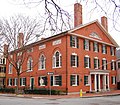
Hamilton Hall is located on Chestnut Street, where many grand mansions can be traced to the roots of the Old China Trade. Hamilton Hall was built in 1805 by Samuel McIntire and is considered one of his best pieces. It was declared a National Historic Landmark by the National Park Service in 1970.

Tourism is the backbone of Salem's economy. Tourism based on the 1692 witch trials dates back to at least the first half of the 20th century, when dry goods merchant Daniel Low sold souvenir spoons with witch images. Such tourism expanded significantly in the 1970s, when the television situation comedy Bewitched filmed several episodes in the city.[86] Witch-related tourism expanded significantly in the 1990s with the movie Hocus Pocus, and the city added an official "Haunted Happenings" celebration during the October tourist season.

In 2007, the city launched the Haunted Passport program which offers visitors discounts and benefits from local tourist attractions and retailers from October to April.[87] The goal of the program is to get visitors to come back to Salem after Halloween and experience businesses that may not be directly tied to Halloween. Thousands watched in 2007 as Mayor Kim Driscoll started a new trend with a massive fireworks display that kicked off at 10:00 pm on Halloween.[88]
In recent years, tourism has been an occasional source of debate in the city, with some residents arguing the city should downplay witch tourism and market itself as a more upscale cultural center. In 2005, the conflict came to a head over plans by the cable television network TV Land to erect a bronze statue of Elizabeth Montgomery, who played the comic witch "Samantha" in the 1960s series Bewitched.[86] A few special episodes of the series were actually filmed in Salem, and TV Land said that the statue commemorated the 35th anniversary of those episodes. The statue was sculpted by StudioEIS under the direction of brothers Elliott and Ivan Schwartz. Many felt the statue was good fun and appropriate to a city that promotes itself as "The Witch City", and contains a street named "Witch Way". Others objected to the use of public property for what was transparently commercial promotion.[89]
Other tourist attractions

In 2000, the replica tall ship Friendship of Salem was finished and sailed to Salem Harbor, where she sits today. The Friendship of Salem is a reconstruction of a 171-foot (52 m) three-masted East Indiaman trading ship, originally built in 1797, which traveled the world over a dozen times and returned to Salem after each voyage with goods from all over the world. The original was taken by the British during the War of 1812, then stripped and sold in pieces.[90]
In 2006, with the assistance of a 1.6 million dollar grant and additional funds provided by the City of Salem,[citation needed] Mayor Driscoll launched The Nathaniel Bowditch, a 92-foot catamaran with a top speed of 30 knots which makes the trip between Salem and Boston in just under an hour. Bowditch, who was born in Salem and had a home on North Street, is considered the founder of modern maritime navigation. His book, Bowditch's American Practical Navigator, first published in 1802, is still carried on board every commissioned U.S. naval vessel.[citation needed]
The original Fame was a fast Chebacco fishing schooner that was reborn as a privateer when war broke out in the summer of 1812. She was arguably the first American privateer to bring home a prize, and she made 20 more captures before being wrecked in the Bay of Fundy in 1814.
The new Fame is a full-scale replica of this famous schooner. Framed and planked of white oak and trunnel-fastened in the traditional manner, the replica of Fame was launched in 2003. She is now based at Salem's Pickering Wharf Marina, where she takes the paying public for cruises on Salem Sound.[91]
Salem Harborwalk opened in July 2010 to celebrate the rebirth of the Salem waterfront as a source of recreation for visitors as well as the local community. The 1,100-foot (340 m) walkway extends from the area of the Salem Fire Station to the Salem Waterfront Hotel.[92][93]

The Peabody Essex Museum is a leading museum of Asian art and culture and early American maritime trade and whaling; its collections of Indian, Japanese, Korean, and Chinese art, and in particular Chinese export porcelain, are among the finest in the country. Founded in 1799, it is the oldest continuously operating museum in the United States.[94] The museum owns and exhibits a number of historic houses in downtown Salem. In 2003, it completed a massive $100 million renovation and expansion, designed by architect Moshe Safdie, and moved a 200-year-old 16-room Chinese home from Xiuning County in southeastern China to the grounds of the museum.[95]
In 2011, the Peabody Essex Museum announced it had raised $550 million with plans to raise an additional $100 million by 2016.[96] The Boston Globe reported this was the largest capital campaign in the museum's history vaulting the Peabody Essex into the top tier of major art museums.[97] The Peabody Essex Museum trustees co-chairs Sam Byrne and Sean Healey with board president Robert Shapiro led the campaign.[98]$200 to $250 million will fund the museum’s 175,000-square-foot expansion bringing the total square footage to 425,000 square feet. [18]

The Misery Islands which are a nature reserve were established in 1935 and located in Salem Sound and are managed by the Trustees of Reservations. The islands' name come from shipbuilder Robert Moulton who was stranded on the islands during a winter storm in the 1620s. The island, in the past, has been home to a club with a golf course and subsequently about two dozen cottages. The island is now uninhabited.
The Pioneer Village, created in 1930, was America's first living-history museum. The site features a three-acre re-creation of a Puritan village and allows visitors the opportunity to participate in activities from the lives of Salem's earliest English settlers.[99]
The Old Salem Jail, an active correctional facility until 1991, once housed captured British soldiers from the War of 1812. It contains the main jail building (built in 1813, renovated in 1884), the jail keeper's house (1813) and a barn (also about 1813). The jail was shuttered in 1991 when Essex County opened its new facility in Middleton. In 2010, a $12 million renovation was completed.[100] One feature of the reconstruction is the jail keeper's house, a three-story brick, Federal-period building originally built in 1813. The project went into a long phase of stagnation when in 1999 the county government was dissolved, resulting in the sale of Salem Jail by the Commonwealth of Massachusetts to the City of Salem for $1.[101] The Old Salem Jail complex was renamed 50 Saint Peter Street and is now private property, with private residences.[102]

Salem Willows is an oceanfront neighborhood and amusement park. It is named for the European white willow trees planted there in 1801 to form a shaded walk for patients convalescing at a nearby smallpox hospital. The area became a public park in 1858, and in the twentieth century became a summer destination for residents of Boston's North Shore, many of whom escaped the heat of the city on newly popular streetcars. The beaches are also a common place to watch the 4th of July fireworks since you can see three sets of fireworks; Salem, Beverly, and Marblehead. The Willows also has a famous popcorn stand, Hobbs, which is known around the North Shore as one of the best places to get popcorn or and ice cream.
Points of interest

- Crowninshield-Bentley House (c. 1727–30)
- Gedney House (c. 1665), one of the oldest homes in Salem; located on High Street and Summer Street
- House of the Seven Gables (1668)
- John Tucker Daland House (1851)
- Joseph Story House
- McIntire Historic District, greatest concentration of 17th and 18th century domestic structures in the U.S.
- Misery Islands
- Nathaniel Bowditch House (c. 1805), home of the founder of modern navigation
- Nathaniel Hawthorne Birthplace (c. 1730–45)
- Peabody Essex Museum (1799), oldest continually operated museum in America
- Phillips Library
- Pickering House (c. 1651), Broad Street
- Pioneer Village (c. 1930), Forest River Park
- Ropes Mansion (late 1720s)
- Salem Athenaeum
- Salem Common
- Salem Maritime National Historic Site, the only remaining intact waterfront from the U.S. age of sail
- Salem Willows Park (1858), a small oceanfront amusement park
- Stephen Phillips Memorial Trust House (1800 & 1821)
- Winter Island, park and historic point of the U.S. Coast Guard in WW2 for U-boat patrol
- The Witch House, the home of the Salem witch trials investigator Jonathan Corwin, and the only building still standing in Salem with direct ties to the witch trials
- Salem Points of Interest
-

-
 Gallows Hill Park. Popular legend places the execution of the Salem Witches near this site.
 -
 The Pickman House, built circa 1664, believed to be Salem's oldest surviving building
 -
 The Gedney House (1665) on High Street
 -
 Salem Common bandshell in 2005
 -
 Hamilton Hall (1805), 9 Chestnut Street
 -
 Peirce Nichols House (1782), 80 Federal Street
 -
 Phillips House (1800), 34 Chestnut Street
 -
 John Ward House (1684)
_-_Salem,_Massachusetts.jpg)


_-_Salem,_Massachusetts.JPG)

.jpg)


Notable people
- Nehemiah Adams (1806–1878), clergyman and author
- Alexander Graham Bell (1847-1922), inventor of telephone
- Frank Weston Benson (1862–1951), impressionist artist
- John Prentiss Benson (1865–1947), architect and maritime artist
- William Bentley (1759–1819), Unitarian minister, Salem diarist
- Nathaniel Bowditch (1773–1838), mathematician and navigator
- Rick Brunson, former NBA player
- Timothy Burgess, entomologist and zoologist
- Laurie Cabot, Witchcraft high priestess and author
- Robert Ellis Cahill (1934–2005), sheriff, historian and author
- Roger Conant (c.1592–1679), founder of Salem
- Crowninshield family, Boston Brahmins who later helped settle Salem
- Elias Hasket Derby (1739–1799), merchant, first millionaire[103]
- Joseph Horace Eaton (1815–1896), artist and military officer
- John Endecott (1588–1665), governor
- Thomas Gardner (c.1592–1674), co-founder of Salem
- John Hathorne (1641–1717), the "Hanging Judge" in Salem witch trials
- William Hathorne (c. 1576–1650), early businessman and political leader
- Nathaniel Hawthorne (1804–1864), writer
- Jeff Juden, major league baseball pitcher
- Frederick W. Lander (1821–1862), Civil War general, wagon trail and railroad surveyor, poet
- John Larch, actor (1914–2005)
- Dudley Leavitt (1720–1762), early Harvard-educated Congregational minister,[104] New Hampshire native, married to Mary Pickering,[105] Salem's Leavitt Street named for him[106]
- Mary Lou Lord, singer/songwriter; grew up in Salem
- Samuel McIntire (1757–1811), architect and woodcarver
- Rob Oppenheim, professional golfer
- Charles Grafton Page (1812–1868), electrical inventor
- George Swinnerton Parker (1866–1952), founder of Parker Brothers
- Samuel Parris (1653–1720), minister
- Timothy Pickering (1745–1829), secretary of state
- Benjamin Pickman (1763–1843), early Salem merchant for whom Salem's Pickman Street is named[107]
- Dudley Leavitt Pickman (1779–1846), state legislator,[108] Salem merchant, partner, Devereux, Pickman & Silsbee,[109] wealthiest Salem merchant of his day[110][111]
- Sarah Parker Remond (1826–1894), abolitionist
- Ernest R. Redmond (1883-1966), United States Army officer and Chief of the National Guard Bureau
- Aaron Richmond (1895–1965), impresario and artist manager
- Brian St. Pierre, quarterback for the Carolina Panthers
- Samuel Sewall (1652–1730), magistrate
- Samuel Skelton (c. 1584–1634), first pastor of the First Church in Salem, the original Puritan church in North America
- Steve Thomas, former host of PBS's This Old House
- Bob Vila, craftsman
- Thomas A. Watson, assistant to Alexander Graham Bell, his name was the first phrase ever uttered over a telephone.
- Jack Welch, former chairman and CEO of General Electric; grew up in Salem and attended Salem High School
- Roger Williams (1603–1683), theologian
- Notable Residents of Salem
-
 Frank Weston Benson
 -
 Nathaniel Bowditch
 -
 Elias Hasket Derby
 -
 John Endecott
 -
 Nathaniel Hawthorne
 -
 Frederick W. Lander
 -
 Charles Grafton Page
 -
 Timothy Pickering
 -
 Sarah Parker Remond
 -
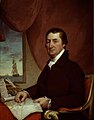
 Samuel McIntyre, c. 1786, pastel portrait attributed to Benjamin Blyth

,_American_mathematician_and_actuary.jpeg)


Sister cities
 - Oroville, California (USA) 2007[112]
 - Ōta, Tokyo (Japan) 1991[113]
Notes
- ^ "Profile of General Population and Housing Characteristics: 2010 Demographic Profile Data (DP-1): Salem city, Massachusetts". U.S. Census Bureau, American Factfinder. Retrieved August 30, 2012.
- ^ "'We're still a hot spot' » Local News » SalemNews.com, Salem, MA". Z4m.cnhi.zope.net. 2012-08-30. Retrieved 2012-09-03.
- ^ a b More than a dozen (old planters) followed Conant to Salem, Gardner & Tylley included. Phippen, George D. "Old Planters of Salem" Hist. Coll. of the Essex Institute Vol. 1, 97 et seq.
- ^ The four Old Planters are John Balch, Roger Conant, Peter Palfrey & John Woodbury. Crawford, Mary Caroline, Famous families of Massachusetts. Boston: Little, Brown, and Co., 1930. Chap 6
- ^ Richard Gildrie, Salem Massachusetts 1626-1683, 4.
- ^ Goff, John. (2009) Salem's Witch House: A Touchstone to Antiquity The History Press (via google.com)
- ^ Felt, J.B. (1827) Annals of Salem W.&S. B. Ives
- ^ Craddock's letter to Endicott. Young, A. (1846). Chronicles of the First Planters of the Colony ... C.C. Little & J. Brown (via archive.org)
- ^ "Barz-Snell, Rev. Jeffrey, "A 'Short' History of the First Church in Salem," First Church in Salem, Unitarian Web Site , Retrieved 4 February, 2011".
- ^ Marsh, D. W., Ed., Genealogy of the Marsh Family Outline for Five Generations, p. 1, Press of J. R. Williams, Amherst, MA, 1886.
- ^ Upham, William Phineas, Papers Relating to the Rev. Samuel Skelton, 1875.
- ^ Harrison, Bruce H., The Family Forest Descendants of Rev. Samuel Skelton, p. 4, Millisecond Publishing Co., Inc., Kamuela, HI, 2004.
- ^ "Soldiers in King Philip's War, Chapter 22".
- ^ Anderson, Robert, The Great Migration Begins: Immigrants to New England, 1620-1633, Entry for William Hathorne, New England Historic Genealogical Society, Boston, MA, 1999.
- ^ Albert Christophe. The Romantic Story of the Puritan Fathers: And Their Founding of NewBoston. Retrieved 2007-11-14.
{{cite book}}: Cite has empty unknown parameter:|month=(help) - ^ Norton, Mary Beth (2002). In the Devil's Snare: the Salem Witchcraft Crisis of 1692. New York: Alfred A. Knopf. pp. 23–24. ISBN 9780375407093.
- ^ Starkey, Marion, The Devil in Massachusetts, Knopf, Doubleday, 1969.
- ^ "Brief Biography of John Hathorne, Hawthorne in Salem Web site".
- ^ ''The Loyalists of Massachusetts and the Other Side of the American Revolution'', James H. Stark, James H. Stark, Boston, 1910. Books.google.com. Retrieved 2012-11-10.
- ^ "John Fraylor. Salem Maritime National Historic Park". Nps.gov. Retrieved 2012-09-03.
- ^ Trow, Charles Edward. "Introduction". The old shipmasters of Salem. New York and London: G.P. Putnam's Sons. pp. xx–xxiii. OCLC 4669778.
- ^ a b Gilbert, Wesley John (2011). Our Man in Zanzibar: Richard Waters, American Consul (1837-1845) (free) (B.A. Thesis). Departmental Honors in History. Thesis advisor, Professor Kirk Swinehart. Middletown, Connecticut: Wesleyan University. p. 20. Retrieved May 3, 2012.
Note 23: Of the two hundred registered Salem vessels in 1812, all but fifty-seven were destroyed in the war. James Duncan Phillips, Salem and the Indies; the Story of the Great Commercial Era of the City (Boston: Houghton Mifflin Co., 1947), 422.
{{cite book}}: Cite has empty unknown parameter:|nopp=(help); Unknown parameter|month=ignored (help) - ^ Cotheal, Alexander I. (2008-01-17). "Treaty between the United States of America and the Sultân of Masḳaṭ: The Arabic Text" (free). Journal of the American Oriental Society. 4 (1854). JSTOR: 341–343. Retrieved April 5, 2012.
- ^ "Salem history". Salempd.org. 2010-05-13. Retrieved 2012-11-10.
- ^ "Salem Massachusetts - Sites and Attractions Tour". Salemweb.com. Retrieved 2012-09-03.
- ^ Lytle, Stewart (2011-08-03). "Benefits, Concerns Discussed at Wind Turbine Hearing - Salem, MA Patch". Salem.patch.com. Retrieved 2012-09-03.
- ^ Goff, John (2010-12-04). "John Goff: Salem windmills, revisited - Salem, Massachusetts - Salem Gazette". Wickedlocal.com. Retrieved 2012-09-03.
- ^ Davis, Brendan (2011-06-16). "Wind turbine project moves forward in Salem - Salem, Massachusetts - Salem Gazette". Wickedlocal.com. Retrieved 2012-09-03.
- ^ The results of the City of Salem wind tests can be viewed at [1].
- ^ "Plan calls for amphitheater, other fixes at Winter Island » Local News » SalemNews.com, Salem, MA". Salemnews.com. 2012-08-30. Retrieved 2012-09-03.
- ^ "Patrick-Murray Administration Creates Ports of Massachusetts Compact". Mass.gov. 2012-04-30. Retrieved 2012-09-03.
- ^ "The National Guard - Guard celebrates 373rd First Muster on Salem Common". Ng.mil. 2010-04-10. Retrieved 2012-09-03.
- ^ "Governor Patrick Designates Salem as Birthplace of National Guard". Mass.gov. 2010-08-19. Retrieved 2012-09-03.
- ^ "National Guard bill passes muster with House » Local News » SalemNews.com, Salem, MA". Salemnews.com. 2012-08-30. Retrieved 2012-09-03.
- ^ "Muster's 375th anniversary today » Local News » SalemNews.com, Salem, MA". Salemnews.com. 2012-08-30. Retrieved 2012-09-03.
- ^ "THE ELIAS HASKET DERBY FEDERAL CARVED MAHOGANY SIDE CHAIR | CARVING ATTRIBUTED TO SAMUEL MCINTIRE (1757-1811), SALEM, MASSACHUSETTS, 1790-1798 | American Furniture & Decorative Arts Auction | side chair, Furniture & Lighting | Christie's". Christies.com. Retrieved 2012-09-03.
- ^ "World Auction Records At Christie'S «". Antiquesandartireland.com. 2011-01-26. Retrieved 2012-09-03.
- ^ Guerriero, Lisa (2008-05-20). "'Bride Wars' takes Salem by storm - Salem, Massachusetts - Salem Gazette". Wickedlocal.com. Retrieved 2012-09-03.
- ^ "A real Zombie visits Salem » Local News » SalemNews.com, Salem, MA". Salemnews.com. 2012-08-30. Retrieved 2012-09-03.
- ^ "CASTING call » Business » SalemNews.com, Salem, MA". Salemnews.com. 2012-02-22. Retrieved 2012-09-03.
- ^ "The Salem Harbor Plan". The Salem Partnership. 2006-06-22. Retrieved 2012-09-03.
- ^ "Salem ferry cuts back to three days a week » Local News » SalemNews.com, Salem, MA". Salemnews.com. 2012-08-30. Retrieved 2012-09-03.
- ^ "Salem may dump ferry operator". Salemnews.com. 2012-08-30. Retrieved 2012-09-03.
- ^ "Salem ferry operator: 'It's not working out' » Local News » SalemNews.com, Salem, MA". Salemnews.com. 2012-08-30. Retrieved 2012-09-03.
- ^ "The Salem Ferry". The Salem Ferry. Retrieved 2012-11-10.
- ^ "Commuter trip is in ferry bid » Local News » SalemNews.com, Salem, MA". Salemnews.com. 2012-08-30. Retrieved 2012-09-03.
- ^ "Salem ferry delayed » Local News » SalemNews.com, Salem, MA". Salemnews.com. 2012-08-30. Retrieved 2012-09-03.
- ^ "Ferry to run between Salem and South Shore for Halloween » SalemNews.com, Salem, MA". Salemnews.com. 2012-08-27. Retrieved 2012-11-10.
- ^ "A SECOND CYCLE » Local News » SalemNews.com, Salem, MA". Salemnews.com. 2012-08-30. Retrieved 2012-09-03.
- ^ "Salem gets $1M for waterfront » SalemNews.com, Salem, MA". Salemnews.com. 2006-12-18. Retrieved 2012-09-03.
- ^ "State awards $1.75M to Blaney Street wharf project » Local News » SalemNews.com, Salem, MA". Salemnews.com. 2012-08-30. Retrieved 2012-09-03.
- ^ "Dominion to Sell Blaney Street Property to City of Salem - SALEM, Mass., June 7 /PRNewswire/". Massachusetts: Prnewswire.com. Retrieved 2012-09-03.
- ^ "Salem is focusing its sights on shore » Local News » SalemNews.com, Salem, MA". Salemnews.com. 2012-08-30. Retrieved 2012-09-03.
- ^ City of Salem, MA. "City of Salem, MA - City to purchase Blaney Street parcel today". Salem.com. Retrieved 2012-09-03.
- ^ "Salem pier work under way » Local News » SalemNews.com, Salem, MA". Salemnews.com. 2012-08-30. Retrieved 2012-09-03.
- ^ "Salem Harbor Power Station To Close In 2014 « CBS Boston". Boston.cbslocal.com. 2011-05-11. Retrieved 2012-09-03.
- ^ "Grant of $2.5M to aid wharf makeover » Local News » SalemNews.com, Salem, MA". Salemnews.com. 2012-08-30. Retrieved 2012-09-03.
- ^ "Salem, Mass. power plant to close". Necn.com. 2011-05-12. Retrieved 2012-09-03.
- ^ Guerriero, Lisa. "Dominion: Entire Salem power plant will close June 1, 2014 - Salem, Massachusetts - Salem Gazette". Wickedlocal.com. Retrieved 2012-09-03.
- ^ "Massachusetts Chapter Sierra Club". Sierraclubmass.org. Retrieved 2012-09-03.
- ^ "Footprint Power of New Jersey to buy Salem Harbor Power Station - The Boston Globe". Boston.com. 2012-06-30. Retrieved 2012-09-03.
- ^ [2][dead link]
- ^ "Company inks deal for plant » Local News » SalemNews.com, Salem, MA". Salemnews.com. 2012-08-30. Retrieved 2012-09-03.
- ^ "Total Population (P1), 2010 Census Summary File 1". American FactFinder, All County Subdivisions within Massachusetts. United States Census Bureau. 2010.
- ^ "Massachusetts by Place and County Subdivision - GCT-T1. Population Estimates". United States Census Bureau. Retrieved July 12, 2011.
- ^ "1990 Census of Population, General Population Characteristics: Massachusetts" (PDF). US Census Bureau. December 1990. Table 76: General Characteristics of Persons, Households, and Families: 1990. 1990 CP-1-23. Retrieved July 12, 2011.
- ^ "1980 Census of the Population, Number of Inhabitants: Massachusetts" (PDF). US Census Bureau. December 1981. Table 4. Populations of County Subdivisions: 1960 to 1980. PC80-1-A23. Retrieved July 12, 2011.
- ^ "1950 Census of Population" (PDF). Bureau of the Census. 1952. Section 6, Pages 21-10 and 21-11, Massachusetts Table 6. Population of Counties by Minor Civil Divisions: 1930 to 1950. Retrieved July 12, 2011.
- ^ "1920 Census of Population" (PDF). Bureau of the Census. Number of Inhabitants, by Counties and Minor Civil Divisions. Pages 21-5 through 21-7. Massachusetts Table 2. Population of Counties by Minor Civil Divisions: 1920, 1910, and 1920. Retrieved July 12, 2011.
- ^ "1890 Census of the Population" (PDF). Department of the Interior, Census Office. Pages 179 through 182. Massachusetts Table 5. Population of States and Territories by Minor Civil Divisions: 1880 and 1890. Retrieved July 12, 2011.
- ^ "1870 Census of the Population" (PDF). Department of the Interior, Census Office. 1872. Pages 217 through 220. Table IX. Population of Minor Civil Divisions, &c. Massachusetts. Retrieved July 12, 2011.
- ^ "1860 Census" (PDF). Department of the Interior, Census Office. 1864. Pages 220 through 226. State of Massachusetts Table No. 3. Populations of Cities, Towns, &c. Retrieved July 12, 2011.
- ^ "1850 Census" (PDF). Department of the Interior, Census Office. 1854. Pages 338 through 393. Populations of Cities, Towns, &c. Retrieved July 12, 2011.
- ^ "1950 Census of Population" (PDF). 1: Number of Inhabitants. Bureau of the Census. 1952. Section 6, Pages 21-7 through 21-09, Massachusetts Table 4. Population of Urban Places of 10,000 or more from Earliest Census to 1920. Retrieved July 12, 2011.
{{cite journal}}: Cite journal requires|journal=(help) - ^ a b Source: US 2010 Census bureau quickfacts for Salem, Massachusetts
- ^ "Massachusetts - Race and Hispanic Origin for Selected Cities and Other Places: Earliest Census to 1990". U.S. Census Bureau.
- ^ "Salem State University: Facts and Figures". Salem, Massachusetts: Salem State University. 2010. Retrieved April 28, 2011.
- ^ "Salem State University Series". Salem, Massachusetts: Salem State University. 2011. Retrieved April 28, 2011.
- ^ "History of Salem State University". Salem, Massachusetts: Salem State University. 2011. Retrieved April 28, 2011.
- ^ "Time line of a crisis » Local News » SalemNews.com, Salem, MA". Salemnews.com. Retrieved 2012-11-10.
- ^ "Schools regroup; cops probe $4.7M deficit » Local News » SalemNews.com, Salem, MA". Salemnews.com. 2008-01-24. Retrieved 2012-11-10.
- ^ "St. Joseph School in Salem closing » Local News » SalemNews.com, Salem, MA". Salemnews.com. 2008-12-05. Retrieved 2012-11-10.
- ^ http://www.salem.com/Pages/SalemMA_Fire/index
- ^ http://www.salem.com/Pages/SalemMA_Fire/staffdirectory
- ^ "The Witch House (Jonathan Corwin House), Salem, Massachusetts". Salemweb.com. Retrieved 2012-09-03.
- ^ a b Brooks, Anthony (May 5, 2005). "Salem Residents Oppose Planned 'Bewitched' Statue". National Public Radio. Retrieved April 28, 2011.
- ^ Cassidy, Chris (July 11, 2007). "Could Halloween 'passport' scare up year-round profits?". The Salem News. Community Newspaper Holdings, Inc. Retrieved April 28, 2011.
- ^ Guerriero, Lisa (September 13, 2007). "Carnival, fireworks added to Halloween offerings; more plans brewing". Salem Gazette. GateHouse Media, Inc. Retrieved April 28, 2011.
- ^ Matarazzo, Jr., Bruno (July 20, 2006). "Controversial'Bewitched'statue besmirched by red paint". The Salem News. Community Newspaper Holdings, Inc. Retrieved April 28, 2011.
- ^ "Friendship Overview". Salem, Massachusetts: salemweb.com. Retrieved April 28, 2011.
- ^ "The Schooner Fame ~ The Salem Privateer - Harbor Cruises in Salem, MA". Schoonerfame.com. 2012-06-14. Retrieved 2012-09-03.
- ^ Galang, Stacie N. (July 16, 2010). "Salem Harborwalk opens amid appreciative crowd". The Salem News. Community Newspaper Holdings, Inc. Retrieved April 28, 2011.
- ^ Glasset, Meaghan (November 8, 2007). "Grants will transform Peabody Street lot into park, harbor walk destination". Salem Gazette. GateHouse Media, Inc. Retrieved April 28, 2011.
- ^ "About PEM". Salem, Massachusetts: Peabody Essex Museum. Retrieved April 28, 2011.
- ^ "Yin Yu Tang". Pem.org. 2006-06-07. Retrieved 2012-11-10.
- ^ Peabody Essex announces $650 million campaign, WickedLocal.com, November 14, 2011
- ^ Peabody Essex vaults into top tier by raising $550 million, Boston Globe, November 6, 2011.
- ^ PEM announces $650 million advancement, Peabody Essex Museum press release, November 7, 2011.
- ^ "Pioneer Village: Salem 1630". Salem, Massachusetts: salemweb.com. Retrieved April 28, 2011.
- ^ Dalton, Tom (March 24, 2010). "Salem Jail to hold first open house". The Salem News. Community Newspaper Holdings, Inc. Retrieved April 28, 2011.
- ^ Dalton, Tom (April 22, 2009). "Work set to begin at old jail". The Salem News. Community Newspaper Holdings, Inc. Retrieved April 28, 2011.
- ^ Dalton, Tom (July 19, 2010). "Access to public an issue at old jail". The Salem News. Community Newspaper Holdings, Inc. Retrieved April 28, 2011.
- ^ Hasket Derby Pickman, Harvard College class of 1815 and son of Col. Benjamin Pickman Esq. and his wife Anstiss Derby, daughter of merchant Elias Hasket Derby and his wife Elizabeth Crowninshield, died the year he graduated from Harvard.[3]
- ^ The Native Ministry of New Hampshire, Nathan Franklin Carter, Rumford Printing Co., Concord, N.H., 1906. Books.google.com. 1987-04-01. Retrieved 2012-11-10.
- ^ The Life of Timothy Pickering, Vol. II, Octavius Pickering, Charles Wentworth Upham, Little, Brown & Co., Boston, 1873. Books.google.com. Retrieved 2012-11-10.
- ^ Leavitt was minister of a splinter church of Salem's First Church. Upon Leavitt's untimely death in 1762, the church elected to call itself 'the Church of which the Rev. Mr. Dudley Leavitt was late Pastor.'[4]
- ^ Naturalization papers of Benjamin Pickman, Dudley Leavitt Pickman Papers, Phillips Library Collection, Peabody Essex Museum, pem.org/museum[dead link]
- ^ Acts and Resolves Passed by the General Court, Russell, Cutler & Co., Boston, 1812-1815. Books.google.com. Retrieved 2012-11-10.
- ^ George Nichols, Salem Shipmaster and Merchant, George Nichols, Martha Nichols, Reprinted by Ayers Publishing, 1970. Books.google.com. Retrieved 2012-11-10.
- ^ Yankee India: American Commercial and Cultural Encounters with India in the Age of Sail, 1784–1860, Susan S. Bean, Peabody Essex Museum, Published by Peabody Essex Museum, 2001. Books.google.com. Retrieved 2012-11-10.
- ^ History of Essex County, Massachusetts, Vol. I, Douglas Hamilton Hurd, J.W. Lewis & Co., Philadelphia, 1888. Books.google.com. Retrieved 2012-11-10.
- ^ "Chico considers establishing permanent sister city guidelines - Chico Enterprise Record". Chicoer.com. Retrieved 2012-11-10.
- ^ City of Salem, MA (2008-06-17). "This resulted from the affiliation between Salem's Peabody Essex Museum (PEM) and the Ota Folk Museum in Japan". Salem.com. Retrieved 2012-11-10.
References
- Perley, Sidney. History of Salem, Massachusetts in Three Volumes. Full images at University of Virginia eText Center and the Salem Witch Trial Documentary Archive and Transcription Project.
- 1795 Map of Salem.
- Saunders, Jonathan P. 1832 Map of Salem.
- Beer, D.G. 1872 Atlas of Essex County Map of Salem. Plate 118.
- Walker, George H. 1884 Atlas of Essex County Salem South. Plate 16. Salem-Jail-to-hold-first-open-houseSalem North. Plate 17.
- Various Salem Atlases.
- Hopkins, C.M. Atlas of Salem, Massachusetts. Published in 1874.
- Sanborn Map Co. Map of Salem Showing Area Destroyed by Fire June 25, 1914.
- Atlas of Salem for 1890-1903 Index Map. Page selection.
- 1897 Atlas of Salem Massachusetts Index Map.
- Walker. 1911 Atlas of Salem, Massachusetts.
- Salem 1906-1938 Index or Key Map.
- Vital Records of Salem, Massachusetts to 1849.[dead link] Published 1916, 1918, 1924, 1925. Transcribed and put online by John Slaugher.
Further reading
- Booth, Robert. Death of an empire : the rise and murderous fall of Salem, America's richest city, 1st ed., New York : Thomas Dunne Books, 2011. ISBN 978-0-312-54038-8
- Goff, John, "Looking at Salem's beginnings: The White and Gardner family contributions", Salem Gazette, GateHouse News Service story, December 29, 2007
- Morris, Richard J., "Redefining the Economic Elite in Salem, Massachusetts, 1759-1799: A Tale of Evolution, Not Revolution", The New England Quarterly, Vol. 73, No. 4 (Dec., 2000), pp. 603–624. Published by: The New England Quarterly, Inc.
- National Park Service, "Salem Maritime Salem Maritime National Historic Site: Official Map and Guide", United States Department of the Interior
- Norton, Mary Beth, In the Devil's Snare: The Salem Witchcraft Crisis of 1692, 1st ed., New York : Alfred A. Knopf, 2002. ISBN 0-375-40709-X
- Saville, Susanne. Hidden History of Salem, 1st ed., Charleston, SC : The History Press, 2010. ISBN 978-1-59629-062-4
- Smith, Bonnie Hurd. "Salem Women's Heritage Trail," Salem, MA: Salem Chamber of Commerce, 2000. http://shop.historysmiths.com/Salem-Womens-Heritage-Trail-0-9704784-0-2.htm
- Smith-Dalton, Maggi (Salem History Society) "A history of spiritualism and the occult in Salem : the rise of witch city," Charleston, SC : History Press, 2012.https://www.worldcat.org/title/history-of-spiritualism-and-the-occult-in-salem-the-rise-of-witch-city/oclc/808684425&referer=brief_results
- Smith-Dalton, Maggi (Salem History Society) "Stories & shadows from Salem's past : Naumkeag notations,"American Chronicles Series,Charleston, SC : History Press, 2010.https://www.worldcat.org/title/stories-shadows-from-salems-past-naumkeag-notations/oclc/642511300&referer=brief_results
- Wagner, E.J., "A Murder in Salem", Smithsonian magazine, November 2010
External links
- City of Salem official website
- Salem Public Library
- The First Church in Salem
- SalemWeb
- [19]
- Salem Police Department
- Multimedia walking tour of Salem
- Salem Architecture from the 17th and 18th Centuries
- Stephen Phillips Memorial Trust House
- This Week in Salem History
- History of the Salem Common
- The Bewitched Statue of Salem MA
- Salem Old Town Hall
- Salem Pioneer Village
- City of Salem 3D Models
42°31′01″N 70°53′55″W / 42.516845°N 70.898503°W
Municipalities and communities of Essex County, Massachusetts, United States | ||
|---|---|---|
| Cities |  | |
| Towns | ||
| CDPs | ||
| Other villages | ||