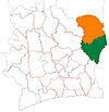
Sandégué
Sandégué | |
|---|---|
Town, sub-prefecture, and commune | |
| Coordinates: 7°57′N 3°35′W / 7.950°N 3.583°W | |
| Country | |
| District | Zanzan |
| Region | Gontougo |
| Department | Sandégué |
| Population (2014)[1] | |
| • Total | 23,068 |
| Time zone | UTC+0 (GMT) |
Sandégué is a town in eastern Ivory Coast. It is a sub-prefecture of and the seat of Sandégué Department in Gontougo Region, Zanzan District. Sandégué is also a commune.
In 2014, the population of the sub-prefecture of Sandégué was 23,068.[2]
Villages[edit]
The fourteen villages of the sub-prefecture of Sandégué and their population in 2014 are:[2]
- Sandégué (2 972)
- Bandakagni-Sokoura (3 531)
- Daridougou (2 784)
- Gbangbo (944)
- Kamelé (2 005)
- Kassoumdougou (331)
- Kiéti (869)
- Kouakoukankro (1 549)
- Logondé (371)
- Madam (1 432)
- Pala (1 651)
- Sanguéhi (1 605)
- Talahini-Sokoura (371)
- Talahini-Tomora (2 653)
Notes[edit]
- ^ "Côte d'Ivoire". geohive.com. Retrieved 14 December 2015.
- ^ a b "RGPH 2014, Répertoire des localités, Région Gontougo" (PDF). ins.ci. Retrieved 5 August 2019.


