
Tattnall County, Georgia
Tattnall County | |
|---|---|
 Tattnall County Courthouse | |
 Location within the U.S. state of Georgia | |
 Georgia's location within the U.S. | |
| Coordinates: 32°02′N 82°04′W / 32.04°N 82.06°W | |
| Country | |
| State | |
| Founded | December 5, 1801 |
| Named for | Josiah Tattnall |
| Seat | Reidsville |
| Largest city | Glennville |
| Area | |
| • Total | 488 sq mi (1,260 km2) |
| • Land | 479 sq mi (1,240 km2) |
| • Water | 8.9 sq mi (23 km2) 1.8% |
| Population (2020) | |
| • Total | 22,842 |
| • Density | 48/sq mi (19/km2) |
| Time zone | UTC−5 (Eastern) |
| • Summer (DST) | UTC−4 (EDT) |
| Congressional district | 12th |
| Website | www |
Tattnall County is a county located in the southeast portion of the U.S. state of Georgia, located within the Magnolia Midlands, a part of the Historic South region. As of the 2020 census, the population was 22,842.[1] The county seat is Reidsville.[2] Tattnall County was created on December 5, 1801, from part of Montgomery County, Georgia by the Georgia General Assembly.[3]
The county is named after Josiah Tattnall (1762–1803), a planter, soldier and politician.[4]
Geography[edit]
According to the U.S. Census Bureau, the county has a total area of 488 square miles (1,260 km2), of which 479 square miles (1,240 km2) is land and 8.9 square miles (23 km2) (1.8%) is water.[5]
Most of the western portion of Tattnall County, defined by a line running from Cobbtown south to Collins, then east to a point halfway to Bellville, and then south and southwest to the middle of the county's southern border, is located in the Ohoopee River sub-basin of the Altamaha River basin. The northeastern portion of the county, from Cobbtown to east of Reidsville, is located in the Canoochee River sub-basin of the Ogeechee River basin. The southeastern and southwestern parts of Tattnall County are located in the Altamaha River sub-basin of the larger river basin by the same name.[6]
Major highways[edit]
Adjacent counties[edit]
- Candler County - north
- Evans County - northeast
- Liberty County - east
- Long County - southeast
- Wayne County - south
- Appling County - southwest
- Toombs County - west
- Emanuel County - northwest
Communities[edit]
Cities[edit]
- Cobbtown
- Collins
- Glennville (largest city)
- Manassas
- Reidsville (county seat)
Census-designated place[edit]
Demographics[edit]
| Census | Pop. | Note | %± |
|---|---|---|---|
| 1810 | 2,206 | — | |
| 1820 | 2,644 | 19.9% | |
| 1830 | 2,040 | −22.8% | |
| 1840 | 2,724 | 33.5% | |
| 1850 | 3,227 | 18.5% | |
| 1860 | 4,352 | 34.9% | |
| 1870 | 4,860 | 11.7% | |
| 1880 | 6,988 | 43.8% | |
| 1890 | 10,253 | 46.7% | |
| 1900 | 20,419 | 99.2% | |
| 1910 | 18,569 | −9.1% | |
| 1920 | 14,502 | −21.9% | |
| 1930 | 15,411 | 6.3% | |
| 1940 | 16,243 | 5.4% | |
| 1950 | 15,939 | −1.9% | |
| 1960 | 15,837 | −0.6% | |
| 1970 | 16,557 | 4.5% | |
| 1980 | 18,134 | 9.5% | |
| 1990 | 17,722 | −2.3% | |
| 2000 | 22,305 | 25.9% | |
| 2010 | 25,520 | 14.4% | |
| 2020 | 22,842 | −10.5% | |
| 2023 (est.) | 24,296 | [7] | 6.4% |
| U.S. Decennial Census[8] 1790-1880[9] 1890-1910[10] 1920-1930[11] 1930-1940[12] 1940-1950[13] 1960-1980[14] 1980-2000[15] 2010[16] | |||
| Race | Num. | Perc. |
|---|---|---|
| White (non-Hispanic) | 13,825 | 60.52% |
| Black or African American (non-Hispanic) | 5,961 | 26.1% |
| Native American | 36 | 0.16% |
| Asian | 127 | 0.56% |
| Pacific Islander | 6 | 0.03% |
| Other/Mixed | 584 | 2.56% |
| Hispanic or Latino | 2,303 | 10.08% |
As of the 2020 United States census, there were 22,842 people, 8,241 households, and 5,875 families residing in the county.
Government and infrastructure[edit]
.jpg)
The Georgia Department of Corrections operates the Rogers State Prison, and formerly the Georgia State Prison in unincorporated Tattnall County,[18] near Reidsville.[19] As of 2020, according to the Georgia State Prison Fact Sheet, the facility occupies 9,800 acres of land inside Tattnall County and provides 162 staff housing units on the reservation. The prison cemetery has 971 burials which are inmates who died while serving time from 1937 to present.
Another large government parcel of land is the 10,000 acre Big Hammock Wildlife Management Preserve in the southwest section of the county. The entrance is 12 miles south of Glennville on Hwy 144 at the Ohoopee River Bridge. This is controlled by the GA Department of Natural Resources under the Wildlife Resources Division. It has a shooting range and 2 boat ramps along the river which are north of the merger with the Altamaha River which forms the southern border of the county. Permits are issued for seasonal hunting of deer, turkey, and small game. Updates are posted at www.GoHuntGeorgia.com
Another large government land parcel is on the eastern side of Tattnall County along the border with Evans, Liberty, and Long Counties. This 6000+ acres forms the western side of the Fort Stewart Army Reservation which is based in Hinesville, GA. Originally this was farmland purchased by the Army during and after World War II. It has since been turned into forest land with no development. The current Ft. Stewart Land Use Development plan excludes any of this property in their 25-year future planning approved by the Department of Defense. This land mass can be viewed on Google Maps with additional info from the website for the Ft. Stewart Joint Land Use Study. (www.mrrpc.com/Misc_pdfs/Fort_Stewart_JLUS_Final_Report.pdf)
Politics[edit]
| Year | Republican | Democratic | Third party | |||
|---|---|---|---|---|---|---|
| No. | % | No. | % | No. | % | |
| 2020 | 6,054 | 73.95% | 2,062 | 25.19% | 71 | 0.87% |
| 2016 | 5,096 | 73.54% | 1,681 | 24.26% | 153 | 2.21% |
| 2012 | 4,706 | 70.48% | 1,897 | 28.41% | 74 | 1.11% |
| 2008 | 4,730 | 70.32% | 1,932 | 28.72% | 64 | 0.95% |
| 2004 | 4,657 | 71.93% | 1,787 | 27.60% | 30 | 0.46% |
| 2000 | 3,597 | 64.12% | 1,963 | 34.99% | 50 | 0.89% |
| 1996 | 2,518 | 46.23% | 2,369 | 43.49% | 560 | 10.28% |
| 1992 | 2,566 | 43.18% | 2,360 | 39.72% | 1,016 | 17.10% |
| 1988 | 3,172 | 65.03% | 1,694 | 34.73% | 12 | 0.25% |
| 1984 | 3,641 | 65.08% | 1,954 | 34.92% | 0 | 0.00% |
| 1980 | 2,082 | 41.62% | 2,864 | 57.26% | 56 | 1.12% |
| 1976 | 1,326 | 27.16% | 3,556 | 72.84% | 0 | 0.00% |
| 1972 | 2,892 | 85.46% | 492 | 14.54% | 0 | 0.00% |
| 1968 | 852 | 16.34% | 957 | 18.35% | 3,405 | 65.30% |
| 1964 | 3,264 | 66.45% | 1,648 | 33.55% | 0 | 0.00% |
| 1960 | 869 | 31.29% | 1,908 | 68.71% | 0 | 0.00% |
| 1956 | 440 | 18.96% | 1,881 | 81.04% | 0 | 0.00% |
| 1952 | 1,114 | 31.41% | 2,433 | 68.59% | 0 | 0.00% |
| 1948 | 216 | 11.59% | 1,071 | 57.46% | 577 | 30.95% |
| 1944 | 494 | 28.91% | 1,215 | 71.09% | 0 | 0.00% |
| 1940 | 421 | 25.15% | 1,246 | 74.43% | 7 | 0.42% |
| 1936 | 214 | 16.82% | 1,047 | 82.31% | 11 | 0.86% |
| 1932 | 37 | 1.70% | 2,133 | 98.02% | 6 | 0.28% |
| 1928 | 791 | 63.23% | 460 | 36.77% | 0 | 0.00% |
| 1924 | 66 | 5.02% | 1,100 | 83.65% | 149 | 11.33% |
| 1920 | 301 | 40.24% | 447 | 59.76% | 0 | 0.00% |
| 1916 | 49 | 5.95% | 574 | 69.74% | 200 | 24.30% |
| 1912 | 18 | 2.11% | 592 | 69.40% | 243 | 28.49% |
Education[edit]
Tattnall County School District serves as the designated K-12 school district, except parts in Fort Stewart. Fort Stewart has the Department of Defense Education Activity (DoDEA) as its local school district,[21] for the elementary level.[22] Students at the secondary level on Fort Stewart attend public schools operated by county school districts.[23]
See also[edit]
- National Register of Historic Places listings in Tattnall County, Georgia
- List of counties in Georgia
References[edit]
- ^ "Census - Geography Profile: Tattnall County, Georgia". United States Census Bureau. Retrieved December 29, 2022.
- ^ "Find a County". National Association of Counties. Retrieved June 7, 2011.
- ^ "Tattnall County Historical Maps". Retrieved May 28, 2013.
- ^ Krakow, Kenneth K. (1975). Georgia Place-Names: Their History and Origins (PDF). Macon, GA: Winship Press. p. 222. ISBN 0-915430-00-2. Archived (PDF) from the original on September 17, 2003.
- ^ "US Gazetteer files: 2010, 2000, and 1990". United States Census Bureau. February 12, 2011. Retrieved April 23, 2011.
- ^ "Georgia Soil and Water Conservation Commission Interactive Mapping Experience". Georgia Soil and Water Conservation Commission. Retrieved November 22, 2015.
- ^ "Annual Estimates of the Resident Population for Counties: April 1, 2020 to July 1, 2023". United States Census Bureau. Retrieved March 31, 2024.
- ^ "Decennial Census of Population and Housing by Decades". United States Census Bureau.
- ^ "1880 Census Population by Counties 1790-1800" (PDF). United States Census Bureau. 1880.
- ^ "1910 Census of Population - Georgia" (PDF). United States Census Bureau. 1910.
- ^ "1930 Census of Population - Georgia" (PDF). United States Census Bureau. 1930.
- ^ "1940 Census of Population - Georgia" (PDF). United States Census Bureau. 1940.
- ^ "1950 Census of Population - Georgia -" (PDF). United States Census Bureau. 1950.
- ^ "1980 Census of Population - Number of Inhabitants - Georgia" (PDF). United States Census Bureau. 1980.
- ^ "2000 Census of Population - Population and Housing Unit Counts - Georgia" (PDF). United States Census Bureau. 2000.
- ^ "State & County QuickFacts". United States Census Bureau. Archived from the original on January 17, 2016. Retrieved June 26, 2014.
- ^ "Explore Census Data". data.census.gov. Retrieved December 18, 2021.
- ^ "2020 CENSUS - CENSUS BLOCK MAP: Tattnall County, GA" (PDF). U.S. Census Bureau. p. 6 (PDF. p. 7/16). Archived (PDF) from the original on August 13, 2022. Retrieved August 13, 2022.
Rogers State Prison [...] Georgia State Prison
- ^ "Georgia State Prison Archived 2008-03-05 at the Wayback Machine." Georgia Department of Corrections. Retrieved on September 14, 2010.
- ^ Leip, David. "Dave Leip's Atlas of U.S. Presidential Elections". uselectionatlas.org. Retrieved March 22, 2018.
- ^ "2020 CENSUS - SCHOOL DISTRICT REFERENCE MAP: Tattnall County, GA" (PDF). U.S. Census Bureau. Archived (PDF) from the original on July 5, 2022. Retrieved July 5, 2022. - text list - "Fort Stewart School District" refers to the DoDEA schools.
- ^ "Fort Stewart Schools". Department of Defense Education Activity. Retrieved July 5, 2022.
- ^ "Fort Stewart Education". Military One Source. Retrieved July 5, 2022. - This is from a .mil website.
Places adjacent to Tattnall County, Georgia | ||||||||||||||||
|---|---|---|---|---|---|---|---|---|---|---|---|---|---|---|---|---|
| ||||||||||||||||
Municipalities and communities of Tattnall County, Georgia, United States | ||
|---|---|---|
| Cities | 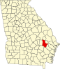 | |
| CDP | ||
| Unincorporated community | ||
| Ghost town | ||
| International | |
|---|---|
| National | |
| Other | |