
Thompson Falls, Montana: Difference between revisions
m Reverting possible vandalism by 216.14.228.38 to version by Numbo3-bot. False positive? Report it. Thanks, ClueBot. (825604) (Bot) |
No edit summary |
||
| Line 78: | Line 78: | ||
'''Thompson Falls''' is a city in and the [[county seat]] of [[Sanders County, Montana|Sanders County]], [[Montana]], [[United States]].{{GR|6}} The population was 1,321 at the [[2000 United States Census|2000 census]]. |
'''Thompson Falls''' is a city in and the [[county seat]] of [[Sanders County, Montana|Sanders County]], [[Montana]], [[United States]].{{GR|6}} The population was 1,321 at the [[2000 United States Census|2000 census]]. |
||
==History== |
==History== |
||
Thompson Falls is named for the British explorer, geographer and fur trader [[David Thompson |
Thompson falls is the gayest place ever. there is alot of dicks here. dont come to thompson falls because i will kill you! Fuck you team wikipedia. Thompson Falls is named for the British explorer, geographer and fur trader [[David Thompson(explorer)|David Thompson]], who in 1809 founded [[Saleesh House]], a [[North West Company]] [[Fur trade|fur trading]] post.<ref>[http://fwp.mt.gov/mtoutdoors/HTML/articles/2007/davidthompson.htm Incredible Journeys], Montana Outdoors</ref> The arrival of the railroad in 1881 brought the first real activity to the area, two years later when the gold rush hit nearby Couer D'Alene the town grew to accommodate the men going over the Murray trail to the mines. In 1885 John Russell bought {{convert|40|acre|m2}} and plotted the town site. |
||
==Geography and ecology== |
==Geography and ecology== |
||
Revision as of 16:52, 17 November 2009
Thompson Falls, Montana | |
|---|---|
 Location of Thompson Falls, Montana | |
| Country | United States |
| State | Montana |
| County | Sanders |
| Area | |
| • Total | 1.9 sq mi (4.8 km2) |
| • Land | 1.9 sq mi (4.8 km2) |
| • Water | 0.0 sq mi (0.0 km2) |
| Elevation | 2,556 ft (779 m) |
| Population (2000) | |
| • Total | 1,321 |
| • Density | 708.5/sq mi (273.5/km2) |
| Time zone | UTC-7 (Mountain (MST)) |
| • Summer (DST) | UTC-6 (MDT) |
| ZIP code | 59873 |
| Area code | 406 |
| FIPS code | 30-73825 |
| GNIS feature ID | 0792090 |
Thompson Falls is a city in and the county seat of Sanders County, Montana, United States.Template:GR The population was 1,321 at the 2000 census.
History
Thompson falls is the gayest place ever. there is alot of dicks here. dont come to thompson falls because i will kill you! Fuck you team wikipedia. Thompson Falls is named for the British explorer, geographer and fur trader David Thompson, who in 1809 founded Saleesh House, a North West Company fur trading post.[1] The arrival of the railroad in 1881 brought the first real activity to the area, two years later when the gold rush hit nearby Couer D'Alene the town grew to accommodate the men going over the Murray trail to the mines. In 1885 John Russell bought 40 acres (160,000 m2) and plotted the town site.
Geography and ecology
Thompson Falls is located at 47°35′48″N 115°20′37″W / 47.59667°N 115.34361°WInvalid arguments have been passed to the {{#coordinates:}} function (47.596587, -115.343730)Template:GR in the Clark Fork Valley at an elevation of 2,419 feet (737 m).
According to the United States Census Bureau, the city has a total area of 1.9 square miles (4.8 km²), all of it land.
An amphibian, the Rough-skinned Newt, has a population at Thompson Falls which is incontiguous with the remainder of the Western USA population of the species.[2]
Demographics
As of the censusTemplate:GR of 2000, there were 1,321 people, 549 households, and 357 families residing in the city. The population density was 708.5 people per square mile (274.2/km²). There were 619 housing units at an average density of 332.0/sq mi (128.5/km²). The racial makeup of the city was 96.74% White, 0.23% African American, 1.44% Native American, 0.15% Asian, 0.08% from other races, and 1.36% from two or more races. Hispanic or Latino of any race were 0.98% of the population.
There were 549 households out of which 28.1% had children under the age of 18 living with them, 53.7% were married couples living together, 9.1% had a female householder with no husband present, and 34.8% were non-families. 31.0% of all households were made up of individuals and 14.9% had someone living alone who was 65 years of age or older. The average household size was 2.36 and the average family size was 2.92.
In the city the population was spread out with 25.1% under the age of 18, 6.4% from 18 to 24, 24.3% from 25 to 44, 27.2% from 45 to 64, and 17.0% who were 65 years of age or older. The median age was 41 years. For every 100 females there were 95.4 males. For every 100 females age 18 and over, there were 92.0 males.
The median income for a household in the city was $28,103, and the median income for a family was $31,544. Males had a median income of $28,125 versus $18,333 for females. The per capita income for the city was $13,245. About 13.6% of families and 16.1% of the population were below the poverty line, including 20.2% of those under age 18 and 18.6% of those age 65 or over.
Education
Local teenagers attend Thompson Falls High School, a Class B school. It offers eight sports to its students.[citation needed]
References
- ^ Incredible Journeys, Montana Outdoors
- ^ C. Michael Hogan (2008) Rough-skinned Newt (Taricha granulosa), Globaltwitcher, ed. N. Stromberg [1]
External links
Municipalities and communities of Sanders County, Montana, United States | ||
|---|---|---|
| City | 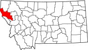 | |
| Towns | ||
| CDPs | ||
| Indian reservation | ||
| Footnotes | ‡This populated place also has portions in an adjacent county or counties | |