
Tondo, Manila
Tondo | |
|---|---|
 Recto Avenue running through Divisoria. | |
 | |
| Country | Philippines |
| Region | National Capital Region |
| City | Manila |
| Congress | Part of the 1st and 2nd Districts of Manila |
| Barangays | 169 |
Tondo is a district located in Manila, Philippines. It is the largest in terms of area and population of Manila's sixteen districts,[1] with a Census-estimated 631,313 people in 2015[2] and consists of two congressional districts. It is also the most densely populated district in the city. Today, if it were an independent city, Tondo would rank as the thirteenth most populous city in the Philippines, behind only the other districts of the City of Manila combined, and the cities of Quezon, Davao, Caloocan, Cebu, Zamboanga, Taguig, Antipolo, Pasig, Cagayan de Oro, Paranaque and Dasmarinas. Tondo hosts the country's largest ports, the Manila North Harbour and the Manila International Container Terminal.
According to Laguna Copperplate Inscription, Tondo has existed since 900 AD, and has been ruled first by Jayadewa who holds the title Senapati or "admiral" in Sanskrit.
History
Etymology
Numerous theories on the origin of the name "Tondo" have been put forward. Philippine National Artist Nick Joaquin suggested that it might be a reference to high ground ("tundok").[3] French linguist Jean-Paul Potet, however, has suggested that the River Mangrove, Aegiceras corniculatum, which at the time was called "tundok" ("tinduk-tindukan" today), is the most likely origin of the name.[4]
Kingdom of Tondo

The former region of Tondo is over 1,100 years old. Historically, Tondo already existed in the year 900 AD according to the Laguna Copperplate Inscription,[5] a legal document written in Kawi now housed in the National Museum of Anthropology. According to this document, Tondo was ruled by person called Jayadeva who holds the Sanskrit title of senapati or the equivalent of an admiral. The Kingdom of Tondo also extended all the way to the modern-day province of Bulacan particularly around Lihan (Malolos) and Gatbuca (Calumpit).[citation needed]
Tondo was ruled by a line of lakan until the Spanish conquest.[citation needed]
Colonial Period
After the Spaniards conquered Tundun in January 1571 they established the Province of Tondo with the city of Manila as its center, the province covered much territories in Northern Luzon particularly Pampanga, Bulacan and Rizal (formerly called Morong) In census conducted by Miguel de Loarca in 1583 Tondo was reported to have spoken the same language as the natives of the province of Pampanga.[6] Institute of National Language commissioner Jose Villa Panganiban also wrote that the dividing line between Kapampangan and Tagalog was the Pasig River, and that Tondo therefore originally spoke Kapampangan.[7] although Fray Isacio Rodriquez's Historia dela Provincia del Santisimo Nombre de Jesus de Filipinas stated that Provincia de Tagalos which is Tondo covers all the territories of the future Archdiocese of Manila. Prior to the establishment of the Province of Bulacan in 1578 Malolos and Calumpit were also included in the territory of Tondo as its visitas. In 1800, the Province of Tondo was renamed to Province of Manila.[citation needed]
Tondo was one of the first provinces to declare rebellion against Spain in year 1896. In 1911, under the American colonial regime, there was a major reorganization of political divisions, and the province of Tondo was dissolved, and its towns given to the provinces of Rizal and Bulacan. Today, Tondo just exists as a district in the City of Manila.[citation needed]
Characteristics
- A densely populated district
- West Tondo, which includes the Manila North Harbour area, has a land area of 5.64 km². with a population of 407,330 (2007); 72,222 persons per km².
- East Tondo, commonly known as Gagalangin, has a land area of 3.46 km². with a population of 223,274 (2007); 64,530 persons per km².
- average residential population density: 69,297 persons per km².
- It is the location of a notorious and now closed landfill called Smokey Mountain.
- It once was the location of the major Procter and Gamble plant in the Philippines at Vitas Street—now closed and dismantled.
- It once was the location of the La Tondena Distillery located in Dagupan St. near the Tutuban Station and the Tutuban Shopping Center
- The main terminal of the Philippine National Railways is located at the Tutuban district, which is close to the birthplace of Andres Bonifacio. This is now converted to a mall (Tutuban Center).
- West of the district lies the major inter-island port of Manila, North Harbor, and the Manila Container Port.
- The slaughterhouse (matadero) of the Manila City Government is located also at Vitas Street.
- Every third Sunday of January, the Feast of the Sto. Niño of Manila (the Infant Jesus) is celebrated by a procession early in the morning from Tondo Church and winding down its narrow streets punctuated by fireworks.
- The LRT Line 1 has 2 stations in the Tondo area, namely: Abad Santos and R. Papa.
- It is the Location of Largest Common Locale of Iglesia ni Cristo which is the 6000 seater INC Tondo Locale Chapel at Juan Luna st. cor. Moriones Road.
Lakbayaw Festival
On the third Sunday of January, the Sto. Niño festivals began in various parts of the country, particularly in Tondo, Manila. Its parish priest Fr. Enrique Santos, of the Sto. Niño Parish, said the celebrations of 2008 started "with the traditional procession of devotees dancing on the street while carrying images of the Child Jesus; a pagoda carrying an old image of Sto. Niño from Spain will lead the parade with 20 smaller boats accompanying it; the parish in Tondo houses the image of Sto. Niño made of ivory that was brought to the country by Augustinian priests from Acapulco, Mexico in the late 1570s."[8]
Hospitals
- Tondo General Hospital
- Mary Johnston Hospital
- Gat. Andres Bonifacio Hospital
- Metropolitan Hospital
- Ospital ng Tondo
- Amisola Maternity Hospital (Hermosa Street, Manuguit, Tondo)
- Santa Rita College Hospital (T.Earnshaw Street, Gagalangin Tondo) [DEMOLISHED]
- Jose Hospital
Landmarks
- Katipunan Foundation Site
- Plaza Andres Bonifacio
- Plaza Moriones
- Plaza A. Hernandez
- Plaza Morga
- Smokey Mountain
- Plaza Leon
- Plaza Vicente Del Fierro (Gagalangin)
In Popular Culture
Tondo is the backdrop for the independent movie Tribu, which shows street life and gang life from an impoverished boy's point of view.
Photos
-
 Fruit Vendor in Juan Luna Street
 -
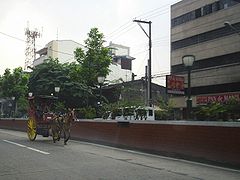 Calesa, a Horse-Drawn Carriage
 -
 Pedicab ride to School
 -
 Busy street near Pritil Market
 -
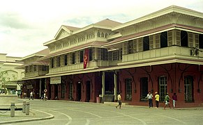 Tutuban Centermall


References
- ^ "Republic Act No. 409: AN ACT TO REVISE THE CHARTER OF THE CITY OF MANILA, AND FOR OTHER PURPOSES". Official Gazette.
- ^ "Highlights of the Philippine Population 2015 Census of Population". Philippine Statistics Authority. May 19, 2016. Retrieved December 9, 2016.
- ^ Joaqiun, Nick (1990). Manila, My Manila: A History for the Young. City of Manila: Anvil Publishing, Inc. ISBN 978-9715693134.
{{cite book}}: Cite has empty unknown parameter:|coauthors=(help) - ^ Potet, Jean-Paul G. (2013). Arabic and Persian Loanwords in Tagalog. p. 444. ISBN 9781291457261.
- ^ Paul Morrow's The Laguna Copperplate Inscription
- ^ Miguel de Loarca's Census of 1583
- ^ Panganiban
- ^ www.abs-cbnnews.com, Sto. Niño festivals start Saturday
Further reading
- Gaspar de San Agustin, Conquistas de las Islas Filipinas 1565-1615, Translated by Luis Antonio Mañeru, 1st bilingual ed [Spanish and English], published by Pedro Galende, OSA: Intramuros, Manila, 1998
- Henson, Mariano A. 1965. The Province of Pampanga and Its Towns: A.D. 1300-1965. 4th ed. revised. Angeles City: By the author.
- Loarca, Miguel de. 1582. Relacion de las Yslas Filipinas. Blair and Robertson vol. 5 page 87:
- Panganiban, J.V. 1972. Diksyunaryo-Tesauro Pilipino-Ingles. Quezon City: Manlapaz Publishing Co.
- Mallat, Jean, Les Philippines: Histoire, Geographie, Moeurs, Agriculture, Idustrie, Commerce des colonies Espagnoles dans l'Océanie, Paris: Arthus Bertrand, Libraire de la Société de Géographie, 1846
- Santiago, Luciano P.R., The Houses of Lakandula, Matanda, and Soliman [1571-1898]: Genealogy and Group Identity, Philippine Quarterly of Culture and Society 18 [1990]
- Scott, William Henry, Barangay: Sixteenth-Century Philippine Culture and Society, Quezon City: Ateneo de Manila University Press, 1994
- Scott, William Henry, Prehispanic Source Materials for the Study of Philippine History, Quezon City: New Day Publishers, 1984
External links
- The Many Faces of Tondo
- Paul Morrow's THE LAGUNA COPPERPLATE INSCRIPTION
- 宋史
- 東西洋考
- GMA NEWS.TV, video, Sto. Niño parish in Tondo prepares for feast - 18 January 2008
- gmanews.tv, video, Feast of Sto. Nino starts - 19 January 2008
| Topics |  | |
|---|---|---|
| Government | ||
| Districts | ||
| Mixed-use developments | ||
| Beaches | ||
| Legislative districts | ||