Upham, Hampshire
| Upham | |
|---|---|
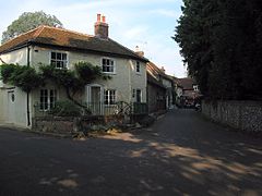
 Southeastern corner of Upham triangle | |
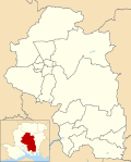
Location within Hampshire | |
| Population | 616 [1] 663 (2011 Census)[2] |
| OS grid reference | SU531202 |
| Civil parish |
|
| District | |
| Shire county | |
| Region | |
| Country | England |
| Sovereign state | United Kingdom |
| Post town | Southampton |
| Postcode district | SO32 |
| Dialling code | 01489 |
| Police | Hampshire and Isle of Wight |
| Fire | Hampshire and Isle of Wight |
| Ambulance | South Central |
| UK Parliament | |
| Website | Upham Parish Council |
Upham is a small village and civil parish in the south of England located in Hampshire approximately 7 miles south-east of Winchester .
The village[edit]
There is a small post office and a local primary school. The village is divided into two parts: Upham, centred on the church to the north, and Lower Upham, centred on the post office and main road. There are two pubs, the Brushmakers Arms and the Alma Inn. Other features include a village pond.
The country house The Holt, a Grade II-listed building, was the longtime seat of the Shendley-Leavett family, and the home of John Alfred Leavett-Shendley, DL, High Sheriff of Hampshire in 1985–1986 who married Alison Yvonne Cecil, daughter of Hon. Yvonne Cornwallis and Royal Navy Commander Henry Mitford Amherst Cecil, O.B.E., who served as a Navy Commander in both World Wars. It was also the home of Sir Robert Calder, a naval officer in the Napoleonic Wars, who died there in 1815. Calder is buried in the local churchyard.
There are marginal remains of a Late Roman period Villa in nearby Little Woodcotte, found in 1849.
Transport[edit]
Lower Upham is crossed by the B2177 road, formerly the A333 Winchester to Portsmouth road; there are no other main roads in the parish. There is a regular bus service to Winchester, Twyford, Colden Common, Bishop's Waltham and Fareham.
The parish is crossed by many trackways and paths including the Monarch's Way, Pilgrims' Trail and King's Way. In the south of the parish King's Way and the Pilgrims' Trail partly use the course of the former Roman road from Winchester to Portchester, which passes between Upham and Lower Upham.[3][4]
Geology[edit]
Upham lies on the northern margin of the Paleogene deposits of the Hampshire Basin. The north of the parish is on chalk with the Lambeth Group and London Clay to the south.[5]
References[edit]
- ^ "Parish Headcounts, Area: Upham CP". Neighbourhood Statistics. Office for National Statistics. 2001. Retrieved 11 March 2008.
- ^ "Civil Parish population 2011". Neighbourhood Statistics. Office for National Statistics. Retrieved 22 January 2017.
- ^ Ordnance Survey (2007), Meon Valley, Portsmouth, Gosport & Fareham, Explorer 119, 1:25,000 scale map, Southampton: Ordnance Survey, ISBN 0-319-23596-3
- ^ Ordnance Survey (2001), Roman Britain south sheet, 5th Ed, 1:625,000 map, Southampton: Ordnance Survey, ISBN 0-319-29029-8
- ^ Andrews I.J. & Balson P.S. (1995), Wight: Sheet 50N 02W Solid Geology, 1:250,000 geological map series, Keyworth: British Geological Survey, ISBN 978-0-7518-3088-0 (flat).
External links[edit]
![]() Media related to Upham, Hampshire at Wikimedia Commons
Media related to Upham, Hampshire at Wikimedia Commons


