
Washington State Route 123
State Route 123 | ||||
|---|---|---|---|---|
 SR 123 is highlighted in red. | ||||
| Route information | ||||
| Auxiliary route of US 12 | ||||
| Maintained by WSDOT | ||||
| Length | 16.34 mi[1] (26.30 km) | |||
| Existed | 1967[2]–present | |||
| Major junctions | ||||
| South end | ||||
| North end | ||||
| Location | ||||
| Country | United States | |||
| State | Washington | |||
| Highway system | ||||
| ||||

State Route 123 (SR 123) is a state highway in the Gifford Pinchot National Forest and Mount Rainier National Park east of Mount Rainier in the U.S. state of Washington. Located in the counties of Lewis and Pierce, the 16.34-mile (26.30 km) long roadway extends through a heavily forested canyon from U.S. Route 12 (US 12) to SR 410. First established as a branch of State Road 5 in 1923, the designation of SR 123 has changed from a branch of Primary State Highway 5 (PSH 5) in 1937 to SR 143 during the 1964 highway renumbering and SR 123 in 1967. The northern terminus of the highway, Cayuse Pass, is closed annually and in late 2006, the Hanukkah Eve windstorm of 2006 washed out a 10.90-mile (17.54 km) long segment of the roadway.
Route description[edit]

State Route 123 (SR 123) begins at an intersection with U.S. Route 12 (US 12) northeast of Packwood, in the Gifford Pinchot National Forest. Paralleling US 12 and the Ohanapecosh River, the highway crosses Boulder Creek and enters a canyon where the roadway encounters Forest Route 44 (FR 44), a connector from SR 706 to Mount Rainier National Park. The segment of SR 123 in the heavily forested canyon is the busiest along the road, with a daily average of 803 motorists in 2007.[3] Still in the canyon, the roadway exits the Gifford Pinchot National Forest and enters the Mount Rainier National Park.[4] The roadway enters Pierce County from Lewis County and passes the Ohanapecosh Visitor Center, located 1,900 feet (579.12 m) above sea level. SR 123 crosses Laughingwater Creek and passes Silver Falls and the entrance to Steve Canyon to the trailhead of the Grove of the Patriarchs Trail. Now following the Chinook Creek, the highway travels into a tunnel under Seymour Peak and ends at an intersection with SR 410 at Cayuse Pass.[5][6][7][8]
SR 123 is part of the route for the Ride Around Mount Rainier in One Day, annual bicycle race held in July that circumnavigates Mount Rainier National Park.[9]
History[edit]

The history of SR 123 begins with the establishment of the Pacific Forest Reserve in 1893, which became the Mount Rainier Forest Reserve on in 1897, both included the area near the present highway.[10][11] The Mount Rainier National Park was established as the fifth national park on March 2, 1907.[12] The Mount Rainier National Forest Reserve became the Rainier National Forest in 1907 and Columbia National Forest in 1908.[10] In 1923, a renumbering and restructuring of the state highway system occurred and a branch of State Road 5, later named the Cayuse Pass–Yakima branch, was added to the system.[13][14] The northern terminus of the roadway at Cayuse Pass became U.S. Route 410 (US 410) during the creation of the United States Numbered Highways.[15][16] The Columbia National Forest replaced the Rainier National Forest in 1933.[10] The branch of State Road 5 became the Cayuse Pass branch of Primary State Highway 5 (PSH 5) in 1937.[17][18] Between 1946 and 1959, a ski resort operated at Cayuse Pass.[19] In 1949, the Columbia National Forest was renamed to the Gifford Pinchot National Forest to honor a pioneer of the same name.[10][11][20] During the 1964 highway renumbering, the Cayuse Pass branch of PSH 5 became SR 143, an auxiliary route of SR 14.[21] SR 14 became US 12 on June 20, 1967 and SR 143 became SR 123, while US 410 became SR 410.[7][22] Since 1974, the Washington State Department of Transportation (WSDOT) has recorded the opening and closing dates of Cayuse Pass. The only season when the pass was not closed was between 1976 and 1977. The earliest closure was on October 7, 1996 and the earliest opening was on March 30, 1992. The latest closure was on January 4, 1990 and the latest opening was June 21, 1996.[23] After the Hanukkah Eve windstorm of 2006, a 10.90-mile (17.54 km) long segment of SR 123, which is only 16.34 miles (26.30 km) long,[1] was washed out and need reconstruction. Construction started on June 21, 2007 and the road reopened on September 28, 2007.[24][25]
Major intersections[edit]
| County | Location | mi[1] | km | Destinations | Notes |
|---|---|---|---|---|---|
| Lewis | Gifford Pinchot NF | 0.00 | 0.00 | ||
| 5.40 | 8.69 | ||||
| Mount Rainier National Park boundary | |||||
| Pierce | Mt. Rainier NP | 16.34 | 26.30 | ||
| 1.000 mi = 1.609 km; 1.000 km = 0.621 mi | |||||
References[edit]
- ^ a b c Washington State Department of Transportation (2008). "State Highway Log: Planning Report, SR 2 to SR 971" (PDF). Retrieved July 24, 2009.
- ^ Washington State Legislature (1970). "RCW 47.17.230: State route No. 123". Retrieved July 24, 2009.
- ^ Washington State Department of Transportation (2007). "2007 Annual Traffic Report" (PDF). Retrieved July 24, 2009.
- ^ Gifford Pinchot National Forest Vinicity (PDF) (Map). United States Forest Service. May 2009. Retrieved July 24, 2009.
- ^ Mount Rainier National Park (PDF) (Map). National Park Service. 2009. Retrieved July 24, 2009.
- ^ Google (July 24, 2009). "State Route 123" (Map). Google Maps. Google. Retrieved July 24, 2009.
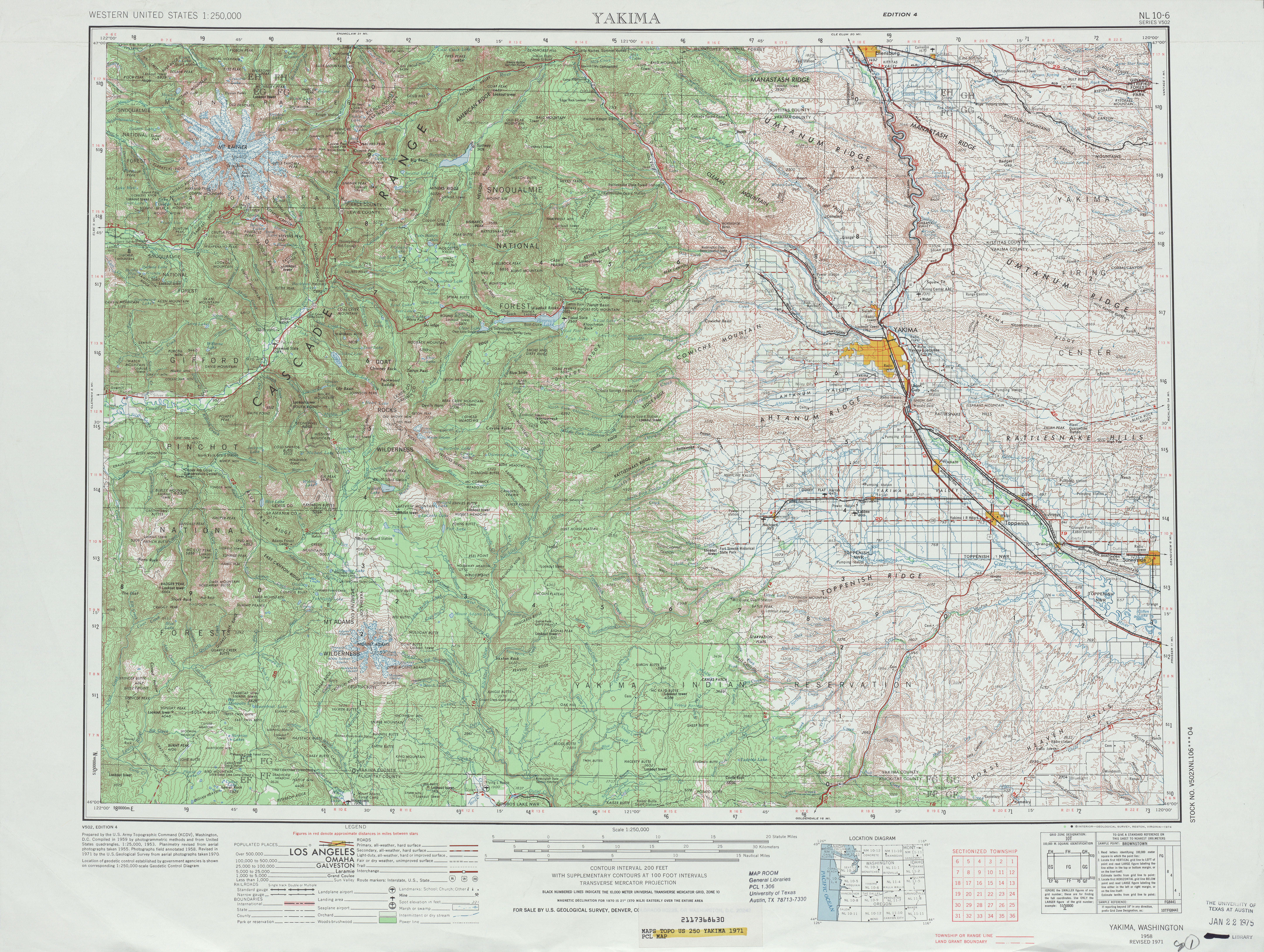
- ^ a b Yakima, 1971 (Map). 1:250,000. Cartography by United States Geological Survey. University of Texas at Austin. 1971. Retrieved July 24, 2009.
- ^ Washington State Highways, 2008–2009 (PDF) (Map) (2008–09 ed.). 1:842,000. Cartography by United States Geological Survey. Washington State Department of Transportation. 2008. § F4. Retrieved July 24, 2009.
- ^ Miller-Still, Ray (July 26, 2022). "RAMROD races around Plateau early Thursday". Enumclaw Courier-Herald. Retrieved July 27, 2023.
- ^ a b c d Davis, Richard C. (September 29, 2005). "The National Forests of the United States" (PDF). The Forest History Society. Retrieved July 24, 2009.
- ^ a b United States Forest Service (November 15, 2007). "Gifford Pinchot National Forest – About Us". Retrieved July 24, 2009.
- ^ National Park Service (July 24, 2000). "Mount Rainier National Park – Wonderland: An Administrative History, Part II: Founding Years, 1893-1916, Chapter III: Establishment of Mount Rainier National Park". Retrieved July 24, 2009.
- ^ Washington State Legislature (March 19, 1909). "Chapter 185: Primary and Secondary State Highways". Session Laws of the State of Washington (1923 ed.). Olympia, Washington: Washington State Legislature. pp. 628–629. Retrieved July 24, 2009.
- ^ Mount Rainier, 1924 (Map). 1:125,000. Washington 1:125,000 topographic quadrangles. Cartography by United States Geological Survey. Washington State University. 1924. Retrieved July 24, 2009.
- ^ Bureau of Public Roads & American Association of State Highway Officials (November 11, 1926). United States System of Highways Adopted for Uniform Marking by the American Association of State Highway Officials (Map). 1:7,000,000. Washington, DC: United States Geological Survey. OCLC 32889555. Retrieved November 7, 2013 – via Wikimedia Commons.
- ^ Rand McNally Junior Road Map, Washington (Map). Rand McNally. 1926. Retrieved July 24, 2009.
- ^ Washington State Legislature (March 17, 1937). "Chapter 190: Establishment of Primary State Highways". Session Laws of the State of Washington (1937 ed.). Olympia, Washington: Washington State Legislature. pp. 935–937. Retrieved July 24, 2009.
- ^ Yakima, 1963 (Map). 1:250,000. Cartography by United States Geological Survey. University of Texas at Austin. 1963. Retrieved July 24, 2009.
- ^ Washington State Department of Transportation (2009). "Cayuse Pass". Retrieved July 24, 2009.
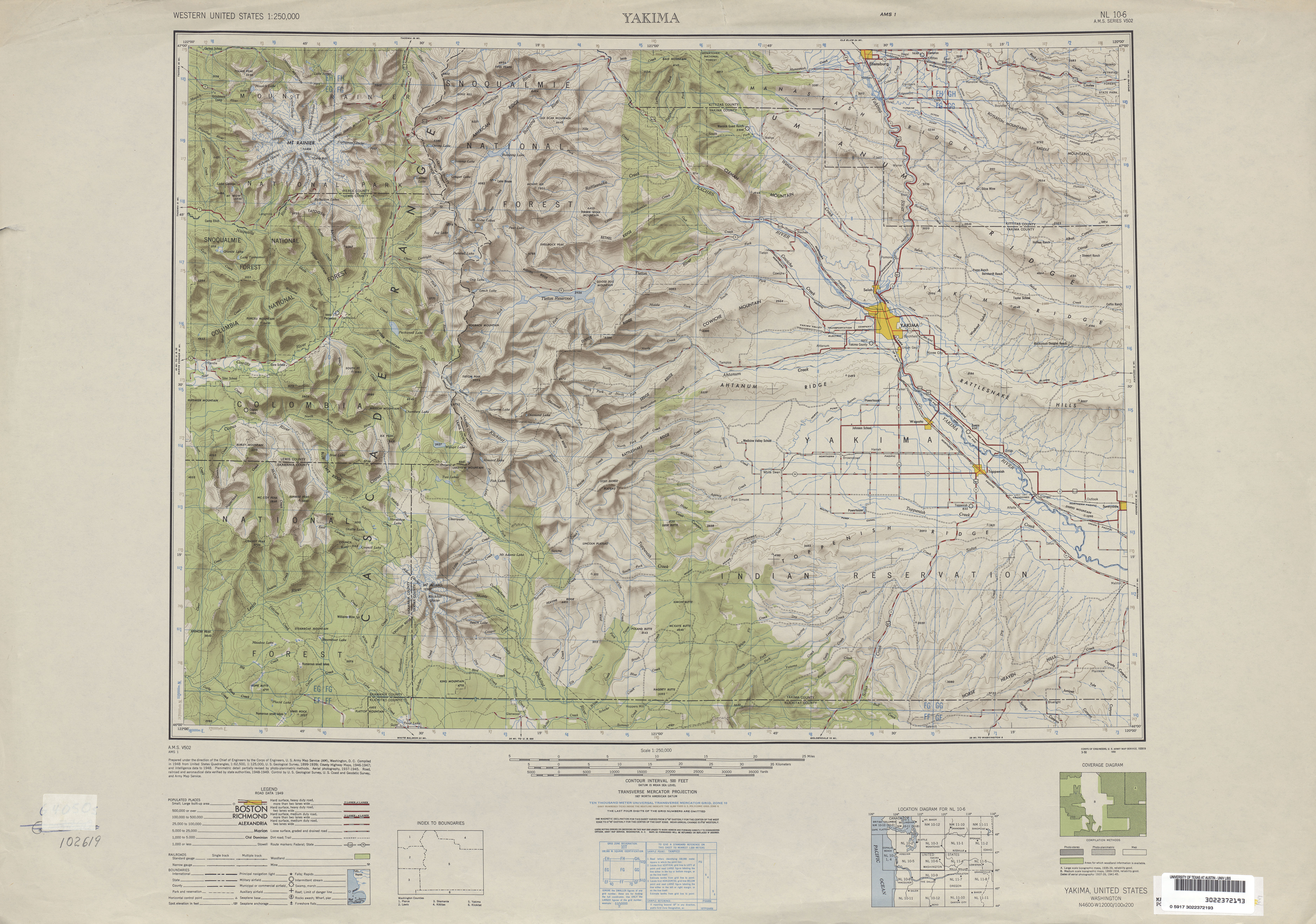
- ^ Yakima, 1949 (Map). 1:250,000. Cartography by United States Geological Survey. University of Texas at Austin. 1949. Retrieved July 24, 2009.
- ^ C. G. Prahl (December 1, 1965). "Identification of State Highways" (PDF). Washington State Highway Commission, Department of Highways. Retrieved July 24, 2009.
- ^ Weingroff, Richard M. (January 9, 2009). "U.S. 12 Michigan to Washington". Federal Highway Administration. Retrieved July 24, 2009.
- ^ Washington State Department of Transportation (2009). "Cayuse Pass – Historic Opening and Closing Dates". Retrieved July 24, 2009.
- ^ "Flood Damage Repair Work Begins on SR 123 in Mount Rainier National Park" (Press release). Washington State Department of Transportation. June 21, 2007. Retrieved July 24, 2009.
- ^ "SR 123 Reopens Sept. 28 Following Flood Damage Repairs" (Press release). Washington State Department of Transportation. September 24, 2007. Retrieved July 24, 2009.