
Washington State Route 206
State Route 206 | ||||
|---|---|---|---|---|
| Mount Spokane Park Drive | ||||
 SR 206 is highlighted in red. | ||||
| Route information | ||||
| Auxiliary route of US 2 | ||||
| Maintained by WSDOT | ||||
| Length | 15.30 mi[1] (24.62 km) | |||
| Existed | 1964[2]–present | |||
| Major junctions | ||||
| West end | ||||
| East end | Mount Spokane State Park | |||
| Location | ||||
| Country | United States | |||
| State | Washington | |||
| Counties | Spokane | |||
| Highway system | ||||
| ||||

State Route 206 (SR 206, named the Mount Spokane Park Drive) is a 15.30-mile-long (24.62 km) state highway serving Mount Spokane State Park in the U.S. state of Washington. Beginning at U.S. Route 2 (US 2) north of Mead, the highway travels east through unincorporated Spokane County and northeast into the Selkirk Mountains, ending at the entrance to Mount Spokane State Park. The roadway, first constructed in the 1890s and reconstructed several times, was designated as SR 206 during the 1964 highway renumbering.
Route description[edit]
SR 206 begins as Mount Spokane Park Drive at an intersection with US 2 north of Mead and east of Mead Flying Service Airport.[3] The highway travels east under a BNSF Railway line and serves Mt. Spokane High School before a roundabout with Bruce Road.[1][4] SR 206 turns northeast, parallel to Deadman Creek, towards Green Bluff and the Selkirk Mountains. The highway ends at the entrance of Mount Spokane State Park,[5] and the road continues northeast to serve the Mount Spokane Ski and Snowboard Park.[6]
Every year the Washington State Department of Transportation (WSDOT) conducts a series of surveys on its highways in the state to measure traffic volume. This is expressed in terms of annual average daily traffic (AADT), which is a measure of traffic volume for any average day of the year. In 2011, WSDOT calculated that between 210 and 10,000 vehicles per day used the highway, mostly in the Mead area.[7]
History[edit]
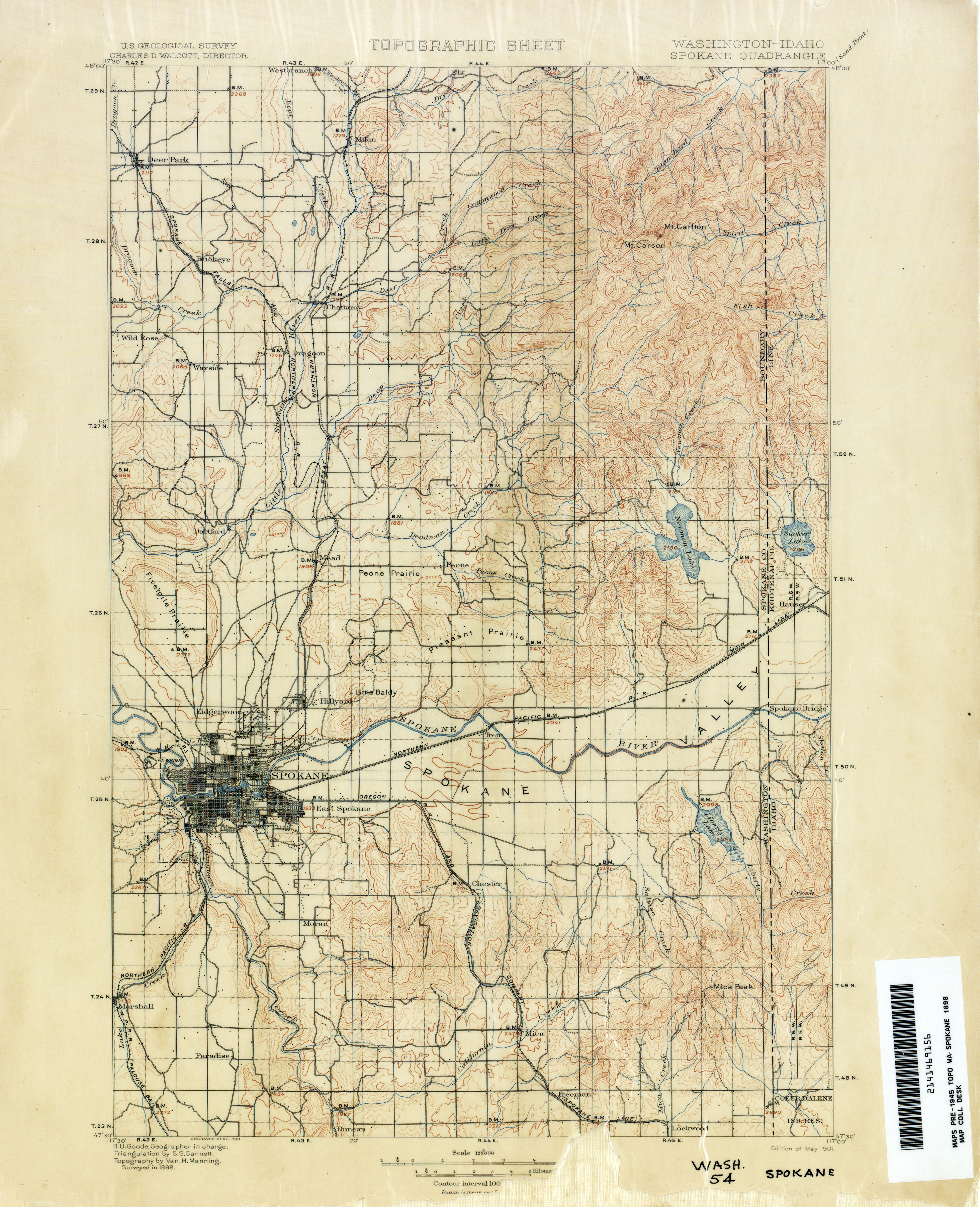
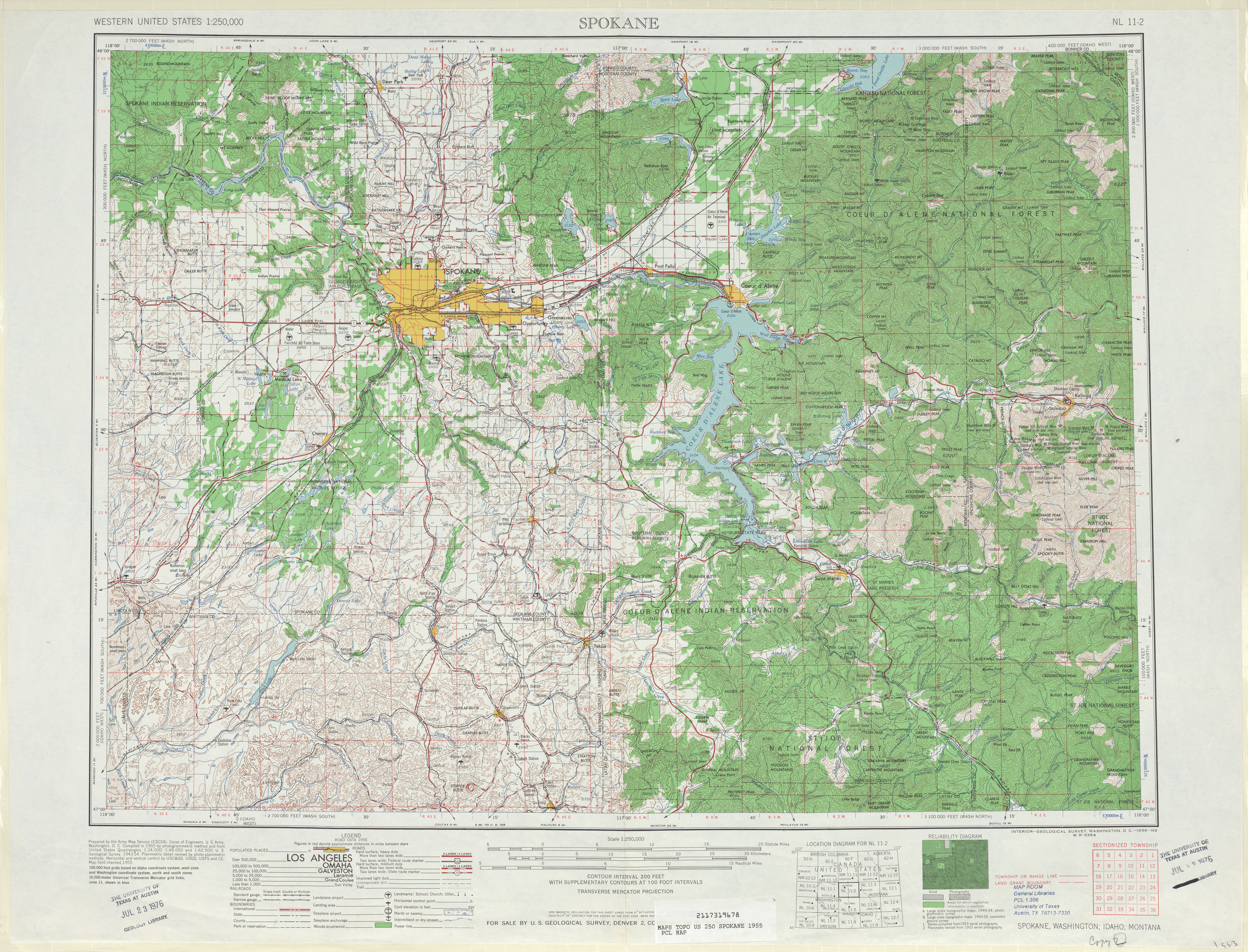
During the 1890s, a road connecting Mead to Mount Carlton, later renamed to Mount Spokane, via Deadman Creek was constructed.[8] The road to Mount Spokane was paved in 1921,[9] and was later improved in the late 1940s.[10][11] The Mount Spokane road was designated as SR 206, extending from US 2 north of Mead to Mount Spokane State Park, during the 1964 highway renumbering.[2] The state legislature passed a bill creating the highway in 1963 with the designation of Secondary State Highway 6C, which was never signed.[12] SR 206 was improved and re-paved in 1985,[13] but remains prone to closures.[14] Since 1964, no major revisions to the route of the highway have occurred,[15] however the route was shortened by 0.09 miles (0.14 km) in 1999 after the construction of a new rail overpass.[1][16]
Major intersections[edit]
The entire highway is in Spokane County.
| Location | mi[1] | km | Destinations | Notes | |
|---|---|---|---|---|---|
| Mead | 0.00 | 0.00 | |||
| | 15.30 | 24.62 | Mount Spokane State Park | ||
| 1.000 mi = 1.609 km; 1.000 km = 0.621 mi | |||||
References[edit]
- ^ a b c d Strategic Planning Division (March 5, 2012). State Highway Log Planning Report 2011, SR 2 to SR 971 (PDF) (Report). Washington State Department of Transportation. pp. 1238–1240. Retrieved January 21, 2013.
- ^ a b "47.17.405: State route No. 206". Revised Code of Washington. Washington State Legislature. 1987 [1970]. Retrieved January 21, 2013.
- ^ "All State Airports: Mead Flying Service - Mead". Washington State Department of Transportation. Retrieved January 21, 2013.
- ^ 2011 Washington State Rail System (PDF) (Map). Washington State Department of Transportation. January 2012. Retrieved January 21, 2013.
- ^ "Mount Spokane State Park" (PDF). Washington State Parks. March 19, 2010. Retrieved January 21, 2013.
- ^ Google (January 21, 2013). "State Route 206" (Map). Google Maps. Google. Retrieved January 21, 2013.
- ^ Staff (2011). "2011 Annual Traffic Report" (PDF). Washington State Department of Transportation. p. 158. Retrieved January 21, 2013.
- ^ Washington–Idaho: Spokane Quadrangle (JPG) (Map). 1:125,000. United States Geological Survey. May 1901. Retrieved January 21, 2013.
- ^ "Open Mount Spokane Road Saturday; Hundreds Expected To Make The Trip". Spokane Daily Chronicle. July 13, 1921. p. 9. Retrieved January 21, 2013.
- ^ "Mt. Spokane Road Work Is Underway". Spokane Daily Chronicle. May 14, 1949. p. 22. Retrieved January 21, 2013.
- ^ Spokane, 1955 (JPG) (Map). 1:250,000. United States Geological Survey. 1955. Retrieved January 21, 2013.
- ^ "Bill Would Hike Status of Road". Spokane Daily Chronicle. February 1, 1963. p. 6. Retrieved February 9, 2020 – via Newspapers.com.
- ^ "Progress on Mount Spokane road". The Spokesman-Review. June 6, 1985. p. 3. Retrieved January 21, 2013.
- ^ "Mount Spokane road washes out". The Seattle Times. May 19, 2008. Retrieved January 21, 2013.
- ^ Washington State Highways, 2011–2012 (PDF) (Map). 1:842,000. Washington State Department of Transportation. 2011. Retrieved January 21, 2013.
- ^ Planning and Programming Service Center (2000). State Highway Log Planning Report 2000, SR 2 to SR 971 (PDF) (Report). Washington State Department of Transportation. p. 1027. Archived from the original (PDF) on August 20, 2006. Retrieved January 21, 2013.