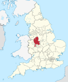
Wilnecote railway station
 | |
| General information | |
| Location | Wilnecote, Tamworth England |
| Grid reference | SK217014 |
| Managed by | West Midlands Railway[1] |
| Platforms | 2 |
| Other information | |
| Station code | WNE |
| Classification | DfT category F2 |
| Key dates | |
| 1842 | Opened as Wilnecote and Fazeley |
| 1904 | Renamed as Wilnecote |
| Passengers | |
| 2018/19 | |
| 2019/20 | |
| 2020/21 | |
| 2021/22 | |
| 2022/23 | |
| Notes | |
Passenger statistics from the Office of Rail and Road | |
Wilnecote railway station is a small unmanned station serving the suburban area of Wilnecote 1.5 miles (2 km) south of Tamworth town centre in Staffordshire, England.[2] The station is situated beneath a bridge which carries the former A5 Watling Street.
History[edit]
It was opened in 1842 by the Birmingham and Derby Junction Railway as Wilnecote and Fazeley, the name being shortened in 1904.[3]
In 1889, John William Leader, a corn merchant of Tamworth was killed at the station when crossing the tracks he was struck by an express from Derby.[4]
Stationmasters[edit]
In 1961 Brian A. Martin was appointed station master a few months after his twentieth birthday and was at the time the youngest station master on British Railways.[5]
- Joseph Passey ca. 1851 – 1860[6]
- William Hunt 1860–1879[6][7]
- G. Hull 1879[7]
- A. Withers 1879–1880[7]
- William Headford 1880–1888[7][8] (formerly station master at Great Glen)
- George E. Cookson 1888–1899[8][9] (formerly station master at Finedon)
- Samuel Allanach 1900–1906[9] (afterwards station master at West Bridge, Leicester)
- Henry Molineux 1906–1908[9]
- George Parker 1908–1931[9]
- Percy Jackson 1931–1932[10] (formerly station master at Church Gresley)
- Walter J. Crisp 1932–1933[11]
- Noel Manton 1933–1940[12] (formerly station master at Borrowash, afterwards station master at Oakham)
- F.A. Brown from 1940
- Brian A. Martin from 1961[13]
Services[edit]
Wilnecote is served by hourly CrossCountry services soutbound Cardiff Central via Birmingham New Street, Cheltenham Spa, Gloucester and Newport and northbound Nottingham via Derby, the first two trains of the day to each of Cardiff and Nottingham start from New Street.[14] West Midlands Trains manage the station but do not provide any train services here.
| Preceding station | Following station | |||
|---|---|---|---|---|
| CrossCountry | ||||
References[edit]
- ^ "Wilnecote (Staffs)". West Midlands Railway.
- ^ "Wilnecote (Staffs) (WNE)". National Rail.
- ^ Pixton, B., (2005) Birmingham-Derby: Portrait of a Famous Route, Runpast Publishing
- ^ "The accident at Wilnecote Railway Station". Burton Chronicle. England. 2 January 1890. Retrieved 23 July 2021 – via British Newspaper Archive.
- ^ "Young One". Daily Mirror. England. 30 October 1962. Retrieved 23 July 2021 – via British Newspaper Archive.
- ^ a b "1859–1866". Midland Railway Miscellaneous Depts: 93. 1859. Retrieved 23 July 2021.
- ^ a b c d "1871-1879 Coaching". Midland Railway Operating, Traffic and Coaching Depts: 837. 1871. Retrieved 23 July 2021.
- ^ a b "1881-1898 Coaching". Midland Railway Operating, Traffic and Coaching Depts: 290. 1881. Retrieved 23 July 2021.
- ^ a b c d "1899-1908 Coaching; Piece 1027". Midland Railway Operating, Traffic and Coaching Depts: 543. 1899. Retrieved 23 July 2021.
- ^ "Wilnecote". Tamworth Herald. England. 10 October 1931. Retrieved 23 July 2021 – via British Newspaper Archive.
- ^ "Wilnecote". Tamworth Herald. England. 26 March 1932. Retrieved 23 July 2021 – via British Newspaper Archive.
- ^ "Promotion". Tamworth Herald. England. 16 November 1940. Retrieved 23 July 2021 – via British Newspaper Archive.
- ^ "Mr. B.A. Martin". Birmingham Daily Post. England. 17 October 1961. Retrieved 23 July 2021 – via British Newspaper Archive.
- ^ "Stansted, Cambridge & Nottingham to Birmingham & Cardiff – Sunday 21 May 2023 – Saturday 09 December 2023" (PDF). Cross Country Trains.
External links[edit]
- Train times and station information for Wilnecote railway station from National Rail
52°36′40″N 1°40′44″W / 52.611°N 1.679°W
- Railway stations in Staffordshire
- DfT Category F2 stations
- Former Midland Railway stations
- Railway stations in Great Britain opened in 1842
- Railway stations served by CrossCountry
- Railway stations in Great Britain not served by their managing company
- Staffordshire building and structure stubs
- West Midlands (region) railway station stubs

