
Richfield, Kansas
Richfield, Kansas | |
|---|---|
 Location within Morton County and Kansas | |
 | |
| Coordinates: 37°15′55″N 101°46′58″W / 37.26528°N 101.78278°W[1] | |
| Country | United States |
| State | Kansas |
| County | Morton |
| Founded | 1880s |
| Platted | 1885 |
| Incorporated | 1887 |
| Named for | Rich soil |
| Area | |
| • Total | 1.00 sq mi (2.60 km2) |
| • Land | 1.00 sq mi (2.60 km2) |
| • Water | 0.00 sq mi (0.00 km2) |
| Elevation | 3,389 ft (1,033 m) |
| Population | |
| • Total | 30 |
| • Density | 30/sq mi (12/km2) |
| Time zone | UTC-6 (CST) |
| • Summer (DST) | UTC-5 (CDT) |
| ZIP code | 67953 |
| Area code | 620 |
| FIPS code | 20-59200 |
| GNIS ID | 2396363[1] |
Richfield is a city in Morton County, Kansas, United States.[1] As of the 2020 census, the population of the city was 30.[3]
History[edit]
19th century[edit]
Richfield was platted in 1885 and was named for the fertility of the land.[4] A town was built up quickly: in less than one year, Richfield had 600 inhabitants.[5] In 1886, Morton County was founded and Richfield was established as the county seat.[6]
20th century[edit]
By 1900, the population of Richfield had declined to 61.[5]
In the 1930s, the area was further affected by its location within the Dust Bowl. This catastrophe intensified the economic impact of the Great Depression in the region.
In 1961, the county seat was moved from Richfield to Elkhart.[6] Richfield has subsequently been the center for basic services for residents of the surrounding rural region: school, postal, fire and police, food and fuel.
Geography[edit]
According to the United States Census Bureau, the city has a total area of 1.00 square mile (2.59 km2), all of it land.[7]
Climate[edit]
According to the Köppen Climate Classification system, Richfield has a semi-arid climate, abbreviated "BSk" on climate maps.[8]
Demographics[edit]
| Census | Pop. | Note | %± |
|---|---|---|---|
| 1890 | 164 | — | |
| 1900 | 61 | −62.8% | |
| 1910 | 53 | −13.1% | |
| 1920 | 62 | 17.0% | |
| 1930 | 106 | 71.0% | |
| 1940 | 96 | −9.4% | |
| 1950 | 105 | 9.4% | |
| 1960 | 122 | 16.2% | |
| 1970 | 82 | −32.8% | |
| 1980 | 81 | −1.2% | |
| 1990 | 50 | −38.3% | |
| 2000 | 48 | −4.0% | |
| 2010 | 43 | −10.4% | |
| 2020 | 30 | −30.2% | |
| U.S. Decennial Census | |||
2020 census[edit]
The 2020 United States census counted 30 people, 17 households, and 15 families in Richfield.[9][10] The population density was 29.9 per square mile (11.5/km2). There were 21 housing units at an average density of 20.9 per square mile (8.1/km2).[10][11] The racial makeup was 83.33% (25) white or European American (83.33% non-Hispanic white), 0.0% (0) black or African-American, 0.0% (0) Native American or Alaska Native, 0.0% (0) Asian, 0.0% (0) Pacific Islander or Native Hawaiian, 0.0% (0) from other races, and 16.67% (5) from two or more races.[12] Hispanic or Latino of any race was 3.33% (1) of the population.[13]
Of the 17 households, 29.4% had children under the age of 18; 70.6% were married couples living together; 29.4% had a female householder with no spouse or partner present. 5.9% of households consisted of individuals and 0.0% had someone living alone who was 65 years of age or older.[10] The average household size was 3.5 and the average family size was 3.5.[14] The percent of those with a bachelor’s degree or higher was estimated to be 3.3% of the population.[15]
23.3% of the population was under the age of 18, 0.0% from 18 to 24, 30.0% from 25 to 44, 16.7% from 45 to 64, and 30.0% who were 65 years of age or older. The median age was 43.5 years. For every 100 females, there were 114.3 males.[10] For every 100 females ages 18 and older, there were 130.0 males.[10]
The 2016-2020 5-year American Community Survey estimates show that the median household income was $105,000 (with a margin of error of +/- $15,368) and the median family income was $105,000 (+/- $15,368).[16] Males had a median income of $71,250 (+/- $59,117) versus $20,625 (+/- $10,464) for females.[17] Approximately, 0.0% of families and 0.0% of the population were below the poverty line, including 0.0% of those under the age of 18 and 0.0% of those ages 65 or over.[18][19]
2010 census[edit]
As of the census[20] of 2010, there were 43 people, 20 households, and 15 families residing in the city. The population density was 43.0 inhabitants per square mile (16.6/km2). There were 25 housing units at an average density of 25.0 per square mile (9.7/km2). The racial makeup of the city was 100.0% White.
There were 20 households, of which 25.0% had children under the age of 18 living with them, 70.0% were married couples living together, 5.0% had a female householder with no husband present, and 25.0% were non-families. 25.0% of all households were made up of individuals, and 10% had someone living alone who was 65 years of age or older. The average household size was 2.15 and the average family size was 2.53.
The median age in the city was 50.5 years. 16.3% of residents were under the age of 18; 7% were between the ages of 18 and 24; 25.6% were from 25 to 44; 18.7% were from 45 to 64; and 32.6% were 65 years of age or older. The gender makeup of the city was 44.2% male and 55.8% female.
2000 census[edit]
As of the census[21] of 2000, there were 48 people, 25 households, and 14 families residing in the city. The population density was 48.1 inhabitants per square mile (18.6/km2). There were 26 housing units at an average density of 26.1 per square mile (10.1/km2). The racial makeup of the city was 100.00% White.
There were 25 households, out of which 20.0% had children under the age of 18 living with them, 52.0% were married couples living together, 4.0% had a female householder with no husband present, and 44.0% were non-families. 40.0% of all households were made up of individuals, and 28.0% had someone living alone who was 65 years of age or older. The average household size was 1.92 and the average family size was 2.57.
In the city, the population was spread out, with 16.7% under the age of 18, 4.2% from 18 to 24, 22.9% from 25 to 44, 33.3% from 45 to 64, and 22.9% who were 65 years of age or older. The median age was 52 years. For every 100 females, there were 84.6 males. For every 100 females age 18 and over, there were 81.8 males.
The median income for a household in the city was $37,813, and the median income for a family was $42,500. Males had a median income of $33,750 versus $12,083 for females. The per capita income for the city was $16,974. There were no families and 10.3% of the population living below the poverty line, including no under eighteens and none of those over 64.
References[edit]
- ^ a b c d U.S. Geological Survey Geographic Names Information System: Richfield, Kansas
- ^ "2019 U.S. Gazetteer Files". United States Census Bureau. Retrieved July 24, 2020.
- ^ a b "Profile of Richfield, Kansas in 2020". United States Census Bureau. Archived from the original on November 13, 2021. Retrieved November 13, 2021.
- ^ Capace, Nancy (June 1, 2000). Encyclopedia of Kansas. North American Book Dist LLC. p. 258. ISBN 978-0-403-09312-0.
- ^ a b Blackmar, Frank Wilson (1912). Kansas: A Cyclopedia of State History, Volume 2. Standard Publishing Company. pp. 582.
- ^ a b Morton County Facts; mtcoks.com
- ^ "US Gazetteer files 2010". United States Census Bureau. Archived from the original on January 12, 2012. Retrieved July 6, 2012.
- ^ Climate Summary for Richfield, Kansas
- ^ "US Census Bureau, Table P16: HOUSEHOLD TYPE". data.census.gov. Retrieved January 16, 2024.
- ^ a b c d e "US Census Bureau, Table DP1: PROFILE OF GENERAL POPULATION AND HOUSING CHARACTERISTICS". data.census.gov. Retrieved January 16, 2024.
- ^ Bureau, US Census. "Gazetteer Files". Census.gov. Retrieved December 30, 2023.
- ^ "US Census Bureau, Table P1: RACE". data.census.gov. Retrieved January 16, 2024.
- ^ "US Census Bureau, Table P2: HISPANIC OR LATINO, AND NOT HISPANIC OR LATINO BY RACE". data.census.gov. Retrieved January 16, 2024.
- ^ "US Census Bureau, Table S1101: HOUSEHOLDS AND FAMILIES". data.census.gov. Retrieved January 16, 2024.
- ^ "US Census Bureau, Table S1501: EDUCATIONAL ATTAINMENT". data.census.gov. Retrieved January 16, 2024.
- ^ "US Census Bureau, Table S1903: MEDIAN INCOME IN THE PAST 12 MONTHS (IN 2020 INFLATION-ADJUSTED DOLLARS)". data.census.gov. Retrieved January 16, 2024.
- ^ "US Census Bureau, Table S2001: EARNINGS IN THE PAST 12 MONTHS (IN 2020 INFLATION-ADJUSTED DOLLARS)". data.census.gov. Retrieved January 16, 2024.
- ^ "US Census Bureau, Table S1701: POVERTY STATUS IN THE PAST 12 MONTHS". data.census.gov. Retrieved January 16, 2024.
- ^ "US Census Bureau, Table S1702: POVERTY STATUS IN THE PAST 12 MONTHS OF FAMILIES". data.census.gov. Retrieved January 16, 2024.
- ^ "U.S. Census website". United States Census Bureau. Retrieved July 6, 2012.
- ^ "U.S. Census website". United States Census Bureau. Retrieved January 31, 2008.
Further reading[edit]
External links[edit]
- Richfield - Directory of Public Officials
- USD 217, local school district
- Richfield City Map, KDOT
Municipalities and communities of Morton County, Kansas, United States | ||
|---|---|---|
| Cities | 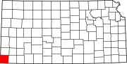 | |
| Unincorporated communities | ||
| Townships |
| |