Čičarovce
This article needs additional citations for verification. (February 2022) |

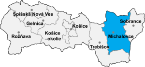
Čičarovce (Slovak pronunciation: [ˈtʂitʂarɔwtse]; Hungarian: Csicser) is a village and municipality in Michalovce District in the Kosice Region of eastern Slovakia.
History
In historical records the village was first mentioned in 1263.
Geography
The village lies at an altitude of 106 metres and covers an area of 26.63 km2 (10.28 sq mi) (2020-06-30/-07-01).[1]
Ethnicity
The population is 93% Magyar and 7% Slovak in ethnicity.
Population
It has a population of 885 people (2020-12-31).[2]
Economy
The village has a food store and a general store.
Culture
The village has a small public library and a football pitch.
Transport
The nearest railway station is located 3 kilometres away at Veľké Kapušany which also contains many of the government institutions for the village.
Genealogical resources
The records for genealogical research are available at the state archive "Statny Archiv in Presov, Slovakia"
- Roman Catholic church records (births/marriages/deaths): 1781-1876 (parish A)
- Greek Catholic church records (births/marriages/deaths): 1789-1886 (parish A)
- Reformated church records (births/marriages/deaths): 1771-1856 (parish A)
See also
References
- ^ "Statistic of Slovak places by Dušan Kreheľ – Export". Retrieved 2021-07-05.
- ^ "Statistic of Slovak places by Dušan Kreheľ – Export". Retrieved 2021-07-05.
External links
48°33′N 22°02′E / 48.550°N 22.033°E
