
File:Sakurajima Landsat image.jpg

Size of this preview: 637 × 600 pixels. Other resolutions: 255 × 240 pixels | 510 × 480 pixels.
Original file (800 × 753 pixels, file size: 86 KB, MIME type: image/jpeg)
| This is a file from the Wikimedia Commons. Information from its description page there is shown below. Commons is a freely licensed media file repository. You can help. |
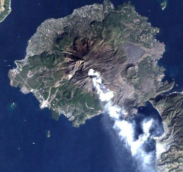
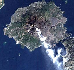
Sakurajima volcano, Japan, imaged by Landsat satellite.
From [1].
| This file is in the public domain in the United States because it was solely created by NASA. NASA copyright policy states that "NASA material is not protected by copyright unless noted". (See Template:PD-USGov, NASA copyright policy page or JPL Image Use Policy.) | ||
 |
Warnings:
|
File history
Click on a date/time to view the file as it appeared at that time.
| Date/Time | Thumbnail | Dimensions | User | Comment | |
|---|---|---|---|---|---|
| current | 12:12, 16 October 2006 | | 800 × 753 (86 KB) | Pazuzu | Sakurajima volcano, Japan, imaged by Landsat satellite. From [http://landsat.usgs.gov/gallery/]. {{PD-USGov-NASA}} Category:Sakurajima |
File usage
The following pages on the English Wikipedia use this file (pages on other projects are not listed):
Global file usage
The following other wikis use this file:
- Usage on azb.wikipedia.org
- Usage on bg.wikipedia.org
- Usage on de.wikipedia.org
- Usage on es.wikipedia.org
- Usage on fi.wikipedia.org
- Usage on fr.wikinews.org
- Usage on he.wikipedia.org
- Usage on id.wikipedia.org
- Usage on it.wikipedia.org
- Usage on ja.wikipedia.org
- 桜島
- 国道224号
- 古里温泉
- 桜島フェリー
- 桜島大根
- 鹿児島市立黒神中学校
- 鹿児島市立桜島中学校
- 有村温泉
- 鹿児島市立東桜島中学校
- サクラジマミカン
- 道の駅桜島
- 克灰袋
- 鹿児島県道26号桜島港黒神線
- 鹿児島市立桜洲小学校
- 鹿児島市立桜峰小学校
- 鹿児島市立黒神小学校
- 鹿児島市立東桜島小学校
- 東桜島町
- 黒神町
- 有村町
- 古里町 (鹿児島市)
- 野尻町 (鹿児島市)
- 持木町
- 高免町
- 桜島横山町
- 桜島藤野町
- 桜島赤生原町
- 桜島小池町
- 桜島松浦町
- 桜島赤水町
- 桜島白浜町
- 桜島武町
- 桜島西道町
- 桜島二俣町
- 桜島ビジターセンター
- 桜島国際火山砂防センター
- 桜島総合体育館
- 桜島爆発記念碑
- 桜島の大正大噴火
- 桜島港
- 安永大噴火
View more global usage of this file.