
File:Das Osmanische Reich in Asien 1829 Turkey and Caucasus.JPG

Size of this preview: 800 × 358 pixels. Other resolutions: 320 × 143 pixels | 640 × 287 pixels | 1,024 × 458 pixels | 1,959 × 877 pixels.
Original file (1,959 × 877 pixels, file size: 537 KB, MIME type: image/jpeg)
| This is a file from the Wikimedia Commons. Information from its description page there is shown below. Commons is a freely licensed media file repository. You can help. |
Summary
| Description |
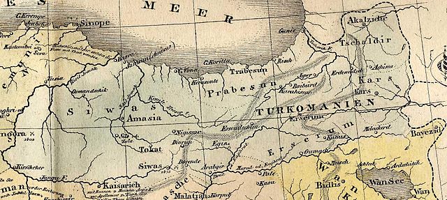
English: scanned by Olahus. Origin of the map: HISTORISCH-GENEALOGISCH-GEOGRAPHISCHER ATLAS von Le Sage Graf Las Cases. Karlsruhe. Bei Creuzbauer und Nöldeke 1829. |
| Date | |
| Source | |
| Author |
|
| This is a retouched picture, which means that it has been digitally altered from its original version. The original can be viewed here: Das Osmanische Reich in Asien 1829.JPG:
|
Licensing
|
This is a faithful photographic reproduction of a two-dimensional, public domain work of art. The work of art itself is in the public domain for the following reason:
The official position taken by the Wikimedia Foundation is that "faithful reproductions of two-dimensional public domain works of art are public domain".
This photographic reproduction is therefore also considered to be in the public domain in the United States. In other jurisdictions, re-use of this content may be restricted; see Reuse of PD-Art photographs for details. | ||||
Original upload log
This image is a derivative work of the following images:
- File:Das_Osmanische_Reich_in_Asien_1829.JPG licensed with Cc-pd-mark-footer, PD-old
- 2007-03-31T06:05:58Z Olahus 4689x2865 (3134814 Bytes) I scanned the map. Origin of the map: HISTORISCH-GENEALOGISCH-GEOGRAPHISCHER ATLAS von Le Sage Graf Las Cases. Karlsruhe. Bei Creuzbauer und Nöldeke 1829. == Licensing == {{PD-old}}
Uploaded with derivativeFX
File history
Click on a date/time to view the file as it appeared at that time.
| Date/Time | Thumbnail | Dimensions | User | Comment | |
|---|---|---|---|---|---|
| current | 03:53, 29 December 2010 | | 1,959 × 877 (537 KB) | Geagea | == {{int:filedesc}} == {{Information |Description={{en|1=scanned by Olahus. Origin of the map: HISTORISCH-GENEALOGISCH-GEOGRAPHISCHER ATLAS von Le Sage Graf Las Cases. Karlsruhe. Bei Creuzbauer und Nöldeke 1829.}} |Source=*[[:File:Das_Os |
File usage
The following pages on the English Wikipedia use this file (pages on other projects are not listed):
Global file usage
The following other wikis use this file:
- Usage on az.wikipedia.org
- Usage on ba.wikipedia.org
- Usage on fa.wikipedia.org
- Usage on hy.wikipedia.org
- Usage on pnb.wikipedia.org
- Usage on ru.wikipedia.org
- Usage on tr.wikipedia.org
- Usage on ur.wikipedia.org