
Daytona Beach Shores, Florida
Daytona Beach Shores, Florida | |
|---|---|
| City of Daytona Beach Shores | |
 Daytona Beach Shores City Hall | |
 Seal | |
| Motto: "Life is Better Here" | |
 Location in Volusia County and the state of Florida | |
| Coordinates: 29°10′33″N 80°58′59″W / 29.17583°N 80.98306°W | |
| Country | |
| State | |
| County | |
| Incorporated | April 22, 1960 |
| Government | |
| • Type | Commission-Manager |
| • Mayor | Nancy Miller |
| • Vice Mayor | Michael Politis |
| • Commission Members | Richard Bryan, Chris Conomos, and Mel Lindauer |
| • City Manager | Kurt Swartzlander |
| • City Clerk | Cheri Schwab |
| Area | |
| • Total | 0.88 sq mi (2.28 km2) |
| • Land | 0.85 sq mi (2.20 km2) |
| • Water | 0.03 sq mi (0.08 km2) 3.56% |
| Elevation | 15 ft (5 m) |
| Population (2020) | |
| • Total | 5,179 |
| • Density | 6,092.94/sq mi (2,352.26/km2) |
| Time zone | UTC-5 (Eastern (EST)) |
| • Summer (DST) | UTC-4 (EDT) |
| ZIP code | 32118 |
| Area code | 386 |
| FIPS code | 12-16550[3] |
| GNIS feature ID | 0281354[4] |
| Website | http://www.dbshores.org/ |
Daytona Beach Shores is a city in Volusia County, Florida, United States. The population was 5,179 at the 2020 census.[5]
History[edit]
Daytona Beach Shores was first organized in 1960 by local business leaders convinced that a smaller community could provide better services to its residents.[citation needed] The city was incorporated on April 22, 1960.
In the 1970s and the 1980s, the city saw a massive building program. Now about 80 percent of the residents live in high-rise condominiums that stretch along the Atlantic Ocean.
A resort and retirement community built on tourism and the service industry, Daytona Beach Shores has no manufacturing industry, but caters to tourists year-round with miniature golf courses and other types of family entertainment.
Geography[edit]
According to the United States Census Bureau, the city has a total area of 0.90 square miles (2.34 km2), of which 0.90 square miles (2.33 km2) is land and 0.039 square miles (0.1 km2) (3.56%) is water.[6]
The city of Daytona Beach Shores is located on a barrier island along the Atlantic Ocean. The other side of the island (the west side) is bordered by the Halifax River lagoon, part of the Intracoastal Waterway. The city is bordered on the north by Daytona Beach and on the south by Wilbur-by-the-Sea, and Port Orange. The major highway that serves the city is State Road A1A (Atlantic Avenue).
Daytona Beach Shores has a humid subtropical climate (Cfa), typical for a city in the southeastern United States. Summers are hot and humid, with highs usually in the 90s (Fahrenheit) and a heat index often exceeding 100 degrees °F. Thunderstorms are frequent in summer afternoons, and the hot, humid weather can last right through the fall months. Winters are dry and mild, marked by a constant series of cold fronts and warm-ups. Temperatures dip into the low 30s°F and upper 20s°F on occasion, and freezes are not uncommon. Frost usually occurs a few times a year, but snowfall is very rare. The last time snow flurries fell on the city of Daytona Beach Shores was in December 2007. Temperatures in spring feature warm afternoons, cool evenings, and far less humidity. This beach-going weather attracts tourists to the beaches, usually by early March.
Demographics[edit]
| Census | Pop. | Note | %± |
|---|---|---|---|
| 1970 | 768 | — | |
| 1980 | 1,324 | 72.4% | |
| 1990 | 2,335 | 76.4% | |
| 2000 | 4,299 | 84.1% | |
| 2010 | 4,247 | −1.2% | |
| 2020 | 5,179 | 21.9% | |
| U.S. Decennial Census[7] | |||
2010 and 2020 census[edit]
| Race | Pop 2010[8] | Pop 2020[9] | % 2010 | % 2020 |
|---|---|---|---|---|
| White (NH) | 3,935 | 4,539 | 92.65% | 87.64% |
| Black or African American (NH) | 33 | 100 | 0.78% | 1.93% |
| Native American or Alaska Native (NH) | 9 | 4 | 0.21% | 0.08% |
| Asian (NH) | 91 | 115 | 2.14% | 2.22% |
| Pacific Islander or Native Hawaiian (NH) | 6 | 1 | 0.14% | 0.02% |
| Some other race (NH) | 3 | 22 | 0.07% | 0.42% |
| Two or more races/Multiracial (NH) | 61 | 153 | 1.44% | 2.95% |
| Hispanic or Latino (any race) | 109 | 245 | 2.57% | 4.73% |
| Total | 4,247 | 5,179 |
As of the 2020 United States census, there were 5,179 people, 2,841 households, and 1,134 families residing in the city.[10]
As of the 2010 United States census, there were 4,247 people, 2,404 households, and 1,226 families residing in the city.[11]
2000 census[edit]
As of the census[3] of 2000, there were 4,299 people, 2,423 households, and 1,439 families residing in the city. The population density was 4,722.2 inhabitants per square mile (1,823.3/km2). There were 4,385 housing units at an average density of 4,816.6 per square mile (1,859.7/km2). The racial makeup of the city was 96.58% White, 0.58% African American, 0.16% Native American, 1.72% Asian, 0.12% Pacific Islander, 0.14% from other races, and 0.70% from two or more races. Hispanic or Latino of any race were 1.07% of the population.
In 2000, there were 2,423 households, out of which 4.1% had children under the age of 18 living with them, 54.5% were married couples living together, 3.6% had a female householder with no husband present, and 40.6% were non-families. 35.2% of all households were made up of individuals, and 19.7% had someone living alone who was 65 years of age or older. The average household size was 1.77 and the average family size was 2.18.
In 2000, in the city, the population was spread out, with 4.3% under the age of 18, 2.4% from 18 to 24, 11.5% from 25 to 44, 32.6% from 45 to 64, and 49.2% who were 65 years of age or older. The median age was 65 years. For every 100 females, there were 90.1 males. For every 100 females age 18 and over, there were 89.5 males.
In 2000, the median income for a household in the city was $43,796, and the median income for a family was $52,731. Males had a median income of $39,118 versus $24,826 for females. The per capita income for the city was $37,010. About 5.4% of families and 6.8% of the population were below the poverty line, including 6.8% of those under age 18 and 6.0% of those age 65 or over.
Law and government[edit]
Daytona Beach Shores features a City Manager/Commission form of government. Residents elect a five-member City Commission to four-year terms. The Commission members are elected at large and represent the entire community. The Mayor is also elected, and serves as one of the five Commission members and as chairman of the Commission. The City Manager is selected by the Commission members and is the City's chief administrator. That individual directs staff, carries out policies set by Commission, and provides advice to the Commission members, but does not vote. Daytona Beach Shores utilizes a department of public safety, which combines police and fire services into one department.
Elected officials[edit]
- Mayor – Nancy Miller
- Vice-Mayor - Michael Politis
- Seat 1 Commissioner – Christopher Conomos
- Seat 2 Commissioner – Mark Card
- Seat 3 Commissioner - Stephan Dembinsky
- City Manager (appointed) – Kurt Swartzlander
Federal, state and county representation[edit]
Daytona Beach Shores is in the 7th Congressional District. The residents of the 6th district are represented in the United States House of Representatives by Republican Cory Mills.
Daytona Beach Shores is part of Florida Senate District 8, and is represented by Republican Tom Wright. It is also part of Florida House of Representatives District 28, represented by Republican Tom Leek.
Public safety[edit]
Daytona Beach Shores has a public safety department which is responsible for combined fire-rescue as well as law enforcement. All full-time officers are certified as firefighters, EMTs, and police.
Notable people[edit]
- Duane Allman, musician
- Gregg Allman, musician
Parks and recreation[edit]
- Dahlia Park
- Fornari Park
- Max Samuely Park
- McElroy Park
- Frank Rendon Park
- Sundown Park
- Sunglow Pier
Images[edit]
-
 Sunrise at Daytona Beach Shores
 -
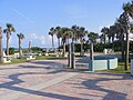
 Atlantic Avenue (Florida Highway A1A)
 -
 Frank Rendon Park
 -
 The Sunglow Pier in Daytona Beach Shores
 -
 Daytona Beach Shores Police Car
 -
 Sunset in Daytona Beach Shores as viewed from across South Atlantic Avenue


References[edit]
- ^ "2020 U.S. Gazetteer Files". United States Census Bureau. Retrieved October 31, 2021.
- ^ "Daytona Beach Shores, United States Page". Falling Rain Genomics. Retrieved July 24, 2007.
- ^ a b "U.S. Census website". United States Census Bureau. Retrieved January 31, 2008.
- ^ "US Board on Geographic Names". United States Geological Survey. October 25, 2007. Retrieved January 31, 2008.
- ^ "Explore Census Data". data.census.gov. Retrieved December 7, 2021.
- ^ "Geographic Identifiers: 2010 Demographic Profile Data (G001): Daytona Beach Shores city, Florida". United States Census Bureau. Retrieved February 14, 2012.
- ^ "Census of Population and Housing". Census.gov. Retrieved June 4, 2015.
- ^ "P2 HISPANIC OR LATINO, AND NOT HISPANIC OR LATINO BY RACE - 2010: DEC Redistricting Data (PL 94-171) - Daytona Beach Shores city, Florida". United States Census Bureau.
- ^ "P2 HISPANIC OR LATINO, AND NOT HISPANIC OR LATINO BY RACE - 2020: DEC Redistricting Data (PL 94-171) - Daytona Beach Shores city, Florida". United States Census Bureau.
- ^ "S1101 HOUSEHOLDS AND FAMILIES - 2020: Daytona Beach Shores city, Florida". United States Census Bureau.
- ^ "S1101 HOUSEHOLDS AND FAMILIES - 2010: Daytona Beach Shores city, Florida". United States Census Bureau.
External links[edit]
- Official website
 Daytona Beach Shores travel guide from Wikivoyage
Municipalities and communities of Volusia County, Florida, United States | ||
|---|---|---|
| Cities |  | |
| Towns | ||
| CDPs | ||
| Unincorporated communities | ||
| Ghost town | ||
| Footnotes | ‡This populated place also has portions in an adjacent county or counties | |
| International | |
|---|---|
| National | |