2008–09 Australian region cyclone season: Difference between revisions
→Tropical Cyclone Charlotte: add date and location |
→Tropical Cyclone Charlotte: Use UTC dates please |
||
| Line 126: | Line 126: | ||
}} |
}} |
||
On January 8, TCWC Darwin identified a Tropical Low in the southern Gulf of Carpentaria. The next day TCWC Brisbane begin to issue advices on the low issuing Cyclone Watches for coastal communities between [[w:Aurukun, Queensland|Aurukun]] on the [[Cape York Peninsula]] and the [[Northern Territory]]/[[Queensland]] border. On January 11 the Tropical Low developed into Tropical Cyclone Charlotte |
On January 8, TCWC Darwin identified a Tropical Low in the southern Gulf of Carpentaria. The next day TCWC Brisbane begin to issue advices on the low issuing Cyclone Watches for coastal communities between [[w:Aurukun, Queensland|Aurukun]] on the [[Cape York Peninsula]] and the [[Northern Territory]]/[[Queensland]] border. On January 11, the Tropical Low developed into Tropical Cyclone Charlotte, and later that day, crossed the coast near the Gilbert River Mouth with wind gusts of 70 mph (120 km/h). |
||
{{clear}} |
{{clear}} |
||
Revision as of 22:02, 11 January 2009
| 2008–09 Australian region cyclone season | |
|---|---|
 Season summary map | |
| Seasonal boundaries | |
| First system formed | November 18 |
| Last system dissipated | Season Still Active |
| Strongest storm | |
| Name | Billy |
| • Maximum winds | 175 km/h (110 mph) (10-minute sustained) |
| • Lowest pressure | 948 hPa (mbar) |
| Seasonal statistics | |
| Tropical lows | 6 |
| Tropical cyclones | 3 |
| Severe tropical cyclones | 1 |
| Total fatalities | 0 |
| Total damage | $500,000 (2008 USD) |
| Related articles | |
The 2008-09 Australian region cyclone season is an event in the ongoing cycle of tropical cyclone formation. It officially started on November 1, 2008, and will end on April 30, 2009. The regional tropical cyclone operational plan defines a "tropical cyclone year" separately from a "tropical cyclone season"; the "tropical cyclone year" began on July 1, 2008 and will end on June 30, 2009.[1]
The scope of the Australian region is limited to all areas south of the equator, east of 90°E and west of 160°E. This area includes Australia, Papua New Guinea, western parts of the Solomon Islands, East Timor and southern parts of Indonesia. [1]
Tropical cyclones in this area are monitored by five Tropical Cyclone Warning Centres (TCWCs): the Australian Bureau of Meteorology in Perth, Darwin, and Brisbane; TCWC Jakarta in Indonesia; and TCWC Port Moresby in Papua New Guinea.[1] The Joint Typhoon Warning Centre issues unofficial warnings for the region, designating tropical depressions with the "S" suffix when they form west of 135°E, and the "P" suffix when they form east of 135°E.
Seasonal Forecasts
| Category | Sustained winds |
Gusts |
|---|---|---|
| Five | >107 kn (198 km/h; 123 mph) | >151 kn (280 km/h; 174 mph) |
| Four | 86–107 kn (159–198 km/h; 99–123 mph) | 122–151 kn (226–280 km/h; 140–174 mph) |
| Three | 64–85 kn (119–157 km/h; 74–98 mph) | 90–121 kn (167–224 km/h; 104–139 mph) |
| Two | 48–63 kn (89–117 km/h; 55–72 mph) | 68–89 kn (126–165 km/h; 78–102 mph) |
| One | 34–47 kn (63–87 km/h; 39–54 mph) | 49–67 kn (91–124 km/h; 56–77 mph) |
On September 26 2008 the New Zealand National Institute of Water & Atmospheric Research issued a seasonal forecast for the whole of the southern Pacific Ocean to the east of 150°E. They predicted that the 2008-09 South Pacific cyclone season would see an average risk of cyclones forming, which meant that 8-10 tropical cyclones with wind speeds greater than 35 knots would form east of 150°E.[2]
The Tropical Cyclone Warning Center in Perth on October 20 2008 forecasted that five to seven tropical cyclones, would form in their area of responsibility.[3] The forecast also predicted that there would be at least 2 coastal impacts, with a "higher than normal risk" of a pre Christmas tropical cyclone.[3] There was also a "significant risk" of a severe tropical cyclone impacting the north-western Australian coast.[3]
The Tropical Cyclone Warning Center in Darwin on October 20 2008 also predicted that the 2008-09 season may be an "above average" season in the Northern Territory.[4] An average season sees two-three cyclones form in TCWC Darwins area of responsibility, which includes the includes the Gulf of Carpentaria.[4] TCWC Darwin also predicted that there was an "even chance" of a severe tropical cyclone (Category 3 or greater) forming and that an cyclone would form before Christmas in the Timor Sea.[4]
Storms
Tropical Low Bernard (01U/03R)
| Tropical low (Australian scale) | |
| Duration | November 21 – November 22 |
|---|---|
| Peak intensity | Winds not specified; 998 hPa (mbar) |
The remnants of Moderate Tropical Storm Bernard crossed east of 90E and was designated as a tropical low.[5]
Tropical Cyclone Anika
| Category 2 tropical cyclone (Australian scale) | |
| Tropical storm (SSHWS) | |
| Duration | November 18 – November 21 |
|---|---|
| Peak intensity | 95 km/h (60 mph) (10-min); 990 hPa (mbar) |
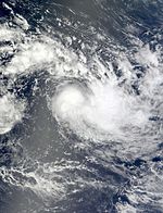
Late on November 17, the Joint Typhoon Warning Center noted that an area of low pressure had formed within the Central Indian Ocean just inside TCWC Jakarta's area of responsbiilty. Early the next day TCWC Jakarta declared it as a tropical depression and started to issue Cyclone Warnings for the Cocos (Keeling) Islands. The JTWC began issuing advisories on Tropical Cyclone 02S later that day. It was upgraded to a Category 1 cyclone early on November 19. Cyclone Anika passed to the north of the Cocos Islands, and cyclone warnings were cancelled later that day. The system dissipated on November 21. There are no reports of damages or deaths due to Anika to date.
Severe Tropical Cyclone Billy
| Category 4 severe tropical cyclone (Australian scale) | |
| Category 3 tropical cyclone (SSHWS) | |
| Duration | December 17 – December 28 |
|---|---|
| Peak intensity | 175 km/h (110 mph) (10-min); 948 hPa (mbar) |
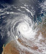
On December 17, a tropical low formed in the Arafura Sea north-west of Darwin in the Northern Territory. It moved into the Joseph Bonaparte Gulf and has been very slow moving. On the night of December 18 it intensified into a Category 1 cyclone and was named Billy. On December 20, Billy made landfall as a Category 2 cyclone approximately 65 kilometres north of Wyndham. After then, it weakened to a tropical low and moved slowly southwestwards. It then moved off the coast just north of Kuri Bay and redeveloped into a tropical cyclone on December 22 as the storm turned to the north-northeast. Late on December 24, Billy began to rapidly intensify and reached Category 4 strength early on December 25. Later that same day, Billy weakened into a category 3 cyclone and TCWC Perth issued their final tropical advice as the system was moving away from land. Billy weakened into a category 1 cyclone on December 27 and weakened into a tropical low on December 28. Later that day, TCWC Perth issued their final advisory as it countinued to weaken.[6]
Two remote indigenous communities, Kalumburu and Oombulgurri were cut off by floodwaters with roads and the airstrips closed.[7]
Tropical Low 04U
| Tropical low (Australian scale) | |
| Duration | December 22 – December 24 |
|---|---|
| Peak intensity | 55 km/h (35 mph) (10-min); 1000 hPa (mbar) |
On December 22, a tropical low formed in the southwestern Gulf of Carpentaria southeast of Groote Eylandt in the Northern Territory. Moving generally west, it dissipated later that day over the Northern Territory without ever attaining tropical cyclone status.
Tropical Low 05U
| Tropical low (Australian scale) | |
| Duration | December 23 – December 28 |
|---|---|
| Peak intensity | 35 km/h (25 mph) (10-min); 1003 hPa (mbar) |
On December 23, TCWC Brisbane noted that a weak tropical low had formed within the Solomon Sea, about 1330 km/s to the northeast of Cairns.[8] Over the next few days the low moved towards the southwest into the Coral Sea.[9]
Tropical Cyclone Charlotte
| Category 1 tropical cyclone (Australian scale) | |
| Tropical storm (SSHWS) | |
| Duration | January 8 – Still Active |
|---|---|
| Peak intensity | 85 km/h (50 mph) (10-min); 987 hPa (mbar) |
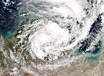
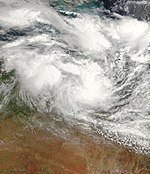
On January 8, TCWC Darwin identified a Tropical Low in the southern Gulf of Carpentaria. The next day TCWC Brisbane begin to issue advices on the low issuing Cyclone Watches for coastal communities between Aurukun on the Cape York Peninsula and the Northern Territory/Queensland border. On January 11, the Tropical Low developed into Tropical Cyclone Charlotte, and later that day, crossed the coast near the Gilbert River Mouth with wind gusts of 70 mph (120 km/h).
Timeline of Recent Events

December
- December 17
-
- 0600 UTC - Tropical Cyclone Warning Center Darwin designates 97S.INVEST along the Northern Territory coastline near Kalumburu as a Tropical Low.
- December 18
-
- 0600 UTC - Tropical Cyclone Warning Center Darwin upgrades the Tropical Low near Kalumbura to Category One Tropical Cyclone Billy.
- December 19
-
- 0600 UTC - TCWC Darwin upgrades Category One Cyclone Billy to Category Two Cyclone.
- December 20
- December 22
- December 23
-
- 2100 UTC - TCWC Perth upgrades Category One Tropical Cyclone Billy to a Category Two Cyclone.
- December 24
-
- 0300 UTC - TCWC Perth upgrades Category Two Tropical Cyclone Billy to a Severe Category Three Cyclone.
- 0600 UTC - TCWC Darwin issues its final advisory on the Tropical Low over northern Victoria River District.
- 0900 UTC - TCWC Perth upgrades Category Three Severe Tropical Cyclone Billy to a Severe Category Four Cyclone.
- December 25
-
- 1800 UTC - TCWC Perth downgrades Category Four Severe Tropical Cyclone Billy to a Severe Category Three Cyclone.
- December 26
-
- 1800 UTC - TCWC Perth downgrades Category Three Severe Tropical Cyclone Billy to a Category Two Cyclone.
- December 27
-
- 1200 UTC - TCWC Perth downgrades Category Two Tropical Cyclone Billy to a Category One Cyclone.
- December 28
-
- 1200 UTC - TCWC Perth downgrades Category One Tropical Cyclone Billy to a Tropical Low and issues its final advisory.
- January 10
-
- 1200 UTC - TCWC Brisbane upgrades the Tropical Low near in the Gulf of Carpenteria to Category One Tropical Cyclone Charlotte.
Storm names
TCWC Jakarta
TCWC Jakarta monitor Tropical Cyclones from the Equator to 10S and from 90E to 125E. Should a Tropical Depression reach Tropical Cyclone strength within Jakarta's Area of Responsibility then it will be assigned a name from the following list. [10] The first five names of the list are shown below. Names that have not yet been assigned are shown in gray; bold names are currently active.
|
|
TCWC Port Moresby
Tropical cyclones that develop north of 10°S between 141°E and 160°E are assigned names by the Tropical Cyclone Warning Centre in Port Moresby, Papua New Guinea. Tropical cyclone formation in this area is rare, with no cyclones developing in it since 2007.[11] As names are assigned in a random order the whole list is shown below. Names that have not yet been assigned are shown in gray; bold names are currently active.
|
|
Australian Bureau of Meteorology
Each Australian Tropical Cyclone Warning Centre (Perth, Darwin, and Brisbane) used to maintain a list of names arranged alphabetically and alternating male and female. Except from the start of the 2008-09 Tropical Cyclone Year, there will only be one list that the Bureau of Meteorology (BoM) will use to name Tropical Cyclones.[12] BOM will monitor all tropical cyclones that form between 90°E and 160°E, issuing special advisories when a cyclone forms in either TCWC Jakarta's or Port Moresby's area of responsibility. Names in bold+ are currently active and names in gray have not been used so far in this season.
| Tropical Cyclone Naming List | |||||
|---|---|---|---|---|---|
| Anika | Anthony | Alessia | Alfred | Ann | |
| Billy | Bianca | Bruce | Blanche | Blake | |
| Charlotte (active) | Carlos | Cathy | Caleb | Claudia | |
| Dominic | Dianne | Dylan | Debbie | Damien | |
| Ellie | Errol | Edna | Ernie | Esther | |
| Freddy | Fina | Fletcher | Frances | Ferdinand | |
| Gabrielle | Grant | Gillian | Greg | Gretel | |
| Hamish | Heidi | Hadi | Hilda | Harold | |
| Ilsa | Iggy | Ita | Ira | Imogen | |
| Jasper | Jasmine | Jack | Joyce | Joshua | |
| Kirrily | Koji | Kate | Kelvin | Kimi | |
| Laurence | Lua | Lam | Linda | Lucas | |
| Magda | Mitchell | Marcia | Marcus | Marian | |
| Neville | Narelle | Nathan | Nora | Noah | |
| Olga | Oswald | Olwyn | Owen | Odette | |
| Paul | Peta | Quang | Penny | Paddy | |
| Robyn | Rusty | Raquel | Riley | Ruby | |
| Sean | Sandra | Stan | Savannah | Seth | |
| Tasha | Tim | Tatjana | Trevor | Tiffany | |
| Vince | Victoria | Uriah | Veronica | Verdun | |
| Zelia | Zane | Yvette | Wallace | -------- | |
See also
- List of Southern Hemisphere tropical cyclone seasons
- Atlantic hurricane seasons: 2008, 2009
- Pacific hurricane seasons: 2008, 2009
- Pacific typhoon seasons: 2008, 2009
- North Indian Ocean cyclone seasons: 2008, 2009
References
- ^ a b c "Tropical Cyclone Operational plan for the South Pacific & Southeast indian Ocean 2008" (PDF). WMO. Retrieved 2008-12-11.
- ^ "Average risk of tropical cyclones across the South Pacific". National Institute of Water & Atmospheric Research. 2008-09-26. Retrieved 2008-10-21.
- ^ a b c "Outlook for tropical cyclone season for North West Australia". TCWC Perth. 2008-10-20. Retrieved 2008-10-21.
- ^ a b c "Tropical Cyclone Seasonal Outlook for the Northern Region". TCWC Darwin. 2008-10-20. Retrieved 2008-10-21.
- ^ http://www.webcitation.org/5cU6ykuC9
- ^ "TCWC Perth's final advisory on Billy". TCWC Perth. 12-28-2008. Retrieved 2008-12-28.
{{cite web}}: Check date values in:|date=(help) - ^ "Cyclone Billy expected to intensify". The Age. 2008-12-21. Retrieved 2008-12-21.
- ^ "Tropical Cyclone Outlook for the Coral Sea 23-12-08 05z". Australian Bureau of Meteorology. Retrieved 2008-12-26.
- ^ "Tropical Cyclone Outlook for the Coral Sea 26-12-08 05z". Australian Bureau of Meteorology. Retrieved 2008-12-26.
- ^ "Tropical Cyclone names". WMO. Retrieved 2008-09-04.
- ^ "Monthly Global Tropical Cyclone Summary October". Gary Padgett.
- ^ "Tropical Cyclone Names". BOM. Retrieved 2008-08-08.


