
Malabo: Difference between revisions
No edit summary |
|||
| Line 72: | Line 72: | ||
===British Presence=== |
===British Presence=== |
||
In [[1821]], the British captain Nelly approached the island of Fernando Poo. He found abandoned and founded the establishments of ''[[Riaba|Melville Bay]]'' (Riaba) and ''[[San Carlos de Luba|San Carlos]]'' (Luba). Some years later, another British captain, [[William Fitzwilliam Owen]] decided to colonize the island and set in the north of it -in the site of the present capital- a base for British ships chasing European dealers of [[African slave trade|slaves]]. Thus arises, the [[December 25]] of [[1827]] ''Port Clarence'' on the ruins of a previous Portuguese settlement. The name was chosen in honor of the Duke of Clarence, who later became Williams IV. The [[Bubi]]s indigenous to the island called it "''Ripotó'' ('' |
In [[1821]], the British captain Nelly approached the island of Fernando Poo. He found abandoned and founded the establishments of ''[[Riaba|Melville Bay]]'' (Riaba) and ''[[San Carlos de Luba|San Carlos]]'' (Luba). Some years later, another British captain, [[William Fitzwilliam Owen]] decided to colonize the island and set in the north of it -in the site of the present capital- a base for British ships chasing European dealers of [[African slave trade|slaves]]. Thus arises, the [[December 25]] of [[1827]] ''Port Clarence'' on the ruins of a previous Portuguese settlement. The name was chosen in honor of the Duke of Clarence, who later became Williams IV. The [[Bubi]]s indigenous to the island called it "''Ripotó'' (''place of the foreigners''). The population of the capital was increased by the arrival of freed slave of ship captured by the British navy who decided to stay and live on the island. The settlement of the freedmen in Port Clarence preceded the formation of [[Sierra Leone]] as a colony for freed slaves. The descendants of these people enslaved and freed remain on the island. At they joined other migrants arrived as free workers from Liberia, Sierra Leone, Ghana, Ivory Coast, Benin, Nigeria and Cameroon, constituting the population group called Creole or [[fernandino]]s, and whose own language the [[Pidgin]] Bantu-English with Spanish elements. |
||
During the period of the British presence, British consuls automatically became governors of the colony. Including Governor John Beecroft, a British mulatto sailor who modernized the capital, whose work was recognized later by Spain erecting a monument which is located in Punta Fernanda. |
During the period of the British presence, British consuls automatically became governors of the colony. Including Governor John Beecroft, a British mulatto sailor who modernized the capital, whose work was recognized later by Spain erecting a monument which is located in Punta Fernanda. |
||
| Line 89: | Line 89: | ||
Behind the near the barracks next to Governor's palace, next to a black beach at the mouth of the Cónsul River, is the shameful and famous [[Black Beach Prison]] also known as ''Blay Beach prison'' (or Playa Negra prison) where several people have been jailed in the over 35 years of dictatorship. Among those imprisoned and tortured numerous times are many political leaders as Fabián Nsue (UP), Felipe Ondo Obiang (FDR), Martín Puye of [[Movement for the Self-Determination of Bioko Island]] (MAIB) or [[Plácido Micó]] of the Social Democratic [[Convergence for Social Democracy]] (CPDS). |
Behind the near the barracks next to Governor's palace, next to a black beach at the mouth of the Cónsul River, is the shameful and famous [[Black Beach Prison]] also known as ''Blay Beach prison'' (or Playa Negra prison) where several people have been jailed in the over 35 years of dictatorship. Among those imprisoned and tortured numerous times are many political leaders as Fabián Nsue (UP), Felipe Ondo Obiang (FDR), Martín Puye of [[Movement for the Self-Determination of Bioko Island]] (MAIB) or [[Plácido Micó]] of the Social Democratic [[Convergence for Social Democracy]] (CPDS). |
||
== |
== Geography == |
||
[[File:Klimadiagramm-Malabo-Aequatorial-Guinea-metrisch-deutsch.png|thumb|250px|right|Climatological diagram of Malabo]] |
|||
Malabo is situated north of the island of Bioko, at coordinates 3° 45' 7.43" North and 8° 46' 25.32" East. The south of Malabo is limited by the Cónsul River and just across the river, south-west, is the hospital. West of the city, located about 9 km from the center of Malabo, is renewed [[Malabo International Airport]]. In the coastal region north of the city are the [[Bay (geography)|bays]] and [[cape (geography)|capes]]. The elder is the punta de la Unidad Africana located just behind the [[presidential palace in Malabo|Presidential Palace]] and which occupies the entire eastern part of the Bay of Malabo. Another cape of importance is punta Europa located in the west of the city near to the airport. |
|||
===Climate=== |
|||
Malabo features a [[tropical monsoon climate]]. Malabo sees on average 1,800 mm of rain per year. The city has a pronounced, albeit short [[dry season]] from December through February. February is normally its driest with 33 mm (0.2 in) of rain falling on average. It also has a very lengthy [[wet season]] that covers the remaining nine months. On average, the months hit hardest by the wet season are from September to October, with {{convert|500|mm|in|0}} of rain falling between them. |
Malabo features a [[tropical monsoon climate]]. Malabo sees on average 1,800 mm of rain per year. The city has a pronounced, albeit short [[dry season]] from December through February. February is normally its driest with 33 mm (0.2 in) of rain falling on average. It also has a very lengthy [[wet season]] that covers the remaining nine months. On average, the months hit hardest by the wet season are from September to October, with {{convert|500|mm|in|0}} of rain falling between them. |
||
| Line 192: | Line 196: | ||
</div> |
</div> |
||
== Administration == |
|||
==Layout== |
|||
The current [[mayor]] is María Coloma Edjang Mbengono who establishes that municipal services prescribed by law and which are the responsibility of the municipality are: [[water supply network|drinking water]] and others [[source (architecture)|public sources]], [[street lighting|lighting]], [[firm|paving]] of roads, [[cemetery]]s, [[cleaning]] and [[sanitation]], the [[trash|sanitary waste treatment]] and waste, [[disinfecting]] and [[insect]], emergency -[[first aid]]-, health inspections and drinks , health [[inspection systems|inspection]] of poor housing, sanitation, [[bank (furniture)|public banks]], [[slaughterhouse]]s, [[market]]s and the elimination of [[sewage|stagnant water]] among others. |
|||
Despite its status as the capital of Equatorial Guinea for several decades, Malabo's street network remains poorly developed. Malabo itself has few paved roads leading into it, and fewer than one hundred paved and developed streets. Many of the street names reflect an [[African nationalism|African nationalist]] or anti-colonial theme, with names such as "Independence Avenue" or "[[Patrice Lumumba]] Road" being main roads. The few large roads not named for an African nationalist ideal or person are named for cities in Equatorial Guinea or other places or countries in [[Africa]], as well as the road leading to the presidential palace. The palace and grounds consume a substantial part of the eastern side of Malabo, and are off-limits. The heart of the city is the colonial cathedral at Independence Place. Many buildings in the city from the Spanish colonial era are still standing. |
|||
[[File:CCEI Bank GE HQ Malabo 2013.jpg|thumb|right|250px|CCEI Bank headquarter in Malabo.]] |
|||
=== List of mayors since 1960 <ref> === |
|||
The south of Malabo is bordered by the ''Rio Consul''. Across this lies the hospital to the southeast. To the west is the recently renovated [[Malabo Airport]]. The coastal northern region of the city is pierced by headlands and bays. The largest headland is the crescent-shaped ''Tip of African Unity'' behind the presidential palace. Encompassing the entire eastern side of Malabo Bay, it is almost as long as Malabo is tall. Malabo is part of a wider bay that represents most of the northern coast of Bioko; it stretches from ''Europe Point'' in the west (home to the airport), to barren lands in the east. |
|||
{| |
|||
|| |
|||
* Wilwardo Jones Níger |
|||
* Abilio Balboa Arking |
|||
* Antonio Ribeiro Ebuera |
|||
* Julio Bonete Eiye |
|||
* Julián Ehapo Bomaho |
|||
* Vidal Djoni Bekoba |
|||
* Tomás Alfredo King Tomas |
|||
|| |
|||
* Rosendo Toichoa Borico |
|||
* Felipe Beta Tobachi |
|||
* Antonio Reibeira Ebuera |
|||
* Elías Manuel Macho Ricacha |
|||
* Basilio Cañadas Idjabe |
|||
* Cristina Djombe Djangani |
|||
|| |
|||
* Vicente Ebong Uwa |
|||
* Bernardino Edu Oba |
|||
* Victorino Bolekia Bonay |
|||
* Gabriel Mba Bela |
|||
* María Coloma Edjang Mbengono |
|||
* Isabel Eraul Ivina |
|||
|} |
|||
==Cultural Centres== |
|||
Notable buildings in Malabo include [[Malabo Cathedral]], [[Malabo Government Building]], and the [[Malabo Court Building]]. The city is served by [[Malabo International Airport]], while [[ferry|ferries]] sail from its [[port]] to [[Douala]] and [[Bata, Equatorial Guinea|Bata]]. The city contains several notable hotels including [[Sofitel Malabo President Palace]], [[Hotel Ureka]], [[Hotel Bahia (Malabo)|Hotel Bahia]] and [[Hotel Impala]]. |
|||
Through the [[Spanish Agency for International Cooperation for Development]] (AECID), are made several development projects at both regional and national level. Headquartered in the Technical Cooperation Office in Malabo (created in 1984), carried out actions for the development of the [[culture]], [[health]], [[education]] and institutional strengthening. Stressing the [[Cultural Center of Spain in Malabo]] (CCEM), founded in 2003, where young people are encouraged to feel a cultural space where they can unleash their creative freedom. It also has three geographical axes, in order to capture the largest number of people in the region and contribute to its development. Activities include the [[Education|training]], [[art]], [[film]], [[theater]], [[music]] and [[games]], with the two main festivals: Traveling Film Festival of Equatorial Guinea (FECIGE) and the International Festival of Hip Hop in Malabo. <ref> |
|||
Another important center is the [[Hispano-Guinean]] Cultural Center, from 2012 Equatorial Guinean Cultural Center began as headquarters of [[Institute Cardinal Cisneros]], and then archive, museum and library. It was built in [[1950s]] <ref{{cite web |url=http://www.ayuntamientodemalabo.com/malabo_es/ayuntamiento_de_malabo_lista_de_alcaldes.htm |title=List of Mayors (1960-present) (in Spanish) |work=City Council of Malabo |accessdate = 19 November 2013}}</ref> |
|||
A major museums is the [[Museum of Modern Art in Equatorial Guinea]], with traditional and contemporary art of the country and the continent. In the city also it is the [[National Library of Equatorial Guinea|National Library]], which was built in 1916. <ref{{web cite |url=http://www.aecid.es/ES/Paginas/D%C3%B3nde%20Cooperamos/%C3%81frica%20Subsahariana/Guin%C3%A9a-Ecuatorial.aspx |title=Equatorial Guinea (in Spanish) |accessdate=November 24, 2013 |publisher=AECID}}</ref> <ref>{{cite web |url=http://ccemalabo.es/ | title = Cultural Center of Spain in Malabo (in Spanish) |accessdate=November 24, 2013 |publisher=Embassy of Spain in Equatorial Guinea}} </ref> |
|||
== Demographics == |
|||
{| class="toccolours" style="width:180px; margin: 0 0 0.5em 1em; float:right; clear:right;line-height:100%;font-size: 90%; border-collapse: collapse" border="2" cellpadding="4" cellspacing="0" |
|||
|- |
|||
!colspan=3 align=center | Growth of population of Malabo |
|||
|- |
|||
! Year || People || % |
|||
|- |
|||
|[[1983]] || align=right | 31 650 || align=right | - |
|||
|- |
|||
|[[1994]] || align=right | 60 065 || align=right | 89,8 |
|||
|- |
|||
|[[2000]] || align=right | 73 117 || align=right | 21,7 |
|||
|- |
|||
|[[2007]]<ref name=popun>{{cite web |url=http://data.un.org/CountryProfile.aspx?crName=Equatorial%20Guinea |title=Equatorial Guinea |accessdate= November 24, 2013 |publisher=United Nations Statistics Division |work=UNData}}</ref> || align=right | 96 000 || align=right | 31,3 |
|||
|- |
|||
|colspan=3 |1983 and 1994: censuses<br/>2000 and 2007: estimated |
|||
|} |
|||
Malabo has a relatively young population. Approximately 45% of its population does not exceed 15 years. About 4% of the population is over 65 years. Most of the population lives in [[rural]] areas of the island. |
|||
===Religion=== |
|||
The city, according to the rest of the country is predominantly [[Catholicism|Catholic]], fact reflected in the Western [[colonialism]]. More than 80% of the city population is Catholic and about 4% is some sort of tribal religion. The [[Islam]] is also present in the city and the [[Judaism]]. Some Christian communities, such as [[Mormon]] and [[JW]], are also present in Malabo, although in smaller numbers. |
|||
[[File:Malabo08220.JPG|thumb|left|250px|One of the main roads in Malabo.]] |
|||
== Economy == |
|||
Malabo is the commercial and financial center. Malabo's economy is based on the [[public administration|administration]] and other services. Also the [[trade]] it is one of the most prominent and important economic activities, especially since the arrival of companies from the [[US]] which exploit [[oil well]]s close to the coast. This trade is also given by the presence of other Americans, of [[Latin American]]s, [[Nigeria]]n [[Cameroon|Cameroon]], [[Spain|Spanish]] and other inhabitants of the countries of [[Central Africa]] that increase trade. In Malabo is the headquarters of the BEAC or [[Bank of Central African States]]. Its building was built by the [[Banco Popular Español]], but after independence became the seat of [[Bando de Guinea Ecuatorial]].<ref name=calendar/> |
|||
The substantial profits from oil exploitation have not been applied in reducing [[poverty]] of the city nor the country <ref name=afrol> {{cite web | url=http://www.afrol.com/articles/10288 |title=Luanda, Malabo strengthen link with US oil capital | accessdate = November 24, 2013 |publisher=Afrol News}} </ref> |
|||
The main [[industry]] of the city is the development of [[fish]], while [[cacao]] and [[Coffea|coffee]] are the main products of [[export]].<ref name=afrol/> |
|||
Malabo has [[port]] of high tonnage connected mainly with the ports of [[Douala]] (Cameroon) and [[Bata (Equatorial Guinea)|Bata]], and air link via an international airport. |
|||
There are about 300 [[hotel|hotel beds]], of which only 50 are of quality. |
|||
== Education == |
|||
The [[National University of Equatorial Guinea]] (UNGE) and the [[National Distance Education University]] (UNED), the latter Spanish, have headquarters in the city. The [[Colegio Nacional Enrique Nvó Okenve]], one of the country's universities, has one of its two campuses in the city. |
|||
[[File:Kathedrale Santa Isabel.jpg|thumb|right|250px|[[Cathedral of Malabo|Cathedral of Santa Isabel]].]] |
|||
==Attractions== |
|||
Malabo is a city that preserves buildings from the colonial era such as the [[presidential palace in Malabo|Presidential Palace]] and the [[Palace of Justice of Malabo]]. In the downtown are also found other colonial buildings, although they are worn as the wooden buildings of [[19th century]] of Nigeria and Rey Boncoro streets. |
|||
Notable buildings stand out as the [[Cathedral of Malabo |Cathedral of Santa Isabel]], which is in turn based on the [[Roman Catholic Archdiocese of Malabo]]. It is a temple of [[neo-Gothic]] style, built between 1897 and 1916. Its architect was Luis Segarra Llairadó and paid by contributions from the government of [[Spain]] and donations of faithfuls. It has two towers of 40 meters high. Maybe the same [[Antoni Gaudí]] oversee the plans. <ref name=calendar/> |
|||
Other points of interest are [[La Gaditana]], formerly known as Finca Amilivia, prior to 1918, <ref name=calendar/> The [[casa Teodolita]] in 1902 and one of the oldest in the city, <ref name=calendar/> the building of the [[City Hall of Malabo]], the [[Church of Elá Nguema]], the Independence Square, the [[Casa de España (Malabo)|Casa de España]] and the bay of the harbor. |
|||
== Gastronomy == |
|||
Are famous the [[restaurant]]s where are served grilled fish dishes. Are cooked crocodile meat dishes, wild boar and antelope with tomato sauce, modica, eggplant or peanut, rice, fermented cassava, fried or cooked banana <ref> {{Web cite |url=http://www.eldiariomontanes.es/v/20110611/sociedad/destacados/malabo-conserva-pasado-espanol-20110611.html |title = "Malabo retains its Spanish past" (in Spanish) |accessdate=November 24, 2013 |publisher=eldiariomontanes.es |date=June 11, 2011}}</ref> |
|||
== Transport == |
|||
===Public transport system=== |
|||
The system of [[public transport]] of the capital includes service of [[bus|buses]] to make the journey between downtown of Malabo and the neighborhood of [[Ela Nguema]] of taxis circulating the city and outlying areas, and car hire called [[Avis Rent a Car System|Avis]] and [[Europcar]]. |
|||
[[File:Aeropuerto Malabo.jpg|thumb|left|250px|[[Malabo International Airport]].]] |
|||
===Maritime transport=== |
|||
The [[port]] of Malabo can reach a theoretical treatment capacity of 200,000 tons/year. The main maritime links are with national destination to Bata and international to Spain and Douala in Cameroon. |
|||
===Aviation=== |
|||
The [[Malabo International Airport]] serves the city. It is located 7 km from the center in punta Europa. It covers long distance direct flights to [[Europe]] and some African capitals. Operating companies are [[Iberia (airline)|Iberia]], [[Swiss]], [[KLM]] and [[British Airways]]. The highest percentage of air traffic constitute links to Bata, Douala (Cameroon), [[Cotonou]] ([[Benin]]) and [[Libreville]] ([[Gabon]]) by airlines [[Camair-co]], [[Air Gabon]] and [[Ecuato Guineana|EGA]]. |
|||
==Discovery of oil== |
==Discovery of oil== |
||
| Line 209: | Line 304: | ||
|date=16 December 2002}}</ref> |
|date=16 December 2002}}</ref> |
||
==Education== |
|||
{{expand section|date=April 2015}} |
|||
The [[Colegio Nacional Enrique Nvó Okenve]] has campuses here and in [[Bata, Equatorial Guinea|Bata]].<ref>[http://pdf.usaid.gov/pdf_docs/PDACJ154.pdf "TECHNICAL SUPPORT PROJECT FOR SOCIAL INVESTMENT AND CAPACITY BUILDING IN EQUATORIAL GUINEA"], Design and Implementation Plan, Contract No. DFD-I-00-05-0020 TO #2, (September 2006 through August 2008).</ref> |
|||
International schools include: |
|||
*''[[Lycée Francais de Malabo]]'' |
|||
==Transportation== |
|||
[[Image:Aeropuerto de Malabo.jpg|thumb|right|[[Malabo International Airport]] ]] |
|||
[[Malabo International Airport]] serves Malabo. Several domestic and international carriers fly into Malabo. |
|||
==International relations== |
==International relations== |
||
| Line 232: | Line 317: | ||
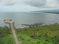
File:Malabo waterfront.jpg|Waterfront. |
File:Malabo waterfront.jpg|Waterfront. |
||
File:Mercado Central, Malabo City, Equatorial Guinea.jpg|Mercado Central, Malabo City, Equatorial Guinea. |
File:Mercado Central, Malabo City, Equatorial Guinea.jpg|Mercado Central, Malabo City, Equatorial Guinea. |
||
File:Gepetrol HQ Malabo 2013.jpg|Headquarter Gepetrol in Malabo Dos. Gepetrol is the national oil company of Equatorial Guinea. |
|||
File:Kathedrale Ela Nguema.jpg|Church of Elá Nguema. |
|||
File::Malabo08223.JPG|View the Atlantic coast, from Malabo. |
|||
</gallery> |
</gallery> |
||
Revision as of 21:26, 7 September 2015
This article needs additional citations for verification. (November 2009) |
Malabo | |
|---|---|
 Venus Bay | |
 Flag .svg) Seal | |
| Country | |
| Province | Bioko Norte Province |
| Founded | 1827 |
| Current name | Since 1973 |
| Elevation | 0 m (0 ft) |
| Population (2012) | |
| • Total | 187,302 |
| Demonym | Malabeño-a |
| Time zone | UTC+1 (WAT) |
| Website | www |
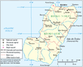
Malabo /məˈlɑːboʊ/ it is the capital and largest city of Equatorial Guinea and of province of Bioko Norte. It is located on the north coast of the island of Bioko -island formerly known by the Bubis, its autocthonous inhabitants, as Etulá and as Fernando Poo by the Europeans and has a population of approximately of 187,302 inhabitants.
The languages city officials, as well as across the country, are the Spanish (main language and practically the only one used), the French and Portuguese.
Malabo is the oldest city of Equatorial Guinea. That is why it can see a lot of buildings with colonial architecture at the same time coexist with modern buildings built in the last and recent stage. The downtown streets, with a square design, reveal the ancient conception of modern city with pedestrian areas at all. The city also offers numerous green areas and leisure. This phenomenon causes a feeling of architecture attenuated by the low height of buildings in a combination of architectural Westernization and Africanism.
Oyala is a planned city currently under construction, designed to replace Malabo as the capital.
History
Discovery and Portuguese conquest
In 1472, in an attempt to find a new route to the India, the Portuguese navigator Fernão do Pó, discovered the island of Bioko, which He called "Fermosa". Later the island was named after its discoverer, Fernando Poo. At the beginning of 16th century, specifically in 1507, the Portuguese Ramos de Esquivel made a first attempt at colonization on the island of Fernando Poo. He established a factory in Concepción (current Riaba) and developed plantations of sugarcane, but the hostility of the insular Bubi people and diseases ended this experience quickly.

With the treaties of San Ildefonso in 1777 and El Pardo in 1778, during the reign of the Spanish King Carlos III the Portuguese gave to the Spanish island of Fernando Poo, Annobón and the right to conduct trade in the mainland, an area of influence approximately of 800 000 km² in Africa, in exchange for the Colonia del Sacramento in the River Plate and the Santa Catalina Island off the Brazilian coast (occupied by the Spaniards). The area stretching from the Niger Delta to the mouth of Ogüé River -in the current Gabon- and included, besides the islands of Fernando Poo and Annobon, the islets of Corisco and Elobeyes. Failed its various unsuccessful attempts to colonize these lands, Spain for its internal problems, lost interest in Spanish Guinea in 1827 and authorized the British use the island as a base for the work of persecution of the Slave Trade.
British Presence
In 1821, the British captain Nelly approached the island of Fernando Poo. He found abandoned and founded the establishments of Melville Bay (Riaba) and San Carlos (Luba). Some years later, another British captain, William Fitzwilliam Owen decided to colonize the island and set in the north of it -in the site of the present capital- a base for British ships chasing European dealers of slaves. Thus arises, the December 25 of 1827 Port Clarence on the ruins of a previous Portuguese settlement. The name was chosen in honor of the Duke of Clarence, who later became Williams IV. The Bubis indigenous to the island called it "Ripotó (place of the foreigners). The population of the capital was increased by the arrival of freed slave of ship captured by the British navy who decided to stay and live on the island. The settlement of the freedmen in Port Clarence preceded the formation of Sierra Leone as a colony for freed slaves. The descendants of these people enslaved and freed remain on the island. At they joined other migrants arrived as free workers from Liberia, Sierra Leone, Ghana, Ivory Coast, Benin, Nigeria and Cameroon, constituting the population group called Creole or fernandinos, and whose own language the Pidgin Bantu-English with Spanish elements.
During the period of the British presence, British consuls automatically became governors of the colony. Including Governor John Beecroft, a British mulatto sailor who modernized the capital, whose work was recognized later by Spain erecting a monument which is located in Punta Fernanda.

Spanish definitive control and new capital
In 1844, when Queen Elizabeth II ruled after the regency of her mother Maria Cristina and Baldomero Espartero, in an attempt to modernize Spain and rescuing its heritage, Spain let him know the UK its desire to be of regain control of the colony and thus the island. It took another decade to implement this direct control. The capital already had more dynamic and Protestant religious missions were very successful. Both factors helped to change the attitude of Spain, in addition to internal reasons already alluded.
Spain again took control of the island in 1855 and the capital Port Clarence was renamed Santa Isabel, in honor of the queen Isabel II of Spain. The capital of the island of Fernando Poo became the capital of Equatorial Guinea.
Its present name was given in 1973 as part of the campaign of President Macías Nguema to replace the place names of European origin with African names properly, honoring Malabo Lopelo Melaka, the last Bubi king. Malabo, son of King Moka, surrendered to the Spaniards, while his uncle Sas Ebuera, head of the Bubi warriors, claimed the legitimacy of Bubi rule and opposed with value to the Spaniards. After the murder of Sas Ebuera by the Spanish, Malabo became king without opposed, but without authority. Bubi clans and localities were slow to accept Spanish sovereignty over the island, and even 1912 was not achieved by conquest and pacification of the whole island.
Reign of Terror
During the so-called Reign of Terror of Macías Nguema, the dictator suppressed much of the intelligentsia of the country, initiating the process of taking over the positions of the public administration, by part of the natives of Mongomo and clan Esangui. Many city residents had to leave. In the last years of his mandate, almost a fifth of the population fled. Still today Malabo tries to heal his wounds from that period, while the successor as head of state, Teodoro Obiang Nguema with his Democratic Party of Equatorial Guinea, dictator from 1979 by a coup that overthrew Macías has not made improvements of any kind.
Behind the near the barracks next to Governor's palace, next to a black beach at the mouth of the Cónsul River, is the shameful and famous Black Beach Prison also known as Blay Beach prison (or Playa Negra prison) where several people have been jailed in the over 35 years of dictatorship. Among those imprisoned and tortured numerous times are many political leaders as Fabián Nsue (UP), Felipe Ondo Obiang (FDR), Martín Puye of Movement for the Self-Determination of Bioko Island (MAIB) or Plácido Micó of the Social Democratic Convergence for Social Democracy (CPDS).
Geography

Malabo is situated north of the island of Bioko, at coordinates 3° 45' 7.43" North and 8° 46' 25.32" East. The south of Malabo is limited by the Cónsul River and just across the river, south-west, is the hospital. West of the city, located about 9 km from the center of Malabo, is renewed Malabo International Airport. In the coastal region north of the city are the bays and capes. The elder is the punta de la Unidad Africana located just behind the Presidential Palace and which occupies the entire eastern part of the Bay of Malabo. Another cape of importance is punta Europa located in the west of the city near to the airport.
Climate
Malabo features a tropical monsoon climate. Malabo sees on average 1,800 mm of rain per year. The city has a pronounced, albeit short dry season from December through February. February is normally its driest with 33 mm (0.2 in) of rain falling on average. It also has a very lengthy wet season that covers the remaining nine months. On average, the months hit hardest by the wet season are from September to October, with 500 millimetres (20 in) of rain falling between them.
Daytime temperatures do not vary at all day to day, and only vary a few degrees throughout the entire year. At night, the average low temperature is 21-22 degrees in every month of the year, apart from January when average low is 19 degrees). January has cooler nights and hotter days because it has clearer weather. Nonetheless, Malabo, with only 1,180 hours of sunshine per year, is one of the gloomiest capitals in the world and experiences much fog even when it is not raining.
| Climate data for Malabo | |||||||||||||
|---|---|---|---|---|---|---|---|---|---|---|---|---|---|
| Month | Jan | Feb | Mar | Apr | May | Jun | Jul | Aug | Sep | Oct | Nov | Dec | Year |
| Mean daily maximum °C (°F) | 31 (88) |
32 (90) |
31 (88) |
32 (90) |
31 (88) |
29 (84) |
29 (84) |
29 (84) |
30 (86) |
30 (86) |
30 (86) |
31 (88) |
30 (86) |
| Daily mean °C (°F) | 25 (77) |
26 (79) |
26 (79) |
26 (79) |
25 (77) |
25 (77) |
24 (75) |
24 (75) |
24 (75) |
24 (75) |
25 (77) |
25 (77) |
25 (77) |
| Mean daily minimum °C (°F) | 19 (66) |
21 (70) |
21 (70) |
21 (70) |
22 (72) |
21 (70) |
21 (70) |
21 (70) |
21 (70) |
21 (70) |
22 (72) |
21 (70) |
21 (70) |
| Average rainfall mm (inches) | 42 (1.7) |
33 (1.3) |
110 (4.3) |
187 (7.4) |
179 (7.0) |
224 (8.8) |
284 (11.2) |
188 (7.4) |
277 (10.9) |
238 (9.4) |
92 (3.6) |
36 (1.4) |
1,890 (74.4) |
| Average rainy days (≥ 0.1 mm) | 4 | 4 | 11 | 14 | 18 | 21 | 21 | 18 | 23 | 20 | 13 | 5 | 172 |
| Average relative humidity (%) | 86 | 85 | 90 | 89 | 87 | 90 | 90 | 92 | 95 | 94 | 93 | 91 | 90 |
| Mean monthly sunshine hours | 148.8 | 152.5 | 108.5 | 120.0 | 117.8 | 69.0 | 46.5 | 58.9 | 48.0 | 68.2 | 99.0 | 139.5 | 1,176.7 |
| Source: Climate & Temperature[1] | |||||||||||||
Administration
The current mayor is María Coloma Edjang Mbengono who establishes that municipal services prescribed by law and which are the responsibility of the municipality are: drinking water and others public sources, lighting, paving of roads, cemeterys, cleaning and sanitation, the sanitary waste treatment and waste, disinfecting and insect, emergency -first aid-, health inspections and drinks , health inspection of poor housing, sanitation, public banks, slaughterhouses, markets and the elimination of stagnant water among others.

=== List of mayors since 1960 Cite error: A <ref> tag is missing the closing </ref> (see the help page).
A major museums is the Museum of Modern Art in Equatorial Guinea, with traditional and contemporary art of the country and the continent. In the city also it is the National Library, which was built in 1916. <ref"Equatorial Guinea (in Spanish)". AECID. Retrieved November 24, 2013.</ref> [2]
Demographics
| Growth of population of Malabo | ||
|---|---|---|
| Year | People | % |
| 1983 | 31 650 | - |
| 1994 | 60 065 | 89,8 |
| 2000 | 73 117 | 21,7 |
| 2007[3] | 96 000 | 31,3 |
| 1983 and 1994: censuses 2000 and 2007: estimated | ||
Malabo has a relatively young population. Approximately 45% of its population does not exceed 15 years. About 4% of the population is over 65 years. Most of the population lives in rural areas of the island.
Religion
The city, according to the rest of the country is predominantly Catholic, fact reflected in the Western colonialism. More than 80% of the city population is Catholic and about 4% is some sort of tribal religion. The Islam is also present in the city and the Judaism. Some Christian communities, such as Mormon and JW, are also present in Malabo, although in smaller numbers.

Economy
Malabo is the commercial and financial center. Malabo's economy is based on the administration and other services. Also the trade it is one of the most prominent and important economic activities, especially since the arrival of companies from the US which exploit oil wells close to the coast. This trade is also given by the presence of other Americans, of Latin Americans, Nigerian Cameroon, Spanish and other inhabitants of the countries of Central Africa that increase trade. In Malabo is the headquarters of the BEAC or Bank of Central African States. Its building was built by the Banco Popular Español, but after independence became the seat of Bando de Guinea Ecuatorial.[4]
The substantial profits from oil exploitation have not been applied in reducing poverty of the city nor the country [5]
The main industry of the city is the development of fish, while cacao and coffee are the main products of export.[5]
Malabo has port of high tonnage connected mainly with the ports of Douala (Cameroon) and Bata, and air link via an international airport.
There are about 300 hotel beds, of which only 50 are of quality.
Education
The National University of Equatorial Guinea (UNGE) and the National Distance Education University (UNED), the latter Spanish, have headquarters in the city. The Colegio Nacional Enrique Nvó Okenve, one of the country's universities, has one of its two campuses in the city.

Attractions
Malabo is a city that preserves buildings from the colonial era such as the Presidential Palace and the Palace of Justice of Malabo. In the downtown are also found other colonial buildings, although they are worn as the wooden buildings of 19th century of Nigeria and Rey Boncoro streets.
Notable buildings stand out as the Cathedral of Santa Isabel, which is in turn based on the Roman Catholic Archdiocese of Malabo. It is a temple of neo-Gothic style, built between 1897 and 1916. Its architect was Luis Segarra Llairadó and paid by contributions from the government of Spain and donations of faithfuls. It has two towers of 40 meters high. Maybe the same Antoni Gaudí oversee the plans. [4]
Other points of interest are La Gaditana, formerly known as Finca Amilivia, prior to 1918, [4] The casa Teodolita in 1902 and one of the oldest in the city, [4] the building of the City Hall of Malabo, the Church of Elá Nguema, the Independence Square, the Casa de España and the bay of the harbor.
Gastronomy
Are famous the restaurants where are served grilled fish dishes. Are cooked crocodile meat dishes, wild boar and antelope with tomato sauce, modica, eggplant or peanut, rice, fermented cassava, fried or cooked banana [6]
Transport
Public transport system
The system of public transport of the capital includes service of buses to make the journey between downtown of Malabo and the neighborhood of Ela Nguema of taxis circulating the city and outlying areas, and car hire called Avis and Europcar.

Maritime transport
The port of Malabo can reach a theoretical treatment capacity of 200,000 tons/year. The main maritime links are with national destination to Bata and international to Spain and Douala in Cameroon.
Aviation
The Malabo International Airport serves the city. It is located 7 km from the center in punta Europa. It covers long distance direct flights to Europe and some African capitals. Operating companies are Iberia, Swiss, KLM and British Airways. The highest percentage of air traffic constitute links to Bata, Douala (Cameroon), Cotonou (Benin) and Libreville (Gabon) by airlines Camair-co, Air Gabon and EGA.
Discovery of oil

Malabo has been significantly affected by Teodoro Obiang Nguema Mbasogo's growing co-operation with the oil industry. The country's production has reached 360,000 barrels per day (57,000 m3/d) as of 2004, an increase which led to a doubling of the city's population, but for the vast majority, very little of that wealth has been invested in development.[7]
International relations
Twin towns – Sister cities
Malabo is twinned with:
 Guadalajara, Mexico[8]
Gallery
-
 Island of Bioko.
 -
 Coastline.
 -
 Waterfront.
 -
 Mercado Central, Malabo City, Equatorial Guinea.
 -
 Headquarter Gepetrol in Malabo Dos. Gepetrol is the national oil company of Equatorial Guinea.
 -
 Church of Elá Nguema.


See also
References
- ^ "Malabo, Equatorial Guinea". Climate & Temperature. Retrieved August 13, 2012.
- ^ "Cultural Center of Spain in Malabo (in Spanish)". Embassy of Spain in Equatorial Guinea. Retrieved November 24, 2013.
- ^ "Equatorial Guinea". UNData. United Nations Statistics Division. Retrieved November 24, 2013.
- ^ a b c d Cite error: The named reference
calendarwas invoked but never defined (see the help page). - ^ a b "Luanda, Malabo strengthen link with US oil capital". Afrol News. Retrieved November 24, 2013.
- ^ ""Malabo retains its Spanish past" (in Spanish)". eldiariomontanes.es. June 11, 2011. Retrieved November 24, 2013.
- ^ Cobb, Charles (16 December 2002). "Obiang Sure to Win As Opposition Quits Poll". AllAfrica.
- ^ "Sister Cities, Public Relations". Guadalajara municipal government. Archived from the original on March 2, 2012. Retrieved March 12, 2013.
External links
3°45′N 8°47′E / 3.750°N 8.783°E
| International | |
|---|---|
| National | |
| Geographic | |
| Other | |