
Ayun Stream: Difference between revisions
mNo edit summary |
|||
| Line 9: | Line 9: | ||
The Arabic name is most often transliterated as "Dardara" for the upper course and "Bareighit" or "Bureighith" for the lower one. The "Memoirs of the Survey of Western Palestine", published in 1881 in connection with the maps resulting from the 1870s Survey, use a slightly different spelling; the "very large spring" of a ''' 'Ain ed Derdarah''', ''lit.'' "the spring of the ''derdârah'' ([[elm]]) tree", from the village of El [[Khiam]], is mentioned to create a "strong stream", that once it's enhanced by the waters of '' 'Ain Hosh'' (Hosh Spring) becomes '''Nahr Bareighit''', ''lit.'' "the river of fleas".<ref name="SWPI">{{Cite book |title= The Survey of Western Palestine |author1=[[Claude Reignier Conder|C. R. Conder]] |author2=[[Herbert Kitchener|H. H. Kitchener]] |volume= I. Sheets I.-VI. Galilee. |pages= 88, 97, 99, 100, 104 |publisher= The Committee of the [[Palestine Exploration Fund]] (PEF) |location= London |year= 1881 |quote= p88) El Khiam (O a).—A village, north-east of the Merj Ayun.... The water supply..., and the good spring of 'Ain ed Derdarah. / (p97) Commencing from the west, the streams that go to form the Jordan are the Nahr Bareighit, rising from the large springs of Derdarah and Hush, near el Kulei'ah, in the Merj 'Ayun; this stream is not large, and nearly dries up in autumn. / (p99) 'Ain ed Derdarah (R a).—A very large spring....; a strong stream flows from it, and after receiving the waters of 'Ain Hosh, becomes the Nahr Bareighit. / (p100) 'Ain el Hosh (Q a [''sic'', Q b]).—A large spring, .... which joins the waters of 'Ain ed Derdurah [''sic'', Derdarah]. / (p104) Nahr Bareighit. —This is a small perennial stream of water flowing from 'Ain Derdarah. |url= http://users.cecs.anu.edu.au/~bdm/yabber/pef/SWPI.pdf |access-date=12 December 2019 }}</ref><ref name="Bolen">{{Cite book |title= The Survey of Western Palestine: An Index of the Arabic and English Name Lists |author= Compiled by Henry C. Stewardson |volume= |page= |publisher= The Committee of the Palestine Exploration Fund (PEF) |location= London |year= 1888 |edition= Electronic Edition by Todd Bolen/BiblePlaces.com, 2005 |url= http://www.bibleplaces.com/Survey_of_Western_Palestine,_Combined_Index.pdf |access-date=12 December 2019 }}</ref> However, the Survey map actually uses another name altogether for the upper course, '''Wadi el Kharrar''',<ref>SWP map, sheet 2, square Qb</ref> "the valley of the murmuring water".<ref name="Bolen"/> This seems to be either a typo, or a lesser-used name, since the index list of the Memoirs is sending under "Wadi el Kharrar", to page 36, where the name Wadi el Kharrar doesn't appear at all; instead, on that page there is an explanation regarding names omitted from the map due to lack of space - but this doesn't apply either, since the name "Wadi Kharrar" appears very well visible on Sheet 2 / Qb across the Merj 'Ayun plain. |
The Arabic name is most often transliterated as "Dardara" for the upper course and "Bareighit" or "Bureighith" for the lower one. The "Memoirs of the Survey of Western Palestine", published in 1881 in connection with the maps resulting from the 1870s Survey, use a slightly different spelling; the "very large spring" of a ''' 'Ain ed Derdarah''', ''lit.'' "the spring of the ''derdârah'' ([[elm]]) tree", from the village of El [[Khiam]], is mentioned to create a "strong stream", that once it's enhanced by the waters of '' 'Ain Hosh'' (Hosh Spring) becomes '''Nahr Bareighit''', ''lit.'' "the river of fleas".<ref name="SWPI">{{Cite book |title= The Survey of Western Palestine |author1=[[Claude Reignier Conder|C. R. Conder]] |author2=[[Herbert Kitchener|H. H. Kitchener]] |volume= I. Sheets I.-VI. Galilee. |pages= 88, 97, 99, 100, 104 |publisher= The Committee of the [[Palestine Exploration Fund]] (PEF) |location= London |year= 1881 |quote= p88) El Khiam (O a).—A village, north-east of the Merj Ayun.... The water supply..., and the good spring of 'Ain ed Derdarah. / (p97) Commencing from the west, the streams that go to form the Jordan are the Nahr Bareighit, rising from the large springs of Derdarah and Hush, near el Kulei'ah, in the Merj 'Ayun; this stream is not large, and nearly dries up in autumn. / (p99) 'Ain ed Derdarah (R a).—A very large spring....; a strong stream flows from it, and after receiving the waters of 'Ain Hosh, becomes the Nahr Bareighit. / (p100) 'Ain el Hosh (Q a [''sic'', Q b]).—A large spring, .... which joins the waters of 'Ain ed Derdurah [''sic'', Derdarah]. / (p104) Nahr Bareighit. —This is a small perennial stream of water flowing from 'Ain Derdarah. |url= http://users.cecs.anu.edu.au/~bdm/yabber/pef/SWPI.pdf |access-date=12 December 2019 }}</ref><ref name="Bolen">{{Cite book |title= The Survey of Western Palestine: An Index of the Arabic and English Name Lists |author= Compiled by Henry C. Stewardson |volume= |page= |publisher= The Committee of the Palestine Exploration Fund (PEF) |location= London |year= 1888 |edition= Electronic Edition by Todd Bolen/BiblePlaces.com, 2005 |url= http://www.bibleplaces.com/Survey_of_Western_Palestine,_Combined_Index.pdf |access-date=12 December 2019 }}</ref> However, the Survey map actually uses another name altogether for the upper course, '''Wadi el Kharrar''',<ref>SWP map, sheet 2, square Qb</ref> "the valley of the murmuring water".<ref name="Bolen"/> This seems to be either a typo, or a lesser-used name, since the index list of the Memoirs is sending under "Wadi el Kharrar", to page 36, where the name Wadi el Kharrar doesn't appear at all; instead, on that page there is an explanation regarding names omitted from the map due to lack of space - but this doesn't apply either, since the name "Wadi Kharrar" appears very well visible on Sheet 2 / Qb across the Merj 'Ayun plain. |
||
==Nature |
==Nature reserve== |
||
[[Image:HaEshed fall.JPG|thumb|Eshed Fall|200px]] |
[[Image:HaEshed fall.JPG|thumb|Eshed Fall|200px]] |
||
During the rainy winter months the water-flow is strongest. During the summer months, water is diverted for crop irrigation close to the stream's springs. Differences in elevation form waterfalls along the stream. These falls were declared a nature reserve,<ref>{{cite web|url= http://www.protectedplanet.net/sites/Ha_Tanunr_Nahal_Ayoun_Nature_Reserve |title= Ha Tanunr (Nahal Iyyon) Nature Reserve |publisher= ProtectedPlanet.com |url-status= dead |archiveurl= https://web.archive.org/web/20110724022511/http://www.protectedplanet.net/sites/Ha_Tanunr_Nahal_Ayoun_Nature_Reserve |archivedate= 2011-07-24}}</ref> and include: |
|||
* Iyyon waterfall, 9.2 m |
* Iyyon waterfall, 9.2 m |
||
* Tahana |
* Tahana ("flourmill") waterfall, 21 m |
||
* Eshed waterfall, with two steps, 5 m and 9 m |
* Eshed ("lion")<ref>David Curwin, [http://www.balashon.com/2015/01/lion.html lion], 'Balashon - Hebrew Language Detective' website, 7 January 2015, accessed 12 December 2019</ref> waterfall, with two steps, 5 m and 9 m |
||
* Tannur ("oven")<ref>Yona Sabar, |
|||
* Tanur waterfall, 30 m |
|||
[https://jewishjournal.com/current_edition/178737/ Hebrew word of the week: Tannur], Jewish Journal, 20 October 2015, Tribe Media Corp., accessed 12 December 2019</ref> waterfall, 30 m |
|||
==Flora and fauna== |
==Flora and fauna== |
||
Revision as of 18:30, 12 December 2019
33°16′11.42″N 35°34′40.26″E / 33.2698389°N 35.5778500°E

Nahal Ayun[1] (Hebrew: נחל עיון, lit. Ayun Stream),[1], sometimes spelled Nahal Iyyon, in Arabic: براغيث Bureighit, [2] or in full Nahr Bareighit,[3] is a perennial stream and a tributary of the Jordan River.[1] The stream originates from two springs in the Marjayoun (Merj 'Ayun) valley in southern Lebanon,[4] runs southward for seven kilometers through various irrigation ditches, then flows into Israel near Metulla, where it continues through the Hula Valley in the Galilee Panhandle[5] until emptying in the Hasbani River just before it reaches the Jordan River.[3]

Names
Arabic
The Arabic name is most often transliterated as "Dardara" for the upper course and "Bareighit" or "Bureighith" for the lower one. The "Memoirs of the Survey of Western Palestine", published in 1881 in connection with the maps resulting from the 1870s Survey, use a slightly different spelling; the "very large spring" of a 'Ain ed Derdarah, lit. "the spring of the derdârah (elm) tree", from the village of El Khiam, is mentioned to create a "strong stream", that once it's enhanced by the waters of 'Ain Hosh (Hosh Spring) becomes Nahr Bareighit, lit. "the river of fleas".[4][6] However, the Survey map actually uses another name altogether for the upper course, Wadi el Kharrar,[7] "the valley of the murmuring water".[6] This seems to be either a typo, or a lesser-used name, since the index list of the Memoirs is sending under "Wadi el Kharrar", to page 36, where the name Wadi el Kharrar doesn't appear at all; instead, on that page there is an explanation regarding names omitted from the map due to lack of space - but this doesn't apply either, since the name "Wadi Kharrar" appears very well visible on Sheet 2 / Qb across the Merj 'Ayun plain.
Nature reserve

During the rainy winter months the water-flow is strongest. During the summer months, water is diverted for crop irrigation close to the stream's springs. Differences in elevation form waterfalls along the stream. These falls were declared a nature reserve,[8] and include:
- Iyyon waterfall, 9.2 m
- Tahana ("flourmill") waterfall, 21 m
- Eshed ("lion")[9] waterfall, with two steps, 5 m and 9 m
- Tannur ("oven")[10] waterfall, 30 m
Flora and fauna
Tree types in the reserve include Pistacia palaestina, Rhamnus palaestinus, and Acer obtusifolium maple. Other growth includes Spanish broom, rubus, Cyclamen persicum, and Anemones.
Grey wagtails can be found during the winter months, as well as white-throated kingfishers and common kestrels.
See also
References
- ^ a b c Ayun Stream Nature Reserve, Israel Nature and Parks Authority website (English, accessed 12 December 2019 Cite error: The named reference "ParksE" was defined multiple times with different content (see the help page).
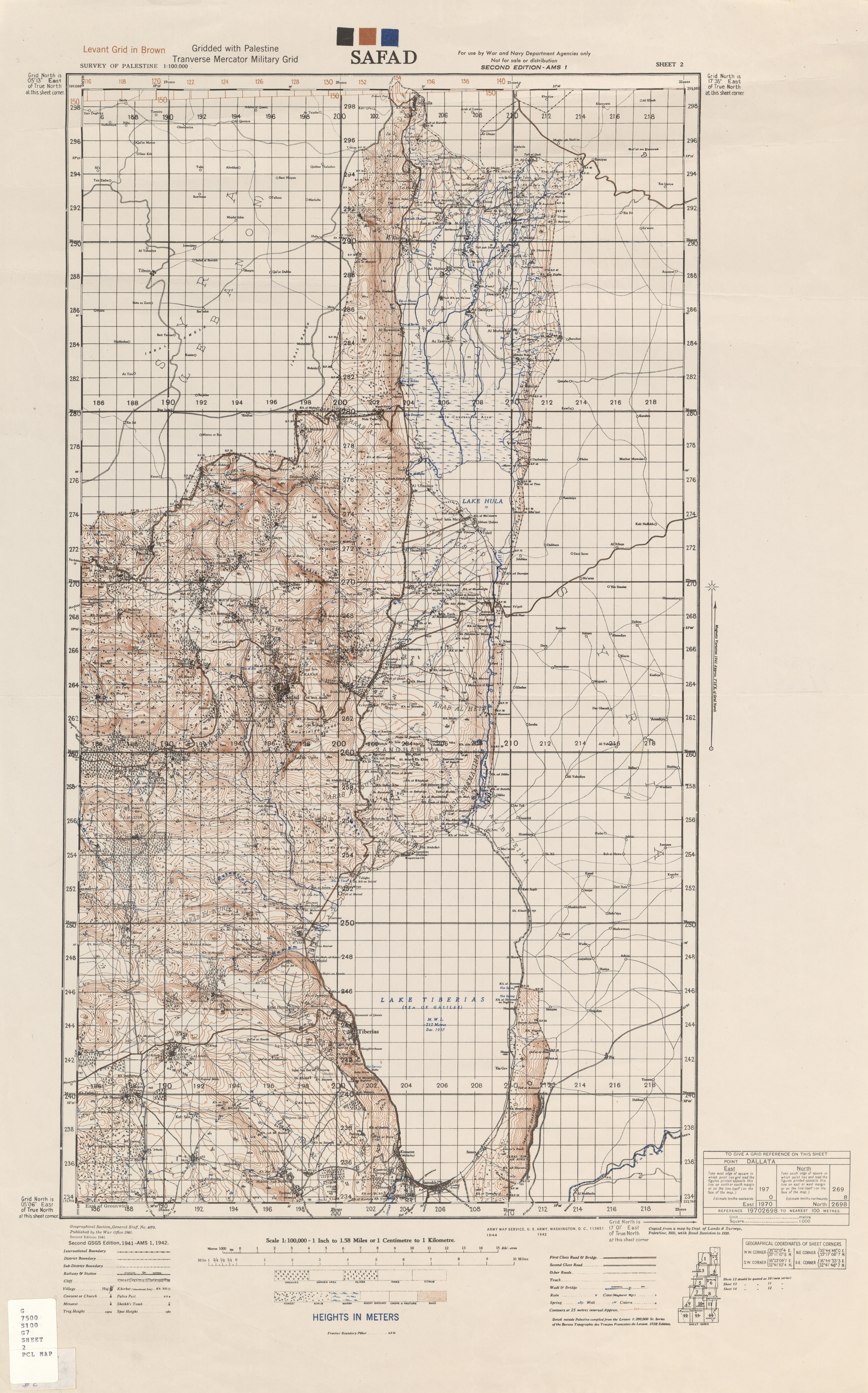
- ^ "Safad" (Map). Palestine. 1:100,000. K631. Great Britain War Office. 1942. Retrieved February 2, 2016.
- ^ a b The Zondervan Encyclopedia of the Bible. Vol. 3 (revised full-color edition ed.). Zondervan Academic. 2010. p. 1703. ISBN 9780310876984. Retrieved 12 December 2019.
{{cite book}}:|edition=has extra text (help); Unknown parameter|editors=ignored (|editor=suggested) (help); horizontal tab character in|editors=at position 36 (help) - ^ a b C. R. Conder; H. H. Kitchener (1881). The Survey of Western Palestine (PDF). Vol. I. Sheets I.-VI. Galilee. London: The Committee of the Palestine Exploration Fund (PEF). pp. 88, 97, 99, 100, 104. Retrieved 12 December 2019.
p88) El Khiam (O a).—A village, north-east of the Merj Ayun.... The water supply..., and the good spring of 'Ain ed Derdarah. / (p97) Commencing from the west, the streams that go to form the Jordan are the Nahr Bareighit, rising from the large springs of Derdarah and Hush, near el Kulei'ah, in the Merj 'Ayun; this stream is not large, and nearly dries up in autumn. / (p99) 'Ain ed Derdarah (R a).—A very large spring....; a strong stream flows from it, and after receiving the waters of 'Ain Hosh, becomes the Nahr Bareighit. / (p100) 'Ain el Hosh (Q a [sic, Q b]).—A large spring, .... which joins the waters of 'Ain ed Derdurah [sic, Derdarah]. / (p104) Nahr Bareighit. —This is a small perennial stream of water flowing from 'Ain Derdarah.
- ^ "שמורת טבע נחל עיון (התנור)" [The Nahal Iyyon Nature Reserve (Tannur)]. Israel Nature and Parks Authority.
- ^ a b Compiled by Henry C. Stewardson (1888). The Survey of Western Palestine: An Index of the Arabic and English Name Lists (PDF) (Electronic Edition by Todd Bolen/BiblePlaces.com, 2005 ed.). London: The Committee of the Palestine Exploration Fund (PEF). Retrieved 12 December 2019.
- ^ SWP map, sheet 2, square Qb
- ^ "Ha Tanunr (Nahal Iyyon) Nature Reserve". ProtectedPlanet.com. Archived from the original on 2011-07-24.
- ^ David Curwin, lion, 'Balashon - Hebrew Language Detective' website, 7 January 2015, accessed 12 December 2019
- ^ Yona Sabar, Hebrew word of the week: Tannur, Jewish Journal, 20 October 2015, Tribe Media Corp., accessed 12 December 2019