Dyer, Indiana: Difference between revisions
m →Rail Transportation: Corrected Train numbers for the Hoosier State Routes |
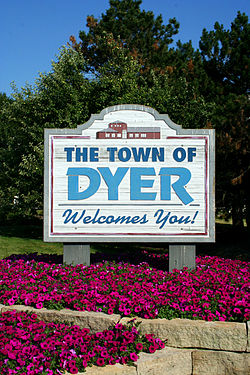
m changed skyline photo to a more relevant picture |
||
| Line 5: | Line 5: | ||
|motto = Striving Higher in Dyer |
|motto = Striving Higher in Dyer |
||
|website = http://www.townofdyer.com/ |
|website = http://www.townofdyer.com/ |
||
|image_skyline = |
|image_skyline = DyerIN.jpg|thumb|center |
||
|imagesize = |
|imagesize = |
||
|image_caption = |
|image_caption = |
||
Revision as of 00:17, 2 April 2008
Town of Dyer, Indiana | |
|---|---|
 | |
| Motto: Striving Higher in Dyer | |
 Location in the state of Indiana | |
| Country | United States |
| State | Indiana |
| County | Lake |
| Township | St. John |
| Settled[1] | 1838 |
| Incorporated | 1910 |
| Government | |
| • Type | Town |
| • Town Manager | Joseph Neeb |
| Area | |
| • Total | 6.0 sq mi (15.4 km2) |
| • Land | 6.0 sq mi (15.4 km2) |
| • Water | 0.0 sq mi (0 km2) |
| Elevation | 640 ft (195 m) |
| Population (2000) | |
| • Total | 13,895 |
| • Density | 2,331/sq mi (900.1/km2) |
| Time zone | UTC-6 (CST) |
| • Summer (DST) | UTC-5 (CDT) |
| ZIP code | 46311 |
| Area code | 219 |
| FIPS code | 18-19270Template:GR |
| GNIS feature ID | 0433824Template:GR |
| Website | http://www.townofdyer.com/ |
Dyer is a town in St. John Township, Lake County, Indiana, United States. The population was 13,895 at the 2000 census.
Geography
Dyer is located at 41°30′1″N 87°30′44″W / 41.50028°N 87.51222°WInvalid arguments have been passed to the {{#coordinates:}} function (41.500218, -87.512161)Template:GR.
Dyer borders Munster to the north, Schererville to the east, and Lynwood, Illinois to the west. The Illinois state line comprises Dyer's entire western border.
According to the United States Census Bureau, the town has a total area of 6.0 square miles (15.4 km²), all of it land. Dyer is built on mostly flat land with an exception being the steep sand ridge south of US Highway 30. This is the Glenwood Shoreline.
Demographics

As of the censusTemplate:GR of 2000, there were 13,895 people, 4,805 households, and 3,863 families residing in the town. The population density was 2,331.3 people per square mile (900.1/km²). There were 4,900 housing units at an average density of 822.1/sq mi (317.4/km²). The racial makeup of the town was 95.42% White, 0.65% African American, 0.14% Native American, 1.60% Asian, 0.04% Pacific Islander, 1.26% from other races, and 0.90% from two or more races. Hispanic or Latino of any race were 5.01% of the population.
There were 4,805 households out of which 38.5% had children under the age of 18 living with them, 70.6% were married couples living together, 7.2% had a female householder with no husband present, and 19.6% were non-families. 16.4% of all households were made up of individuals and 6.1% had someone living alone who was 65 years of age or older. The average household size was 2.82 and the average family size was 3.19.
In the town the population was spread out with 26.1% under the age of 18, 7.7% from 18 to 24, 28.2% from 25 to 44, 25.9% from 45 to 64, and 12.1% who were 65 years of age or older. The median age was 38 years. For every 100 females there were 95.0 males. For every 100 females age 18 and over, there were 90.5 males. The median income for a household in the town was $63,045, and the median income for a family was $68,716. Males had a median income of $51,604 versus $32,427 for females. The per capita income for the town was $27,390. About 2.5% of families and 3.4% of the population were below the poverty line, including 3.9% of those under age 18 and 3.0% of those age 65 or over.
Rail Transportation
Amtrak, the national passenger rail system, provides service to Dyer.
Amtrak Train 51, the westbound Cardinal, is scheduled to depart Dyer at 9:03am on Monday, Thursday, and Saturday; Amtrak Train 851, the westbound Hoosier State, is scheduled to depart Dyer at 9:03am on Sunday, Tuesday, Wednesday, and Friday. Both trains go to Chicago Union Station to connect with other trains.
Amtrak Train 50, the eastbound Cardinal, is scheduled to depart Dyer at 8:57pm on Tuesday, Thursday, and Saturday with service to Rensselaer, Lafayette, Crawfordsville, Indianapolis, Connersville, Cincinnati, Maysville, South Portsmouth, Ashland, Huntington, Charleston, Montgomery, Thurmond, Prince, Hinton, Alderson, White Sulphur Springs, Clifton Forge, Staunton, Charlottesville, Culpeper, Manassas, Alexandria, and Washington, DC and continuing on to New York City.
Amtrak Train 850, the eastbound Hoosier State, is scheduled to depart Dyer at 8:57pm on Sunday, Monday, Wednesday, and Friday with service to Rensselaer, Lafayette, Crawfordsville, and Indianapolis.
Other
Dyer was named as one of the "100 Best Places to Live in the US" by CNN and Money Magazine in 2005. It was one of two Indiana municipalities to earn this distinction (the other being Fishers outside Indianapolis).
A 1.3 mile stretch of US Highway 30 between Dyer and Schererville was considered the Lincoln Highway's "Ideal Section" when it was constructed in the early 1920s. It remains in use to this day.

