Woodhaven, Michigan: Difference between revisions
→Geography: mostly units |
→External links: Added Metro Detroit portal tag |
||
| Line 89: | Line 89: | ||
==External links== |
==External links== |
||
{{Portal|Metro Detroit}} |
|||
* [http://www.woodhavenmi.org/ City of Woodhaven official website] |
* [http://www.woodhavenmi.org/ City of Woodhaven official website] |
||
Revision as of 13:15, 24 August 2011
Woodhaven, Michigan | |
|---|---|
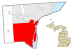
 Location in Wayne County and the state of Michigan | |
| Country | United States |
| State | Michigan |
| County | Wayne |
| Government | |
| • Mayor | Patricia Odette |
| Area | |
| • Total | 6.5 sq mi (16.8 km2) |
| • Land | 6.5 sq mi (16.8 km2) |
| • Water | 0.0 sq mi (0.0 km2) |
| Elevation | 604 ft (184 m) |
| Population (2000) | |
| • Total | 12,530 |
| • Density | 1,936.6/sq mi (747.7/km2) |
| Time zone | UTC-5 (EST) |
| • Summer (DST) | UTC-4 (EDT) |
| ZIP code | 48183, 48134 |
| Area code | 734 |
| FIPS code | 26-88380Template:GR |
| GNIS feature ID | 1616746Template:GR |
Woodhaven is a city in Wayne County in the U.S. state of Michigan. As of the 2000 census, the city population was 12,530. It is part of a collection of 18 suburban communities known as Downriver.
History
Woodhaven was initially incorporated as a village in 1961, and was named after Woodhaven, a village in the Borough of Queens, New York City. It was later incorporated as a city on December 7, 1965.
Woodhaven remains well known as home to the Ford Stamping Plant.
Geography
According to the United States Census Bureau, the city has a total area of 6.5 square miles (16.8 km²), all land.
The city is bounded to the north and west by Brownstown, to the southwest by Flat Rock, to the south by Brownstown, and to the east by Trenton. Woodhaven has two zip codes one is 48183 is the majority of the city; this zipcode also includes Trenton and portions of Brownstown Township. The other zip code is 48134 and includes a small portion of the Southwest corner of the city, Woodhaven shares this zip code with Flat Rock.
Government
The 2009 Mayoral election was be between city administrator David Flaten, who was endorsed by longtime outgoing mayor Karen Mazo, and councilwoman Patty Odette, who had endorsements from The News-Herald(a Downriver newspaper) and labor unions.[1] Odette won by nearly a 2-1 margin(1,475-751) on Tuesday, November 3, 2009.[2] In an unusual show of support, during the swearing in ceremony for Odette, 20 Woodhaven police officers attended.[3]
Demographics
| Census | Pop. | Note | %± |
|---|---|---|---|
| 2000 | 12,530 | — | |
| 2010 | 12,875 | 2.8% |
As of 2010 Woodhaven had a population of 12,875. The median age was 40.3. The racial and ethnic composition of the population was 85.2% non-Hispanic white, 5.3% black or African American, 0.3% Native American, 0.6% Asian Indian, 1.7% other Asian, 0.1% non-Hispanic reporting some other race, 1.9% from two or more races and 5.5% Hispanic or Latino.[4]
As of the censusTemplate:GR of 2000, there were 12,530 people, 4,708 households, and 3,436 families residing in the city. The population density was 1,936.6 per square mile (747.7/km²). There were 4,850 housing units at an average density of 749.6 per square mile (289.4/km²). The racial makeup of the city was 93.22% White, 2.33% African American, 0.49% Native American, 1.64% Asian, 0.02% Pacific Islander, 0.84% from other races, and 1.48% from two or more races. Hispanic or Latino of any race were 3.46% of the population.
There were 4,708 households out of which 35.0% had children under the age of 18 living with them, 60.3% were married couples living together, 9.4% had a female householder with no husband present, and 27.0% were non-families. 22.5% of all households were made up of individuals and 3.9% had someone living alone who was 65 years of age or older. The average household size was 2.63 and the average family size was 3.11.

In the city the population was spread out with 24.6% under the age of 18, 10.0% from 18 to 24, 30.0% from 25 to 44, 28.5% from 45 to 64, and 7.0% who were 65 years of age or older. The median age was 36 years. For every 100 females there were 97.0 males. For every 100 females age 18 and over, there were 94.2 males.
The median income for a household in the city was $64,954, and the median income for a family was $75,813. Males had a median income of $52,584 versus $32,742 for females. The per capita income for the city was $27,759. About 1.5% of families and 3.3% of the population were below the poverty line, including 2.8% of those under age 18 and 3.2% of those age 65 or over.
References
- ^ http://www.thenewsherald.com/articles/2009/11/03/opinion/doc4ae749fcb002b060667810.txt Our picks for Downriver mayors
- ^ http://www.thenewsherald.com/articles/2010/01/12/news/doc4b4cde899b203349437530.txt Political landscape drastically changes
- ^ http://www.thenewsherald.com/articles/2009/12/05/news/doc4b1aa4f25b3e1398276289.txt New mayor appoints city administrator, interim police chief
- ^ 2010 profile of general population and housing characteristics for Woodhaven


