
Cloverdale, Illinois
Cloverdale, Illinois | |
|---|---|
 Cloverdale, Illinois  Cloverdale, Illinois | |
| Coordinates: 41°56′22″N 88°07′13″W / 41.93944°N 88.12028°W | |
| Country | United States |
| State | Illinois |
| County | DuPage |
| Township | Bloomingdale |
| Elevation | 768 ft (234 m) |
| Time zone | UTC-6 (Central (CST)) |
| • Summer (DST) | UTC-5 (CDT) |
| ZIP code | 60103 |
| Area code(s) | 630 & 331 |
| GNIS feature ID | 421755[1] |
Cloverdale is an unincorporated community in Bloomingdale Township, DuPage County, Illinois, United States. Cloverdale is located near Old Gary Avenue and Army Trail Road, near Bloomingdale.
History
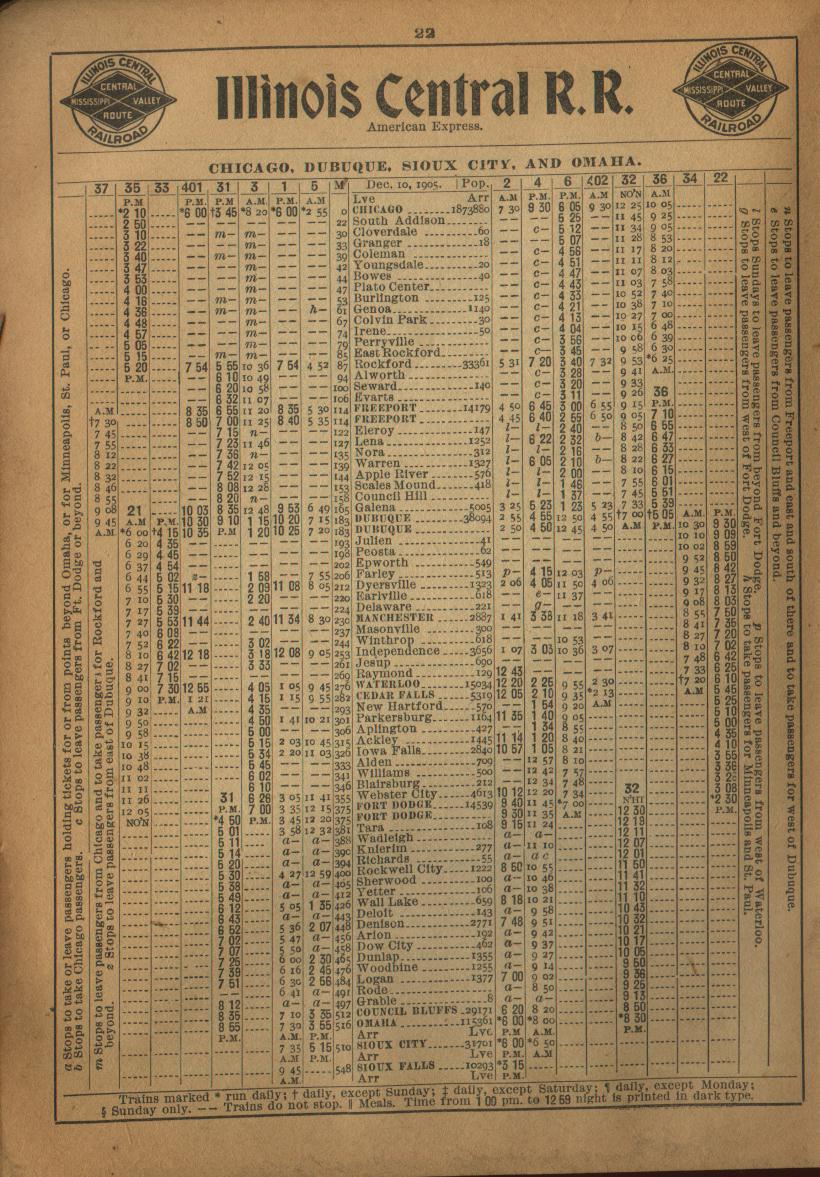
[edit]From the late 1880s, Cloverdale was a milk stop on the Illinois Central Gulf railroad,[2] and during the early 1900s, it was a stop on the Chicago, Dubuque, Sioux City and Omaha line of the Illinois Central Railroad.[3]
References
[edit]- ^ U.S. Geological Survey Geographic Names Information System: Cloverdale, Illinois
- ^ Crisler, Amy E. "Glendale Heights". History of DuPage County. Archived from the original on December 21, 2011. Retrieved December 6, 2013.
- ^ "Railway Guide-IC, YMV Schedules". Illinois-Central.net. Thomas S. Parker & individual contributors. March 1906. Retrieved December 6, 2013.
Municipalities and communities of DuPage County, Illinois, United States | ||
|---|---|---|
| Cities |  | |
| Villages |
| |
| Townships | ||
| Unincorporated communities | ||
| Ghost towns/Neighborhoods | ||
| Footnotes | ‡This populated place also has portions in an adjacent county or counties | |
This DuPage County, Illinois location article is a stub. You can help Wikipedia by expanding it. |