Nusa Dua

Lua error in Module:Location_map at line 526: Unable to find the specified location map definition: "Module:Location map/data/Bali Topography" does not exist.
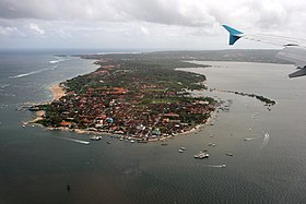
Nusa Dua is known as an enclave of large international 5-star resorts in south-eastern Bali. It is located 40 kilometres from Denpasar, the provincial capital of Bali, and administered under Kuta South District. Nusa Dua means second island.
Tanjung Benoa
Immediately north of Nusa Dua enclave is the peninsula of Tanjung Benoa that includes less exclusive hotels and Benoa village. A multi-denominational area, it includes a mosque, and Chinese and Hindu temples in close proximity. Much of the beach's sand was eroded away following the mining of the nearby barrier reef for construction materials.
8°48′S 115°13′E / 8.800°S 115.217°E
