Jump to content

Downtown Seattle Transit Tunnel

Coordinates: 47°23′28″N 122°15′58″W / 47.391°N 122.266°W / 47.391; -122.266
From Wikipedia, the free encyclopedia

This is an old revision of this page, as edited by Oranviri (talk | contribs) at 09:05, 2 June 2009 (KC Metro links updated). The present address (URL) is a permanent link to this revision, which may differ significantly from the current revision.

47°23′28″N 122°15′58″W / 47.391°N 122.266°W / 47.391; -122.266

The first Central Link Light Rail trains are test-run in the tunnel.

The Downtown Seattle Transit Tunnel, also referred to as the Metro Bus Tunnel, is a 1.3 miles (2.1 km) public transit tunnel that runs the length of downtown Seattle, from 9th Avenue and Pike Street to 5th Avenue S. and S. Jackson Street. Approved by Metro Transit in 1983, construction began in 1987.[1] It was completed and service began in 1990, at a total cost of $455 million.[1]

The tunnel was closed on September 24, 2005 for modification to accommodate both buses and Sound Transit's Central Link light rail trains on a shared alignment. Prior to closure, around two dozen bus routes ran through the tunnel. The buses were dual-powered, using electricity in the tunnel from an above wire connection and diesel on city streets. It reopened on Monday, September 24, 2007.[2] The two-year closure included retrofits for light rail as well as other operating system upgrades. Also, a stub tunnel, branching from the main tunnel, was constructed under Pine Street between 7th and Boren Avenues to allow light rail trains to stop and reverse direction and for future extension of Central Link.[3]

Due to the conversion to light rail, the dual-mode buses that are powered by the above electric connection can no longer operate in the tunnel. Those buses have already been replaced by Metro's current new fleet of hybrid buses. These buses pollute significantly less than standard diesel buses and require no connection to overhead wires.[4]

Since the floor of the tunnel was lowered for the light rail, there have been concerns that the bus mirrors are now at head height and may strike those who are waiting on the platform. To prevent this, the mirrors are equipped with flashing lights. As well, the speed of the buses has been lowered from 15 miles per hour (24 km/h) to 10 miles per hour (16 km/h).[5]

The tunnel is entirely within the Ride Free Area, so no fare is required on buses at any station during hours when the policy is in effect. Due to a different fare structure, it will be required on Link Light Rail trains when revenue service begins.

Service

The Downtown Seattle Transit Tunnel currently serves the following bus routes during tunnel operating hours: King County Metro 41 (Northgate, Lake City), 71 (U-District, Wedgwood), 72 (U-District, Lake City), 73 (U-District, Jackson Park), 74 Express (U-District, Sand Point), 101 (Renton), 106 (Rainier Beach, Renton), 150 (Southcenter, Kent), 174 (Sea-Tac, Federal Way), 194 (Sea-Tac, Federal Way), 212 (Eastgate), 217 mornings only (Eastgate, N Issaquah), 225 (Eastgate, Crossroads, Overlake), 229 (Eastgate, Phantom Lake, Overlake), 255 (Kirkland, Brickyard P&R), 256 (S Kirkland, Overlake), and Sound Transit Express 550 (Bellevue).

In timing with King County Metro's summer service change on May 30, 2009, the tunnel hours expanded in preparation for the opening of Central Link. The hours when buses run in the tunnel expanded to Monday through Saturday, 5:00 am to 1:00 am, and Sunday, 6:00 am to 12:00 midnight. From the summer service change until the opening of Link Light Rail, scheduled for July 18, 2009, light rail vehicles are tested in the tunnel in non-revenue service.

Route

The north portal is located near 9th Avenue and Olive Way, with dual entry/exit ramps onto the Interstate 5 express lanes. From this point, the tunnel runs southwest-northeast under Pine Street, then turns left and runs northwest-southeast under 3rd Avenue for most of its length. The tunnel passes four feet below the Great Northern Tunnel.[6] The south portal of the tunnel is located near 4th Avenue and Royal Brougham Way, where buses have dual entry/exit onto the Interstate 90 express lanes, or the SoDo E-3 Busway. At the south portal, the light rail tracks split from the shared alignment onto their own right-of-way, which runs parallel to the SoDo Busway until just south of Lander Street.

Stations

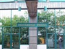
The Downtown Seattle Transit Tunnel has five stations. They are, from north to south:[7]

  • Convention Place Station
    Convention Place Station, 9th Avenue and Pine Street
For Washington State Convention and Trade Center, Paramount Theatre, Greyhound Lines terminal, Federal Courthouse. Transfer to surface bus or cross Interstate 5 to Capitol Hill. Bus routes from south of the tunnel have their terminus and layover here. This station is a future transit-oriented development site.[8]
  • Westlake Station platform
    Westlake Station, Pine Street between 3rd and 6th Avenues
For Westlake Center, Seattle Center Monorail, South Lake Union Streetcar, Nordstrom, Macy's, Pike Place Market. Transfer to surface buses toward Belltown, Queen Anne Hill, Magnolia, Fremont, Shoreline, Green Lake, and Redmond.
Transit information and passes can be obtained from the Metro Customer Stop on the mezzanine level.
This will be the northern terminus of the Central Link light rail.
At this point, the tunnel makes a left, and follows Third Avenue.
For Benaroya Hall, Seattle Art Museum, Seattle Central Library, Main Post Office, Washington Mutual Tower. Transfer to surface buses toward First Hill
For Pioneer Square, King County Courthouse, King County and City of Seattle government offices, King County Jail, Washington State Ferries Colman Dock
For International District, King Street Station, Uwajimaya, Waterfront Streetcar, Metro and Sound Transit offices. Transfer to surface buses toward Rainier Valley, Beacon Hill, Industrial District, SoDo, and the Eastside. Bus routes from north of the tunnel have their terminus and layover here.

Public Art

Each station features unique art and architecture representing the neighborhood it serves.

See also

References

  1. ^ a b Crowley, Walt (2000-10-01). "Metro transit begins excavating downtown Seattle transit tunnel on March 6, 1987". HistoryLink.org. Retrieved 2009-05-30.
  2. ^ "Seattle bus tunnel set to reopen". KOMO News. 2007-09-18. Retrieved 2009-05-30. {{cite web}}: Cite has empty unknown parameter: |1= (help)
  3. ^ "Pine Street Stub Tunnel". Sound Transit. Retrieved 2009-05-30. {{cite web}}: Cite has empty unknown parameter: |1= (help)
  4. ^ "Downtown Seattle Transit Tunnel and Changing Bus Technology". King County Metro. 2007-12-14. Retrieved 2009-05-30.
  5. ^ Brown, Charles E. (2007-09-28). "The Bumper Connection: Tunnel Vision". The Seattle Times. Retrieved 2009-05-30.
  6. ^ "Pioneer Square Station-the Pioneering Spirit". King County Metro. 2008-03-15. Retrieved 2009-05-30. {{cite web}}: Cite has empty unknown parameter: |1= (help)
  7. ^ "Metro Bus Tunnel Stations". King County Metro. 2008-07-18. Retrieved 2009-05-30.
  8. ^ "TOD projects and sites in King County". King County Department of Transportation. 2007-11-19. Retrieved 2009-05-30.