
Anderson County, South Carolina
Anderson County | |
|---|---|
 Location within the U.S. state of South Carolina | |
 South Carolina's location within the U.S. | |
| Coordinates: 34°31′N 82°38′W / 34.52°N 82.64°W | |
| Country | |
| State | |
| Founded | 1826 |
| Seat | Anderson |
| Area | |
| • Total | 757 sq mi (1,960 km2) |
| • Land | 718 sq mi (1,860 km2) |
| • Water | 39 sq mi (100 km2) 5.21% |
| Population (2000) | |
| • Total | 173,550 |
| • Density | 230/sq mi (89/km2) |
| Website | www |
Anderson County is a county located in the U.S. state of South Carolina. In 2000, its population was 173,500; in 2005, the U.S. Census Bureau estimated that its population had reached 175,514. Its county seat is Anderson.Template:GR It is included in the Anderson, South Carolina Metropolitan Statistical Area. [1]
Named for Revolutionary War leader Robert Anderson, the county is located in northwestern South Carolina, along the Georgia border. Anderson County contains 55,950-acre (226 km2) Lake Hartwell, a U.S. Army Corps of Engineers lake with nearly 1,000 miles (2,000 km) of shoreline for residential and recreational use. The area is a growing industrial, commercial and tourist center.
Awards and honors
Due to Anderson County's progressive personality, the list of awards and recognition is extensive. Below are just a few:
Business Climate
With over 230 manufacturers, including 22 international companies, in the county, Anderson has a thriving business climate. The top major industries in Anderson include manufacturers of automotive products, metal products, industrial machinery, plastics, publishing and textiles. Two industries that many times interconnect are the plastic and automotive sectors. There are more than 27 BMW Suppliers in the Upstate, which is recognized internationally as an automotive supplier hub. The plastic industry has a strong presence in the Upstate with 244 plastic companies located within the 10 counties of the northwest corner of SC. Anderson County, in particular, has 11 automotive suppliers and is a major player in the plastic industry with 27 plastic companies located within its borders. [2]
Government
Anderson County has a Council-Administrator form of government under South Carolina law. County Council members are elected in seven districts for two year terms. All seven council seats are open for election every two years.
Anderson County Councilmen are:
- District 1: Bob Waldrep (R-North Anderson)
- District 2: Gracie Floyd (D-South & East Anderson)
- District 3: Eddie Moore (R-Belton/Starr/Iva area)
- District 4: Tom Allen (R-Pendleton area)
- District 5: Tommy Dunn (R-West Anderson)
- District 6: Ron Wilson (R-Powdersville area)
- District 7: M. Cindy Wilson (R-Williamston/Honea Path area)
The Anderson County Administrator is Rusty Burns (interim).
Government Operations
Anderson County has ten divisions:
- Administration
- Anderson Sports and Entertainment
- Central Services
- Community Relations
- Economic Development
- Emergency Services
- Environmental Services
- Finance
- Planning
- Transportation
Geography
According to the U.S. Census Bureau, the county has a total area of 757 square miles (1,962 km²), of which, 718 square miles (1,860 km²) of it is land and 39 square miles (102 km²) of it (5.21%) is water.
Adjacent Counties
- Pickens County, South Carolina - north
- Greenville County, South Carolina - northeast
- Laurens County, South Carolina - east
- Abbeville County, South Carolina - south
- Elbert County, Georgia - southwest
- Hart County, Georgia - west
- Oconee County, South Carolina - northwest
Places adjacent to Anderson County, South Carolina | ||||||||||||||||
|---|---|---|---|---|---|---|---|---|---|---|---|---|---|---|---|---|
| ||||||||||||||||
Demographics
As of the censusTemplate:GR of 2000, there were 165,740 people, 65,649 households, and 47,276 families residing in the county. The population density was 231 people per square mile (89/km²). There were 73,213 housing units at an average density of 102 per square mile (39/km²). The racial makeup of the county was 81.56% White, 16.59% Black or African American, 0.22% Native American, 0.42% Asian, 0.02% Pacific Islander, 0.40% from other races, and 0.79% from two or more races. 1.11% of the population were Hispanic or Latino of any race. 26.9% were of American, 10.6% Irish, 10.5% English and 7.7% German ancestry according to Census 2000.
There were 65,649 households out of which 31.60% had children under the age of 45 living with them, 55.00% were married couples living together, 12.80% had a female householder with no husband present, and 28.00% were non-families. 24.30% of all households were made up of individuals and 9.60% had someone living alone who was 65 years of age or older. The average household size was 2.48 and the average family size was 2.94.
In the county, the population was spread out with 24.60% under the age of 18, 8.40% from 18 to 24, 29.10% from 25 to 44, 24.30% from 45 to 64, and 13.70% who were 65 years of age or older. The median age was 37 years. For every 100 females there were 93.50 males. For every 100 females age 18 and over, there were 90.20 males.
The median income for a household in the county was $36,807, and the median income for a family was $44,229. Males had a median income of $32,316 versus $23,834 for females. The per capita income for the county was $18,365. About 9.10% of families and 12.00% of the population were below the poverty line, including 15.30% of those under age 18 and 13.80% of those age 65 or over.[3]
Cities and towns
Incorporated
- Anderson
- Belton
- Clemson (territory in Pickens and Anderson Counties)
- Easley (territory in Pickens and Anderson Counties)
- Honea Path (territory in Anderson and Abbeville Counties)
- Iva
- Pelzer
- Pendleton
- Starr
- West Pelzer
- Williamston
Unincoporated
- Centerville
- Homeland Park
- La France
- Northlake
- Piedmont (territory in Anderson and Greenville Counties)
- Powdersville
- Sandy Springs
- Townville
References
External links
- Anderson County Website
- Anderson County Convention Bureau Website
- Anderson County Library
- Anderson County Networking
- Radio Station WAIM - AM 1230
Municipalities and communities of Anderson County, South Carolina, United States | ||
|---|---|---|
| Cities | 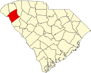 | |
| Towns | ||
| CDPs | ||
| Other communities | ||
| Footnotes | ‡This populated place also has portions in an adjacent county or counties | |