
Sagadahoc County, Maine
Sagadahoc County | |
|---|---|
 Seal | |
 Location within the U.S. state of Maine | |
 Maine's location within the U.S. | |
| Coordinates: 43°56′58″N 69°51′26″W / 43.949341°N 69.8573°W | |
| Country | |
| State | |
| Founded | February 14, 1854 |
| Seat | Bath |
| Area | |
| • Total | 370.19 sq mi (958.8 km2) |
| • Land | 253.90 sq mi (657.6 km2) |
| • Water | 116.29 sq mi (301.2 km2) 31.41% |
| Population (2010) | |
| • Total | 35,293 |
| • Density | 138.9/sq mi (53.63/km2) |
| Website | www |
Sagadahoc County (/[invalid input: 'icon']ˈsæɡədəˌhɒk/ SAG-ə-də-hok) is a county located in the U.S. state of Maine. As of 2010, the population was 35,293. Its county seat is Bath.Template:GR In total area, it is the smallest county in Maine.
Sagadahoc County is part of the Portland–South Portland–Biddeford, Maine Metropolitan Statistical Area.
Geography
According to the 2000 census, the county has a total area of 370.19 square miles (958.8 km2), the smallest county in Maine, of which 253.90 square miles (657.6 km2) (or 68.59%) is land and 116.29 square miles (301.2 km2) (or 31.41%) is water.[1]
Adjacent counties
- Kennebec County, Maine - north
- Lincoln County, Maine - east
- Cumberland County, Maine - west
- Androscoggin County, Maine - northwest
National protected area
History
Exploration and settlement
Sagadahoc County was initially part of York and, later, Lincoln County before being set off and incorporated in 1854. Samuel de Champlain led the first known visit of Europeans to the region. In 1607, the English Popham Colony was established in what is now Phippsburgh; it was abandoned a year later, but English fishermen and trappers continued to visit the area. John Smith explored the region in 1614 and reported back to King Charles I, who named the Sagadahoc area "Leethe."[2]
When the Plymouth Council for New England was dissolved in 1635, 10,000 acres (40 km2) on the east side of the Kennebec River were divided up and granted to private owners. Over the years, these proprietors extended their claims through additional land grants, purchases from Native Americans, and exploitation of the often poorly defined boundaries of their lands. By 1660, Englishmen held the titles to the whole of what is now Sagadahoc County.[2]
When King Philip’s War broke out in 1675, the plundering of one house was the only hostile act in Sagadahoc County until August, 1676, at which point three settlements were attacked and 53 people taken captive by Native Americans. The region was almost totally abandoned by settlers, and no permanent settlement was established until 1715, when Arrowsic and Brunswick were founded. Scotch-Irish Presbyterians began immigrating to the region in increasingly large numbers, though occasional violence persisted until 1759, when the French and Indian Wars ended in Maine.[2]
Later conflicts
There were no significant conflicts in Sagadahoc during the American Revolutionary War, despite fear of attack from British cruisers. Two British armed vessels sailed up the Kennebec River toward Bath, but turned back after being attacked. In the War of 1812, the capture of HMS Boxer occurred nearby. During the Civil War the county furnished to the Union forces 2,488 men.[2]
Nineteenth century
Steam power was first used on the Kennebec as early as 1818 for propelling boats. What became the Bath branch of the Maine Central Railroad was completed in 1849; and the Knox and Lincoln Railroad was opened in 1871. The first newspaper was published in the county in 1820.
Sagadahoc County was set off from Lincoln and incorporated in 1854, with Bath as the county seat. Its valuation in 1870 was $11,041,340. In 1880 it was $10,297,215. The polls in 1870 numbered 4,669, and in 1880, 5,182. The population in 1870 was 18,803. In 1880 it was 19,276.[2]
From 1880 to 2000, the county's population nearly doubled to 35,214.[3]
Demographics
| Census | Pop. | Note | %± |
|---|---|---|---|
| 1860 | 21,790 | — | |
| 1870 | 18,803 | −13.7% | |
| 1880 | 19,272 | 2.5% | |
| 1890 | 19,452 | 0.9% | |
| 1900 | 20,330 | 4.5% | |
| 1910 | 18,574 | −8.6% | |
| 1920 | 23,021 | 23.9% | |
| 1930 | 16,927 | −26.5% | |
| 1940 | 19,123 | 13.0% | |
| 1950 | 20,911 | 9.3% | |
| 1960 | 22,793 | 9.0% | |
| 1970 | 23,452 | 2.9% | |
| 1980 | 28,795 | 22.8% | |
| 1990 | 33,535 | 16.5% | |
| 2000 | 35,214 | 5.0% | |
| 2010 | 35,293 | 0.2% | |
| [4][5][6] | |||
As of the censusTemplate:GR of 2000,[7] there were 35,214 people, 14,117 households, and 9,641 families residing in the county. The population density was 139 people per square mile (54/km²). There were 16,489 housing units at an average density of 65 per square mile (25/km²). The racial makeup of the county was 96.49% White, 0.92% Black or African American, 0.31% Native American, 0.63% Asian, 0.06% Pacific Islander, 0.38% from other races, and 1.21% from two or more races. 1.11% of the population were Hispanic or Latino of any race.
There were 14,117 households out of which 33.20% had children under the age of 18 living with them, 54.60% were married couples living together, 9.60% had a female householder with no husband present, and 31.70% were non-families. 25.20% of all households were made up of individuals and 9.30% had someone living alone who was 65 years of age or older. The average household size was 2.47 and the average family size was 2.96.
In the county the population was spread out with 25.80% under the age of 18, 6.60% from 18 to 24, 30.50% from 25 to 44, 24.90% from 45 to 64, and 12.30% who were 65 years of age or older. The median age was 38 years. For every 100 females there were 96.30 males. For every 100 females age 18 and over, there were 93.10 males.
The median income for a household in the county was $41,908, and the median income for a family was $49,714. Males had a median income of $34,039 versus $24,689 for females. The per capita income for the county was $20,378. About 6.90% of families and 8.60% of the population were below the poverty line, including 12.20% of those under age 18 and 6.40% of those age 65 or over.
22.0% were of English, 11.6% Irish, 11.1% French, 10.6% United States or American, 8.0% French Canadian and 7.3% German ancestry according to Census 2000. 96.1% spoke English and 2.2% French as their first language.
Politics
| Year | Democrat | Republican |
|---|---|---|
| 2008 | 57.1% 12,152 | 40.9% 8,721 |
| 2004 | 52.7% 11,107 | 45.1% 9,497 |
| 2000 | 48.1% 8,844 | 43.8% 8,052 |
Cities and towns
Territories and locations
- Perkins Township (Swan Island) - a ghost town originally incorporated as the town of Perkins.
See also
References
- ^ "Census 2000 U.S. Gazetteer Files: Counties". United States Census. Retrieved 2011-02-13.
- ^ a b c d e Varney, George Jones (1881). "History of Sagadahoc County, Maine". A Gazetteer of the State of Maine. B. B. Russell. ISBN 1-55613-454-1, 978-1556134548. Retrieved 15 August 2011.
{{cite book}}: Check|isbn=value: invalid character (help) - ^ "U.S. Census Bureau - State & County QuickFacts - Sagadahoc County". Retrieved 2007-08-10.
- ^ http://www.census.gov/population/www/censusdata/cencounts/files/me190090.txt
- ^ http://factfinder2.census.gov/faces/tableservices/jsf/pages/productview.xhtml?pid=DEC_10_PL_QTPL&prodType=table
- ^ http://mapserver.lib.virginia.edu/
- ^ "State & County "QuickFacts": Sagadahoc County". U.S. Census Bureau. Retrieved 2007-05-13.
- ^ "Dave Leip's Atlas of U.S. Presidential Elections". Retrieved 2011-06-11.
External links
Places adjacent to Sagadahoc County, Maine | ||||||||||||||||
|---|---|---|---|---|---|---|---|---|---|---|---|---|---|---|---|---|
| ||||||||||||||||
Municipalities and communities of Sagadahoc County, Maine, United States | ||
|---|---|---|
| City | 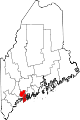 | |
| Towns | ||
| Unorganized territory | ||
| CDPs | ||
| Other villages | ||