
Khmelnytskyi
This article has multiple issues. Please help improve it or discuss these issues on the talk page. (Learn how and when to remove these messages)
|
You can help expand this article with text translated from the corresponding article in Ukrainian. (August 2013) Click [show] for important translation instructions.
|
Khmelnytskyi
Хмельницький Template:Uk icon | |
|---|---|
 vulytsia Proskurivska in Khmelnytskyi | |
 Flag  Coat of arms | |
| Country | |
| Province | |
| City council | |
| First mentioned | 1431 |
| City rights | September 22, 1937 |
| Government | |
| • City Head | Serhiy Melnyk |
| Area | |
| • Total | 90 km2 (30 sq mi) |
| Population (2005) | |
| • Total | 290,100 |
| • Density | 2,822/km2 (7,310/sq mi) |
| Postal code | 29000 |
| Area code | +380 382 |
| Website | http://www.khmelnytsky.com |
Khmelnytskyi (Ukrainian: Хмельни́цький, Khmel'nyts'ky)[1] (until 1954, Proskuriv, Ukrainian: Проскурів) is a city in near west, central Ukraine, the administrative center for the Khmelnytskyi Oblast (province) and the Khmelnytskyi Raion. Khmelnytskyi is located in the historic region of Podolia (Podillia) on the banks of the Buh River.
In 2009, the city's population was 290,100. The city received its current local government designation in 1941.
History
This section needs expansion. You can help by adding to it. (August 2013) |
The city foundation date is uncertain. Since 1431 it was known as Ploskyriv or Ploskyrivtsi (Плоскирів or Плоскирівці), and later came to be called Proskuriv (Проскурів), but in 1954 was the city was finally renamed Khmelnytskyi (Хмельницький) in the honor of the 300th anniversary of a treaty negotiated by Bohdan Khmelnytsky. The city was occupied by the German Army from July 8, 1941 to March 25, 1944.
Pogroms
A series of pogroms have been carried out in the region, known as the Proskurov pogrom. One of the more substantial pogroms occurred during the Schwartzbard mistrial after which Petliura's assassin was pardoned on the grounds of self-trail (revenge). According to Vinnytsia's city archives the pogrom was conducted on the Friday night of February 15, 1919 by one of the otamans (generals) of the Ukrainian People's Army Otaman Semysenko. In total 390 men, 309 women and 76 children were killed, and 500 individuals were wounded. The chief Otaman Petliura was appointed the head of state just two days prior to the tragedy on February the 13th. Petliura issued the Order 131 in which he mentioned the fact that numerous Jewish parties in Ukraine (Bund, Poale Zion, Folks-Partei, Unificationists) rose to the sovereignty of the Ukrainian Republic and were cooperating with the Ukrainian government, and he condemned such actions calling those initiators deserters, enemies of the State that must be liquidated. The order was co-signed by the Chief of staff otaman Yunakiv. The order was published in the Ukraina newspaper on February 20 (March 4, old style). Later, Petliura issued a special order to execute Semysenko as the pogrom-initiator, which was had been carried out on March 20, 1920.[2] [verification needed]
Cold War-time military base
The Khmelnytskyi was home, during the Cold War, to the 19th Division of the 43rd Rocket Army of the Soviet Strategic Rocket Forces.[3] The intercontinental ballistic missile silos of the division that were housed there were removed and destroyed, partially with U.S. Cooperative Threat Reduction funding, during the 1990s.
Geography and natural resources

Khmelnytskyi is the regional center of the Khmelnytskyi region which is located in the western part of Ukraine in the middle of Podillia, its total area makes up 8,624 ha (21,310 acres). Khmelnytskyi has a favorable geographical position. Khmelnytskyi is crossed by one of the longest rivers of Ukraine – the Southern Bug. Coincidentally, through the western portion of the city flows small river Ploska.
The climate of Khmelnytskyi is moderately continental. The average temperature of Khmelnytskyi in its warmest month (July) is 20 to 22 °C (68 to 72 °F), and the average temperature in the coldest month (January) is −5 to −6 °C (23 to 21 °F). The maximum temperatures in the summer on average reaches 36 to 38 °C (97 to 100 °F), and the minimum temperatures in the winter on average is −24 to −30 °C (−11 to −22 °F). Khmelnytskyi's average annual temperature is 7 to 8 °C (45 to 46 °F). Khmelnytskyi's average annual precipitation is 510 to 580 mm (20.08 to 22.83 in).
The most abundant make up for the ground in Khmelnytskyi are layers of the following overburden: loess and loess-type rocks. The ground-climatic conditions of Khmelnytskyi are favorable for the cultivation of winter wheat and rye, sugar beet, potato and other crops. Khmelnytskyi is also ideal for the development of gardening and vegetable growing. In the territory of Khmelnytskyi there are the vegetations of two geobotanical zones of Ukraine: Polissya and forest-steppe. Khmelnytskyi and its greater region supplies many rock products, particularly building materials such as: limestone, plaster, chalk, tripoli powder, crystal layers (granites, gneisses), sand, sandstones, and also graphite, saponite, kaolin, phosphorite, lithographic stone and roofing slate. There are also deposits of peat, bitumen, shale and oil.
| Climate data for Khmelnytskyi (1955-2011) | |||||||||||||
|---|---|---|---|---|---|---|---|---|---|---|---|---|---|
| Month | Jan | Feb | Mar | Apr | May | Jun | Jul | Aug | Sep | Oct | Nov | Dec | Year |
| Record high °C (°F) | 12.0 (53.6) |
17.1 (62.8) |
23.0 (73.4) |
26.5 (79.7) |
31.7 (89.1) |
33.9 (93.0) |
35.5 (95.9) |
34.0 (93.2) |
30.4 (86.7) |
26.6 (79.9) |
20.0 (68.0) |
12.8 (55.0) |
35.5 (95.9) |
| Mean daily maximum °C (°F) | −2.1 (28.2) |
−0.6 (30.9) |
4.6 (40.3) |
12.9 (55.2) |
19.3 (66.7) |
22.2 (72.0) |
23.9 (75.0) |
23.3 (73.9) |
18.5 (65.3) |
12.3 (54.1) |
4.8 (40.6) |
−0.5 (31.1) |
11.6 (52.9) |
| Daily mean °C (°F) | −4.5 (23.9) |
−3.5 (25.7) |
0.8 (33.4) |
8.0 (46.4) |
13.9 (57.0) |
17.0 (62.6) |
18.6 (65.5) |
17.8 (64.0) |
13.1 (55.6) |
7.7 (45.9) |
2.0 (35.6) |
−2.7 (27.1) |
7.4 (45.3) |
| Mean daily minimum °C (°F) | −7.4 (18.7) |
−6.5 (20.3) |
−2.7 (27.1) |
3.2 (37.8) |
8.6 (47.5) |
11.8 (53.2) |
13.5 (56.3) |
12.7 (54.9) |
8.4 (47.1) |
3.7 (38.7) |
−0.7 (30.7) |
−5.3 (22.5) |
3.4 (38.1) |
| Record low °C (°F) | −30.5 (−22.9) |
−27.0 (−16.6) |
−23.6 (−10.5) |
−7.2 (19.0) |
−2.8 (27.0) |
2.2 (36.0) |
3.6 (38.5) |
2.1 (35.8) |
−5.0 (23.0) |
−11.4 (11.5) |
−17.8 (0.0) |
−25.4 (−13.7) |
−30.5 (−22.9) |
| Average precipitation mm (inches) | 32.5 (1.28) |
36.4 (1.43) |
30.2 (1.19) |
50.0 (1.97) |
60.6 (2.39) |
94.1 (3.70) |
105.0 (4.13) |
64.4 (2.54) |
58.4 (2.30) |
38.0 (1.50) |
45.5 (1.79) |
41.7 (1.64) |
656.8 (25.86) |
| Average precipitation days | 20.7 | 19.0 | 17.7 | 13.1 | 11.0 | 11.3 | 10.5 | 7.7 | 10.5 | 11.5 | 16.1 | 20.2 | 169.3 |
| Average relative humidity (%) | 87.5 | 85.1 | 78.1 | 65.9 | 65.5 | 71.3 | 74.1 | 72.4 | 75.5 | 80.9 | 88.0 | 88.9 | 77.8 |
| Source: Climatebase.ru[4] | |||||||||||||
Demographics
The average life expectancy of its inhabitants is 65 years for men, and 75 years for women. In 2006 Khmelnytskyi's birth rate continues to grow as 2,593 children were born. Due to Khmelnytskyi's geographical location and natural resources the city has always attracted foreigners, including Turks, Germans, Hungarians, Poles, Lithuanians, Austrians, Swedes and Russians.
Transport
Khmelnytskyi has infrastructure for transportation connections with Moscow, Prague, Bratislava, Warsaw, Budapest, Belgrade and all major Ukrainian cities. The distance from Khmelnytskyi to Kyiv by the railway it is estimated to be 366 km (227 mi), by highway it is estimated to be 384 km (239 mi). The highways Kyiv-Lviv, Odesa-Lviv and Chernivtsi-Kyiv pass through Khmelnytskyi. The city is served by the Khmelnytskyi Ruzhychna Airport. Khmelnytskyi's airport has a 2,200 m (7,217.85 ft) concrete runway; at the airport there is a check point for crossing the state border of Ukraine.
Sports
Khmelnytskyi is home to the competitive football team FC Dynamo Khmelnytskyi.
Points of interest
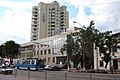
- Proskurivska street, a modern central pedestrian street of the city, preserved buildings of the end of the 19th - the beginnings of 20th century in the styles of modernist, eclecticisms, Baroque, stone (characteristic only for Proskuriv).
- The house of the former Oleksiyivske real school (now it is the building of the City Executive Committee)
- The house of O. Brusilov (now is the House of Ceremonial events)
- The church of Nativity of the Virgin (the first stone construction in the city)
- The Protection cathedral
- Saint-Georgiy church
- Andriy Pervozvannyi church in "Dubovo" district
Famous people from Khmelnytskyi
- Ariel Durant, American author and historian
- Alberto Gerchunoff, Argentine author and journalist
- Anatoly Kashpirovsky, Russian psychotherapist and psychic healer
- Mischa Mischakoff, Russian violinist, teacher, and conductor
- Oleksandr Ponomaryov, Ukrainian singer
- Bohdan Shershun, Ukrainian footballer
- Alexandra Shevchenko, FEMEN activist
- Oksana Shachko, Ukrainian artist and activist with FEMEN
- Natalia Valevskaya, Ukrainian singer
International relations
Twin towns — Sister cities
Khmelnytskyi is twinned with:
 Modesto, United States (1987)
 Silistra, Bulgaria (1992)
 Bor, Serbia (1995)
 Bălți, Moldova (1996)
 Ciechanów, Poland (1996)
 Kramfors, Sweden (1997)
 Shijiazhuang, China (1998)
 Tver, Russia (2007)
Views of Khmelnytskyi
-
 Podilska St, near Trade Center
 -
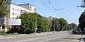 Shevchenko Street - one of the main streets of Khmelnytskyi
 -


.jpg)

References
- ^ The alternative transliterations of the name include Khmel’nyts’kyỹ, Khmel’nyts’kyy, Khmelnitsky, and Khmelnitskiy
- ^ Faina Vinokurova, PhD in historical sciences.
- ^ Feskov, V.I.; Kalashnikov, K.A.; Golikov, V.I. (2004). The Soviet Army in the Years of the Cold War 1945–91. Tomsk: Tomsk University Publishing House. p. 133. ISBN 5-7511-1819-7.
- ^ "Khmelnytskyi, Ukraine Climate Data". Climatebase. Retrieved November 25, 2013.
External links
- khmelnytsky.com - Khmelnytskyi City Rada website
- Photos of Khmelnytskyi
- Khmelnytskyi Sights and Streets