
2019 Pacific typhoon season
| 2019 Pacific typhoon season | |
|---|---|
 Season summary map | |
| Seasonal boundaries | |
| First system formed | December 31, 2018 |
| Last system dissipated | Season ongoing |
| Strongest storm | |
| Name | Wutip and Lekima |
| • Maximum winds | 195 km/h (120 mph) (10-minute sustained) |
| • Lowest pressure | 920 hPa (mbar) |
| Seasonal statistics | |
| Total depressions | 29 |
| Total storms | 15 |
| Typhoons | 5 |
| Super typhoons | 3 (unofficial) |
| Total fatalities | 171 total |
| Total damage | $9.52 billion (2019 USD) |
| Related articles | |
The 2019 Pacific typhoon season is an ongoing event in the annual cycle of tropical cyclone formation, in which tropical cyclones form in the western Pacific Ocean. The season runs throughout 2019, though most tropical cyclones typically develop between May and October. The season's first named storm, Pabuk, reached tropical storm status on January 1, becoming the earliest-forming tropical storm of the western Pacific Ocean on record, breaking the previous record that was held by Typhoon Alice in 1979. The season's first typhoon, Wutip, reached typhoon status on February 20. Wutip further intensified into a super typhoon on February 23, becoming the strongest February typhoon on record,[1] and the strongest tropical cyclone recorded in February in the Northern Hemisphere. Another notable storm, Typhoon Lekima, became the second costliest typhoon in Chinese history, behind Typhoon Fitow of 2013.
The scope of this article is limited to the Pacific Ocean to the north of the equator between 100°E and 180th meridian. Within the northwestern Pacific Ocean, there are two separate agencies that assign names to tropical cyclones which can often result in a cyclone having two names. The Japan Meteorological Agency (JMA) will name a tropical cyclone should it be judged to have 10-minute sustained wind speeds of at least 65 km/h (40 mph) anywhere in the basin, while the Philippine Atmospheric, Geophysical and Astronomical Services Administration (PAGASA) assigns names to tropical cyclones which move into or form as a tropical depression in their area of responsibility located between 135°E–115°E and between 5°N–25°N regardless of whether or not a tropical cyclone has already been given a name by the JMA. Tropical depressions that are monitored by the United States' Joint Typhoon Warning Center (JTWC) are given a number with a "W" suffix.
Seasonal forecasts
| TSR forecasts Date |
Tropical storms |
Total Typhoons |
Intense TCs |
ACE | Ref. |
|---|---|---|---|---|---|
| Average (1965–2018) | 26 | 16 | 9 | 295 | [2] |
| May 7, 2019 | 27 | 17 | 10 | 354 | [2] |
| July 5, 2019 | 25 | 15 | 8 | 260 | [3] |
| August 7, 2019 | 26 | 16 | 8 | 270 | [4] |
| Other forecasts Date |
Forecast Center |
Period | Systems | Ref. | |
| February 7, 2019 | PAGASA | January–March | 1–2 tropical cyclones | [5] | |
| February 7, 2019 | PAGASA | April–June | 2–4 tropical cyclones | [5] | |
| July 15, 2019 | PAGASA | July–September | 6–9 tropical cyclones | [6] | |
| July 15, 2019 | PAGASA | October–December | 3–5 tropical cyclones | [6] | |
| 2019 season | Forecast Center |
Tropical cyclones |
Tropical storms |
Typhoons | Ref. |
| Actual activity: | JMA | 29 | 15 | 5 | |
| Actual activity: | JTWC | 16 | 13 | 5 | |
| Actual activity: | PAGASA | 12 | 5 | 2 | |
During the year, several national meteorological services and scientific agencies forecast how many tropical cyclones, tropical storms, and typhoons will form during a season and/or how many tropical cyclones will affect a particular country. These agencies included the Tropical Storm Risk (TSR) Consortium of University College London, PAGASA and Taiwan's Central Weather Bureau. The first forecast of the year was released by PAGASA on February 7, within its seasonal climate outlook for the period January–June.[5] The outlook noted that one to two tropical cyclones were expected between January and March, while two to four were expected to develop or enter the Philippine Area of Responsibility between April and June. Moreover, PAGASA predicts an 80% chance of a weak El Niño presence during February–March–April period.[5] On May 7, the TSR issued their first forecast for the season, predicting that the 2019 season would be a slightly above average season, producing 27 named storms, 17 typhoons, and ten intense typhoons.[2] One of the factors behind this is due to the possible development of a moderate El Niño anticipated within the third quarter of the year.[2]
On July 5, the TSR released their second forecast for the season, now lowering their numbers and predicting that the season would be a below-average season with 25 named storms, 15 typhoons, and eight intense typhoons.[3] The PAGASA issued their second forecast for the season on July 15, predicting six to nine tropical cyclones expected to develop or enter their area between July and September and about three to five tropical cyclones by September to December. The agency also predicted that the weak El Niño was expected to weaken towards neutral conditions by August and September 2019.[6] On August 7, the TSR released their final forecast for the season, predicting a near-normal season with 26 named storms, 16 typhoons and eight intense typhoons.[4]
Season summary

The season started with Tropical Storm Pabuk active to the east of Thailand, which had formed on the last day of 2018, and being named on the first day of 2019, becoming the earliest-forming tropical storm of the Western Pacific Ocean on record, breaking the previous record held by Typhoon Alice in 1979. The storm tracked westward for three days before crossing over to the North Indian Ocean. A weak tropical depression formed near the Philippines and was named Amang by PAGASA, but quickly degenerated into a remnant low. Typhoon Wutip (Betty) developed on February 18 and became the season's first super typhoon, becoming the strongest February typhoon on record. A month later, Tropical Depression 03W formed and was named "Chedeng" by PAGASA, which later made landfall in Mindanao and dissipated in the Sulu Sea. May was rather inactive with many tropical depressions forming but never intensifying. During late June, tropical activity fired up, as Tropical Depression Dodong formed east of Philippines which absorbed another tropical depression in the South China Sea, and intensified into tropical storm Sepat. Sepat then moved northeast and became extratropical. After Sepat, Tropical Depression 04W (Egay) formed, which dropped rainfall over the drought-stricken Luzon; but soon dissipated due to unfavorable conditions. Another tropical depression formed in the South China Sea in early July, which later became Tropical Storm Mun and made landfall in Vietnam. By late July, the season kickstarted with Tropical Storms Nari and Wipha and Typhoon Francisco, later followed by Typhoon Lekima and Krosa. Lekima and Krosa later became typhoons, with Lekima intensifying into the 2nd super typhoon of the 2019 season. 3 tropical depressions in mid-August was monitored by JMA, but only one of them intensified into Severe Tropical Storm Bailu (Ineng). Another Tropical Depression formed in late-August, and then intensified into Tropical Storm Podul (Jenny). Another trio of depressions formed in late-August, and soon, the first became Typhoon Lingling (Liwayway), and the second Tropical Storm Kajiki (Kabayan). Lingling then intensified into a Category 4, becoming the season’s 4th major typhoon in the 2019 season.
The first half of the 2019 season proved unusually quiet. For the first time since reliable records began in 1950, no typhoons existed between February 27 and August 4.[7]
Systems
Tropical Storm Pabuk
| Tropical storm (JMA) | |
| Tropical storm (SSHWS) | |
  | |
| Duration | December 31, 2018 – January 4, 2019 (Exited basin) |
|---|---|
| Peak intensity | 85 km/h (50 mph) (10-min); 996 hPa (mbar) |
A tropical disturbance formed over the southern portion of the South China Sea on December 28, 2018,[8] which absorbed the remnants of Tropical Depression 35W (Usman) on December 30.[9] Under high vertical wind shear, the low-pressure area remained disorganized until December 31 when it was upgraded to a tropical depression by both the JMA and the JTWC.[10] As it was designated 36W by the JTWC, it was unofficially the last system of the 2018 typhoon season.[11] At around 06:00 UTC on January 1, 2019, the system was upgraded to the first tropical storm of the 2019 typhoon season and named Pabuk by the JMA, surpassing Typhoon Alice in 1979 to become the earliest-forming tropical storm of the northwest Pacific Ocean on record.[12] At that time, Pabuk was about 650 km (405 miles) southeast of Ho Chi Minh City, Vietnam and drifted westward slowly with a partially exposed low-level circulation center.[13]
Under marginal conditions including warm sea surface temperatures, excellent poleward outflow but strong vertical wind shear, Pabuk struggled to intensify further for over two days until it accelerated west-northwestward and entered the Gulf of Thailand on January 3, where vertical wind shear was slightly weaker. It became the first tropical storm over the gulf since Muifa in 2004. Moreover, it tried to form an eye revealed by microwave imagery.[14] On January 4, the Thai Meteorological Department reported that Pabuk had made landfall over Pak Phanang, Nakhon Si Thammarat at 12:45 ICT (05:45 UTC), although other agencies indicated a landfall at peak intensity between 06:00 and 12:00 UTC.[15] Pabuk became the first tropical storm to make landfall over southern Thailand since Linda in 1997. Shortly after 12:00 UTC, the JMA issued the last full advisory for Pabuk as it exited the basin into the North Indian Ocean.[16][17]
One of the islands in the south of Thailand, Koh Samui, appeared to have been spared much of the brunt of the storm with no confirmed deaths. Beaches were closed, but even with the bad weather approaching, tourists on the popular island in the Gulf of Thailand continued to visit bars and restaurants catering to them.[18]
In Vietnam, Pabuk caused one death,[19] and the losses were estimated at ₫27.87 billion (US$1.2 million).[20] Eight people in Thailand were killed,[21][22] and the losses in the country were estimated to be 5 billion bahts (US$156 million).[23] Pabuk also killed one person in Malaysia.[24]
Tropical Depression 01W (Amang)
| Tropical depression (JMA) | |
| Tropical depression (SSHWS) | |
  | |
| Duration | January 4 – January 22 |
|---|---|
| Peak intensity | 55 km/h (35 mph) (10-min); 1004 hPa (mbar) |
The JTWC upgraded a disturbance north of Bairiki to a tropical depression with the designation 01W late on January 4 and expected some intensification,[25] but it failed to develop and the JTWC downgraded it back to a disturbance on January 6.[26] The system continued drifting westwards for two weeks without development. On January 19, the JMA upgraded the low-pressure area to a tropical depression when it was already located about 200 km (120 mi) west of Palau.[27] The tropical depression entered the Philippine Area of Responsibility, being given the name Amang by PAGASA. Tropical Depression 01W (Amang) continued its westward motion for another day, turning northward on January 20, just off the coast of the southern Philippines. On January 21, Tropical Depression 01W (Amang) abruptly turned southward, making landfall on Samar on January 22, before dissipating shortly afterward, due to strong northeasterly shear.
The depression indirectly triggered landslides and flash floods in Davao Oriental and Agusan del Norte, killing 10 people.[28] Damage in Davao were at ₱318.99 million (US$6.04 million).[29][30]
Typhoon Wutip (Betty)
| Violent typhoon (JMA) | |
| Category 5 super typhoon (SSHWS) | |
  | |
| Duration | February 18 – March 2 |
|---|---|
| Peak intensity | 195 km/h (120 mph) (10-min); 920 hPa (mbar) |
A low-pressure area formed just south of the Marshall Islands on February 16. It then began to gradually organize while moving westward, just south of Federated States of Micronesia.[31] The system was upgraded to a tropical depression by the JMA on February 18, with the JTWC following suit on the following day, assigning the storm the identifier 02W. On February 20, the tropical depression intensified into a tropical storm and received the name Wutip from the JMA. On February 21, Wutip strengthened into a severe tropical storm, before intensifying further into a typhoon later that day.[citation needed] On February 23, Wutip intensified further, reaching its initial peak intensity as a Category 4-equivalent super typhoon with maximum 10-minute sustained winds of 185 km/h (115 mph), 1-minute sustained winds of 250 km/h (155 mph), and a minimum pressure of 925 hPa (mbar), while passing to the southwest of Guam, surpassing Typhoon Higos from 2015 as the strongest February typhoon on record.[1] Wutip underwent an eyewall replacement cycle shortly thereafter, weakening in intensity as it did so while turning to the northwest. The typhoon finished its eyewall replacement cycle on February 24 and resumed strengthening; early on February 25, Wutip reached its peak intensity as a Category 5-equivalent super typhoon, with maximum 10-minute sustained winds of 195 km/h (121 mph), 1-minute sustained winds of 260 km/h (160 mph), and a minimum central pressure of 920 hPa (27 inHg). This made Wutip the first Category 5-equivalent super typhoon recorded in the month of February.[32] This also made Wutip the strongest typhoon ever recorded in February in the Northern hemisphere[citation needed]. On February 26, Wutip entered a hostile environment with moderate wind shear and began to weaken, concurrently making another turn westward. On February 28, Wutip weakened into a tropical depression and lost most of its convection. On the same day, Wutip was given the name "Betty" by the PAGASA, as the storm entered the Philippine Sea. Soon afterward, Wutip entered a more hostile environment, with very high vertical wind shear (40–50 knots or 74–93 km/h or 46–58 mph) and lower sea surface temperatures, and the storm rapidly weakened until it dissipated on March 2.
Preliminary estimates of damage in Guam and Micronesia were at $3.3 million.[33][34]
Tropical Depression 03W (Chedeng)
| Tropical depression (JMA) | |
| Tropical depression (SSHWS) | |
  | |
| Duration | March 14 – March 20 |
|---|---|
| Peak intensity | <55 km/h (35 mph) (10-min); 1006 hPa (mbar) |
On March 14, Tropical Depression 03W formed over the Federated States of Micronesia. Over the next couple of days, the system drifted westward, while gradually organizing. Early on March 17, the tropical depression entered the PAGASA's area of responsibility in the Philippine Sea, and consequently, the agency assigned the name Chedeng to the storm, shortly before it made landfall on Palau. At 5:30 PST on March 19, Chedeng made landfall on Malita, Davao Occidental.[35] Chedeng rapidly weakened after making landfall in the Philippines, degenerating into a remnant low on March 19. Chedeng's remnants continued weakening while moving westward, dissipating over the southern Sulu Sea on March 20.
Infrastructural damage in Davao Region were at Php1.2 million (US$23,000).[36]
Tropical Storm Sepat (Dodong)
| Tropical storm (JMA) | |
| Subtropical storm (SSHWS) | |
  | |
| Duration | June 24 – June 28 |
|---|---|
| Peak intensity | 75 km/h (45 mph) (10-min); 994 hPa (mbar) |
On June 24, the JMA began monitoring on a tropical depression that had formed well to the east of Luzon from the remnants of a separate system. On June 25, the system began curving towards the northeast; the PAGASA also began to issue warnings on the formative disturbance.[37] Rounding the periphery of a subtropical ridge of high pressure, the depression tracked towards the east-northeast through the East China Sea, intensifying some as it encountered an area of high sea surface temperatures and low wind shear.[38][39] On June 26, the cyclone left the PAGASA's area of responsibility.[40] Curved banding developed later that day as the center passed east of Okinawa.[41] Tracing the northwestern periphery of the ridge, the system curved towards the east-northeast, paralleling the southern coast of the main Japanese islands. Supported by favorable sea surface temperatures and outflow, the system was upgraded to a tropical storm at 09:00 UTC on June 27, gaining the name Sepat.[42] A peak intensity with 75 km/h (47 mph) 10-minute sustained winds was attained later that day while Sepat began to acquire extratropical characteristics.[43][44] The next day, the storm fully transitioned into an extratropical system while accelerating eastward 580 km (360 mi) east of Hitachinaka, Japan.[45] Sepat's extratropical remnants continued accelerating towards the northeast, moving into the western Bering Sea on July 1, before eventually dissipating over the Arctic Ocean early on July 5.[citation needed]
This system was not tracked by the JTWC; however, the agency classified the system as a subtropical storm, with 1-minute sustained winds at 75 km/h (45 mph).[46] Some ferry routes and bullet trains were suspended as the storm passed near Tokyo on June 28, dropping heavy rainfall.[47] Evacuations were advised for most districts in Kagoshima due to an increased risk of landslides. In Hioki, Kagoshima, 164 mm (6.5 in) of rain fell in a six-hour period on the morning of June 28;[48] 240 mm (9.4 in) fell in Kamikatsu, Tokushima, in a 24-hour period.[49] An EF0 tornado damaged 17 structures in Gifu and Ginan.[50][51]
Tropical Depression 04W (Egay)
| Tropical depression (JMA) | |
| Tropical storm (SSHWS) | |
  | |
| Duration | June 27 – July 1 |
|---|---|
| Peak intensity | <55 km/h (35 mph) (10-min); 1000 hPa (mbar) |
Early on June 27, a tropical depression formed to the southwest of the Mariana Islands. At around 21:00 Philippine Standard Time (09:00 UTC), the tropical depression entered the PAGASA's area of responsibility in the Philippine Sea, though PAGASA did not recognize the system as a tropical cyclone at the time. On June 28, the JTWC initiated advisories on the system and gave it the identifier 04W. On the next day, PAGASA named the tropical depression “Egay” and the JTWC initiated advisories on Egay as a tropical storm. On June 30, Tropical Depression Egay encountered high wind shear in the Philippine Sea and began weakening soon afterward. On July 1, Egay turned to the north-northwest and reached the southern coast of Taiwan, and both the PAGASA and the JTWC issued their final warnings on the weakening storm; Egay degenerated into a remnant low late that day. Afterward, Egay passed over northern Taiwan and continued its northward motion, before dissipating on the next day, just off the coast of China.[citation needed]
Tropical Storm Mun
| Tropical storm (JMA) | |
| Tropical storm (SSHWS) | |
  | |
| Duration | July 1 – July 4 |
|---|---|
| Peak intensity | 65 km/h (40 mph) (10-min); 992 hPa (mbar) |
On July 1, an area of low pressure organized into a tropical depression formed in the South China Sea, near Hainan and the Paracel Islands. The system gradually organized while drifting eastward. On the next day, the tropical depression strengthened into a tropical storm, and the JMA named the storm Mun. Later that day, Tropical Storm Mun made landfall on the island of Hainan. However, the JTWC still recognized Mun as a monsoon depression and didn’t upgrade it into a tropical cyclone for another day. Late on July 3, after the storm had nearly crossed the Gulf of Tonkin to the coast of Vietnam, the JTWC upgraded the storm to tropical storm status and initiated advisories on the system, stating that Mun had organized enough to be considered a tropical cyclone.[citation needed] Between 4:30–5:00 a.m. ICT on July 4 (21:30–22:00 UTC on July 3), Mun made landfall in Thái Bình Province in northern Vietnam.[52] Afterward, Mun moved inland while weakening, before dissipating late on July 4.
A bridge in Tĩnh Gia District was damaged by the storm, which killed 2 people and left 3 injured. Damage of an electric pole in Trấn Yên District were at ₫5.6 billion (US$240,000).[52]
Tropical Storm Danas (Falcon)
| Tropical storm (JMA) | |
| Tropical storm (SSHWS) | |
  | |
| Duration | July 14 – July 21 |
|---|---|
| Peak intensity | 85 km/h (50 mph) (10-min); 985 hPa (mbar) |
On July 12, an area of low pressure formed near the Mariana Islands. During the next couple of days, the system slowly drifted westward while gradually organizing. Early on July 14, the low-pressure area organized into a tropical depression to the southwest of the Mariana Islands. Later that day, the tropical depression entered the Philippine area of responsibility, and the PAGASA gave the system the name Falcon. Afterward, the system continued organizing while approaching Luzon. On July 16, the tropical depression strengthened into a tropical storm, and the JMA named the system Danas. Shortly afterward, at 12:00 UTC that day, the JTWC upgraded Danas to a tropical storm. At 12:30 a.m. on July 17 (PST), PAGASA reported that Danas (Falcon) had made landfall at Gattaran, Cagayan and looped over the landmass. However, Danas's center of circulation still remained off the coast of Luzon, and the JMA and JTWC both stated that Danas did not make landfall at all. Northeasterly wind shear had displaced much of Danas' convection to the west, and an area of low pressure had formed to the east of Luzon. This led to the formation of another area of low pressure over the western Philippines. This low would later develop into Tropical Depression Goring. On July 19, the JMA reported that Danas has reached its peak intensity with winds of 85 km/h (50 mph). Later that day, Danas began to weaken. On July 20, around 13:00 UTC, Danas made landfall on North Jeolla Province, South Korea, before weakening into a tropical depression soon afterward. At 12:45 UTC on July 21, Danas transitioned into an extratropical low in the Sea of Japan, and the JMA issued their final advisory on the storm.[citation needed]
In Philippines, four people were killed after Danas triggered flooding in the country.[53] Agricultural damage in Negros Occidental were calculated at P19 million (US$372,000),[54] while agricultural damage in Lanao Norte reached P277.8 million (US$5.44 million).[55] Danas caused stormy weather across South Korea; however, its effects were relatively minor. Heavy rains amounted to 329.5 mm (12.97 in) in Geomun-do.[56] A man died after being swept away by strong waves in Geochang County.[57] Damage in South Jeolla Province were at W395 million (US$336,000),[58] while damage in Jeju Island up to W322 million (US$274,000).[59] Additionally, Danas also triggered flash flooding in Kyushu. A 11-year-old boy was killed.[60]
Tropical Depression Goring
| Tropical depression (JMA) | |
  | |
| Duration | July 17 – July 19 |
|---|---|
| Peak intensity | 55 km/h (35 mph) (10-min); 996 hPa (mbar) |
On July 17, a tropical depression formed from the western part of Tropical Storm Danas after it was battered by northeast wind shear, over the eastern part of the South China Sea, just off the coast of Luzon. Over the next couple of days, the system moved northeastward, and re-entered the PAGASA's Philippine Area of Responsibility, and was named Goring while the JTWC issued a Tropical Cyclone Formation Alert (TCFA) on Goring. Goring reached southern Taiwan early on July 19.[citation needed] However, the storm made landfall on Taiwan soon afterward and weakened; as a result, the JTWC cancelled the TCFA and has lowered Goring's chance for development to 'medium'.[61] Goring dissipated by 18:00 UTC on July 19 (July 20 PST), with PAGASA declaring that Goring had degenerated into a low-pressure area and discontinued advisories on the storm, and the JMA ceased advisories as well. The remnant of Goring was then merged with a new low pressure system which would eventually become a Tropical Storm Nari.[citation needed]
Tropical Storm Nari
| Tropical storm (JMA) | |
| Tropical storm (SSHWS) | |
  | |
| Duration | July 24 – July 28 |
|---|---|
| Peak intensity | 65 km/h (40 mph) (10-min); 998 hPa (mbar) |
On July 21, the JTWC started tracking an area of low pressure associated with remnant of tropical depression Goring for the potential formation of a tropical cyclone. Under favorable conditions, the system organized itself in the next several days. At 00:00 UTC on July 24, it developed into a tropical depression to the west of the Bonin Islands. The storm gradually became more organized while moving north-northwestward. Early on July 25, the JTWC initiated advisories on the storm and gave it the identification "07W". Early on July 26, the tropical depression strengthened into a tropical storm, and the JMA named it Nari while it moved northwards. The storm approached southern Japan and as it moved inland, it weakened into a tropical depression. Several hours later, it degenerated into a remnant low. Thus, the JTWC and JMA issued their final advisories on the system.[citation needed]
Tropical Storm Wipha
| Tropical storm (JMA) | |
| Tropical storm (SSHWS) | |
  | |
| Duration | July 30 – August 3 |
|---|---|
| Peak intensity | 85 km/h (50 mph) (10-min); 985 hPa (mbar) |
On July 30, a tropical depression formed in the South China Sea near Paracel Islands and Hainan. On the next day, it strengthened into a tropical storm, and JMA named it Wipha. By July 31, JTWC upgraded Wipha to a tropical storm.[citation needed] Wipha then made landfall in Vietnam on August 2, and dissipated fully the next day.
In Vietnam, at least 27 people were killed. Thanh Hóa Province was the worst hit province within the nation, with 16 people died alone,[62] and the losses were amounted to 1 trillion đồng (US$43.1 million).[63] Damage in Sơn La Province reached 28 billion đồng (US$1.21 million).[64]
Typhoon Francisco
| Typhoon (JMA) | |
| Category 1 typhoon (SSHWS) | |
  | |
| Duration | August 1 – August 7 |
|---|---|
| Peak intensity | 130 km/h (80 mph) (10-min); 970 hPa (mbar) |
On August 1, a tropical depression formed to the east of Mariana Islands. By midnight on August 1, the depression rapidly intensified to be Tropical Storm Francisco. Over the next few days, Francisco gradually strengthened and became a severe tropical storm on August 3. It then became a typhoon 12 hours later.[citation needed]
In anticipation of coastal flooding, 20,020 people were evacuated from Kokuraminami-ku and Moji-ku.[65] Transportation in the affected region was disrupted, with 130 flights cancelled and the Kyushu Railway Company suspending train service.[66] Striking Kyushu as a typhoon, Francisco brought heavy rain and strong winds to much of the island. Rainfall accumulations exceeded 120 mm (4.7 in) in Nobeoka and 110 mm (4.3 in) in Saiki.[67] Nobeoka observed a local hourly rainfall record of 95.5 mm (3.76 in).[66] A maximum wind gust of 143 km/h (89 mph) was observed at Miyazaki Airport,[68] the highest August wind gust on record for the city. One person drowned in a flooded river in Kokonoe.[66] Two people suffered injury after being knocked over by strong winds.[65]
Typhoon Lekima (Hanna)
| Violent typhoon (JMA) | |
| Category 4 super typhoon (SSHWS) | |
  | |
| Duration | August 2 – August 14 |
|---|---|
| Peak intensity | 195 km/h (120 mph) (10-min); 920 hPa (mbar) |
On August 2, the JMA began monitoring a tropical depression that had developed in the Philippine Sea. It was named Hanna by PAGASA. Tropical Depression Hanna strengthened into a tropical storm a day later, and was given the international name Lekima. Lekima soon started to intensify as it moves west-northwestwards, becoming a severe tropical storm on August 4, and rapidly intensifying in the favorable waters, which allowed Lekima reach category 3-equivalent intensity on August 7 and rapid intensification helped it intensify, and soon became a super typhoon in just 2 hours. The typhoon underwent an eyewall replacement cycle by the following morning. It began to weaken as it did so, as the South China Sea was not that favorable for further intensification. Lekima made landfall in Wenling, Zhejiang at 12:30 a.m. CST August 10 (16:30 UTC August 9). The system continued to weaken as it moves inland. Lekima then changed its trajectory from west-northwest to north, battering the East China. The system kept moving inland and weakened to a tropical depression. Soon after, Lekima started to undergo extratropical transition. As it did so, the JTWC discontinued advisories on it.[69] The remnants of Lekima made its way to the Korean Peninsula as an extratropical storm.
Though Lekima, known to them as Hanna, did not directly affect the Philippines, it enhanced the southwest monsoon which caused heavy rain to the nation. Three boats sank in Guimaras Strait; 31 people died and three were left missing.[70]
Typhoon Krosa
| Very strong typhoon (JMA) | |
| Category 3 typhoon (SSHWS) | |
  | |
| Duration | August 5 – August 16 |
|---|---|
| Peak intensity | 155 km/h (100 mph) (10-min); 950 hPa (mbar) |
A tropical depression formed near Mariana Islands on August 5. By August 6, it intensified into a tropical storm, and was named Krosa by the JMA. Tropical Storm Krosa soon became a typhoon, and rapidly intensified to become a category 3-equivalent typhoon on August 8. Upwelling of cooler waters induced weakening thereafter; by August 13, Krosa weakened below typhoon intensity. Krosa continued moving, albeit slowly, towards Japan with little change in intensity. Moderately conducive conditions were unable to aid Krosa in strengthening, and it stayed the same intensity before landfall in Japan. On August 14, Krosa emerged in the Sea of Japan and a few days later on August 16 Krosa transitioned into an extratropical low.[citation needed]
The typhoon brought torrential rain to parts of Shikoku and Honshu, with accumulations peaking at 869.5 mm (34.23 in) at Yanase in Kochi Prefecture. Wind gusts reached 151 km/h (94 mph) in Muroto. Rough seas produced by the storm killed two people while flooding killed one other.[71] Fifty-five people were injured in various incidents.[72] Agricultural damage in Japan reached ¥279.61 million (US$2.64 million).[73]
Severe Tropical Storm Bailu (Ineng)
| Severe tropical storm (JMA) | |
| Tropical storm (SSHWS) | |
  | |
| Duration | August 20 – August 26 |
|---|---|
| Peak intensity | 95 km/h (60 mph) (10-min); 985 hPa (mbar) |
On August 20, a tropical depression formed to the west of Mariana Islands. The PAGASA later upgraded the system to Tropical Depression Ineng. On the next day, the JMA designated Tropical Depression Ineng as Tropical Storm Bailu, and the JTWC classified the system as Tropical Depression 12W. Bailu gradually intensified over the Philippine Sea, and later intensifying into a Severe Tropical Storm. At 13:00 TST (05:00 UTC) on August 24, Bailu made landfall over Manzhou Township, Pingtung County, Taiwan.[74] Bailu weakened a little before making landfall in Fujian, China and dissipating late on August 26.
Though Bailu didn't made landfall in the Philippines, two people were killed in Ilocos Norte,[75] and left Php1.1 billion (US$21 million) damage in the province.[76] Bailu also killed one person, and injured nine others in Taiwan.[77] Institutional damage were calculated to be TWD 2.31 million (US$74,000),[78] while agricultural damage reached TWD 175 million (US$5.63 million).[79] Damage in Fujian reached ¥10.49 million (US$1.5 million).[80]
Tropical Storm Podul (Jenny)
| Tropical storm (JMA) | |
| Tropical storm (SSHWS) | |
  | |
| Duration | August 25 – August 31 |
|---|---|
| Peak intensity | 85 km/h (50 mph) (10-min); 992 hPa (mbar) |
On August 25, the Japan Meteorological Agency began to track a tropical depression near Ifalik. On the next day, PAGASA named the storm Jenny, and the Joint Typhoon Warning Center designated the storm as 13W. On August 27, the system intensified to become a tropical storm, and was given the name Podul. Podul made landfall in Casiguran, Aurora at 10:40 p.m. PST (14:40 UTC).[81] It then emerged over the South China Sea, and headed for Vietnam. Podul then intensified a bit further, before making landfall there.
In Negros Oriental, a person was swept away by strong waves, he was later found dead.[82] Podul triggered tornado in Hainan, which killed eight people and left two others injured.[83] Damage of this tornado reached ¥16.22 million (US$2.27 million).[84] In Vietnam, the storm left six dead and two missing.[85] Losses in Sơn La Province exceeds 1.8 billion đồng (US$77,000).[86]
Severe Tropical Storm Faxai
| |||
|---|---|---|---|
Current storm status Severe tropical storm (JMA) | |||
| |||
| As of: | 12:00 UTC, September 6 | ||
| Location: | 24°36′N 148°06′E / 24.6°N 148.1°E 601 nmi (1,115 km; 690 mi) E of Iwo To, Japan | ||
| Sustained winds: | 55 kn (100 km/h; 65 mph) (10-min mean) 55 kn (100 km/h; 65 mph) (1-min mean) gusting to 80 kn (150 km/h; 90 mph) | ||
| Pressure: | 990 hPa (29.23 inHg) | ||
| Movement: | WNW at 18 kn (33 km/h; 21 mph) | ||
| See more detailed information. | |||


At 18:00 UTC on August 29, a tropical depression formed just east of the International Date Line. It moved west across the Pacific Ocean the next day. It was then designated 14W by the Joint Typhoon Warning Center after they initiated advisories. By September 2, the JTWC upgraded 14W to a tropical storm, and maintained its intensity for a couple of days. Three days later, the Japan Meteorological Agency finally upgraded the system to a tropical storm, and named it Faxai.
Current storm information
As of 12:00 UTC September 6, Severe Tropical Storm Faxai is located near 24°36′N 148°06′E / 24.6°N 148.1°E, also about 601 nautical miles (1,115 km; 690 mi) east of Iwo To, Japan. Maximum 10-minute sustained winds are at 55 knots (100 km/h; 65 mph), while maximum 1-minute sustained winds are at 55 knots (100 km/h; 65 mph), with gusts up to 80 knots (150 km/h; 90 mph). The minimum central barometric pressure is 990 hPa (29.23 inHg), and the system is moving west-northwestward at 18 knots (33 km/h; 21 mph).
For the latest official information, see:
- JMA's Tropical Cyclone Information on Severe Tropical Storm 1915 (Faxai)
- JTWC's Tropical Cyclone Warning Text on Tropical Storm 14W (Faxai)
Tropical Storm Kajiki (Kabayan)
| Tropical storm (JMA) | |
| Tropical depression (SSHWS) | |
  | |
| Duration | August 30 – Present |
|---|---|
| Peak intensity | 65 km/h (40 mph) (10-min); 996 hPa (mbar) |
On August 30, a tropical depression formed to the east of Luzon. On the same day, it briefly weakened into a low pressure area and regenerated six hours later into a tropical depression at midnight on August 31.[citation needed] It passed through the Batanes Islands, and PAGASA upgraded the system to a tropical depression, naming it Kabayan;[87] however, the system exited their area of responsibility shortly thereafter.[88] In the same time the Joint Typhoon Warning Center issued a Tropical Cyclone Formation Alert (TCFA) for Kabayan.[89] Kabayan made landfall in Hainan by September 1, and re-emerged over the South China Sea later, and was upgraded by the JTWC to a monsoon depression. By late September 2, the JTWC began issuing advisories on the system, giving the identifier 16W, while the JMA upgraded the system to a tropical storm, naming it Kajiki. Shortly thereafter, Kajiki made landfall over Vietnam. Kajiki then re-emerged on the South China Sea, interacting with a weak tropical depression in Hainan, and then exhibiting to re-intensify once more, as it was absorbing the tropical depression to its northeast.
As a weakening system, Kajiki still brought torrential rains and several landslides throughout Vietnam. Rainfall were recorded to as high as 530 mm within the regions. As of September 5, four people have been killed by the storm while 11 still remain missing.[90]
Typhoon Lingling (Liwayway)
| |||
|---|---|---|---|
Current storm status Typhoon (JMA) | |||
Current storm status Category 3 typhoon (1-min mean) | |||
| |||
| As of: | 12:00 UTC, September 6 | ||
| Location: | 31°24′N 125°12′E / 31.4°N 125.2°E 173 nmi (320 km; 200 mi) NW of Kadena Air Base | ||
| Sustained winds: | 85 kn (155 km/h; 100 mph) (10-min mean) 100 kn (185 km/h; 115 mph) (1-min mean) gusting to 120 kn (220 km/h; 140 mph) | ||
| Pressure: | 950 hPa (28.05 inHg) | ||
| Movement: | N at 18 kn (33 km/h; 21 mph) | ||
| See more detailed information. | |||


On August 31, a trio of tropical depressions formed, one of which was east of Mindanao. The Joint Typhoon Warning Center then issued a Tropical Cyclone Formation Alert for the system.[91] On September 1, the PAGASA upgraded the system and named it Liwayway.[92] The Joint Typhoon Warning Center then gave Liwayway the designation 15W. Liwayway then began to organize itself while in the Philippine Sea. Early on September 2, the Japan Meteorological Agency reported that Liwayway intensified into a tropical storm, and named the system Lingling. Lingling then continued to organize itself, and soon later, the JTWC upgraded Lingling to a tropical storm. Lingling then formed an eye, as the JMA upgraded it to a severe tropical storm. Lingling then became a Category 1 typhoon late on September 3. Typhoon Lingling (Liwayway) then strengthened piece-by-piece, and the eye began to slowly consolidate around the center of the eye, and PAGASA, removed the Tropical Cyclone Wind Signals on Batanes after the storm slowly moved away, hence, it was enhancing the Southwest Monsoon, and causing rains in many parts of the country. Lingling then underwent rapid intensification from super favorable conditions near the South China Sea and soon became a Category 2, and later a Category 4 on the Saffir–Simpson scale, as it was east of Taiwan. The eye became clear and wide as Lingling intensified even further. Lingling, known in the Philippines as Typhoon Liwayway, exited the Philippine Area of Responsibility, and PAGASA issued their final advisory on Lingling. Lingling then made landfall as a Category 4 on Miyakojima, and then intensified to become the seasons’ 3rd super typhoon according to the Saffir–Simpson scale, but soon weakened again to become a Category 3 storm.
Current storm information
As of 12:00 UTC September 6, Typhoon Lingling is located near 31°24′N 125°12′E / 31.4°N 125.2°E, also about 173 nautical miles (320 km; 200 mi) northwest of Kadena Air Base. Maximum 10-minute sustained winds are at 85 knots (155 km/h; 100 mph), while maximum 1-minute sustained winds are at 100 knots (185 km/h; 115 mph), with gusts up to 120 knots (220 km/h; 140 mph). The minimum central barometric pressure is 950 hPa (28.05 inHg), and the system is moving northward at 18 kn (33 km/h; 21 mph).
For the latest official information, see:
- JMA's Tropical Cyclone Information on Typhoon 1913 (Lingling)
- JTWC's Tropical Cyclone Warning Text on Typhoon 15W (Lingling)
Other systems
On May 2, a low-pressure area formed over the Yap Islands. On May 7, the JMA upgraded the low-pressure area to a tropical depression. On May 8, the tropical depression dissipated, and the JMA issued their final advisory on the system. On May 7, a tropical depression formed near the southwest portion of Micronesia. Over the next several days, the system slowly drifted westward, while fluctuating in intensity. On May 9, the tropical depression experienced some weakening. The weakening trend resumed on May 12, as the system drifted to the northwest. Later on the same day, the tropical depression degenerated into a remnant low. However, six hours later, on May 13, the system regenerated into a tropical depression, and the JMA re-initiated advisories on the storm. On May 15, the tropical depression degenerated into a remnant low once again. At 12:00 UTC on May 16, the storm's remnants dissipated. On May 10, another tropical depression formed to the east of Mindanao, and the JMA initiated advisories on the storm. Early on the next day, the tropical depression began to weaken, after encountering hostile conditions while continuing its westward track. On May 11, the tropical depression dissipated to the east of Mindanao.[citation needed]
On June 17, the JMA began monitoring a westward-tracking tropical depression near the Caroline Islands.[93] The system was initially slow moving, and its barometric pressure deepened only slightly the following few days as it drifted towards the west-northwest.[94][95][96] On June 24, the JMA, however, stated that the system got absorbed by another developing LLCC that eventually developed into a new system that would become Tropical Storm Sepat.On June 26, a tropical depression briefly formed in the East China Sea, near the Ryukyu Islands. Later that day, the storm was absorbed into the circulation of a nearby system which would eventually become Tropical Storm Sepat.[citation needed] On August 6, a tropical depression formed in the South China Sea, to the west of Luzon. On August 8, the tropical depression degenerated into a remnant low, and was absorbed by larger Typhoon Lekima to its east. 2 tropical depressions were monitored by JMA, to the Taiwan Strait and out in the North Pacific. On August 17, another depression formed and the JMA started monitoring it. However, a day later, it degenerated to a remnant low.
A tropical depression formed to the southwest of Luzon on September 1. Slowly moving northwards, the system slowly intensified and was later designated as a TCFA by the JTWC. However by 18:00 UTC of September 2, the system rapidly deteriorated as it was getting absorbed by the outflow of the nearby Tropical Storm Kajiki. Another depression formed on September 4 but soon dissipated in the next day.
Storm names
Within the Northwest Pacific Ocean, both the Japan Meteorological Agency (JMA) and the Philippine Atmospheric, Geophysical and Astronomical Services Administration (PAGASA) assign names to tropical cyclones that develop in the Western Pacific, which can result in a tropical cyclone having two names.[97] The Japan Meteorological Agency's RSMC Tokyo — Typhoon Center assigns international names to tropical cyclones on behalf of the World Meteorological Organization's Typhoon Committee, should they be judged to have 10-minute sustained windspeeds of 65 km/h (40 mph).[98] PAGASA names to tropical cyclones which move into or form as a tropical depression in their area of responsibility located between 135°E and 115°E and between 5°N and 25°N even if the cyclone has had an international name assigned to it.[97] The names of significant tropical cyclones are retired, by both PAGASA and the Typhoon Committee.[98] Should the list of names for the Philippine region be exhausted then names will be taken from an auxiliary list of which the first ten are published each season. Unused names are marked in gray.
International names
A tropical cyclone is named when it is judged to have 10-minute sustained wind speeds of 65 km/h (40 mph).[99] The JMA selected the names from a list of 140 names, that had been developed by the 14 members nations and territories of the ESCAP/WMO Typhoon Committee.[100] Retired names, if any, will be announced by the WMO in 2020, though replacement names will be announced in 2021. The next 28 names on the naming list are listed here along with their international numeric designation, if they are used. During the season, the names Mun and Bailu was used for the first time, after it replaced the names Fitow and Haiyan, which was retired after the 2013 season, respectively.
|
|
|
|
Philippines
This season, PAGASA will use its own naming scheme for tropical cyclones that either develop within or move into their self-defined area of responsibility.[101] The names were taken from a list of names last used during 2015 and are scheduled to be used again during 2023.[101] All of the names are the same except Liwayway and Nimfa, replacing the names Lando and Nona after these were retired.[101] The name Liwayway was used for the first time after the original names were retired.
|
|
|
|
|
| Auxiliary list | ||||
|---|---|---|---|---|
|
|
|
|
|
Season effects
This table summarizes all the systems that developed within or moved into the North Pacific Ocean, to the west of the International Date Line during 2019. The tables also provide an overview of a systems intensity, duration, land areas affected and any deaths or damages associated with the system.
| Name | Dates | Peak intensity | Areas affected | Damage (USD) |
Deaths | Refs | ||
|---|---|---|---|---|---|---|---|---|
| Category | Wind speed | Pressure | ||||||
| Pabuk | December 31, 2018 – January 4, 2019 | Tropical storm | 85 km/h (50 mph) | 996 hPa (29.41 inHg) | Natuna Islands, Vietnam, Malaysia, Thailand, Myanmar | $157 million | 10 | [19][21][22][24] |
| 01W (Amang) | January 4 – 22 | Tropical depression | 55 km/h (35 mph) | 1004 hPa (29.65 inHg) | Kiribati, Marshall Islands, Caroline Islands, Philippines | $6.04 million | 10 | [28][30] |
| Wutip (Betty) | February 18 – March 2 | Typhoon | 195 km/h (120 mph) | 920 hPa (27.17 inHg) | Caroline Islands, Mariana Islands | $3.3 million | None | |
| 03W (Chedeng) | March 14 – 19 | Tropical depression | Not specified | 1006 hPa (29.71 inHg) | Caroline Islands, Philippines | $23,000 | None | [36] |
| TD | May 7 – 8 | Tropical depression | Not specified | 1004 hPa (29.65 inHg) | Yap, Palau | None | None | |
| TD | May 7 – 12 | Tropical depression | Not specified | 1004 hPa (29.65 inHg) | Caroline Islands | None | None | |
| TD | May 10 – 11 | Tropical depression | Not specified | 1008 hPa (29.77 inHg) | Mariana Islands | None | None | |
| TD | May 13 – 15 | Tropical depression | Not specified | 1006 hPa (29.71 inHg) | Caroline Islands | None | None | |
| Sepat (Dodong) | June 24 – 28 | Tropical storm | 75 km/h (45 mph) | 994 hPa (29.35 inHg) | Japan, Aleutian Islands, Russian Far East | None | None | |
| TD | June 26 | Tropical depression | 55 km/h (35 mph) | 1000 hPa (29.53 inHg) | Japan, Korean Peninsula | None | None | |
| 04W (Egay) | June 27 – July 1 | Tropical depression | Not specified | 1006 hPa (29.71 inHg) | Yap, Philippines, Taiwan, East China | None | None | |
| Mun | July 1 – 4 | Tropical storm | 65 km/h (40 mph) | 992 hPa (29.29 inHg) | South China, Vietnam, Laos | $240,000 | 2 | [52] |
| Danas (Falcon) | July 14 – 21 | Tropical storm | 85 km/h (50 mph) | 985 hPa (29.09 inHg) | Yap, Philippines, Taiwan, East China, Japan, Korean Peninsula, Russian Far East | $6.42 million | 6 | |
| Goring | July 17 – 19 | Tropical depression | 55 km/h (35 mph) | 996 hPa (29.41 inHg) | Philippines, Taiwan, Ryukyu Islands | None | None | |
| Nari | July 24 – 28 | Tropical storm | 65 km/h (40 mph) | 998 hPa (29.47 inHg) | Japan | None | None | |
| Wipha | July 30 – August 3 | Tropical storm | 85 km/h (50 mph) | 985 hPa (29.09 inHg) | South China, Vietnam, Laos | $44.3 million | 27 | |
| Francisco | August 1 – 7 | Typhoon | 130 km/h (80 mph) | 970 hPa (28.64 inHg) | Japan, Korean Peninsula | Unknown | 1 | [66] |
| Lekima (Hanna) | August 2 – 14 | Typhoon | 195 km/h (120 mph) | 920 hPa (27.17 inHg) | Caroline Islands, Philippines, Ryukyu Islands, Taiwan, China | $9.28 billion | 90 | [102][103][104][105] |
| Krosa | August 5 – 16 | Typhoon | 155 km/h (100 mph) | 950 hPa (28.05 inHg) | Mariana Islands, Japan, Korean Peninsula, Russian Far East | $2.64 million | 3 | |
| TD | August 6 – 8 | Tropical depression | 55 km/h (35 mph) | 996 hPa (29.41 inHg) | Philippines | None | None | |
| TD | August 17 – 18 | Tropical depression | Not specified | 1006 hPa (29.71 inHg) | None | None | None | |
| TD | August 19 – 21 | Tropical depression | Not specified | 1004 hPa (29.65 inHg) | Ryukyu Islands, Taiwan, East China | None | None | |
| Bailu (Ineng) | August 20 – 26 | Severe tropical storm | 95 km/h (60 mph) | 985 hPa (29.09 inHg) | Philippines, Taiwan, South China | $28.2 million | 3 | |
| Podul (Jenny) | August 25 – 31 | Tropical storm | 85 km/h (50 mph) | 992 hPa (29.29 inHg) | Yap, Philippines, Vietnam, Laos, Thailand, Cambodia | $2.35 million | 15 | |
| Faxai | August 30 – Present | Severe tropical storm | 100 km/h (65 mph) | 906 hPa (29.23 inHg) | None | None | None | |
| Kajiki (Kabayan) | August 30 – Present | Tropical storm | 65 km/h (40 mph) | 996 hPa (29.41 inHg) | Philippines, South China, Vietnam, Laos | Minor | 4 | [90] |
| Lingling (Liwayway) | August 31 – Present | Typhoon | 165 km/h (105 mph) | 940 hPa (27.76 inHg) | Philippines, Ryukyu Islands, Korean Peninsula | None | None | |
| TD | September 1 – 2 | Tropical depression | 55 km/h (35 mph) | 998 hPa (29.47 inHg) | Philippines | None | None | |
| TD | September 4 – 5 | Tropical depression | Not specified | 1006 hPa (29.71 inHg) | Caroline Islands | None | None | |
| Season aggregates | ||||||||
| 29 systems | December 31, 2018 – Season ongoing |
195 km/h (120 mph) | 920 hPa (27.17 inHg) | $9.52 billion | 171 | |||
See also
- Tropical cyclones in 2019
- 2019 Atlantic hurricane season
- 2019 Pacific hurricane season
- 2019 North Indian Ocean cyclone season
- South-West Indian Ocean cyclone seasons: 2018–19, 2019–20
- Australian region cyclone seasons: 2018–19, 2019–20
- South Pacific cyclone seasons: 2018–19, 2019–20
References
- ^ a b Kristina Pydynowski; Robert Richards (23 February 2019). "Wutip becomes strongest super typhoon in February as it lashes Guam with rain, wind". Accuweather. Retrieved 23 February 2019.
- ^ a b c d Saunders, Mark; Lea, Adam (May 7, 2019). Extended Range Forecast for Northwest Pacific Typhoon Activity in 2019 (PDF) (Report). Tropical Storm Risk Consortium. Retrieved May 7, 2019.
- ^ a b Saunders, Mark; Lea, Adam (July 5, 2019). July Forecast Forecast Update for Northwest Pacific Typhoon Activity in 2019 (PDF) (Report). Tropical Storm Risk Consortium. Retrieved July 5, 2019.
- ^ a b Saunders, Mark; Lea, Adam (August 7, 2019). August Forecast Forecast Update for Northwest Pacific Typhoon Activity in 2019 (PDF) (Report). Tropical Storm Risk Consortium. Retrieved August 7, 2019.
- ^ a b c d Malano, Vicente B (February 7, 2019). January–June 2019 (PDF) (Seasonal Climate Outlook). Philippine Atmospheric Geophysical and Astronomical Services Administration. Retrieved February 7, 2019.
- ^ a b c July–December 2019 Malano, Vicente B (July 15, 2019). July–December 2019 (Seasonal Climate Outlook). Philippine Atmospheric Geophysical and Astronomical Services Administration. Archived from the original (PDF) on 2017-01-29. Retrieved 2018-01-01.
{{cite report}}: Unknown parameter|deadurl=ignored (|url-status=suggested) (help) - ^ Philip Klotzbach [@philklotzbach] (August 5, 2019). "#Francisco is now a #typhoon - the first in the western North Pacific since February 27. No other #typhoon season on record (since 1950) had 0 typhoons between February 28 - August 4" (Tweet). Retrieved August 6, 2019 – via Twitter.
- ^ "97W INVEST". United States Naval Research Laboratory. 28 December 2018. Archived from the original on 1 January 2019. Retrieved 1 January 2019.
{{cite web}}: Unknown parameter|dead-url=ignored (|url-status=suggested) (help) - ^ "Tropical Depression 35W (Thirtyfive) Warning Nr 023". Joint Typhoon Warning Center. 30 December 2018. Archived from the original on 1 January 2019. Retrieved 1 January 2019.
{{cite web}}: Unknown parameter|dead-url=ignored (|url-status=suggested) (help) - ^ "WTPQ20 RJTD 310600 RSMC Tropical Cyclone Advisory". Japan Meteorological Agency. 31 December 2018. Archived from the original on 2019-01-01. Retrieved 1 January 2019.
{{cite web}}: Unknown parameter|dead-url=ignored (|url-status=suggested) (help) - ^ "Prognostic Reasoning for Tropical Depression 36W (Thirtysix) Warning Nr 001". Joint Typhoon Warning Center. 31 December 2018. Archived from the original on 1 January 2019. Retrieved 1 January 2019.
{{cite web}}: Unknown parameter|dead-url=ignored (|url-status=suggested) (help) - ^ "WTPQ20 RJTD 010600 RSMC Tropical Cyclone Advisory". Japan Meteorological Agency. 1 January 2019. Archived from the original on 2019-01-01. Retrieved 1 January 2019.
{{cite web}}: Unknown parameter|dead-url=ignored (|url-status=suggested) (help) - ^ "Prognostic Reasoning for Tropical Depression 36W (Thirtysix) Warning Nr 005". Joint Typhoon Warning Center. 1 January 2019. Archived from the original on 1 January 2019. Retrieved 1 January 2019.
{{cite web}}: Unknown parameter|dead-url=ignored (|url-status=suggested) (help) - ^ "JTWC/36W/#16/01-04 00Z Prognostic Reasoning". Joint Typhoon Warning Center. 4 January 2019. Archived from the original on 4 January 2019. Retrieved 6 January 2019.
- ^ "Weather Warning "Tropical Storm "PABUK"" No. 18 Time Issued January 4, 2019". Thai Meteorological Department. 4 January 2019. Archived from the original on 6 January 2019. Retrieved 6 January 2019.
- ^ "WTPQ20 RJTD 041200 RSMC Tropical Cyclone Advisory". Japan Meteorological Agency. 4 January 2019. Archived from the original on 2019-01-06. Retrieved 6 January 2019.
{{cite web}}: Unknown parameter|dead-url=ignored (|url-status=suggested) (help) - ^ "WTPQ30 RJTD 041200 RSMC Tropical Cyclone Prognostic Reasoning Reasoning No.18 for TS 1901 Pabuk (1901)". Japan Meteorological Agency. 4 January 2019. Archived from the original on 2019-01-06. Retrieved 6 January 2019.
{{cite web}}: Unknown parameter|dead-url=ignored (|url-status=suggested) (help) - ^ Tropical Storm Pabuk hits Thailand's beaches with rain and surging seas (Report). telegraph. January 5, 2019. Retrieved January 9, 2019.
- ^ a b "Bão số 1 áp sát miền Tây: Sập nhà, 1 người chết" (in Vietnamese). VietNamNet. January 4, 2019. Retrieved January 4, 2019.
- ^ Trương, Huyền (January 6, 2019). "Hậu quả do bão số 1: Còn 2 người mất tích, thiệt hại ước tính 30 tỷ đồng" (in Vietnamese). Báo Kinh Tế Đô Thị. Retrieved January 6, 2019.
- ^ a b Panpetch, Sumeth (January 3, 2019). "Thailand braces for powerful storm at southern beach towns". Associated Press. Retrieved January 4, 2019.
- ^ a b "Thai preparedness limits Pabuk damage". The Thaiger. January 11, 2019. Retrieved January 11, 2019.
- ^ Nguyen, Anuchit (4 January 2019). "Thai Tropical Storm Weakens After Thrashing Southern Region". Bloomberg. Retrieved 5 January 2019.
- ^ a b 罔顧「帕布」風暴來襲警報2男子冒險出海遇巨浪釀1死 (in Chinese). Oriental Daily News. January 4, 2019. Retrieved January 4, 2019.
- ^ "Tropical Depression 01W (One) Warning Nr 001". Joint Typhoon Warning Center. 4 January 2019. Archived from the original on 8 January 2019. Retrieved 8 January 2019.
{{cite web}}: Unknown parameter|dead-url=ignored (|url-status=suggested) (help) - ^ "Tropical Depression 01W (One) Warning Nr 008". Joint Typhoon Warning Center. 6 January 2019. Archived from the original on 8 January 2019. Retrieved 8 January 2019.
{{cite web}}: Unknown parameter|dead-url=ignored (|url-status=suggested) (help) - ^ "WWJP25 RJTD 190600". Japan Meteorological Agency. 19 January 2019. Archived from the original on 19 January 2019. Retrieved 19 January 2019.
- ^ a b Dalizon, Alfred P. (January 24, 2019). "Landslide buries 7 treasure hunters in Agusan del Norte". People's Journal. Retrieved January 25, 2019.
- ^ Comilang, Randie J. (February 5, 2019). "Agriculture damages at P216M". SunStar Davao. Retrieved February 6, 2019.
- ^ a b Regalado, Edith (February 8, 2019). "State of calamity in Davao Oriental due to floods". The Philippine Star. Retrieved February 10, 2019.
- ^ "First February typhoon since 2015 may threaten Guam, Northern Mariana Islands this week". Accuweather. February 18, 2019. Retrieved June 16, 2019.
- ^ Matthew Cappucci (February 25, 2019). "The strongest February typhoon on record packs 180 mph gusts, sideswiping Guam". The Washington Post. Retrieved May 21, 2019.
- ^ "Preliminary cost estimate of Wutip: More than $1.3 million". Guam Pacific Daily News. March 1, 2019. Retrieved May 21, 2019.
- ^ Losinio, Louella (April 12, 2019). "Post-Wutip damages to FSM cost at least $2M". Pacific News Center. Retrieved April 22, 2019.
- ^ "Severe Weather Bulletin #11" (PDF).
- ^ a b NDRRMC Update: SitRep No. 05 re Preparedness Measures for TD CHEDENG (pdf) (Report). NDRRMC. March 21, 2019. Retrieved March 25, 2019.
- ^ "Tropical Cyclone Warning 01" (TXT). Manila, Philippines: Philippines Atmospheric, Geophysical and Astronomical Services Administration. 2019-06-25. Retrieved 2019-08-04 – via Iowa Environmental Mesonet.
- ^ "Reasoning No. 1 for TD Located at 19.3N 128.3E" (TXT). Tokyo, Japan: Japan Meteorological Agency. 2019-06-25. Retrieved 2019-08-04 – via Iowa Environmental Mesonet.
- ^ "WWJP25 RJTD Warning and Summary 261800" (TXT). Tokyo, Japan: Japan Meteorological Agency. 2019-06-26. Retrieved 2019-08-04 – via Iowa Environmental Mesonet.
- ^ "Tropical Cyclone Warning 06 Final" (TXT). Manila, Philippines: Philippines Astronomical, Geophysical and Atmospheric Services Administration. 2019-06-26. Retrieved 2019-08-04 – via Iowa Environmental Mesonet.
- ^ "Reasoning No. 5 for TD Located at 26.1N 130.2E" (TXT). Tokyo, Japan: Japan Meteorological Agency. 2019-06-26. Retrieved 2019-08-04 – via Iowa Environmental Mesonet.
- ^ "Reasoning No. 8 for TS 1903 Sepat (1903)" (TXT). Tokyo, Japan: Japan Meteorological Agency. 2019-06-27. Retrieved 2019-08-04 – via Iowa Environmental Mesonet.
- ^ "Reasoning No. 9 for TS 1903 Sepat (1903)" (TXT). Tokyo, Japan: Japan Meteorological Agency. 2019-06-27. Retrieved 2019-08-04 – via Iowa Environmental Mesonet.
- ^ "RSMC Tropical Cyclone Advisory for TS 1903 Sepat (1903)" (TXT). Tokyo, Japan: Japan Meteorological Agency. 2019-06-27. Retrieved 2019-08-04 – via Iowa Environmental Mesonet.
- ^ "RSMC Tropical Cyclone Advisory for Developing Low Former TS 1903 Sepat (1903)" (TXT). Tokyo, Japan: Japan Meteorological Agency. 2019-06-28. Retrieved 2019-08-04 – via Iowa Environmental Mesonet.
- ^ "94W Data". US Naval Research Laboratory, Marine Meteorology. Archived from the original on 2019-06-29.
{{cite web}}: Unknown parameter|dead-url=ignored (|url-status=suggested) (help) - ^ "Storm disrupts transportation services". NHK World. 2019-06-28. Archived from the original on 2019-06-28. Retrieved 2019-08-04.
- ^ "Landslide warning issued for Kagoshima Pref. after downpour; typhoon moving east". The Mainichi. Tokyo, Japan: The Mainichi Newspapers. 2019-06-28. Retrieved 2019-08-04.
- ^ "Typhoon may bring heavy rain to eastern Japan, disrupt transport". JapanToday. Tokyo, Japan: JPlusMedia Inc. 2019-06-28. Archived from the original on 2019-06-28. Retrieved 2019-08-04.
- ^ "27日の突風は「竜巻」 岐阜市と岐南町". Gifu Shimbun (in Japanese). June 29, 2019. Retrieved August 12, 2019.
- ^ Chukyo TV (June 28, 2019). "台風3号で突風被害の岐阜県で現地調査、竜巻だったのか調べる 岐阜地方気象台" (in Japanese). Yahoo! Japan. Retrieved August 12, 2019.
- ^ a b c "Localities asked to promptly overcome storm consequences". Vietnam+. July 5, 2019. Retrieved July 5, 2019.
- ^ "'Falcon' leaves 4 dead". Philippine Daily Inquirer. July 19, 2019. Retrieved July 20, 2019.
- ^ Nicavera, Erwin P. (August 5, 2019). "Rains, flooding slash almost P19M in Negros Occidental agriculture". Sun Star. Retrieved August 6, 2019.
- ^ Jerusalem, Jigger (August 1, 2019). "'Falcon' destroys P277-M in Lanao Norte". Philippine News Agency. Retrieved August 2, 2019.
- ^ "태풍 다나스 열대저압부로 소멸…광주·전남 태풍경보 해제" (in Korean). Yonhap News Agency. July 20, 2019. Retrieved August 6, 2019.
- ^ Kim, Arin (July 21, 2019). "One found dead as typhoon alert lifted". The Korea Herald. Retrieved July 24, 2019.
- ^ 양창희 (August 5, 2019). "태풍 '다나스' 시설물 피해액, 3억 9천여만 원" (in Korean). KBS News. Retrieved August 6, 2019.
- ^ 김승범 (August 13, 2019). "제5호 태풍 '다나스' 피해복구액 31억원 잠정 집계" (in Korean). Jeju News. Retrieved August 16, 2019.
- ^ "1 dead, 57,000 people ordered to evacuate from rain in Kyushu". The Asahi Shimbun. July 21, 2019. Retrieved July 24, 2019.
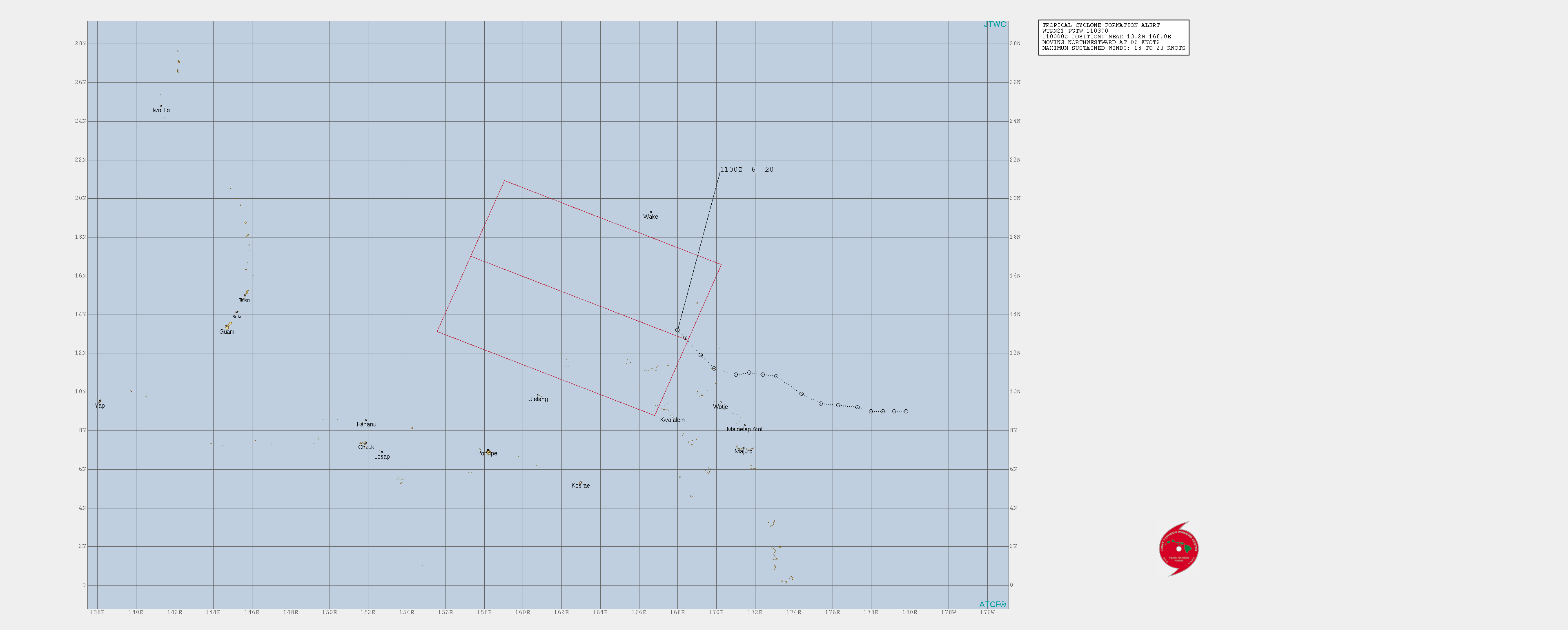
- ^ "WTPN21 PGTW 190230". Joint Typhoon Warning Center. July 19, 2019. Archived from the original on 2019-07-10.
{{cite web}}:|archive-date=/|archive-url=timestamp mismatch; 2019-07-19 suggested (help); Unknown parameter|dead-url=ignored (|url-status=suggested) (help) - ^ "27 người chết trong trận bão Wipha" (in Vietnamese). Tin Việt Nam. August 12, 2019. Retrieved August 15, 2019.
- ^ "Hàng chục người chết, thiệt hại hơn 1 ngàn tỷ đồng sau bão Wipha tại Việt Nam" (in Vietnamese). Radio Free Asia. August 12, 2019. Retrieved August 15, 2019.
- ^ "Sơn La: Bão số 3 gây thiệt hại ước tính trên 28 tỷ đồng" (in Vietnamese). Báo Biên phòng. August 6, 2019. Retrieved August 7, 2019.
- ^ a b "台風8号、九州を進行中 北九州市、2万人に避難勧告". 朝日新聞 (in Japanese). August 6, 2019. Retrieved August 6, 2019.
- ^ a b c d "Typhoon leaves 1 dead in southwestern Japan". Japan Times. August 6, 2019. Retrieved August 6, 2019.
- ^ "台風8号 九州北部を通過中 四国にも発達した雨雲". tenki.jp (in Japanese). August 6, 2019. Retrieved August 6, 2019.
- ^ "Table of Hourly Weather Observations : 06 August 2019 Akae (Miyazaki Airport)". Japan Meteorological Agency. August 6, 2019. Archived from the original on August 6, 2019. Retrieved August 6, 2019.
- ^ "Tropical Depression 10W (Lekima) warning #31". MetOC.navy.mil. Pearl Harbor, Hawaii: Joint Typhoon Warning Center. 2019-08-11. Archived from the original on 2019-08-04. Retrieved 2019-08-11.
- ^ Macairan, Evelyn (August 5, 2019). "Death toll in Iloilo sea tragedy hits 31". The Philippine Star. Retrieved August 5, 2019.
- ^ Eric Leister (August 17, 2019). "At least 3 dead as Krosa pounds Japan with 30 inches of rain and wind gusts of nearly 90 mph". Accuweather. Retrieved August 21, 2019.
- ^ 台風10号、高波や川の増水で死者3人に 温帯低気圧に変わり北海道へ. Mainichi Shimbun (in Japanese). August 16, 2019. Retrieved August 17, 2019.
- ^ 台風10号 長野県内農作物への被害、7700万円 (in Japanese). The Nikkei. August 16, 2019. Retrieved August 17, 2019.
- 台風で県内の農林水産物に被害 ハウス破損や桃の落果など (in Japanese). Sanyo Shimbun. August 16, 2019. Retrieved August 17, 2019.
- 台風10号 県内の農業被害9889万円 /高知 (in Japanese). Mainichi Shimbun. August 19, 2019. Retrieved August 20, 2019.
- 台風10号 農林水産業、被害1億円 県南部に集中 /和歌山 (in Japanese). Mainichi Shimbun. August 19, 2019. Retrieved August 20, 2019.
- ^ "輕度颱風 白鹿(國際命名 BAILU )海上陸上颱風警報 編號第11號颱風警報 第11-2報" (in Chinese). Central Weather Bureau. 24 August 2019. Archived from the original on 24 August 2019. Retrieved 24 August 2019.
- ^ "2 dead as 'Ineng' brings heavy rains, flooding in Ilocos Norte". ABS-CBN News. August 24, 2019. Retrieved August 25, 2019.
- ^ Adriano, Leilanie (August 26, 2019). ""Ineng" leaves over P1.1-B damages in Ilocos Norte". Philippine News Agency. Retrieved August 26, 2019.
- ^ "Storm kills one, injures nine in Taiwan". 7News. August 25, 2019. Retrieved August 25, 2019.
- ^ 許展溢 (August 25, 2019). "11校受颱風波及損失231萬 屏東佳冬高農最慘重" (in Chinese). ETtoday. Retrieved August 26, 2019.
- ^ 簡惠茹 (August 27, 2019). "白鹿颱風全台農損逾1.7億 台東縣占6成5最嚴重" (in Chinese). Liberty Times Net. Retrieved August 27, 2019.
- ^ "台风"白鹿"减弱为热带低压 初步统计造成福建直接经济损失1049万元" (in Chinese). People's Daily Online. August 25, 2019. Retrieved August 26, 2019.
- ^ "Tropical cyclone Jenny makes landfall over Casiguran, Aurora". ABS-CBN News. August 28, 2019. Retrieved August 28, 2019.
- ^ Flores, Helen (August 29, 2019). "Jenny exits the Philippines, leaves 1 dead". The Philippine Star. Retrieved August 29, 2019.
- ^ "Tornado kills 8 on China's Hainan island". Associated Press. August 29, 2019. Retrieved August 29, 2019.
- ^ 姚皓 (August 30, 2019). "海南突发龙卷风影响3市县受灾人口超500人" (in Chinese). 南海网. Retrieved August 31, 2019.
- ^ Cao, Quí (September 1, 2019). "6 người chết, 2 người mất tích do thiên tai trong mưa bão số 4" (in Vietnamese). Kênh Thời Tiế. Retrieved September 1, 2019.
- ^ "Sơn La thiệt hại hơn 1,8 tỷ đồng do ảnh hưởng bão số 4" (in Vietnamese). Báo Tài nguyên & Môi trường. September 1, 2019. Retrieved September 1, 2019.
- ^ Severe Weather Bulletin #1 For: Tropical Depression Kabayan (PDF) (Report). Philippine Atmospheric, Geophysical and Astronomical Services Administration. September 1, 2019. Retrieved September 1, 2019.
- ^ Severe Weather Bulletin #2-Final For: Tropical Depression Kabayan (PDF) (Report). Philippine Atmospheric, Geophysical and Astronomical Services Administration. September 1, 2019. Retrieved September 1, 2019.
- ^ "JTWC TCFA 91W".
{{cite web}}: Cite has empty unknown parameter:|dead-url=(help) - ^ a b Nguyen Quy (September 5, 2019). "Four die in floods, landslides as rains batter central Vietnam". VN Express International.
- ^ "JTWC TCFA 92W".
{{cite web}}: Cite has empty unknown parameter:|dead-url=(help) - ^ Severe Weather Bulletin #1 For: Tropical Depression Liwayway (PDF) (Report). PAGASA. September 1, 2019.
- ^ "WWJP25 RJTD Warning and Summary 171200" (TXT). Tokyo, Japan: Japan Meteorological Agency. 2019-06-17. Retrieved 2019-08-04 – via Iowa Environmental Mesonet.
- ^ "WWJP25 RJTD Warning and Summary 181800" (TXT). Tokyo, Japan: Japan Meteorological Agency. 2019-06-18. Retrieved 2019-08-04 – via Iowa Environmental Mesonet.
- ^ "WWJP25 RJTD Warning and Summary 191800" (TXT). Tokyo, Japan: Japan Meteorological Agency. 2019-06-19. Retrieved 2019-08-04 – via Iowa Environmental Mesonet.
- ^ "WWJP25 RJTD Warning and Summary 221800" (TXT). Tokyo, Japan: Japan Meteorological Agency. 2019-06-22. Retrieved 2019-08-04 – via Iowa Environmental Mesonet.
- ^ a b Padgett, Gary. "Monthly Tropical Cyclone Summary December 1999". Australian Severe Weather. Archived from the original on February 11, 2012. Retrieved October 1, 2013.
{{cite web}}: Unknown parameter|deadurl=ignored (|url-status=suggested) (help) - ^ a b The Typhoon Committee (February 21, 2013). "Typhoon Committee Operational Manual 2013" (PDF). World Meteorological Organization. pp. 37–38. Archived from the original (PDF) on August 1, 2013. Retrieved October 1, 2013.
{{cite web}}: Unknown parameter|dead-url=ignored (|url-status=suggested) (help) - ^ "REVIEW OF THE 2015 TYPHOON SEASON (submitted by the RSMC Tokyo – Typhoon Center)" (PDF). Typhooncommittee.org. Retrieved 13 December 2018.
- ^ Zhou, Xiao; Lei, Xiaotu (2012). "Summary of retired typhoons within the Western North Pacific Ocean". Tropical Cyclone Research and Review. 1 (1). The Economic and Social Commission for Asia and the Pacific/World Meteorological Organization's Typhoon Committee: 23–32. doi:10.6057/2012TCRR01.03. ISSN 2225-6032. Retrieved December 21, 2014.
- ^ a b c "Philippine Tropical Cyclone Names". Philippine Atmospheric, Geophysical and Astronomical Services Administration. Archived from the original on December 28, 2016. Retrieved April 18, 2015.
{{cite web}}: Unknown parameter|dead-url=ignored (|url-status=suggested) (help) - ^ "Typhoon Lekima leaves 45 dead, 16 missing in China". China.org.cn. 12 August 2019. Retrieved 12 August 2019.
- ^ https://www.theweek.in/news/world/2019/08/12/typhoon-lekima-45-dead-one-million-displaced-in-china.html
- ^ https://www.indiatoday.in/world/story/typhoon-lekima-45-killed-over-a-million-displaced-in-china-1580095-2019-08-12
- ^ https://www.abc.net.au/news/2019-08-12/typhoon-lekima-claims-dozens-lives-in-china-as-damage-totals-3bn/11404132
External links
- China Meteorological Agency
- Digital Typhoon
- Hong Kong Observatory
- Japan Meteorological Agency
- Joint Typhoon Warning Center
- Korea Meteorological Administration
- Malaysian Meteorological Department
- National Weather Service Guam
- Philippine Atmospheric, Geophysical and Astronomical Services Administration
- Taiwan Central Weather Bureau
- TCWC Jakarta
- Thai Meteorological Department
- Typhoon2000
- Vietnam's National Hydro-Meteorological Service
Tropical cyclones of the 2019 Pacific typhoon season | ||
|---|---|---|
| ||