
Chelsea, Massachusetts
Chelsea, Massachusetts | |
|---|---|
 The Tobin Bridge, linking Chelsea and Boston | |
 Location in Suffolk County and the state of Massachusetts | |
 Chelsea, Massachusetts Location in the United States | |
| Coordinates: 42°23′30″N 71°02′00″W / 42.39167°N 71.03333°W | |
| Country | United States |
| State | Massachusetts |
| County | Suffolk |
| Settled | 1624 |
| Incorporated | 1739 |
| Government | |
| • Type | Council-manager government |
| • City Manager | Thomas G. Ambrosino |
| • Deputy City Manager | Ned Keefe |
| Area | |
| • Total | 2.5 sq mi (6.4 km2) |
| • Land | 2.2 sq mi (5.7 km2) |
| • Water | 0.2 sq mi (0.6 km2) |
| Elevation | 10 ft (3 m) |
| Population (2010) | |
| • Total | 35,177 |
| • Estimate (2016)[1] | 39,699 |
| • Density | 14,000/sq mi (5,500/km2) |
| Time zone | UTC-5 (Eastern) |
| • Summer (DST) | UTC-4 (Eastern) |
| Zip code | 02150 |
| Area code | 617 / 857 |
| FIPS code | 25-13205 |
| GNIS feature ID | 0612723 |
| Website | http://www.chelseama.gov |
Chelsea is a city in Suffolk County, Massachusetts, United States, directly across the Mystic River from the city of Boston. As of 2013, Chelsea had an estimated population of 36,828.[2] It is also the second most densely populated city in Massachusetts behind Somerville. With a total area of just 2.21 square miles,[3] Chelsea is the smallest city in Massachusetts in terms of total area.[4]
Chelsea is a diverse, working-class community that contains a high level of industrial activity. It is one of only three Massachusetts cities in which the majority of the population identifies as Hispanic or Latino, alongside Lawrence and Holyoke. After flirting with bankruptcy in the 1990s, the once-struggling industrial city has reversed a prolonged decline and in recent years has enjoyed sustained economic growth. Thanks to its relative affordability and close proximity to Boston, Chelsea has added more than 1,200 homes since 2005, mostly loft-style apartments and condominiums suitable for small families or young professionals. There has also been significant office, retail and restaurant development throughout the city.[5]
History


Early settlement
The area of Chelsea was first called Winnisimmet (meaning "good spring nearby") by the Massachusett tribe, which once lived there. It was settled in 1624 by Samuel Maverick, whose palisaded trading post is considered the first permanent settlement by Boston Harbor. In 1635, Maverick sold all of Winnisimmet, except for his house and farm, to Richard Bellingham. The community remained part of Boston until it was set off and incorporated in 1739, when it was named after Chelsea, a neighborhood in London, England.
Role in the Revolutionary War
In 1775, the Battle of Chelsea Creek was fought in the area, the second battle of the Revolution, at which American forces made one of their first captures of a British ship. Part of George Washington's army was stationed in Chelsea during the Siege of Boston.
On February 22, 1841, part of Chelsea was annexed by Saugus, Massachusetts. On March 19, 1846, North Chelsea, which consists of present-day Revere and Winthrop was established as a separate town.[6] Reincorporated as a city in 1857, Chelsea developed as an industrial center and by mid-century had become a powerhouse in wooden sailing ship construction. As the century wore on, steam power began to overtake the age of the sail and industry in the town began to shift toward manufacturing. Factories making rubber and elastic goods, boots and shoes, stoves, and adhesives began to appear along the banks of Boston Harbor. It became home to the Chelsea Naval Hospital designed by Alexander Parris and home for soldiers.[7]
A changing population
According to local historical records, Nathan Morse, the first Jewish resident of Chelsea, arrived in 1864, and by 1890 there were only 82 Jews living in the city. However, Chelsea was a major destination for the "great wave" of Russian and Eastern European immigrants, especially Russian Jews, who came to the United States after 1890. By 1910 the number of Jews had grown to 11,225, nearly one third of the entire population of the city. In the 1930s there were about 20,000 Jewish residents in Chelsea out of a total population of almost 46,000. Given the area of the city, Chelsea may well have had the most Jews per square mile of any city outside of New York City.[8]

On April 12, 1908, nearly half the city was destroyed in the first of two great fires that would devastate Chelsea in the 20th century. The fire left 18,000 people, 56 percent of the population, homeless. Despite the magnitude of the destruction, it would only take the city about two and a half years to rebuild and five years to surpass the extent of 1908's infrastructure. The city was also laid out differently after the fire, with wider streets and more access for emergency vehicles. Many of the city’s residents left and never returned, which opened the door for many immigrants living in Boston to “move up” to Chelsea. To immigrants living in crowded tenements in Boston’s West End, East and South Ends, Chelsea was the next stop on their path of economic upward mobility.[9]
By 1919 Chelsea’s population had reached the record level of 52,662, with foreign-born residents comprising 46 percent of the population. Fully transitioned from a suburb to an industrial city, the waterfront flourished, with shipbuilding, lumberyards, metalworks and paint companies lined Marginal Street.[7]
During the 1930s the first exodus of Jews from Chelsea to the suburbs began. As the community prospered and grew, many wanted to seek new opportunities in the more affluent communities of Newton and Brookline. By the 1950s the Jewish population had decreased to about 8,000 and more people began to establish roots in the seaside towns of Swampscott and Marblehead, Massachusetts.[10]
After World War II, Chelsea began a long, slow decline; between 1940 and 1980, the population declined by 38 percent. Chelsea, however, lost more population than other urban areas after the 1950s because of the elevated expressway built to connect the North Shore to Boston, via the Mystic River Bridge (later renamed for Boston Mayor Maurice J. Tobin). Hundreds of homes were lost to make way for the expressway as it cut the city in half. The resulting out-migration took with it many small, local businesses. Historic homes were abandoned, along with industrial buildings, brownfields, salt piles and gas storage tanks dotting the cityscape.
In 1973, disaster struck again when the Second Great Chelsea Fire burned 18 city blocks, leaving nearly a fifth of the city in ashes. Both fires originated in Chelsea’s “rag shop district,” cluttered streets filled with junk shops hawking scraps, metal, and combustible items. Wood-frame buildings and three- to six-family houses were built tightly together, and quickly caught fire.[11]
A major shift took place in the early 1970s as Chelsea became a center for Latino immigration. Racial conflict and tension became a regular part of life in Chelsea. Although the Hispanic population continued to grow, the city did not hire its first Spanish-speaking police officer until 1992. By the early 1990s, Chelsea was both the poorest and most dangerous city in Massachusetts.
By 1990, Chelsea had collapsed economically and socially. Crime was rampant, not least among the police and local government officials. The population drain made way for more immigrants, but depleted the city’s tax base. The cost of running the city and maintaining its infrastructure did not decrease correspondingly so, in 1991, the city suffered fiscal collapse.
The Commonwealth of Massachusetts enacted special legislation to place Chelsea into receivership. For the first time since the Great Depression, a Massachusetts city surrendered home rule and allowed a state-appointed receiver to control all aspects of city government. Governor William Weld named James Carlin as the first receiver followed by Lewis "Harry" Spence. City Hall was eviscerated, the police and fire departments reorganized, management of the public schools given to Boston University, and indictments handed down. Mayor John “Butchie” Brennan and two former mayors were found guilty of federal crimes.
Fortunately, Chelsea had no long-term debt publicly held; thus, a solution to its problems could be explored in isolation of creditors.[12]
Contemporary revitalization
By the summer of 1995, when the state returned City Hall to the people of Chelsea, a new government had been born, brought to life by a panel of citizens charged with drafting a new city charter. The new charter eliminated the position of mayor, converting management of the city from a mayor to a council–manager government system, where a city manager is selected by City Council members. As such, municipal government focused on improving the quality of services provided to residents and businesses, while establishing financial policies that have significantly improved the city's financial condition. With their leaders more accountable and efficient, Chelsea reversed its long decline and entered a period of population growth and economic development.
In 1998, the City Council's focused efforts earned Chelsea the distinction of being named one of 10 All-America City Award winners by the National Civic League in recognition of its grass-roots approach to solving problems. Since earning that honor, Chelsea has claimed other victories. The city weathered a recession in the early 2000s and emerged with its finances intact, prompting Chelsea's bond rating to improve.
Chelsea's skyline has been transformed by the construction of the Wyndham Chelsea, built on a lot where junk cars once sat abandoned in the wake of the fire of 1973. Opened in 2001, the hotel chain was the first company to make a substantial investment in Chelsea after receivership. The city’s two main shopping centers, the Mystic Mall and Chelsea Commons, have recently undergone major renovations as well.[13]
On July 28, 2014, a tornado touched down in northern Chelsea and made its way to neighboring Revere. While there was relatively little damage in Chelsea, it caused major damage in Revere.[14]
Geography


Located on a small peninsula in Boston Harbor covering a mere 2.21 square miles (6 km2), Chelsea is the smallest city by area in Massachusetts. Chelsea is bordered on three sides by water. The Mystic River borders Chelsea on the southwest, the Chelsea Creek and Mill Creek and the Island End River on the west.
The topography of Chelsea consists primarily of coastal lowlands, punctuated by four drumlins formed during the last Ice Age. These drumlins are located in the southwest (Admirals Hill), southeast (Mount Bellingham), northeast (Powderhorn Hill) and northwest (Mount Washington). A smaller drumlin (Mill Hill) is located on the east side of Chelsea, adjacent to Mill Creek. This sloped and hilly landscape helps to divide the city into discernible neighborhoods, each with its own character, thereby giving the city a manageable sense of scale and orientation.
Neighborhoods and districts
Despite its small size, there are several distinct neighborhoods in Chelsea:
Admirals Hill - Admirals Hill sits atop a point of land between the Mystic River and Island End River. Containing the Naval Hospital Historic District, the area is mostly residential development enjoying expansive views. On the south slope of the hill is the site of the historic Chelsea Naval Hospital, with several brick and granite structures that have been converted to other uses. Between the Naval Hospital and the shoreline is the Mary O'Malley Park, the largest public park in Chelsea.
Addison-Orange Adjacent to the north side of downtown, the Addison-Orange neighborhood is residential, flat and densely populated. Washington Avenue runs through this neighborhood.
Bellingham Square - This historic district became the center of commerce and government after the 1908 fire. The cohesiveness of design is the result of community planning after the Great Fire of 1908. The district includes City Hall, modeled after Old Independence Hall in Philadelphia, the Public Library and Bunker Hill Community College's Chelsea campus.
Box District - Just over a block from City Hall, this once blighted neighborhood gets its name from various box manufacturing companies that operated in the area as early as 1903, when the Russell Box Company began operations at the foot of Gerrish Avenue. Abandoned in the 1960s, the area fell into disrepair until it was rezoned for residential use in the 2000s. It is now the fastest growing part of Chelsea and has enjoyed a building boom since 2005, with town homes and multifamily housing complexes proliferating in the area.[15] The Kayem Foods headquarters is located here, off Marginal Street.
Carter Park- Wyndham Area - The neighborhood around Carter Park is a small enclave of mostly single-family Queen Anne style homes surrounded by heavy commercial and highly trafficked areas. Route 1 looms above the southeastern edge of this tree-lined neighborhood, and Revere Beach Parkway winds along the northern edge. The Chelsea High School is in this area, as well as Market Basket, the Dockside, Home Goods, T.J. maxx and Floramo's. Also, the historic Chelsea Clock used to be in this area.
Chelsea Square - This historic district located in the downtown area contains the finest and most intact grouping of mid 19th and early 20th century commercial architecture in the city. Area includes a waterfront district (South Broadway neighborhood) with brick row houses dating to the mid to late 19th century. Third Street is also in the area, and becomes the industrial Everett Avenue. The Chelsea Police Department is located here.
Chelsea Commons - Formerly known as Parkway Plaza, Chelsea Commons sits on a low flat area near the end of Mill Creek. The plaza consists of big-box retail, fast-food restaurants, and a large apartment building. It is bordered by a strip of wetlands on both sides. The new Chelsea Commons Park was just completed adjacent to this site. Webster Avenue is in this area.
Mill Hill - This largely residential area consists mostly of two- and three-story wood frame detached buildings. Covering the smallest of the city's drumlins, the Mill Hill neighborhood sits on a small neck of land bounded by Chelsea Creek and Mill Creek. This neighborhood is on the Revere line. Eastern Avenue goes through his neighborhood.
Prattville - is the northwestern section of the city. It also borders Revere, and Everett to the west. Pizza Lovers, The Newbridge Cafe and Metrop PCS are located in this area. Metro Credit Union and McDonald's have a large presence there as well. Next to these chains is another, smaller Chelsea Firefighter station. Garfield and Washington Avenues are in Prattville. Route 1 is on the east side of Prattville, and Route 16 is on the south side.
Soldiers Home - The Soldiers Home neighborhood covers the steep slopes and the peak of Powderhorn Hill. This residential area contains some examples of Queen Anne style architecture. Soldiers Home is one of the least dense neighborhoods in the city. At the peak sits the Soldiers Home, a large structure that dominates much of this area. However, there are some smaller associated brick structures in the area as well.
Waterfront District - For the first time, Chelsea is breaking through the heavy industry piled up along the Chelsea Creek, and reconnecting with its waterfront. Established to promote water-oriented industrial uses at Forbes Industrial Park and the lower Chelsea Creek waterfront, its use remains primarily industrial. Most of the waterfront from the Tobin Bridge to the mouth of Mill Creek is a Designated Port Area (DPA), and Chelsea has in the last decade embraced it. The city is encouraging industry to move in, but only if they help finance a new park on the waterfront.[16]
Demographics
Statistics
| Census | Pop. | Note | %± |
|---|---|---|---|
| 1790 | 472 | — | |
| 1800 | 849 | 79.9% | |
| 1810 | 594 | −30.0% | |
| 1820 | 642 | 8.1% | |
| 1830 | 771 | 20.1% | |
| 1840 | 2,390 | 210.0% | |
| 1850 | 6,701 | 180.4% | |
| 1860 | 13,395 | 99.9% | |
| 1870 | 18,547 | 38.5% | |
| 1880 | 21,782 | 17.4% | |
| 1890 | 27,909 | 28.1% | |
| 1900 | 34,072 | 22.1% | |
| 1910 | 32,452 | −4.8% | |
| 1920 | 43,184 | 33.1% | |
| 1930 | 45,816 | 6.1% | |
| 1940 | 41,259 | −9.9% | |
| 1950 | 38,912 | −5.7% | |
| 1960 | 33,749 | −13.3% | |
| 1970 | 30,625 | −9.3% | |
| 1980 | 25,431 | −17.0% | |
| 1990 | 28,710 | 12.9% | |
| 2000 | 35,080 | 22.2% | |
| 2010 | 35,177 | 0.3% | |
| 2016 (est.) | 39,699 | [1] | 12.9% |
| U.S. Decennial Census[17] | |||
As of the 2010 United States Census,[18] there were 35,177 people, 11,888 households, and 7,614 families residing in the city. The population density was 16,036.8 people per square mile (6,184.7/km²), placing it among the highest in population density among U.S. cities.[19] There were 12,337 housing units at an average density of 5,639.9 per square mile (2,175.0/km²). The racial makeup of the city was 47.8% White,[20] 8.5% Black or African American, 3.1% Asian, 1.1% Native American, 0.09% Pacific Islander, 33.6% from other races, and 5.9% were multiracial. In addition, 62.1% of residents identified as Hispanic or Latino (of any race), which includes 18.2% Salvadoran, 12.7% Puerto Rican, 8.4% Honduran, 7.3% Guatemalan, 2.8% Mexican, 2.2% Dominican, 0.5% Cuban, 0.5% Costa Rican, 0.4% Nicaraguan, 0.4% Panamanian, 1.4% other Central American countries, 2.5% other South American countries, 5.3% other Hispanic/Latino.[21]
There were 11,888 households out of which 36.4% had children under the age of 18 living with them, 36.9% were married couples living together, 20.1% had a female householder with no husband present, and 36% were non-families. 28.8% of all households were made up of individuals and 10.8% had someone living alone who was 65 years of age or older. The average household size was 2.87 and the average family size was 3.5.
The population was spread out with 27.3 under the age of 18, 10.6% from 18 to 24, 34.6% from 25 to 44, 16.3% from 45 to 64, and 11.2% who were 65 years of age or older. The median age was 31 years. For every 100 females, there were 100.9 males. For every 100 females age 18 and over, there were 99.7 males.
The median income for a household in the city was $30,161, and the median income for a family was $32,130. Males had a median income of $27,280 versus $26,010 for females. The per capita income for the city was $14,628. About 20.6% of families and 23.3% of the population were below the poverty line, including 28.8% of those under age 18 and 20.9% of those age 65 or over.
Foreign-born population
In 2010, 38% of Chelsea residents had been born outside of the United States. This is the highest percentage of foreign-born residents in the Commonwealth of Massachusetts.[22]
Within recent years, the city has made a sustained effort to work with both immigrant communities and persons of minority faiths. Its “Interfaith Alliance” brings members of the Jewish, Christian, and Muslim communities together to promote inclusiveness, diversity, and tolerance. And, its continued loyalty to its 2007 Sanctuary City Resolution aims to support all foreign born residents regardless of their country of origin or immigration status.[23]
Government and economy
Local
| Voter Registration and Party Enrollment as of February 1, 2017 | |||||
|---|---|---|---|---|---|
| Party | Number of Voters | Percentage | |||
| Democratic | 8,370 | 52.24% | |||
| Republican | 848 | 5.29% | |||
| Libertarian | 19 | 0.12% | |||
| Unenrolled | 6,597 | 41.18% | |||
| Total No. Registered Voters | 16,021 | 100% | |||
| 2017-2018 Council Members | |||||
|---|---|---|---|---|---|
| Name | Title | ||||
| Leo Robinson | Councilor At-Large | ||||
| Roy Avellaneda | Councilor At-Large | ||||
| Damali Vidot | Councilor At-Large, President | ||||
| Robert Bishop | District 1 Councilor | ||||
| Luis Tejada | District 2 Councilor | ||||
| Joe Perlatonda | District 3 Councilor | ||||
| Enio Lopez | District 4 Councilor | ||||
| Judith Garcia | District 5 Councilor | ||||
| Giovanni A. Recupero | District 6 Councilor | ||||
| Yamir Rodriguez | District 7 Councilor | ||||
| Calvin T. Brown | District 8 Councilor, Vice President | ||||
Top employers
According to Chelsea's 2012 Comprehensive Annual Financial Report,[24] the top employers in the city are:
| # | Employer | # of Employees |
|---|---|---|
| 1 | City of Chelsea | 1,254 |
| 2 | Massachusetts Information Technology Center | 1,150 |
| 3 | Market Basket | 900 |
| 4 | Massachusetts Water Resources Authority | 568 |
| 5 | Kayem Foods | 328 |
| 6 | Massachusetts General Hospital | 246 |
| 7 | Paul Revere Transportation | 220 |
| 8 | Signature Breads | 202 |
| 9 | Metropolitan Credit Union | 178 |
| 10 | Stop & Shop | 120 |
Economic development
Under City Manager Ambrosino, Chelsea has implemented several innovative data analysis and tracking programs. Many of these programs are led and administered in conjunction with fellows from the Harvard Kennedy School’s Innovation Field Lab. According to Chelsea’s 2017 “State of the City” report, “this partnership allows the city to benefit from the questions and suggestions of [domestic and] international graduate students.”
These data analysis programs have played a particularly helpful role in the city’s efforts to “revitalize” the downtown area around Bellingham Square via the “Re-Imagining Broadway” initiative. In 2016, the City Council approved a $5.2 million grant for infrastructure improvements in the district. The project has been supported by a newly hired Downtown Coordinator and aims to engage residents and local businesses in a collective effort to advance the economic prosperity and quality of life in the district.
Capital Improvement Plan
As summarized by the "State of the City" report, Chelsea's Capital Improvement Plan will invest in "park development, building improvements, water and sewer upgrades, and neighborhood street/sidewalks improvements. Other specific investments in new graffiti removal and snow re-moval equipment will enhance the quality of life for residents." The expenditures for Fiscal Year 2018 and Fiscal Year 2018–2022 can be found to the right. Total expenditures are divided between utility enhancement, equipment acquisition, parks and open space, public buildings and facilities, public safety, and surface enhancement. For Fiscal Year 2018, almost 64% of the budget will be dedicated to surface enhancements, which includes citywide sidewalks, marginal street pre-engineering, Shurtleff Street roadway and sidewalks, casino mitigation/transportation, citywide traffic calming, Congress Avenue road and sidewalks, Downtown Broadway engineering and construction, and Highland Street Greenway Phase II. [25][26]
Residential development
Housing Composition: According to the 2011-2015 Community Survey, there are a total of 12,940 households in Chelsea, 27.9% of which are owner-occupied and 72.1% of which are renter-occupied. Although Chelsea has been known as the "City of Renters", there has been a push for home ownership. This has been pushed in particular by the Chelsea Restoration Corporation, which offers educational housing workshops and works in partnership with other state, municipal, and private partners to "rehabilitate properties and increase the stock of affordable housing."
Heating: Over half (55.4%) of the housing units in Chelsea use utility gas, 29.8% use electricity, 12.7% use fuel oil, kerosene, etc. and smaller portion (2.1%) of housing units use bottled, tank, or LP gas, as well as other fuel or no fuel at all. With these statistics in mind, Chelsea has started several initiatives towards renewable energy and sustainability. One includes a partnership with SolSmart, a team of individuals dedicated to implementation of Solar energy, by making solar panels accessible through zoning laws, offering affordable solar options and providing education and resources for those who are interested in these efforts. [27][28]
Reimagine Broadway
Reimagine Broadway is 6-month long planning effort with the guidance of the Chelsea City Council, City Manager Ambrosino, Planning and Developing Downtown Coordinator Mimi Graney and several others to transform downtown Chelsea. This effort ranges from supporting small business owners to re-designing the streetscape. The goals of this project are to "Enhance how public space is used and accessed downtown, support existing businesses and encourage new growth, beautify the area and create a consistent, vibrant look, improve overall safety for all users, establish a circulation pattern that works for cars, buses, pedestrians, transit riders, and bicyclists."[29]
Infrastructure
Transportation
Road
The Route 1 North Expressway is a limited access highway that cuts City of Chelsea in half. The Tobin Bridge, a major regional transportation artery, carries Route 1 from Chelsea across the Mystic River to Charlestown.[30]
Bus
Chelsea is served by the Massachusetts Bay Transit Authority. The MBTA Commuter Rail provides service from Boston's North Station with the Chelsea station on its Newburyport/Rockport Line.
Additionally, Chelsea is served by many MBTA bus routes providing local service to East Boston, Revere, Everett and other nearby cities. Chelsea does not have a link to the MBTA subway or light rail systems.
Silver Line Gateway Extension

Governor Deval Patrick announced in October 2013 that MassDOT would collaborate with the MBTA to extend the Silver Line bus rapid transit line to Chelsea via East Boston by 2017.[31]
The new SL3 route begins at South Station and runs through the Waterfront Tunnel, along with the SL1 and SL2 routes, to Silver Line Way, continuing with the SL1 through the Ted Williams Tunnel. The new route diverges to meet the Blue Line at Airport Station, and follows the Coughlin Bypass Road (a half-mile commercial-use-only road which opened in 2012)[32] to the Chelsea Street Bridge. The Silver Line stops at the four stations in Chelsea: Eastern Avenue, Box District, Downtown Chelsea, and Mystic Mall. A new $20 million Chelsea commuter rail station and 'transit hub' was constructed at the Mystic Mall terminus of the new Silver Line route, so that trains no longer block Sixth Street.[33][34] The new Silver Line and commuter rail stations is fully handicapped accessible.[35]
On March 12, 2018, the MBTA announced that construction of the first phase was completed, and that Silver Line service to Chelsea would begin on April 21.[36]
Additionally, a multi-use 0.75-mile (1.21 km) shared path 0.75-mile (1.21 km) linear park runs parallel to the Silver Line bus rapid transit busway utilizing the Boston & Albany Railroad's Grand Junction Branch right-of-way. Located within the Box District neighborhood, the path connects Downtown Chelsea and Eastern Avenue stations.[37]
Education
Chelsea Public Schools has four elementary schools, three middle schools, and one high school, Chelsea High School. The Chelsea school system has historically been towards the bottom of the state's test score rankings. It is plagued by high turnover among students. A very high percentage of students move in or out over the course of the year, and the dropout rate is high. In 1988, the school board made the unprecedented move of delegating its authority for control of the school district to Boston University. In June 2008, a partnership with BU ended, and the schools returned to full local control.
Chelsea has only one private school remaining, St. Rose School, as the others have closed. St. Rose is located on Broadway and, as of 2012, has an enrollment of about 220 students. In addition, there are two public charter schools, the Excel Academy and Phoenix Charter Academy. Bunker Hill Community College and the for-profit Everest Institute have satellite locations of their schools in Chelsea.
Elementary, middle, and high schools in Chelsea include:
- William A. Berkowitz Elementary School
- Edgar F. Hooks Elementary School
- George F. Kelly Elementary School
- Frank M. Sokolowski Elementary School
- Joseph A. Browne School
- Clark Avenue School
- Eugene Wright Science and Technology Academy
- Excel Academy-Chelsea
- Phoenix Charter Academy- Chelsea
- St. Rose School
- Chelsea High School
There are also two post-secondary campuses:
School Committee
The Chelsea School Committee is composed of nine elected members, eight of whom represent a district within Chelsea and one of whom serves the committee At-Large. The 2016-2017 School Committee members include Shawn O'Reagan (Delegate to the Chelsea City Council), Rosemarie Carlisle (Vice-chairman), Jeanette Velez (Chairperson), Richard Maronski, Diana Maldonado, Robert J. Pereira (Delegate to the Shore Collaborative), Ana Hernandez, Kelly Garcia, and Yessenia Alfaro-Alvarez.[38]
As stated by the "Rules and Regulations of the Chelsea School Committee", the responsibilities of these elected officials include: hiring a Superintendent, developing policy that will then be used as a guide by the Superintendent of Schools, assessing the effectiveness of these policies, determining a budget to support policy implementation, and encouraging community engagement to keep the local community informed about the state of schools, as well as a manner of identifying the needs of the public.[39]
Community development
- ROCA
Chelsea houses several non-profit organizations. Among them are ROCA, which provides services to disadvantaged youth and immigrant families, respectively. ROCA's goal is to reduce incarceration rates and transform the lives of young individuals in and around Chelsea.
- Chelsea Collaborative
Similarly, according to the Chelsea Collaborative's website, it is committed to the "social, environmental and economic health of the community and its people." These non-profit organizations continue to positively impact and engage the community within Chelsea.
- CAPIC
The Community Action Programs Inter-City, Inc. (CAPIC) is a non-profit organization, which serves the cities of Revere, Winthrop and Chelsea. CAPIC's goals are to identify the "needs, problems, and concerns of those in poverty" and enable them to be self-sufficient. CAPIC is an umbrella organization which houses many programs that range from early childhood education to Head Start to day-to-day resources through their tax preparation program.
- MGH Chelsea HealthCare Center
After the 2016 Community Health Needs Assessment Report and Implementation Plan, the Mass General Hospital's (MGH) Center for Community Health Improvement (CCHI) determined a need to address factors that lead to adolescent substance use and mental health within Chelsea and surrounding cities
- TND - Chelsea Thrives
The Neighborhood Developers' (TND) mission is to promote healthy homes, financial mobility and engage neighbors through offering affordable home options, access to a Financial Opportunity Center and coordinated community events, such as neighborhood walks. With the collaboration of 25 different private and public sector institutions, TND has been a partner in the goal of reducing crime over a ten-year span.
- Hub
As stated on the Chelsea Police Department's website, the Hub is a collaborative initiative between the Police department and several community organizations to help remove risks, such as, but not limited to drug addiction, domestic violence, or human trafficking from individuals and families. Their goal is to create a safe and healthy environment, where every individual has the opportunity to thrive.
- Healthy Chelsea
In 2009, after identifying the needs for ""obesity prevention and promotion of healthy living"", a coalition of 75 individuals that serve the local government, state government, community healthcare providers and businesses dedicated themselves to addressing Chelsea's high obesity rate.
The coalition works closely with Chelsea Public Schools to implement healthier eating habits and advocate for a dedicated time spent on physical activity. The coalition also formed a collaboration with Chelsea's Planning and Development Department to improve infrastructure through park renovations and installations, traffic calming measures, and road and sidewalk redesigns. Healthy Chelsea works alongside the Board of Health to integrate a regulation for artificial trans-fat free for prepared foods served in businesses within Chelsea.
- GreenRoots
GreenRoots, Inc. is an independent community-based organization based at 227 Marginal Street, Suite 1, Chelsea, MA, which in the past 20 years focused on environmental justice and public health within the city of Chelsea and surrounding communities. Before becoming an independent organization it used to be a grassroots community committee under the Chelsea Collaborative, Inc. (otherwise known as the Collaborative). GreenRoots' accomplishments include enacting the Youth Pass, creating additional community gardens, investing $3 million to reduce air pollutants at the New England Produce Center that were contributing to hotspots, stopping the transport of flammable ethanol, and restoring the Mill Creek area in Chelsea and Revere.
Fire department
| Operational area | |
|---|---|
| Country | United States |
| State | |
| City | Chelsea |
| Agency overview | |
| Annual calls | ~11,000 |
| Employees | 95 |
| Fire chief | Robert Better |
| EMS level | BLS First Responder |
| Facilities and equipment | |
| Battalions | 1 |
| Stations | 3 |
| Engines | 4 |
| Trucks | 2 |
| Squads | 1 |
| Tenders | 1 |
| USAR | 1 |

The city of Chelsea is protected by the career professional firefighters of the City of Chelsea Fire Department, operating from three fire stations across the city, each shift commanded by a Deputy Chief. Chelsea Fire operates an apparatus fleet of 4 Engines, 2 Ladders, 2 Special Operations Units, a Maintenance Unit, a Foam Tender Unit, and several other special, support, and reserve units. Chelsea Fire responds to ~11,000 emergency calls annually.[40] The current Chief of Department is Robert Better.[41]
Chelsea Engine 2 responds to over 4,000 emergency calls annually, with 4,269 in 2011, placing it among the busiest engine companies in the United States, and at 120% of the maximum acceptable threshold for engine company call volume, as set by the Commission on Fire Accreditation International.[42]
Fire station locations and apparatus
| Engine Company | Ladder Company | Special Unit | Command Unit | Address | Neighborhood |
|---|---|---|---|---|---|
| Engine 1 | Engine 4 (Spare) | 32 Sagamore Ave. | Prattville | ||
| Engine 2 | Tower 1 | Rescue 1, Squad 5, Foam Tender Unit (Class B), Maintenance Unit, Special Operations Unit 1, Special Operations Unit 2, Fire Prevention & Arson Fleet | Chief 1(Chief of Department), Chief 2(Deputy Chief of Operations), K1(Deputy Chief of Fire Prevention), H1 (Deputy Chief Training and Safety), H2 (Hazmat Officer) | 307 Chestnut St. | Downtown |
| Engine 3 | Ladder 2 | 885 Broadway | Mill Hill |
Sites of interest
Historic places
Chelsea has eight places on the National Register of Historic Places.


Chelsea Clock Company
Founded in 1897, the Chelsea Clock Company is one of the oldest, largest, and few remaining American clock manufacturing companies in existence. For over a century, Chelsea's clockmakers have been designing and handcrafting distinguished, high quality clocks for customers in the corporate, consumer, government and marine markets. In 2015, the Chelsea Clock Company moved to a smaller building a few blocks away from the original location.[43] Today, the company continues to build and repair clocks from its new headquarters. The old building is slated for demolition to make way for a new apartment building.
Recreational activities
- Food and Drinks
- Things to Do
Open space
-

-

-
-

-
-
-
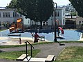
 Port Park
 -

-
-
 Mystic River Overlook Park & Dog Park
 -

-


.jpg)
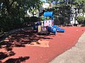
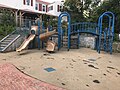
- Bosson Playground
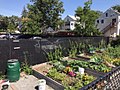
- Chelsea Community Garden
- Chelsea Square (Winnisimmet Park)
- CHS Memorial Stadium
- CND Community Garden
- Cordero Park
- Creekside Common
- Garden Cemetery
- Highland Park
- Howard Park
- Island End Park
- John Ruiz Park
- Mace Housing Development Park
- Mace Tot-Lot
- Malone Park
- Mary O'Malley Park
- Mill Creek Riverwalk
- Polonia Park
- Quigley Park
- Scrivano Park
- Washington Park
- Mill Creek Riverwalk, Revere Beach Parkway
- Chelsea River Walk, 257 Marginal Way
- Highland Street Greenway
- Chelsea Community Garden, Hawthorn St. & Hawthorn Court
- TND Community Garden, Shawmut & Suffolk Streets
Notable people
See also Category:People from Chelsea, Massachusetts
- Horatio Alger, author
- Richard Bellingham, governor of the Massachusetts Bay Colony
- Tom Birmingham, former President of the Massachusetts Senate
- Selma Botman, President of the University of Southern Maine
- Alfred Winsor Brown, 31st Naval Governor of Guam
- Chick Corea, jazz musician
- Norman Cota, United States Army general
- Albert DeSalvo, Boston Strangler
- Win Elliot, sportscaster and game show host
- Anna Christy Fall (1855–1930), lawyer
- Jack Harvey, member of the Wisconsin State Assembly
- Ray Hyman, Professor Emeritus of Psychology at the University of Oregon, author, magician and a noted critic of parapsychology
- Brian Kelly, Notre Dame Fighting Irish head football coach
- Isaac Pendleton Langworthy, American Congregational minister and librarian
- Lewis Howard Latimer, scientist and inventor
- Samuel Maverick, colonist
- Howard B. Meek, educator at Cornell University
- Charles E. Mitchell, banker
- Jim Mutrie, baseball pioneer
- Ray Starita, 1920s clarinetist, saxophonist and bandleader in the UK and USA[45]
- Joseph C. O'Mahoney, United States Senator from Wyoming
- Marion Osgood, violinist, orchestra leader, composer
- Daniel Pratt, author and eccentric
- Harris S. Richardson, former President of the Massachusetts Senate
- Annette Rogers, sprinter and Olympic gold medalist
- John Ruiz, heavyweight boxing champion
- Arnold Stang, actor, known for films such as The Man with the Golden Arm and It's a Mad, Mad, Mad, Mad World
- Elizabeth Cady Stanton, American social activist, abolitionist, and leading figure of the early women's rights movement
- Michelle Tea, author, poet, and literary arts organizer, co-founder of lesbian-feminist performance art collective based in San Francisco
- Carl Voss, National Hockey League Hall of Famer
See also
References
- ^ a b "Population and Housing Unit Estimates". Archived from the original on May 29, 2017. Retrieved June 9, 2017.
{{cite web}}: Unknown parameter|deadurl=ignored (|url-status=suggested) (help) - ^ "Profile of General Population and Housing Characteristics: 2010 Demographic Profile Data (DP-1): Chelsea city, Massachusetts". U.S. Census Bureau, American Factfinder. Archived from the original on September 11, 2013. Retrieved July 3, 2012.
{{cite web}}: Unknown parameter|deadurl=ignored (|url-status=suggested) (help) - ^ "U.S. Census Bureau QuickFacts: Chelsea city, Massachusetts". Census Bureau QuickFacts. Archived from the original on 1 May 2018. Retrieved 1 May 2018.
{{cite web}}: Unknown parameter|deadurl=ignored (|url-status=suggested) (help) - ^ "Geographic Identifiers: 2010 Demographic Profile Data (G001): Chelsea city, Massachusetts". U.S. Census Bureau, American Factfinder. Archived from the original on September 11, 2013. Retrieved July 3, 2012.
{{cite web}}: Unknown parameter|deadurl=ignored (|url-status=suggested) (help) - ^ Ross, Casey (2 July 2013). "Chelsea experiencing a building revival". bostonglobe.com. The Boston Globe. Archived from the original on 14 December 2013. Retrieved 13 December 2013.
{{cite web}}: Unknown parameter|deadurl=ignored (|url-status=suggested) (help) - ^ Wright, Carroll D. (1889). Report on the Custody and Condition of the Public Records of Parishes, Towns, and Counties. Boston: Wright & Potter Printing Company, State Printers. Retrieved August 19, 2015.
- ^ a b Margaret Harriman Clarke (2004). Chelsea in the 20th Century. Arcadia Publishing. pp. 29–, 85–. ISBN 978-0-7385-3628-6.
- ^ Levine, Yitzchok (20 August 2004). "Harav Avigdor Miller's First Rabbanus: The Walnut Street Shul" (PDF). The Hamodia Magazine. Archived from the original (PDF) on 15 August 2014. Retrieved 13 December 2013.
{{cite journal}}: Unknown parameter|deadurl=ignored (|url-status=suggested) (help) - ^ Conti, Katheleen (10 April 2008). "When Chelsea burned". boston.com. The Boston Globe. Archived from the original on 14 December 2013. Retrieved 13 December 2013.
{{cite web}}: Unknown parameter|deadurl=ignored (|url-status=suggested) (help) - ^ Mystic River Jewish Communities Project. "About Chelsea, MA". mysticriverjews.jcam.org/. Jewish Cemetery Association of Massachusetts. Archived from the original on 15 December 2013. Retrieved 13 December 2013.
{{cite web}}: Unknown parameter|deadurl=ignored (|url-status=suggested) (help) - ^ Hanson, Melissa (14 October 2013). "Chelsea recalls 1973 blaze that destroyed 18 blocks". bostonglobe.com. The Boston Globe. Archived from the original on 14 December 2013. Retrieved 13 December 2013.
{{cite web}}: Unknown parameter|deadurl=ignored (|url-status=suggested) (help) - ^ Blanding, Michael (June 2002). "Chelsea Morning". bostonmagazine.com/. Boston Magazine. Archived from the original on 14 December 2013. Retrieved 13 December 2013.
{{cite web}}: Unknown parameter|deadurl=ignored (|url-status=suggested) (help) - ^ Buote, Brenda J. (16 October 2005). "After a Decade of Change, Chelsea Dares to Dream" (PDF). bostonglobe.com. The Boston Globe. Archived from the original (PDF) on 14 December 2013. Retrieved 13 December 2013.
{{cite web}}: Unknown parameter|deadurl=ignored (|url-status=suggested) (help) - ^ Wright, Bruce (28 July 2014). "Tornado Rips Through Revere". Boston Globe Media Partners, LLC. The Boston Globe. Archived from the original on 5 July 2015. Retrieved 4 July 2015.
{{cite news}}: Unknown parameter|deadurl=ignored (|url-status=suggested) (help) - ^ Bailou, Brian (26 November 2007). "From industrial to desirable: rebuilding Chelsea". boston.com. Archived from the original on 14 December 2013. Retrieved 13 December 2013.
{{cite web}}: Unknown parameter|deadurl=ignored (|url-status=suggested) (help) - ^ McMorrow, Paul (12 February 2013). "Chelsea reclaims its waterfront". bostonglobe.com. The Boston Globe. Archived from the original on 14 December 2013. Retrieved 13 December 2013.
{{cite web}}: Unknown parameter|deadurl=ignored (|url-status=suggested) (help) - ^ "Census of Population and Housing". Census.gov. Archived from the original on May 12, 2015. Retrieved June 4, 2015.
{{cite web}}: Unknown parameter|deadurl=ignored (|url-status=suggested) (help) - ^ "American FactFinder". United States Census Bureau. Archived from the original on 2013-09-11. Retrieved 2008-01-31.
{{cite web}}: Unknown parameter|deadurl=ignored (|url-status=suggested) (help) - ^ Demographics of the United States
- ^ "Archived copy". Archived from the original on 2014-12-18. Retrieved 2016-05-07.
{{cite web}}: Unknown parameter|deadurl=ignored (|url-status=suggested) (help)CS1 maint: archived copy as title (link) - ^ Bureau, U.S. Census. "American FactFinder - Results". factfinder.census.gov. Archived from the original on 21 July 2011. Retrieved 1 May 2018.
{{cite web}}: Unknown parameter|deadurl=ignored (|url-status=suggested) (help) - ^ Sacchetti, Maria. "A melting pot stretches out to the suburbs." Boston Globe. September 15, 2010. p. 1 (Archive). Retrieved on September 23, 2014.
- ^ "Archived copy" (PDF). Archived from the original (PDF) on 2017-07-22. Retrieved 2017-08-02.
{{cite web}}: Unknown parameter|deadurl=ignored (|url-status=suggested) (help)CS1 maint: archived copy as title (link) - ^ "City of Chelsea CAFR" (PDF). chelseama.gov. Archived from the original (PDF) on 12 January 2016. Retrieved 1 May 2018.
{{cite web}}: Unknown parameter|deadurl=ignored (|url-status=suggested) (help) - ^ "Archived copy" (PDF). Archived from the original (PDF) on 2017-08-24. Retrieved 2017-08-23.
{{cite web}}: Unknown parameter|deadurl=ignored (|url-status=suggested) (help)CS1 maint: archived copy as title (link) - ^ https://drive.google.com/drive/search?q=capital%20improvement
- ^ "Archived copy" (PDF). Archived from the original (PDF) on 2017-08-24. Retrieved 2017-08-23.
{{cite web}}: Unknown parameter|deadurl=ignored (|url-status=suggested) (help)CS1 maint: archived copy as title (link) - ^
"Archived copy". Archived from the original on 2017-08-24. Retrieved 2017-08-23.
{{cite web}}: Unknown parameter|deadurl=ignored (|url-status=suggested) (help)CS1 maint: archived copy as title (link) - ^ "re-imaginingbroadway". re-imaginingbroadway. Archived from the original on 18 February 2018. Retrieved 1 May 2018.
{{cite web}}: Unknown parameter|deadurl=ignored (|url-status=suggested) (help) - ^ "About the City of Chelsea". chelseama.gov. City of Chelsea. Archived from the original on 14 December 2013. Retrieved 13 December 2013.
{{cite web}}: Unknown parameter|deadurl=ignored (|url-status=suggested) (help) - ^ Royals, Kate (30 October 2013). "Massachusetts Governor Deval Patrick announces expansion of MBTA Silver Line to service Chelsea, East Boston". masslive.com. Mass Live. Archived from the original on 14 December 2013. Retrieved 13 December 2013.
{{cite web}}: Unknown parameter|deadurl=ignored (|url-status=suggested) (help) - ^ Fox, Jeremy C. (28 November 2012). "Martin A. Coughlin Bypass Road opens to route commercial traffic off East Boston streets". Boston Globe. Archived from the original on 15 August 2014. Retrieved 6 May 2013.
{{cite news}}: Unknown parameter|deadurl=ignored (|url-status=suggested) (help) - ^ State House News Surface (30 October 2013). "More details announced on Silver Line expansion to Chelsea". Boston Globe. Archived from the original on 2 November 2013. Retrieved 4 November 2013.
{{cite news}}: Unknown parameter|deadurl=ignored (|url-status=suggested) (help) - ^ Guzman, Dan (30 October 2013). "MBTA To Extend Silver Line To East Boston, Chelsea". 90.9 WBUR. Archived from the original on 5 November 2013. Retrieved 4 November 2013.
{{cite news}}: Unknown parameter|deadurl=ignored (|url-status=suggested) (help) - ^ "Governor Patrick Announces MBTA Silver Line Expansion". Commonwealth Conversations: Transportation. Massachusetts Department of Transportation. 30 October 2013. Archived from the original on 5 November 2013. Retrieved 4 November 2013.
{{cite web}}: Unknown parameter|deadurl=ignored (|url-status=suggested) (help) - ^ Authority, Massachusetts Bay Transportation. "New Silver Line 3-Chelsea Service between Chelsea and South Station | News | MBTA". www.mbta.com. Archived from the original on 2018-03-16. Retrieved 2018-03-24.
{{cite web}}: Unknown parameter|deadurl=ignored (|url-status=suggested) (help) - ^ State House News Surface (30 October 2013). "More details announced on Silver Line expansion to Chelsea". Boston Globe. Archived from the original on 2 November 2013. Retrieved 13 December 2013.
{{cite news}}: Unknown parameter|deadurl=ignored (|url-status=suggested) (help) - ^ Schools, Andrew Moore - Chelsea Public. "Chelsea Public Schools - School Committee Members". www.chelseaschools.com. Archived from the original on 24 August 2017. Retrieved 1 May 2018.
{{cite web}}: Unknown parameter|deadurl=ignored (|url-status=suggested) (help) - ^ "Archived copy" (PDF). Archived from the original (PDF) on 2016-08-04. Retrieved 2017-08-23.
{{cite web}}: Unknown parameter|deadurl=ignored (|url-status=suggested) (help)CS1 maint: archived copy as title (link) - ^ Matrix Consulting Group, Performance and Management Study of the Fire Department, Chelsea, Massachusetts. November, 2012, p. 48.
- ^ "Archived copy". Archived from the original on 2013-08-18. Retrieved 2013-04-07.
{{cite web}}: Unknown parameter|deadurl=ignored (|url-status=suggested) (help)CS1 maint: archived copy as title (link) - ^ Matrix Consulting Group, Performance and Management Study of the Fire Department, Chelsea, Massachusetts. November, 2012, p. 48-49.
- ^ Seth Daniel, "Chelsea Clock Company Making Move to Second St. After 117 Years on Everett Ave." Archived 2016-03-07 at the Wayback Machine, Chelsea Record, May 7, 2015. Retrieved February 22, 2016.
- ^ "Archived copy" (PDF). Archived from the original (PDF) on 2017-08-24. Retrieved 2017-08-24.
{{cite web}}: Unknown parameter|deadurl=ignored (|url-status=suggested) (help)CS1 maint: archived copy as title (link) - ^ Wright, John. "the Starita family". Archived from the original on 11 February 2015. Retrieved 9 February 2014.
{{cite web}}: Unknown parameter|deadurl=ignored (|url-status=suggested) (help)
Further reading
- Chamberlain, Mellen, A documentary history of Chelsea: including the Boston precincts of Winnisimmet, Rumney Marsh, and Pullen Point, 1624-1824, Boston: Massachusetts Historical Society, 1908.
External links
- Official website
- Chelsea Historical Society
- Chelsea Public Library
- Chelsea Chamber of Commerce
- Community Action Programs Inter-City, Inc.
- Chelsea Neighborhood Developers
- The Chelsea Record newspaper
- Centro Latino de Chelsea
- Chelsea Public Documents
- 1908 fire
- 1973 fire
Municipalities and communities of Suffolk County, Massachusetts, United States | ||
|---|---|---|
| Cities |  | |
| Neighborhoods | ||
| International | |
|---|---|
| National | |
| Geographic | |
| Other | |
- Cities in Massachusetts
- Chelsea, Massachusetts
- Cities in Suffolk County, Massachusetts
- Populated places established in 1624
- 1624 establishments in Massachusetts
- Greater Boston
- Early American industrial centers
- Historic Jewish communities in the United States
- Russian communities in the United States
- Populated coastal places in Massachusetts
- Hispanic and Latino American culture in Massachusetts