
Roy, Utah
This article needs additional citations for verification. (April 2010) |
Roy, Utah | |
|---|---|
 Roy Municipal Center | |
 Location in Weber County and the state of Utah | |
| Coordinates: 41°10′14″N 112°2′55″W / 41.17056°N 112.04861°W | |
| Country | United States |
| State | Utah |
| County | Weber |
| Settled | 1873 |
| Incorporated | March 10, 1937 |
| Named for | Roy Peebles |
| Government | |
| • Mayor | Robert E. Dandoy |
| • City Council | Jan Burrell, Bryon Saxton, Joe Paul, Dave Tafoya, Karlene Yeoman[1] |
| Area | |
| • Total | 7.6 sq mi (19.7 km2) |
| • Land | 7.6 sq mi (19.7 km2) |
| • Water | 0.0 sq mi (0.0 km2) |
| Elevation | 4,541 ft (1,384 m) |
| Population (2012) | |
| • Total | 37,604 |
| • Density | 4,853.1/sq mi (1,872.2/km2) |
| Time zone | UTC-7 (Mountain (MST)) |
| • Summer (DST) | UTC-6 (MDT) |
| ZIP codes | 84067, 84401 |
| Area code(s) | 385, 801 |
| FIPS code | 49-65110[2] |
| GNIS feature ID | 1432035[3] |
| Website | Roy City Official Website |
Roy is a city in Weber County, Utah, United States, along Interstate 15. The population was 36,884 at the 2010 census. It is part of the Ogden−Clearfield, Utah Metropolitan Statistical Area.
History
Roy was settled in 1873 by William Evans Baker, twenty-five years after Ogden. Most of the surrounding communities had been settled prior to that time. On May 24, 1894, a post office was established. Previously known as Central City, Sandridge, the Basin, and Lakeview - Roy was ultimately named for a local school teacher's child, Roy C. Peebles, who had died.[4] The City of Roy was incorporated on March 10, 1937. Joseph William Jensen was the first mayor of Roy for 6 years, as elected by the commissioners.[5]
Businesses in Roy were limited until the early 1940s. A gas station, a couple of grocery stores, a cafe, and a lumber yard made up the modest business district. However, Roy developed rapidly during World War II. Roy housed many of the workers and personnel from adjacent military installations, including Hill Air Force Base, the Navy Supply Depot (now the Freeport Center), and the Defense Supply Depot.
September 1953 marked a milestone in Roy's history—Roy received a charter to establish the first branch bank in the state of Utah. This branch of the Bank of Utah pioneered the way for other banks to establish branches throughout the state. Norton Parker, son of Mayor Dean Parker, was the first Manager of this new branch bank.
Roy was designated as "Weber County's Fastest Growing City," with a population of 24,603 in 1990 and 36,884 in 2010 census. There are sewer, gas, and electrical systems and three water systems: a canal, a culinary water system, and a secondary water system. A large museum containing Roy memorabilia was built in 1993.
Roy is generally considered an older city and an exurb for nearby Ogden. Most homes east of the railroad tracks are smaller units constructed in the 1960s and 70s, with houses west of the tracks being constructed between 1985-2000. There is no room to build more dwellings in city limits, and the populace has been trending relocation, especially to Davis County. The business district along 1900 West has undergone significant dilapidation in recent years. This is evident by longstanding business closure.
Geography
Roy is located at 41°10′14″N 112°02′55″W / 41.170614°N 112.048674°W (41.170614, −112.048674).[6]
According to the United States Census Bureau, the city has a total area of 7.6 square miles (19.7 km2), all land. Roy is six miles (10 km) southwest of Ogden, bordering Hill Air Force Base on the east and the town of Hooper on the west.
Schools
Roy is entirely encompassed by Weber School District. There are 6 elementary schools, 2 junior highs, and 1 high school.
| Elementary School | Junior High | High School |
|---|---|---|
| Lakeview [7] | Roy [8] | Roy [9] |
| Municipal [10] | ||
| Roy [11] | ||
| Midland [12] | Sand Ridge OR Roy | |
| North Park [13] | Sand Ridge [14] | |
| Valley View [15] | ||
| West Haven (not in Roy) [16] |
Climate
Roy is located in the Wasatch Front, an area that sees precipitation in spring, autumn and winter, but very little in the summer months. Average precipitation in Roy is about 18 inches. July is the hottest month, while December is the coldest. During the summer, temperatures can sometimes climb into the 100s, while during the winter, temperatures can drop below zero. Snow is Roy's most common type of precipitation, although it does receive a certain amount of rain in spring and autumn.
| Climate data for Roy, Utah | |||||||||||||
|---|---|---|---|---|---|---|---|---|---|---|---|---|---|
| Month | Jan | Feb | Mar | Apr | May | Jun | Jul | Aug | Sep | Oct | Nov | Dec | Year |
| Record high °F (°C) | 63 (17) |
68 (20) |
78 (26) |
87 (31) |
96 (36) |
103 (39) |
108 (42) |
104 (40) |
100 (38) |
95 (35) |
75 (24) |
64 (18) |
108 (42) |
| Mean daily maximum °F (°C) | 37 (3) |
43 (6) |
54 (12) |
64 (18) |
74 (23) |
84 (29) |
94 (34) |
92 (33) |
81 (27) |
66 (19) |
50 (10) |
38 (3) |
65 (18) |
| Daily mean °F (°C) | 27 (−3) |
32.8 (0.4) |
41.2 (5.1) |
50 (10) |
58.9 (14.9) |
67.6 (19.8) |
76 (24) |
73.8 (23.2) |
63.9 (17.7) |
52.4 (11.3) |
38.9 (3.8) |
30 (−1) |
51 (11) |
| Mean daily minimum °F (°C) | 19 (−7) |
23 (−5) |
32 (0) |
38 (3) |
46 (8) |
54 (12) |
61 (16) |
59 (15) |
49 (9) |
39 (4) |
29 (−2) |
21 (−6) |
39 (4) |
| Record low °F (°C) | −26 (−32) |
−21 (−29) |
4 (−16) |
5 (−15) |
25 (−4) |
32 (0) |
39 (4) |
35 (2) |
28 (−2) |
18 (−8) |
−14 (−26) |
−18 (−28) |
−26 (−32) |
| Average precipitation inches (mm) | 1.78 (45) |
1.68 (43) |
1.84 (47) |
1.88 (48) |
2.06 (52) |
1.32 (34) |
0.58 (15) |
0.74 (19) |
1.37 (35) |
1.85 (47) |
1.67 (42) |
1.65 (42) |
18.42 (468) |
| Source: weather.com [17] | |||||||||||||
Demographics
| Census | Pop. | Note | %± |
|---|---|---|---|
| 1900 | 183 | — | |
| 1910 | 447 | 144.3% | |
| 1920 | 558 | 24.8% | |
| 1930 | 670 | 20.1% | |
| 1940 | 868 | 29.6% | |
| 1950 | 3,723 | 328.9% | |
| 1960 | 9,239 | 148.2% | |
| 1970 | 14,356 | 55.4% | |
| 1980 | 19,694 | 37.2% | |
| 1990 | 24,603 | 24.9% | |
| 2000 | 32,885 | 33.7% | |
| 2010 | 36,884 | 12.2% | |
| 2017 (est.) | 38,595 | [18] | 4.6% |
| U.S. Decennial Census[19] | |||
As of the census[2] of 2010, there were 36,884 people, 10,689 households, and 8,604 families residing in the city. The population density was 4,853 people per square mile (1,872/km2). There were 11,053 housing units at an average density of 1,455.3 per square mile (561.5/km2). The racial makeup of the city was 90.75% White, 1.16% African American, 0.59% Native American, 1.79% Asian, 0.11% Pacific Islander, 3.64% from other races, and 1.96% from two or more races. Hispanic or Latino of any race were 7.68% of the population.
There were 10,689 households out of which 46.5% had children under the age of 18 living with them, 65.8% were married couples living together, 10.3% had a female householder with no husband present, and 19.5% were non-families. 15.8% of all households were made up of individuals and 5.8% had someone living alone who was 65 years of age or older. The average household size was 3.06 and the average family size was 3.43.
In the city, the population was spread out with 33.5% under the age of 18, 11.6% from 18 to 24, 30.6% from 25 to 44, 16.1% from 45 to 64, and 8.3% who were 65 years of age or older. The median age was 28 years. For every 100 females, there were 97.9 males. For every 100 females age 18 and over, there were 94.7 males.
The median income for a household in the city was $49,611, and the median income for a family was $53,763. Males had a median income of $37,286 versus $23,793 for females. The per capita income for the city was $17,794. About 4.2% of families and 5.5% of the population were below the poverty line, including 7.5% of those under age 18 and 1.9% of those age 65 or over.
Notables
- Jim McMahon, the quarterback who led the Chicago Bears to victory in Super Bowl XX over the New England Patriots.
- Bill Schuffenhauer, an olympian three times and Silver Medalist in Bobsleigh with Team USA.
- Randal Quarles, former Under Secretary of the Treasury and Executive Director of the International Monetary Fund.
- Sabra Johnson, So You Think You Can Dance season 3 winner resided in Roy before moving to New York, New York to pursue her dancing career.
- Cynthia Brimhall, Playboy Playmate and actress graduated from Roy High School in 1982.
- Gina Barberi, famous Radio DJ and co-host of Salt Lake City, Utah's KXRK 96.3FM "Radio from Hell" show.
- L'Wren Scott, a fashion designer and partner of Mick Jagger.
See also
References
- ^ "City Council". Roy, Utah. Retrieved 2018-08-18.
- ^ a b "American FactFinder". United States Census Bureau. Retrieved 2008-01-31.
- ^ "US Board on Geographic Names". United States Geological Survey. 2007-10-25. Retrieved 2008-01-31.
- ^ Utah History Encyclopedia: Roy
- ^ "Roy City Mayor Biographies - Roy City". www.royutah.org. Retrieved 2015-10-19.
- ^ "US Gazetteer files: 2010, 2000, and 1990". United States Census Bureau. 2011-02-12. Retrieved 2011-04-23.
- ^ "Lakeview Elementary". Retrieved 2017-10-07.
- ^ "Roy Junior High". Retrieved 2017-10-07.
- ^ "Roy High School". Retrieved 2017-10-07.
- ^ "Municipal Elementary". Retrieved 2017-10-07.
{{cite news}}: Cite has empty unknown parameter:|dead-url=(help) - ^ "Roy Elementary". Retrieved 2017-10-07.
- ^ "Midland Elementary". Retrieved 2017-10-07.
- ^ "North Park Elementary". Retrieved 2017-10-07.
- ^ "Sand Ridge Junior High". Retrieved 2017-10-07.
- ^ "Valley View Elementary". Retrieved 2017-10-07.
- ^ "West Haven Elementary". Retrieved 2017-10-07.
- ^ "Monthly Averages for Roy, Utah". The Weather Channel.
- ^ "Population and Housing Unit Estimates". Retrieved November 1, 2018.
- ^ "Census of Population and Housing". Census.gov. Retrieved June 4, 2015.
External links
Places adjacent to Roy, Utah | |
|---|---|
Municipalities and communities of Weber County, Utah, United States | ||
|---|---|---|
| Cities | 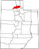 | |
| Town | ||
| Townships | ||
| CDPs | ||
| Unincorporated communities | ||